
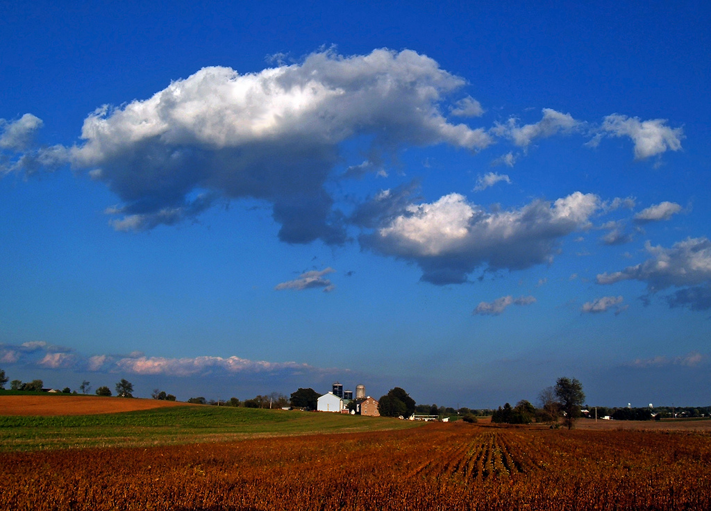


East Petersburg, Pennsylvania
East Petersburg is a borough of 4,591 people in Lancaster County, Pennsylvania, founded in 1812.
Why visit East Petersburg
Townapedia lists 3 museums and landmarks, 3 parks and trails and 13 places to eat in and around town.
Highlights include Buck Hill Farm Covered Bridge, Christian Habeck Farm and Bent Creek Country Club.
July is the warmest month, with average highs of 86°F; January lows average 22°F.
Weather in East Petersburg
Forecast from the National Weather Service. Full forecast
About East Petersburg
East Petersburg is a borough in Lancaster County, Pennsylvania, United States. The population was 4,591 at the 2020 census.
From the Wikipedia article East Petersburg, Pennsylvania (this version), under CC BY-SA 4.0.
Museums and landmarks3

Buck Hill Farm Covered Bridge
Bridge · National Register of Historic Places · 3.2 mi
Bridge in Pennsylvania, United States

Christian Habeck Farm
Monument and historic site · National Register of Historic Places · 3.0 mi
Building in Pennsylvania, United States

Landis Mill Covered Bridge
Bridge · National Register of Historic Places · 2.4 mi
Bridge in Pennsylvania, United States
Parks, trails and playgrounds3




Restaurants and cafes13

DiMaria's Pizza & Italian Kitchen
Restaurant · Pizza · 1.3 mi
1183 Erbs Quarry Road, Lititz
Mo off; Tu-Sa 11:00-21:00; Su 11:30-21:00
Gargano's
Restaurant · Italian · 0.4 mi
5997 Main Street, East Petersburg
Mo-Th,Sa 11:00-20:00; Fr 11:00-21:00; Su off

Josie's Pub
Diner · American
6049 Main Street, East Petersburg
Su,Mo,We,Th 11:00-22:00; Fr,Sa 11:00-23:00; Tu off
Tequila Mexican Grill & Bar
Restaurant · Mexican · 0.8 mi
605 Richmond Drive, Lancaster
Mo-Th,Su 11:00-21:00; Fr-Sa 11:00-23:00
Tokyo Diner Sushi & Hibachi
Restaurant · Japanese, Hibachi, Sushi · 1.5 mi
1625 Manheim Pike, Lancaste
Mo off; Tu-Fr 11:00-15:00,16:30-22:00; Sa 12:00-23:00; Su 12:00-22:00
Two Cousins
Restaurant · Pizza · 0.8 mi
5313 Main Street, East Petersburg
Mo-Sa 11:00-22:00; Su 11:30-21:00
Ciro's Italian Bistro
Restaurant · 0.8 mi
605 Richmond Drive
Tu-Th 11:00-20:00; Fr-Sa 11:00-21:00; Su 12:00-20:00

Mad Chef Craft Brewing
Bar and pub · 0.6 mi
2023 Miller Road, East Petersburg
Mo-Th 16:00-22:00; Fr 12:00-22:00; Sa 11:00-22:00; Su 11:00-20:30

Son's Ice Cream & Italian Ice
Ice cream · 0.7 mi
1991 Miller Road, East Petersburg
12:00-21:00; Jan off; Dec off
1 more on the map.
Churches and places of worship7

East Petersburg Mennonite Church
Church · Mennonite
6279 Main Street, East Petersburg

Association of International Gospel Assemblies
Church · Pentecostal
6139 Main Street, East Petersburg
Zion Evangelical Lutheran Church
Church · Lutheran · 0.4 mi
1905 Broad Street, East Petersburg
Shopping3
Gas and EV charging3
Schools, colleges and libraries41
Healthcare2
LG Health Physicians Family Medicine East Petersburg
Clinic and pharmacy · 0.6 mi
5665 Main Street, East Petersburg
Map of East Petersburg
75 places. The map loads OpenStreetMap tiles when you open it.
Climate by month
Monthly table
| Month | High | Low | Rain |
|---|---|---|---|
| Jan | 40°F | 22°F | 2.6 in |
| Feb | 42°F | 23°F | 2.2 in |
| Mar | 52°F | 31°F | 3.3 in |
| Apr | 64°F | 40°F | 3.3 in |
| May | 74°F | 50°F | 3.4 in |
| Jun | 82°F | 60°F | 4.8 in |
| Jul | 86°F | 65°F | 4.2 in |
| Aug | 85°F | 62°F | 3.5 in |
| Sep | 78°F | 56°F | 4.7 in |
| Oct | 66°F | 44°F | 3.8 in |
| Nov | 54°F | 34°F | 3.1 in |
| Dec | 44°F | 27°F | 3.1 in |
U.S. Climate Normals 1991-2020 for Lancaster Ap (3 mi away), NOAA NCEI.
People and cost of living
American Community Survey 5-year estimates, 2020-2024, U.S. Census Bureau. Estimates have margins of error, larger for small towns.
Disaster history
Lancaster County has had 13 federal disaster declarations since 2000, most often for hurricanes.
- 2020-03-30: Covid-19 Pandemic (Biological)
- 2020-03-13: Covid-19 (Biological)
- 2016-03-23: Severe Winter Storm And Snowstorm (Snowstorm)
- 2014-02-06: Severe Winter Storm (Severe Ice Storm)
- 2012-10-29: Hurricane Sandy (Hurricane)
- 2011-09-12: Tropical Storm Lee (Flood)
OpenFEMA disaster declarations summaries.
Getting there and nearby towns
Lancaster Airport (LNS) is the nearest airport with scheduled flights listed in OpenStreetMap, 3 miles away.
- Lancaster 5 mi southeast, about 8 min by car
- Penryn 6 mi north, about 10 min by car
- Brownstown 7 mi east, about 11 min by car
- Akron 9 mi northeast, about 14 min by car
- Columbia 9 mi southwest, about 15 min by car
- Brickerville 9 mi north, about 15 min by car
- Ephrata 10 mi northeast, about 17 min by car
- Clay 10 mi northeast, about 16 min by car
- Cornwall 11 mi north, about 18 min by car
- Conestoga 11 mi south, about 18 min by car
Drive times are estimates from straight-line distance, not routes.
Local news
Headlines from INDB, the NEMICO news database.
Reviews, tips and questions
Loading what members have shared...
Sources and licences
- NCES EDGE (Public domain): public schools
- NOAA NCEI U.S. Climate Normals 1991-2020 (Public domain): climate by month
- OpenFEMA (Public domain): disaster declarations
- OpenStreetMap contributors (ODbL 1.0): places, airports, map data
- U.S. Census Bureau (Public domain): population, income, housing, education, commute
- Wikidata (CC0 1.0): elevation, founding date, time zone, website, landmarks and historic places
- Wikimedia Commons (see each image): photos
- Wikipedia (CC BY-SA 4.0): overview and history text
Photo credits
- East Petersburg, Nicholas from Pennsylvania, USA, CC BY 2.0
- CHRISTIAN HABECK FARM, EAST HEMPFIELD TWP. LANCASTER COUNTY, LA, Jerrye & Roy Klotz, MD, CC BY-SA 4.0
- Landis Mill Covered Bridge Side View 3264px, Photo by and (c)2006 Derek Ramsey ( Ram-Man ), CC BY-SA 2.5
- Buck Hill Farm Covered Bridge Three Quarters HDR 2950px, Photo by and (c)2007 Derek Ramsey ( Ram-Man ), GFDL 1.2
Page built October 30, 2026. Spotted a mistake? Tell us or suggest a place.