


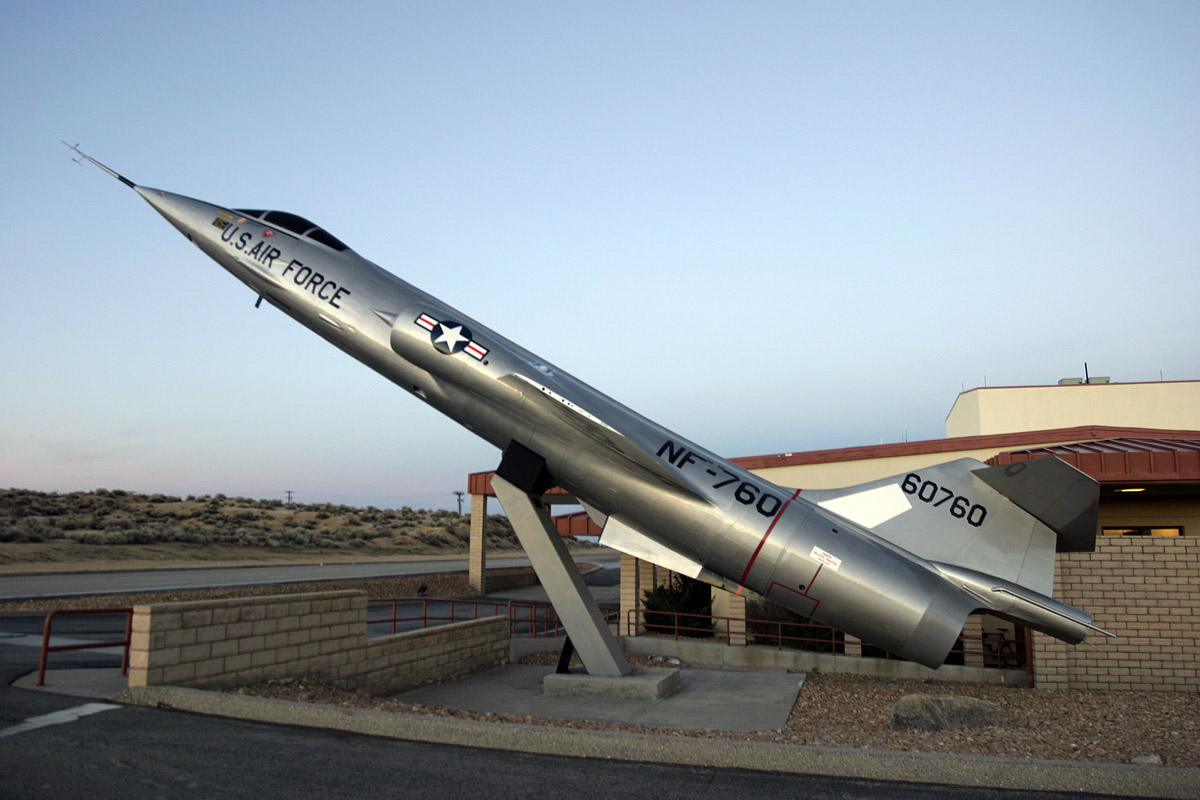
Edwards AFB, California
Edwards AFB is a community of 2,500 people in Kern County, California.
Why visit Edwards AFB
Townapedia lists 20 museums and landmarks, 3 parks and trails, 3 places to eat, 1 place to stay and 1 attraction in and around town.
Highlights include Rogers Dry Lake, Air Force Flight Test Center Museum and Muroc Lake Golf Course.
July is the warmest month, with average highs of 97°F; December lows average 32°F.
Weather in Edwards AFB
Forecast from the National Weather Service. Full forecast
Things to do1

Museums and landmarks20

Rogers Dry Lake
Monument and historic site · National Register of Historic Places · 5.5 mi
Place in California listed on National Register of Historic Places

Fairchild Republic YA-10B Thunderbolt II
Monument and historic site · 0.6 mi
S/n 73-1664
8 more on the map.
Parks, trails and playgrounds3




Restaurants and cafes3

Starbucks 6002
Cafe · Coffee Shop · 1.3 mi
240 West Fitzgerald Boulevard, Edwards Air Force Base
Mo-Fr 05:00-17:00; Sa,Su 08:00-15:00


Burger King 6004
Fast food · Burger · 1.3 mi
305 East Popson Avenue, Edwards Air Force Base
Mo-Fr 06:00-20:00; Su 09:00-19:00
Where to stay1
Shopping3
Schools, colleges and libraries8
Healthcare2
Edwards Air Force Base Clinic
Clinic and pharmacy · 1.7 mi
30 Nightingale Road, Edwards Air Force Base
Map of Edwards AFB
41 places. The map loads OpenStreetMap tiles when you open it.
Climate by month
Monthly table
| Month | High | Low | Rain | Snow |
|---|---|---|---|---|
| Jan | 58°F | 33°F | 1.1 in | 0.5 in |
| Feb | 60°F | 35°F | 1.5 in | 0.1 in |
| Mar | 66°F | 40°F | 0.8 in | 0.2 in |
| Apr | 72°F | 45°F | 0.2 in | 0.0 in |
| May | 81°F | 53°F | 0.1 in | 0.0 in |
| Jun | 91°F | 64°F | 0.0 in | 0.0 in |
| Jul | 97°F | 69°F | 0.2 in | 0.0 in |
| Aug | 97°F | 67°F | 0.2 in | 0.0 in |
| Sep | 90°F | 61°F | 0.1 in | 0.0 in |
| Oct | 78°F | 49°F | 0.4 in | 0.0 in |
| Nov | 66°F | 39°F | 0.3 in | 0.0 in |
| Dec | 56°F | 32°F | 0.8 in | 0.4 in |
U.S. Climate Normals 1991-2020 for Mojave (17 mi away), NOAA NCEI.
People and cost of living
American Community Survey 5-year estimates, 2020-2024, U.S. Census Bureau. Estimates have margins of error, larger for small towns.
Disaster history
Kern County has had 28 federal disaster declarations since 2000, most often for fires.
- 2024-07-27: Borel Fire (Fire)
- 2023-11-21: Tropical Storm Hilary (Hurricane)
- 2023-04-03: Severe Winter Storms, Straight-Line Winds, Flooding, Landslides, And Mudslides (Severe Storm)
- 2023-03-10: Severe Winter Storms, Flooding, Landslides, And Mudslides (Flood)
- 2021-08-25: French Fire (Fire)
- 2020-03-22: Covid-19 Pandemic (Biological)
OpenFEMA disaster declarations summaries.
Getting there and nearby towns
Edwards Air Force Base (EDW) is the nearest airport with scheduled flights listed in OpenStreetMap, 2 miles away.
- Rosamond 17 mi west, about 27 min by car
- California City 17 mi north, about 28 min by car
- Mojave 17 mi northwest, about 27 min by car
- Boron 17 mi northeast, about 27 min by car
- Lancaster 20 mi southwest, about 33 min by car
- Lake Los Angeles 21 mi south, about 34 min by car
- Palmdale 24 mi southwest, about 38 min by car
- Sun Village 24 mi south, about 38 min by car
- Quartz Hill 24 mi southwest, about 39 min by car
- Desert View Highlands 25 mi southwest, about 41 min by car
Drive times are estimates from straight-line distance, not routes.
Local news
Headlines from INDB, the NEMICO news database.
Reviews, tips and questions
Loading what members have shared...
Sources and licences
- NCES EDGE (Public domain): public schools
- NOAA NCEI U.S. Climate Normals 1991-2020 (Public domain): climate by month
- OpenFEMA (Public domain): disaster declarations
- OpenStreetMap contributors (ODbL 1.0): places, airports, map data
- U.S. Census Bureau (Public domain): population, income, housing, education, commute
- Wikidata (CC0 1.0): landmarks and historic places
- Wikimedia Commons (see each image): photos
Photo credits
- ISS065-E-393540 - View of Earth, Earth Science and Remote Sensing Unit , Lyndon B. Johnson Space Center, Public domain
- Iss040e113821, Earth Science and Remote Sensing Unit , Lyndon B. Johnson Space Center, Public domain
- ISS065-E-393539 - View of Earth, Earth Science and Remote Sensing Unit , Lyndon B. Johnson Space Center, Public domain
- Iss040e113822, Earth Science and Remote Sensing Unit , Lyndon B. Johnson Space Center, Public domain
- ISS053-E-382983 - View of Earth, Earth Science and Remote Sensing Unit , Lyndon B. Johnson Space Center, Public domain
- NF-104A Tail Number 760, Kaszeta, CC BY 3.0
- NF-4E Edwards (23962953283), Rob Schleiffert from Holland, CC BY-SA 2.0
- 445th Flight Test Squadron A-7D Corsair II 69-6217, Rob Schleiffert from Holland, CC BY-SA 2.0
- T-38A Edwards (25266816752), Rob Schleiffert from Holland, CC BY-SA 2.0
- STS-31 Discovery Glides toward Landing (27512131734), NASA Hubble Space Telescope, Public domain
- S81-30734, NASA, Public domain
- STS-41 Discovery, OV-103, glides over concrete runway 22 at EAFB, California, 2, NASA, Public domain
- S81-30853, NASA, Public domain
- S81-30852, NASA, Public domain
- S81-30744, NASA, Public domain
- STS-31 crew egresses Discovery, OV-103, via stairway after Edwards landing, NASA, Public domain
- STS-31 Discovery, lands on EAFB concrete runway 22, NASA, Public domain
- S81-30846, NASA, Public domain
- S81-30843, NASA, Public domain
- S81-30845, NASA, Public domain
- S81-30425, NASA, Public domain
- STS-41 Discovery, OV-103, glides over concrete runway 22 at EAFB, California, NASA, Public domain
- STS-31 Discovery, Orbiter Vehicle (OV) 103, lands on EAFB concrete runway 22, NASA, Public domain
- S81-30455, NASA, Public domain
- S81-31913, NASA, Public domain
- STS-31 crew poses on EAFB concrete runway after egressing Discovery, NASA, Public domain
- S81-30746, NASA, Public domain
- S81-30749, NASA, Public domain
- OA-37B Edwards (24754484194), Rob Schleiffert from Holland, CC BY-SA 2.0
- T-28B US Army (26501120222), Rob Schleiffert from Holland, CC BY-SA 2.0
- T-33A USAF (25512782276), Rob Schleiffert from Holland, CC BY-SA 2.0
- B-1A (13475715863), Rob Schleiffert, CC BY-SA 2.0
- STS-4 landing, NASA, Public domain
- Rogers Dry Lake, Alan Radecki, CC BY 2.5


Page built October 30, 2026. Spotted a mistake? Tell us or suggest a place.