
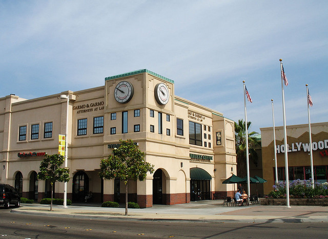


El Cajon, California
El Cajon is a city of 104,449 people in San Diego County, California.
Why visit El Cajon
Townapedia lists 14 museums and landmarks, 28 parks and trails, 251 places to eat, 22 places to stay and 11 attractions in and around town.
Highlights include Reading Cinema, Santee Drive-In, Hubert H. Bancroft Ranch House and Edgemoor Farm Dairy Barn.
August is the warmest month, with average highs of 89°F; December lows average 42°F.
Weather in El Cajon
Forecast from the National Weather Service. Full forecast
About El Cajon
El Cajon ( el kə-HOHN, Spanish pronunciation: [el kaˈxon] ; Spanish: El Cajón, lit. 'the box') is a city in San Diego County, California, United States, 17 mi (27 km) east of downtown San Diego. The city takes its name from Rancho El Cajón, which was named for the box-like shape of the valley that surrounds the city, and the origin of the city's common nickname "the Box".
From the Wikipedia article El Cajon, California (this version), under CC BY-SA 4.0.
Things to do11


Marshal Scotty's Playland Park
Monument and historic site · 5.2 mi
Former American amusement park


Sweetwater River Bridge
Bridge · 4.9 mi
Bridge in United States of America

Museums and landmarks14

Hubert H. Bancroft Ranch House
Monument and historic site · National Register of Historic Places · 4.8 mi
Building in San Diego County, United States of America

Edgemoor Farm Dairy Barn
Monument and historic site · National Register of Historic Places · 2.9 mi

Museum of Creation and Earth History
Museum · 3.0 mi
Young earth creationist museum in California

Olaf Wieghorst Museum & Western Heritage Center
Museum · 0.4 mi
131 Rea Avenue, El Cajon
Fr 11:00-15:00; Sa 12:00-16:00
2 more on the map.
Parks, trails and playgrounds28


Eucalyptus County Park
Park · 3.7 mi
Park in California, United States of America

16 more on the map.
Restaurants and cafes251


Ace New York Giant Pizza Bar & Lounge
Restaurant · Pizza · 2.2 mi
8049 Winter Gardens Boulevard, El Cajon
Mo-Su 11:00-02:00
Ahi Sushi & Grill
Restaurant · Sushi, Japanese · 2.5 mi
2872 Fletcher Parkway, El Cajon
Mo-Su 11:30-14:30,16:00-21:00
Anny´s Fine Burger
Restaurant · Burger · 3.0 mi
9862 Mission Gorge Road, Santee
Mo-Sa 11:00-21:00; Su 11:00-20:00


Broken Yolk Cafe
Restaurant · Breakfast · 3.0 mi
9832 Mission Gorge Road, Santee
Mo-Th 07:00-14:00; Fr-Su 07:00-15:00
Chili's
Restaurant · Tex-Mex · 2.9 mi
9804 Mission Gorge Road, Santee
Su-Th 11:00-22:00; Fr-Sa 11:00-23:00
Denny's
Diner · American · 3.2 mi
140 Town Center Parkway, Santee
Su-Th 05:00-00:00; Fr-Sa 05:00-02:00
239 more on the map.
History
During Spanish rule (1769–1821), the government encouraged settlement of territory now known as California by the establishment of large land grants called ranchos, from which the English word ranch is derived. Land grants were made to the Roman Catholic Church, which set up numerous missions throughout the region. In the early 19th century, mission padres' search for pastureland led them to the El Cajon Valley. Surrounding foothills served as a barrier to straying cattle and a watershed to gather the sparse rainfall. For years, the pasturelands of El Cajon supported the cattle herds of the mission and its native Indian converts.
From the History section of El Cajon, California on Wikipedia, under CC BY-SA 4.0.
Where to stay22
Best Western Continental Inn
Motel and hotel · 0.5 mi
650 North Mollison Avenue, El Cajon
Rodeway Inn & Suites El Cajon San Diego East
Motel and hotel · 2.0 mi
1250 El Cajon Boulevard, El Cajon
Econo Lodge Inn & Suites El Cajon San Diego East
Motel and hotel · 0.5 mi
588 North Mollison Avenue, El Cajon
Churches and places of worship78
Saint Gregory of Nyssa Orthodox Christian Church
Church · Greek Orthodox · 2.8 mi
1454 Jamacha Road, El Cajon
Holy Trinity Catholic Church
Church · Roman Catholic · 1.4 mi
405 Ballard Street, El Cajon
Saint Kieran Catholic Church
Church · Roman Catholic · 2.1 mi
1510 Greenfield Drive, El Cajon
Foothills United Methodist Church
Church · Methodist · 3.4 mi
4031 Avocado Boulevard, La Mesa
Shopping70
Gas and EV charging39
Schools, colleges and libraries91
Healthcare19
Kaiser Permanente - El Cajon Medical Offices
Clinic and pharmacy · 1.3 mi
250 Travelodge Drive, El Cajon
Map of El Cajon
250 places. The map loads OpenStreetMap tiles when you open it.
Climate by month
Monthly table
| Month | High | Low | Rain | Snow |
|---|---|---|---|---|
| Jan | 69°F | 42°F | 2.3 in | 0.0 in |
| Feb | 69°F | 44°F | 2.6 in | 0.0 in |
| Mar | 71°F | 48°F | 1.9 in | 0.0 in |
| Apr | 74°F | 51°F | 0.8 in | 0.0 in |
| May | 76°F | 56°F | 0.3 in | 0.0 in |
| Jun | 81°F | 59°F | 0.1 in | 0.0 in |
| Jul | 86°F | 63°F | 0.2 in | 0.0 in |
| Aug | 89°F | 65°F | 0.0 in | 0.0 in |
| Sep | 87°F | 62°F | 0.1 in | 0.0 in |
| Oct | 81°F | 56°F | 0.5 in | 0.0 in |
| Nov | 75°F | 47°F | 1.0 in | 0.0 in |
| Dec | 68°F | 42°F | 1.8 in | 0.0 in |
U.S. Climate Normals 1991-2020 for El Cajon (2 mi away), NOAA NCEI.
People and cost of living
American Community Survey 5-year estimates, 2020-2024, U.S. Census Bureau. Estimates have margins of error, larger for small towns.
Disaster history
San Diego County has had 35 federal disaster declarations since 2000, most often for fires.
- 2024-02-19: Severe Storm And Flooding (Flood)
- 2023-01-14: Severe Winter Storms, Flooding, Landslides, And Mudslides (Flood)
- 2023-01-09: Severe Winter Storms, Flooding, And Mudslides (Flood)
- 2020-10-16: Wildfires (Fire)
- 2020-03-22: Covid-19 Pandemic (Biological)
- 2020-03-13: Covid-19 (Biological)
OpenFEMA disaster declarations summaries.
Getting there and nearby towns
Gillespie Field (SEE) is the nearest airport with scheduled flights listed in OpenStreetMap, 2 miles away.
- Bostonia 2 mi northeast, about 3 min by car
- Casa de Oro-Mount Helix 3 mi south, about 4 min by car
- Winter Gardens 3 mi northeast, about 5 min by car
- Granite Hills 3 mi east, about 5 min by car
- Rancho San Diego 4 mi southeast, about 6 min by car
- La Mesa 4 mi southwest, about 6 min by car
- Santee 4 mi north, about 6 min by car
- Spring Valley 5 mi south, about 8 min by car
- Lakeside 5 mi northeast, about 8 min by car
- Crest 5 mi east, about 9 min by car
Drive times are estimates from straight-line distance, not routes.
Local news
Headlines from INDB, the NEMICO news database.
Reviews, tips and questions
Loading what members have shared...
Sources and licences
- NCES EDGE (Public domain): public schools
- NOAA NCEI U.S. Climate Normals 1991-2020 (Public domain): climate by month
- OpenFEMA (Public domain): disaster declarations
- OpenStreetMap contributors (ODbL 1.0): places, airports, map data
- U.S. Census Bureau (Public domain): population, income, housing, education, commute
- Wikidata (CC0 1.0): elevation, founding date, time zone, website, landmarks and historic places
- Wikimedia Commons (see each image): photos
- Wikipedia (CC BY-SA 4.0): overview and history text
Photo credits
- El cajon, Allan Ferguson, CC BY 2.0
- Race and ethnicity 2020 El Cajon, CA, CensusDots, CC BY-SA 4.0
- Westfield Parkway (El Cajon, California) (2010-05-02), Amin Eshaiker, CC BY-SA 3.0
- El Cajon, United States (Unsplash), Austin Mabe mabe12, CC0
- Front Entrance to El Cajon Valley High School, Anthonyrdevine, CC BY-SA 4.0
- EL CAJON VALLEY HIGH SCHOOL, Issac I Navarro, CC BY 4.0
- Mother Goose Parade 2017 El Cajon California Firetruck and Smokey the Bear, Socalgœtz, CC BY-SA 4.0
- Mother Goose Parade 2017 El Cajon California Lady Liberty and Carriage, Socalgœtz, CC BY-SA 4.0
- Mother Goose Parade 2017 El Cajon California, Socalgœtz, CC BY-SA 4.0
- Mother Goose Parade 2017 El Cajon California San Diego Padres 3, Socalgœtz, CC BY-SA 4.0
- Mother Goose Parade 2017 El Cajon California Cheerleaders, Socalgœtz, CC BY-SA 4.0
- Mother Goose Parade 2017 El Cajon California San Diego Padres 1, Socalgœtz, CC BY-SA 4.0
- Mother Goose Parade 2017 El Cajon California San Diego Padres 2, Socalgœtz, CC BY-SA 4.0
- CA 54 El Cajon, Rschen7754, CC BY-SA 4.0
- Bancroft Ranch House, Flickr user Allan Ferguson, CC BY 2.0
- Edgemoor Farm Dairy Barn April 2009 002, Somewikistuff, CC BY-SA 3.0
- Saint Peter Chaldean Catholic Church, RightCowLeftCoast, CC BY 4.0
- Garden of Eden, No machine-readable author provided. Mycota assumed (based on copyright claims)., Public domain
- Looking South (Downstream) from wood bridge at Entrance- restrooms at top - Eucalyptus Trees throughout, Animalrescue, CC BY-SA 4.0
- Skyline Wesleyan Church, Photographeroflife, CC BY-SA 4.0
- Clouds in San Diego, CA (16228133409), el cajon yacht club, CC BY 2.0
- Cactus-1140829, el cajon yacht club, CC BY 2.0
- Bee p-rn 50924, el cajon yacht club, CC BY 2.0
- Bee p-rn 50916, el cajon yacht club, CC BY 2.0
- Sunset - panoramio - Scott Cameron, Scott Cameron, CC BY 3.0
- May The Fourth, Nicole Garitta, CC BY 3.0
- Summer, Nicole Garitta, CC BY 3.0
- Parkway Plaza, Issac I Navarro, CC BY 4.0
- Bird of Paradise - 5290409827, Kari, CC BY 2.0
- Student Services Building ECVHS, Anthonyrdevine, CC BY-SA 4.0
- Oak with galls, Angie King Ben's Grandma, CC BY-SA 4.0
- Full Moon Reflections (1285407742), peasap from San Diego, USA, CC BY 2.0
- In-N-Out Burger 4x2, RightCowLeftCoast, CC BY-SA 4.0
- Grouphighwaypicture, EcologicalServantsProject, CC BY-SA 4.0
- Honey, Wash The Car Please. - Flickr - peasap, peasap, CC BY 2.0
- Who Is That Cute Cat?, peasap, CC BY 2.0
- Ecologicalservantsprojectvolunteer, EcologicalServantsProject, CC BY-SA 4.0
- CA 54 eastern terminus, Rschen7754, CC BY-SA 4.0
- Let's Go Swimming - Flickr - peasap, peasap, CC BY 2.0
- August 27 2026 Partial Lunar Eclipse, Wmiggy678, CC0


Page built October 30, 2026. Spotted a mistake? Tell us or suggest a place.