
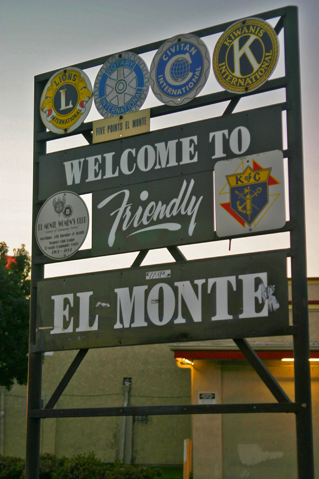


El Monte, California
El Monte is a city of 106,109 people in Los Angeles County, California, founded in 1852.
Why visit El Monte
Townapedia lists 5 museums and landmarks, 14 parks and trails, 42 places to eat, 9 places to stay and 1 attraction in and around town.
Highlights include University of the West, Mission San Gabriel Arcángel, The American Military Museum and Fletcher Park.
August is the warmest month, with average highs of 88°F; December lows average 45°F.
Weather in El Monte
Forecast from the National Weather Service. Full forecast
About El Monte
El Monte is a city in Los Angeles County, California, United States. The city lies in the San Gabriel Valley, east of the city of Los Angeles.
From the Wikipedia article El Monte, California (this version), under CC BY-SA 4.0.
Things to do1

University of the West
School · 3.7 mi
Buddhist private university in Rosemead, California
Museums and landmarks5

Mission San Gabriel Arcángel
Monument and historic site · National Register of Historic Places · 4.7 mi
Roman Catholic mission and a historic landmark in San Gabriel, California

The American Military Museum
Museum · 2.6 mi
Armor & Artillery Museum in South El Monte, CA

Parks, trails and playgrounds14



Vincent Lugo Park
Park · National Register of Historic Places · 4.4 mi
Arcadia County Park
Park · 4.2 mi
Park in Los Angeles County, California, United States of America
Gay's Lion Farm
Park · 0.4 mi
Tourist attraction in El Monte, California, United States (1925–1942)

2 more on the map.
Restaurants and cafes42

Happy Together
Restaurant · Chinese · 1.5 mi
07:00-10:00 is American breakfast for hotel guests
9920 Valley Boulevard, El Monte
Mo-Su 07:00-15:00,17:00-21:00


BMC Pho Banh Mi Che Cali
Restaurant · Vietnamese · 1.2 mi
11016 Lower Azusa Rd, El Monte
Mo-Su 11:00-21:30
China Great Buffet
Restaurant · Chinese · 0.9 mi
11860 Valley Boulevard
30 more on the map.
Where to stay9
Churches and places of worship29
Vietnamese Seventh-day Adventist Church
Church · Seventh Day Adventist · 0.6 mi
11601 Bryant Road, El Monte
Shopping7
Gas and EV charging11
Schools, colleges and libraries73
Healthcare1
Map of El Monte
192 places. The map loads OpenStreetMap tiles when you open it.
Climate by month
Monthly table
| Month | High | Low | Rain | Snow |
|---|---|---|---|---|
| Jan | 69°F | 46°F | 3.6 in | 0.0 in |
| Feb | 68°F | 47°F | 4.2 in | 0.0 in |
| Mar | 71°F | 50°F | 2.5 in | 0.0 in |
| Apr | 74°F | 53°F | 0.6 in | 0.0 in |
| May | 76°F | 58°F | 0.5 in | 0.0 in |
| Jun | 81°F | 62°F | 0.1 in | 0.0 in |
| Jul | 86°F | 65°F | 0.0 in | 0.0 in |
| Aug | 88°F | 66°F | 0.0 in | 0.0 in |
| Sep | 87°F | 64°F | 0.1 in | 0.0 in |
| Oct | 81°F | 57°F | 0.6 in | 0.0 in |
| Nov | 74°F | 51°F | 0.9 in | 0.0 in |
| Dec | 68°F | 45°F | 2.4 in | 0.0 in |
U.S. Climate Normals 1991-2020 for San Gabriel Fire Dept (4 mi away), NOAA NCEI.
People and cost of living
American Community Survey 5-year estimates, 2020-2024, U.S. Census Bureau. Estimates have margins of error, larger for small towns.
Disaster history
Los Angeles County has had 67 federal disaster declarations since 2000, most often for fires.
- 2025-08-08: Canyon Fire (Fire)
- 2025-01-08: Wildfires And Straight-Line Winds (Fire)
- 2025-01-08: Eaton Fire (Fire)
- 2025-01-08: Hurst Fire (Fire)
- 2025-01-07: Palisades Fire (Fire)
- 2024-12-10: Franklin Fire (Fire)
OpenFEMA disaster declarations summaries.
Getting there and nearby towns
San Gabriel Valley Airport (EMT) is the nearest airport with scheduled flights listed in OpenStreetMap, 1 miles away.
- South El Monte 2 mi southwest, about 3 min by car
- Temple City 3 mi northwest, about 4 min by car
- Rosemead 3 mi west, about 5 min by car
- Avocado Heights 3 mi southeast, about 5 min by car
- Baldwin Park 3 mi east, about 5 min by car
- Arcadia 4 mi north, about 6 min by car
- West Puente Valley 4 mi southeast, about 6 min by car
- San Gabriel 4 mi west, about 7 min by car
- East San Gabriel 4 mi northwest, about 7 min by car
- La Puente 5 mi southeast, about 8 min by car
Drive times are estimates from straight-line distance, not routes.
Local news
Headlines from INDB, the NEMICO news database.
Reviews, tips and questions
Loading what members have shared...
Sources and licences
- NCES EDGE (Public domain): public schools
- NOAA NCEI U.S. Climate Normals 1991-2020 (Public domain): climate by month
- OpenFEMA (Public domain): disaster declarations
- OpenStreetMap contributors (ODbL 1.0): places, airports, map data
- U.S. Census Bureau (Public domain): population, income, housing, education, commute
- Wikidata (CC0 1.0): elevation, founding date, time zone, website, landmarks and historic places
- Wikimedia Commons (see each image): photos
- Wikipedia (CC BY-SA 4.0): overview and history text
Photo credits
- Friendly El Monte, Dparranda, Public domain
- Race and ethnicity 2020 El Monte, CA, CensusDots, CC BY-SA 4.0
- El Monte Metrolink station, Metrolink, Public domain
- El Monte Station cycle park, PeterEastern, CC BY-SA 3.0
- El Monte CA banner, Oran Viriyincy from Santa Barbara, United States, CC BY-SA 2.0
- Bike parking near El Monte Station entrance (8172820655), Oran Viriyincy from Santa Barbara, United States, CC BY-SA 2.0
- El Monte Station entrance artwork (8172822517), Oran Viriyincy from Santa Barbara, United States, CC BY-SA 2.0
- El Monte Station main entrance (8172818357), Oran Viriyincy from Santa Barbara, United States, CC BY-SA 2.0
- El Monte lower level & exit access (8172803421), Oran Viriyincy from Santa Barbara, United States, CC BY-SA 2.0
- El Monte lower level platforms (8172840846), Oran Viriyincy from Santa Barbara, United States, CC BY-SA 2.0
- Foothill Transit at El Monte (8172794691), Oran Viriyincy from Santa Barbara, United States, CC BY-SA 2.0
- El Monte upper level platform (8172830330), Oran Viriyincy from Santa Barbara, United States, CC BY-SA 2.0
- Silver Line at El Monte (8172792873), Oran Viriyincy from Santa Barbara, United States, CC BY-SA 2.0
- Boarding Metro Silver Line at El Monte (8172857786), Oran Viriyincy from Santa Barbara, United States, CC BY-SA 2.0
- El Monte elevator shaft (8172830019), Oran Viriyincy from Santa Barbara, United States, CC BY-SA 2.0
- Mission San Gabriel 4-15-05 6611, Robert A. Estremo, CC BY-SA 2.0
- Vincent Lugo Park - 2017 Feb 13 - 4, Hickorypine, CC BY-SA 4.0
- 1st MLG CG speaks during opening of homeless veteran housing project 140312-M-KO203-002, Cpl. Laura Gauna, Public domain
- 1st MLG CG speaks during opening of homeless veteran housing project 140312-M-KO203-003, Cpl. Laura Gauna, Public domain
- 1st MLG CG speaks during opening of homeless veteran housing project 140312-M-KO203-004, Cpl. Laura Gauna, Public domain
- 1st MLG CG speaks during opening of homeless veteran housing project 140312-M-KO203-001, Cpl. Laura Gauna, Public domain
- Merkur-SCORPIO, Accord14, CC BY-SA 4.0
- Metro Local Bus Line 70, George, CC BY-SA 2.0
- Foothill Transit NABI 42-BRT F1807, George from Santa Clarita, CA, United States, CC BY-SA 2.0
- LACMTA Metro Local NABI 40-LFW -7693, George, CC BY-SA 2.0
- Paul Gonzales 2016, Los Angeles County Metropolitan Transportation Authority, a state created local agency., Public domain
- Metro ExpressLanes, Foothill Transit and Greyhound offices (8172846038), Oran Viriyincy from Santa Barbara, United States, CC BY-SA 2.0
- Downward bike rail (8172806697), Oran Viriyincy from Santa Barbara, United States, CC BY-SA 2.0
- Upward bike rail (8172837982), Oran Viriyincy from Santa Barbara, United States, CC BY-SA 2.0
- Backlit transit information display case (8172844502), Oran Viriyincy from Santa Barbara, United States, CC BY-SA 2.0
- TOPAZZ, Accord14, CC BY-SA 4.0
- A. Jeremy Garcia, Jesse! S?, CC BY 2.0
- Los Angeles 2009 03 - panoramio, kl91711, CC BY 3.0
- Open areas above the lower level platforms (8172853870), Oran Viriyincy from Santa Barbara, United States, CC BY-SA 2.0
- 1970 Chevrolet Impala coupe, Accord14, CC BY-SA 4.0
- People gawking at the ExeLoo (8172813569), Oran Viriyincy from Santa Barbara, United States, CC BY-SA 2.0
- Foothill Transit buses layover (8172861152), Oran Viriyincy from Santa Barbara, United States, CC BY-SA 2.0
- Foothill Transit NABI 40-LFW F1408 (8172861152) (cropped), Oran Viriyincy from Santa Barbara, United States, CC BY-SA 2.0
- Foothill Transit NABI 42-BRT F1911 (8172861152) (cropped), Oran Viriyincy from Santa Barbara, United States, CC BY-SA 2.0
- Why 8 mph? (or is it 8 km h?) (8172825963), Oran Viriyincy from Santa Barbara, United States, CC BY-SA 2.0


Page built October 30, 2026. Spotted a mistake? Tell us or suggest a place.