


Eufaula, Alabama
Eufaula is a city of 12,584 people in Barbour County, Alabama, founded in 1834.
Why visit Eufaula
Townapedia lists 14 museums and landmarks, 10 parks and trails, 24 places to eat and 7 places to stay in and around town.
Highlights include Bray-Barron House, Cato House, Eufaula Country Club and Lakepoint State Park Resort Golf Course.
July is the warmest month, with average highs of 94°F; January lows average 37°F.
Weather in Eufaula
Forecast from the National Weather Service. Full forecast
About Eufaula
Eufaula is the largest city in Barbour County, Alabama, United States. As of the 2020 census, Eufaula had a population of 12,882.
From the Wikipedia article Eufaula, Alabama (this version), under CC BY-SA 4.0.
Museums and landmarks14

Bray-Barron House
Monument and historic site · National Register of Historic Places · 1.8 mi
House in Eufaula, Alabama, United States
Cato House
Monument and historic site · National Register of Historic Places · 1.9 mi
House in Eufaula, Alabama

Drewry-Mitchell-Moorer House
Monument and historic site · National Register of Historic Places · 1.7 mi
Mansion in Eufaula, Alabama
Kendall Manor
Monument and historic site · National Register of Historic Places · 1.9 mi
Mansion in Eufaula, Alabama
Kiels-McNab House
Monument and historic site · National Register of Historic Places · 2.2 mi
Historic house in Alabama, United States
McNab Bank Building
Monument and historic site · National Register of Historic Places · 2.1 mi
Bank building in Eufaula, United States of America
Quitman County Courthouse and Old Jail
Monument and historic site · National Register of Historic Places · 3.8 mi
Courthouse in jail in Georgetown, United States
Seth Lore and Irwinton Historic District
Monument and historic site · National Register of Historic Places · 2.1 mi
Historic district in Alabama, United States

Sheppard Cottage
Monument and historic site · National Register of Historic Places · 2.3 mi
Historic house in Alabama, United States

Shorter Mansion
Monument and historic site · National Register of Historic Places · 1.8 mi
Historic house in Alabama, United States

The Tavern
Monument and historic site · National Register of Historic Places · 2.2 mi
Listed on the NRHP in Alabama
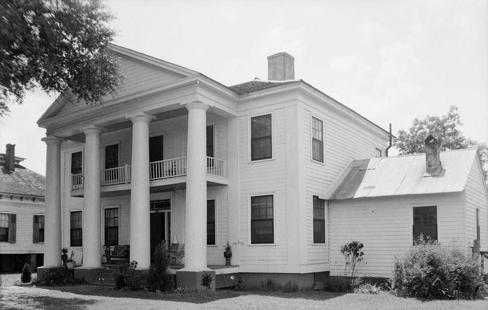


Wellborn
Monument and historic site · National Register of Historic Places · 2.2 mi
House in Eufaula, Alabama
2 more on the map.
Parks, trails and playgrounds10



Restaurants and cafes24

El Jalisco Mexican Grill
Restaurant · Mexican · 2.0 mi
128 East Broad Street
Mo-Sa 11:00-15:00; Su off
Sam’s Southern Eatery
Restaurant · American, Seafood · 2.3 mi
325 South Eufaula Avenue
Su 11:00-19:00; Mo-Sa 10:00-20:00


New No. 1 Buffet
Restaurant · Chinese · 3.3 mi
1601 South Eufaula Avenue, Eufaula
Mo-Su 10:00-22:00

American Deli
Fast food · American · 2.6 mi
801 South Eufaula Avenue, Eufaula
Mo-Sa 10:00-22:00; Su 11:00-21:00
12 more on the map.
Where to stay7

History
The site along the Chattahoochee River that is now modern-day Eufaula was occupied by three Muscogee Creek tribes, including the Eufaulas. By the 1820s the land was part of the Creek Indian Territory and supposedly off-limits to white settlement. By 1827 enough illegal white settlement had occurred that the Creeks appealed to the federal government for protection of their property rights. In July of that year, federal troops were sent to the Eufaula area to remove the settlers by force of arms, a conflict known as the "Intruders War".
The Creeks signed the Treaty of Washington in 1826, ceding most of their land in Georgia and eastern Alabama to the United States, but it was not fully effective in practice until the late 1820s. The 1832 Treaty of Cusseta, by which the Creeks ceded all land east of the Mississippi River to the United States, allowed white settlers to legally buy land from the Creek. However, the treaty's terms did not require any natives to relocate. By 1835 the land on which the town was built had been mostly purchased by white settlers, and had a store, owned in part by William Irwin, after whom the new settlement was named "Irwinton".
From the History section of Eufaula, Alabama on Wikipedia, under CC BY-SA 4.0.
Churches and places of worship36
Holy Redeemer Catholic Church
Church · Roman Catholic · 1.9 mi
515 West Broad Street, Eufaula
Saint Lukes African Methodist Episcopal Church
Church · Methodist · 2.4 mi
240 Doctor T V McCoo Boulevard South, Eufaula
Shopping5
Gas and EV charging21
Schools, colleges and libraries17
Alabama Virtual Academy At Eufaula City Schools
School · 2.2 mi
831 West Washington Street, Eufaula
Healthcare5
Map of Eufaula
139 places. The map loads OpenStreetMap tiles when you open it.
Climate by month
Monthly table
| Month | High | Low | Rain |
|---|---|---|---|
| Jan | 61°F | 37°F | 4.8 in |
| Feb | 66°F | 40°F | 4.7 in |
| Mar | 73°F | 46°F | 5.1 in |
| Apr | 80°F | 52°F | 4.8 in |
| May | 87°F | 60°F | 3.1 in |
| Jun | 92°F | 68°F | 4.6 in |
| Jul | 94°F | 71°F | 5.1 in |
| Aug | 94°F | 71°F | 4.8 in |
| Sep | 89°F | 66°F | 3.7 in |
| Oct | 81°F | 55°F | 3.1 in |
| Nov | 71°F | 44°F | 4.5 in |
| Dec | 63°F | 40°F | 5.2 in |
U.S. Climate Normals 1991-2020 for Weedon Fld Ap (3 mi away), NOAA NCEI.
People and cost of living
American Community Survey 5-year estimates, 2020-2024, U.S. Census Bureau. Estimates have margins of error, larger for small towns.
Disaster history
Barbour County has had 20 federal disaster declarations since 2000, most often for hurricanes.
- 2024-09-26: Hurricane Helene (Hurricane)
- 2023-01-15: Severe Storms, Straight-Line Winds, And Tornadoes (Severe Storm)
- 2020-09-20: Hurricane Sally (Hurricane)
- 2020-09-14: Hurricane Sally (Hurricane)
- 2020-07-10: Severe Storms, Straight-Line Winds, And Tornadoes (Severe Storm)
- 2020-03-29: Covid-19 Pandemic (Biological)
OpenFEMA disaster declarations summaries.
Getting there and nearby towns
Weedon Field (EUF) is the nearest airport with scheduled flights listed in OpenStreetMap, 3 miles away.
- Georgetown-Quitman County unified government 10 mi southeast, about 16 min by car
- Clayton 18 mi west, about 29 min by car
- Fort Gaines 21 mi south, about 34 min by car
- Phenix City 38 mi north, about 1 h by car
- Ozark 43 mi southwest, about 1 h 15 min by car
- Columbus 44 mi north, about 1 h 15 min by car
- Troy 48 mi west, about 1 h 15 min by car
- Dothan 49 mi south, about 1 h 15 min by car
- Auburn 51 mi north, about 1 h 30 min by car
- Opelika 53 mi north, about 1 h 30 min by car
Drive times are estimates from straight-line distance, not routes.
Local news
Headlines from INDB, the NEMICO news database.
Reviews, tips and questions
Loading what members have shared...
Sources and licences
- NCES EDGE (Public domain): public schools
- NOAA NCEI U.S. Climate Normals 1991-2020 (Public domain): climate by month
- OpenFEMA (Public domain): disaster declarations
- OpenStreetMap contributors (ODbL 1.0): places, airports, map data
- U.S. Census Bureau (Public domain): population, income, housing, education, commute
- Wikidata (CC0 1.0): elevation, founding date, time zone, website, landmarks and historic places
- Wikimedia Commons (see each image): photos
- Wikipedia (CC BY-SA 4.0): overview and history text
Photo credits
- MacMonnie's Fountain Eufaula Alabama, Rivers Langley; SaveRivers, CC BY-SA 3.0
- 2011.05.21.081709 N Eufaula Ave. Eufaula Alabama USA, Hermann Luyken, CC0
- 2011.05.21.081901 N Eufaula Ave. Eufaula Alabama USA, Hermann Luyken, CC0
- 2011.05.21.082008 N Eufaula Ave. Eufaula Alabama USA, Hermann Luyken, CC0
- 2011.05.21.081439 Shorter Mansion Eufaula Alabama USA, Hermann Luyken, CC0
- 2011.05.21.081238 Shorter Mansion Eufaula Alabama USA, Hermann Luyken, CC0
- St. James Episcopal Church, Eufaula, Michael Rivera, CC BY-SA 3.0
- Eufaula Carnegie Library, Alabama, Michael Rivera, CC BY-SA 3.0
- Hart House, Eufaula, Michael Rivera, CC BY-SA 3.0
- BP, US84, Eufaula, Michael Rivera, CC BY-SA 3.0
- 235 N Eufaula Ave., Eufaula, Michael Rivera, CC BY-SA 3.0
- 2011.05.21.080301 N Eufaula Ave. Eufaula Alabama USA, Hermann Luyken, CC0
- 200 block, N Eufaula Ave., Eufaula, Michael Rivera, CC BY-SA 3.0
- 2011.05.21.080232 N Eufaula Ave. Eufaula Alabama USA, Hermann Luyken, CC0
- 2011.05.21.080152 Statue N Eufaula Ave. Eufaula Alabama USA, Hermann Luyken, CC0
- 2011.05.21.080356 N Eufaula Ave. Eufaula Alabama USA, Hermann Luyken, CC0
- 2011.05.21.080343 E Broad St. Eufaula Alabama USA, Hermann Luyken, CC0
- 2011.05.21.080515 N Eufaula Ave. Eufaula Alabama USA, Hermann Luyken, CC0
- 2011.05.21.080009 N Randolph Ave. Eufaula Alabama USA, Hermann Luyken, CC0
- 2011.05.21.075955 E Broad St. Eufaula Alabama USA, Hermann Luyken, CC0
- The Lampley Building, Eufaula, Michael Rivera, CC BY-SA 3.0
- 2011.05.21.080615 Shop N Eufaula Ave. Eufaula Alabama USA, Hermann Luyken, CC0
- 2011.05.21.075912 Café E Broad St. Eufaula Alabama USA, Hermann Luyken, CC0
- 2011.05.21.075902 Café E Broad St. Eufaula Alabama USA, Hermann Luyken, CC0
- 2011.05.21.075112 E Broad St. Eufaula Alabama USA, Hermann Luyken, CC0
- 2011.05.21.075043 Lampley Building E Broad St. Eufaula Alabama USA, Hermann Luyken, CC0
- 2011.05.21.075141 Handrail E Broad St. Eufaula Alabama USA, Hermann Luyken, CC0
- 2011.05.21.075102 N Randolph Ave. Eufaula Alabama USA, Hermann Luyken, CC0
- 2011.05.21.075759 E Broad St. Eufaula Alabama USA, Hermann Luyken, CC0
- 2011.05.21.075809 E Broad St. Eufaula Alabama USA, Hermann Luyken, CC0
- 2011.05.21.075013 N Randolph Ave. Eufaula Alabama USA, Hermann Luyken, CC0
- 2011.05.21.075206 E Broad St. Eufaula Alabama USA, Hermann Luyken, CC0
- 2011.05.21.075218 Fountain E Broad St. Eufaula Alabama USA, Hermann Luyken, CC0
- 2011.05.21.075358 E Broad St. Eufaula Alabama USA, Hermann Luyken, CC0
- 2011.05.21.075444 E Broad St. Eufaula Alabama USA, Hermann Luyken, CC0
- Sheppard Cottage Eufaula Alabama, Rivers Langley; SaveRivers, CC BY-SA 3.0
- Shorter Mansion 01, Carol M. Highsmith, Public domain
- The Tavern Eufaula Alabama, Rivers Langley; SaveRivers, CC BY-SA 3.0
- Drewry-Mitchell-Moorer House Eufaula Alabama, Rivers Langley; SaveRivers, CC BY-SA 3.0
- Wellborn Eufaula Alabama, Rivers Langley; SaveRivers, CC BY-SA 3.0


Page built October 30, 2026. Spotted a mistake? Tell us or suggest a place.