


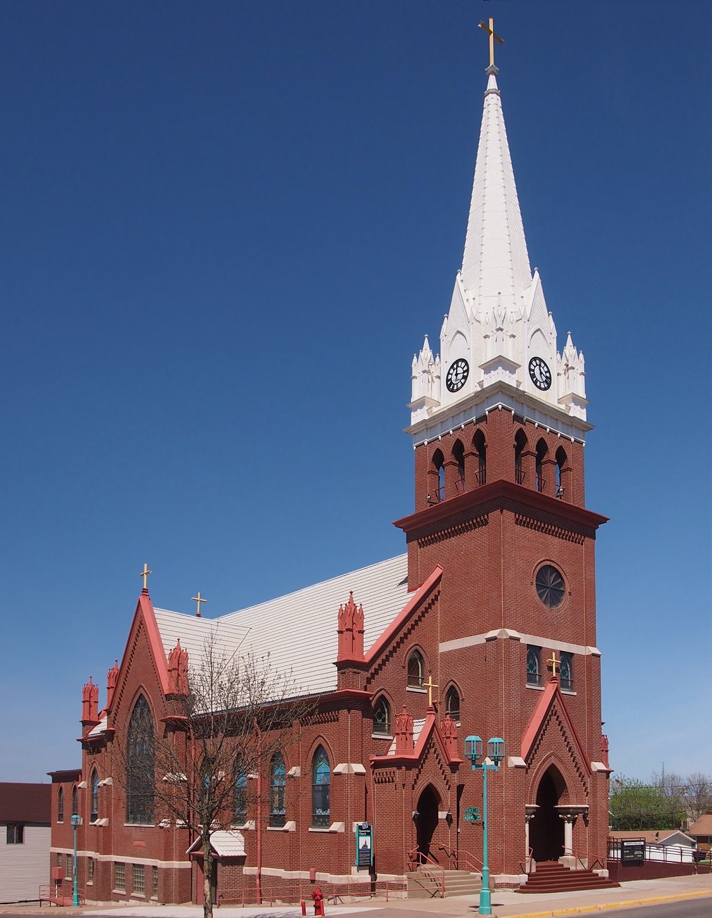

Eveleth, Minnesota
Eveleth is a city of 3,448 people in St. Louis County, Minnesota, founded in 1893.
Why visit Eveleth
Townapedia lists 24 museums and landmarks, 5 parks and trails, 8 places to eat, 1 place to stay and 1 attraction in and around town.
Highlights include Thomas Rukavina Memorial Bridge, B'nai Abraham Synagogue, Charles Lenont House and Olcott Park.
July is the warmest month, with average highs of 77°F; January lows average -2°F.
Weather in Eveleth
Forecast from the National Weather Service. Full forecast
About Eveleth
Eveleth is a city in St. Louis County, Minnesota, United States. The population was 3,493 at the 2020 census. Eveleth is part of the Quad Cities, with Virginia, Gilbert, and Mountain Iron. U.S.
From the Wikipedia article Eveleth, Minnesota (this version), under CC BY-SA 4.0.
Things to do1

Thomas Rukavina Memorial Bridge
Bridge · 2.8 mi
Highway bridge in Minnesota, U.S
Museums and landmarks24

B'nai Abraham Synagogue
Monument and historic site · National Register of Historic Places · 3.0 mi
Historic former synagogue in Virginia, Minnesota, United States
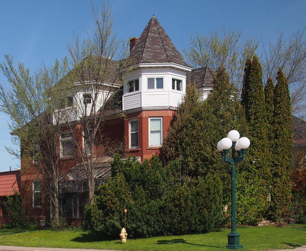
Charles Lenont House
Monument and historic site · National Register of Historic Places · 3.4 mi
Historic house in Virginia, Minnesota, United States
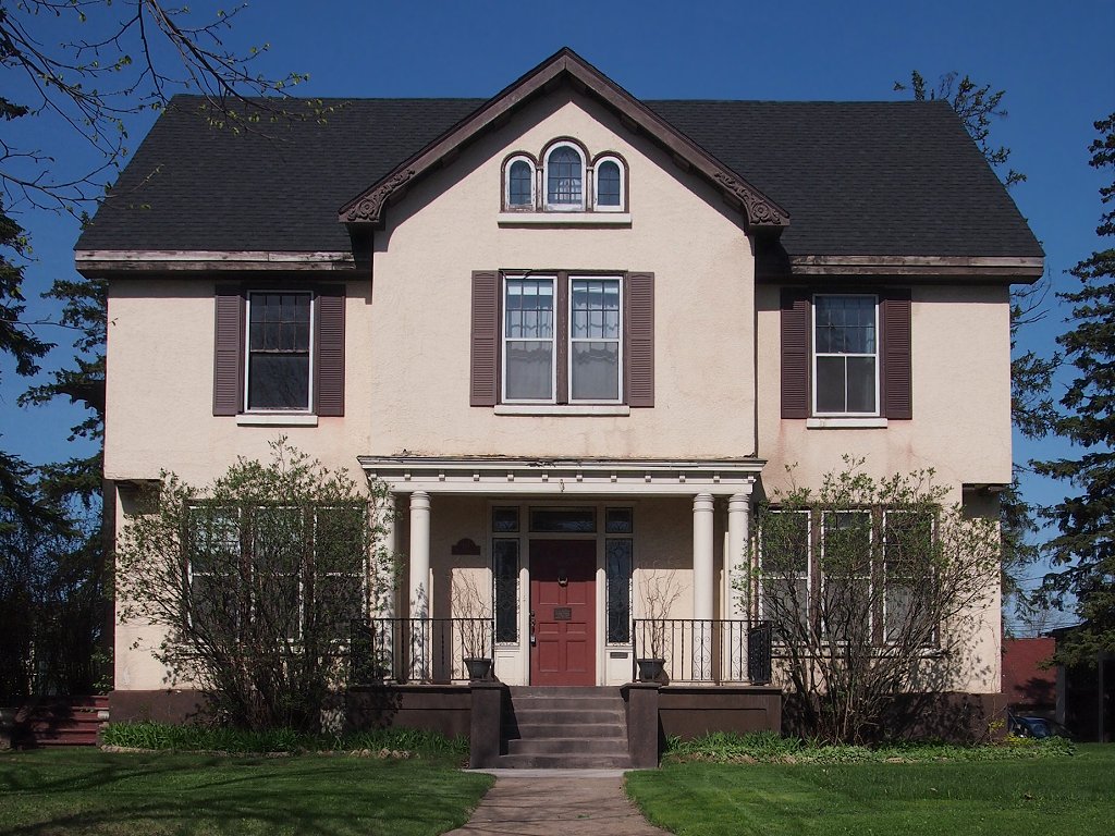
Coates House
Monument and historic site · National Register of Historic Places · 2.8 mi
House in Virginia, Minnesota
Eveleth Recreation Building
Monument and historic site · National Register of Historic Places · 0.8 mi
Historic building in Eveleth, Minnesota, United States
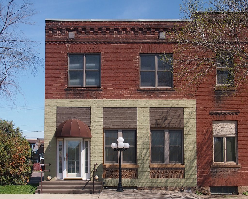
Finnish Sauna
Monument and historic site · National Register of Historic Places · 3.3 mi
Finnish sauna in Virginia, Minnesota

First National Bank of Gilbert
Monument and historic site · National Register of Historic Places · 3.9 mi
Historic bank building in Gilbert, Minnesota, United States

Hotel Glode
Monument and historic site · National Register of Historic Places · 1.0 mi
Historic building in Eveleth, Minnesota, United States

LaSalle Apartments
Monument and historic site · National Register of Historic Places · 3.4 mi
Historic apartment building in Virginia, Minnesota, United States

Lincoln School Building
Monument and historic site · National Register of Historic Places · 3.4 mi
School building in Virginia, United States of America

St. Louis County District Courthouse
Monument and historic site · National Register of Historic Places · 3.1 mi
Virginia, Minnesota, NRHP-listed in St. Louis County

Virginia Brewery
Monument and historic site · National Register of Historic Places · 3.1 mi
Former brewery in Virginia, Minnesota, United States
Virginia City Hall
Monument and historic site · National Register of Historic Places · 3.3 mi
Rathaus in Virginia, United States of America
12 more on the map.
Parks, trails and playgrounds5




RRCC Eveleth Sliding Hill
Park · 0.8 mi
Seasonal Sliding hill funded by city of Eveleth
Restaurants and cafes8


Marys Morsels
Restaurant · Coffee Shop, Burger, American · 0.6 mi
1019 Grant Avenue, Eveleth
Mo-Sa 06:00-14:00
The Rink, Sports Bar & Grill
Restaurant · Burger, Pizza, American · 1.4 mi
301 Hat Trick Avenue, Eveleth
Mo-Su 07:00-22:00


McDonald's
Fast food · Burger · 2.5 mi
1350 South 12th Avenue West, Virginia
Su-Th 05:00-23:00; Fr-Sa 05:00-24:00
History
The Village of Eveleth was platted on April 22, 1893, originally about 1 mile (1.6 km) southwest of the present location, on land then included in the Adams-Spruce Mine (Douglas Avenue between Jones and Monroe Streets). The community was named after Erwin Eveleth, a prominent employee of a timber company in the area. In 1895, iron ore was discovered beneath the village site and a post office was established. Eveleth first established its post office on February 9, 1895, with P. Ellard Dowling as commander-in-chief. Eveleth also had its first paper, The Eveleth Star, the same year. In 1900, the village moved to its present location. It was incorporated as a city in 1902. When the city expanded, it annexed portions of Fayal Township, including the former unincorporated communities of Alice Mine Station (in the Alice Location south of downtown) and Fayal. With further expansion, Eveleth annexed the unincorporated community of Genoa to its east.
Throughout the 20th century, Eveleth's economy remained centered on iron ore mining, which shaped the city's development and population trends. During World War II, mining activity increased to meet wartime demand for iron ore, supporting employment and growth. In the postwar decades, the industry declined, causing economic challenges and population decreases. The city adapted by focusing on diversification efforts and community services.
From the History section of Eveleth, Minnesota on Wikipedia, under CC BY-SA 4.0.
Where to stay1
Churches and places of worship4
Church of St. John the Baptist
Church · National Register of Historic Places · 3.1 mi
Church of the Holy Family
Church · National Register of Historic Places · 0.9 mi
Shopping3
Gas and EV charging3
Schools, colleges and libraries17
East Range Academy of Tech-Science
School · 3.8 mi
8541 Park Ridge Dr, Mountain Iron
Northeast Service Cooperative Oll
School · 3.6 mi
5525 Emerald Ave, Mountain Iron
Map of Eveleth
66 places. The map loads OpenStreetMap tiles when you open it.
Climate by month
Monthly table
| Month | High | Low | Rain |
|---|---|---|---|
| Jan | 16°F | -2°F | 0.8 in |
| Feb | 22°F | 2°F | 0.7 in |
| Mar | 35°F | 14°F | 1.2 in |
| Apr | 49°F | 28°F | 1.9 in |
| May | 63°F | 41°F | 3.0 in |
| Jun | 72°F | 51°F | 4.2 in |
| Jul | 77°F | 56°F | 3.9 in |
| Aug | 76°F | 54°F | 3.5 in |
| Sep | 66°F | 45°F | 3.4 in |
| Oct | 51°F | 33°F | 2.5 in |
| Nov | 34°F | 20°F | 1.4 in |
| Dec | 22°F | 6°F | 1.0 in |
U.S. Climate Normals 1991-2020 for Eveleth Wwtp Hcn (1 mi away), NOAA NCEI.
People and cost of living
American Community Survey 5-year estimates, 2020-2024, U.S. Census Bureau. Estimates have margins of error, larger for small towns.
Disaster history
St. Louis County has had 11 federal disaster declarations since 2000, most often for floods.
- 2025-05-14: Munger Shaw Fire (Fire)
- 2024-06-28: Severe Storms And Flooding (Flood)
- 2023-07-19: Severe Storms And Flooding (Flood)
- 2022-07-13: Severe Storms, Straight-Line Winds, And Flooding (Flood)
- 2020-04-07: Covid-19 Pandemic (Biological)
- 2020-03-13: Covid-19 (Biological)
OpenFEMA disaster declarations summaries.
Getting there and nearby towns
Eveleth-Virginia Municipal Airport (EVM) is the nearest airport with scheduled flights listed in OpenStreetMap, 4 miles away.
- Aurora 15 mi east, about 24 min by car
- Chisholm 16 mi west, about 25 min by car
- Hibbing 19 mi west, about 31 min by car
- Ely 44 mi northeast, about 1 h 15 min by car
- Coleraine 45 mi west, about 1 h 15 min by car
- Grand Rapids 49 mi west, about 1 h 15 min by car
- Hermantown 49 mi south, about 1 h 15 min by car
- Duluth 52 mi south, about 1 h 30 min by car
- Cloquet 52 mi south, about 1 h 30 min by car
- Cohasset 55 mi west, about 1 h 30 min by car
Drive times are estimates from straight-line distance, not routes.
Local news
Headlines from INDB, the NEMICO news database.
Reviews, tips and questions
Loading what members have shared...
Sources and licences
- NCES EDGE (Public domain): public schools
- NOAA NCEI U.S. Climate Normals 1991-2020 (Public domain): climate by month
- OpenFEMA (Public domain): disaster declarations
- OpenStreetMap contributors (ODbL 1.0): places, airports, map data
- U.S. Census Bureau (Public domain): population, income, housing, education, commute
- Wikidata (CC0 1.0): elevation, founding date, time zone, website, landmarks and historic places
- Wikimedia Commons (see each image): photos
- Wikipedia (CC BY-SA 4.0): overview and history text
Photo credits
- Eveleth Carnegie Library, McGhiever, CC BY-SA 3.0
- Duluth, Winnipeg, & Pacific Depot, McGhiever, CC BY-SA 3.0
- Eveleth Recreation Building, McGhiever, CC BY-SA 3.0
- Virginia City Hall, McGhiever, CC BY-SA 3.0
- Church of the Holy Family, McGhiever, CC BY-SA 3.0
- Lincoln School Building, McGhiever, CC BY-SA 3.0
- B'nai Abraham Synagogue, McGhiever, CC BY-SA 3.0
- Church of St. John the Baptist (Virginia, MN), McGhiever, CC BY-SA 3.0
- W. Bailey House, McGhiever, CC BY-SA 3.0
- Charles Lenont House, McGhiever, CC BY-SA 3.0
- Hotel Glode, McGhiever, CC BY-SA 3.0
- The Ivy Manor in Virginia, Minnesota, Tcadeau, CC BY-SA 4.0
- Virginia Commercial Historic District, McGhiever, CC BY-SA 3.0
- Virginia-Rainy Lake Lumber Company Manager's Residence, McGhiever, CC BY-SA 3.0
- Coates House, McGhiever, CC BY-SA 3.0
- Finnish Sauna, McGhiever, CC BY-SA 3.0
- St. Louis County District Courthouse, McGhiever, CC BY-SA 3.0
- Virginia Recreation Building, McGhiever, CC BY-SA 3.0
- W.T. Bailey House 2017, McGhiever, CC BY-SA 4.0
- Virginia Brewery, McGhiever, CC BY-SA 3.0
- First National Bank of Gilbert, McGhiever, CC BY-SA 3.0
- Jukola Boardinghouse, McGhiever, CC BY-SA 3.0
- Virginia-Rainy Lake Lumber Company Office, McGhiever, CC BY-SA 3.0
- Valon Tuote Raittiusseura, McGhiever, CC BY-SA 3.0
- IronRangeHistoricalSociety, DrGregMN, CC BY-SA 3.0
- Olcott Park, McGhiever, CC BY-SA 4.0


Page built October 30, 2026. Spotted a mistake? Tell us or suggest a place.