
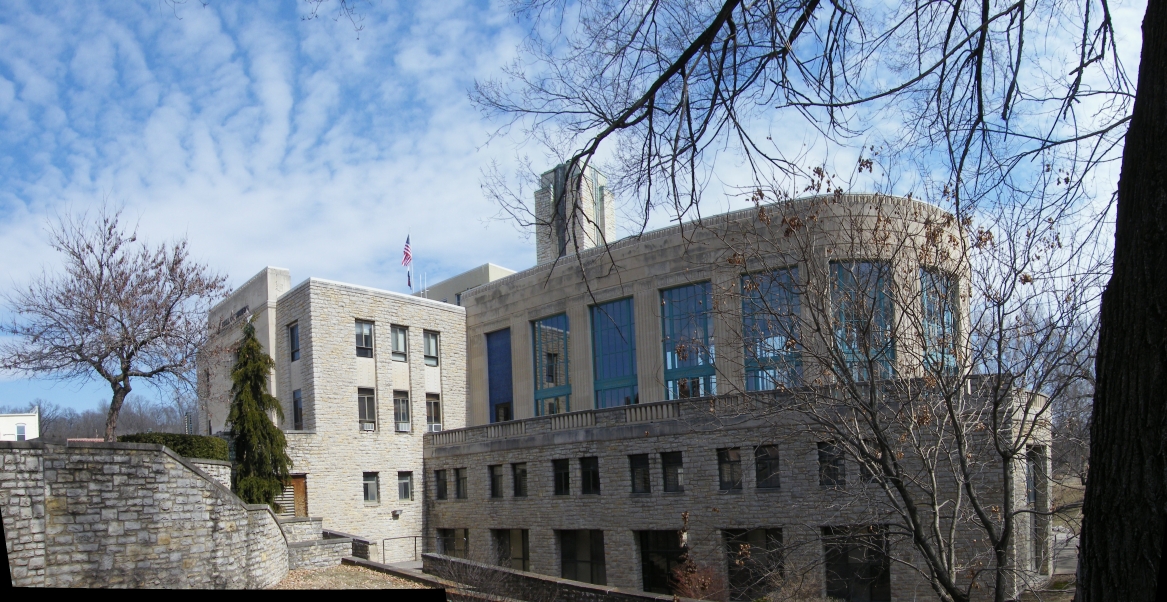


Excelsior Springs, Missouri
Excelsior Springs is a city of 10,484 people in Clay County, Missouri, founded in 1880.
Why visit Excelsior Springs
Townapedia lists 10 museums and landmarks, 10 parks and trails, 18 places to eat, 1 place to stay and 2 attractions in and around town.
Highlights include Colonial Hotel, Elms Hotel, Excelsior Springs Golf Course and Tryst Falls Park.
July is the warmest month, with average highs of 88°F; January lows average 17°F.
Weather in Excelsior Springs
Forecast from the National Weather Service. Full forecast
About Excelsior Springs
Excelsior Springs is a city in Clay and Ray counties in the U.S. state of Missouri and part of the Kansas City metropolitan area. The population was 10,553 at the 2020 census. It is located approximately 30 miles (48 km) northeast of central Kansas City, Missouri.
From the Wikipedia article Excelsior Springs, Missouri (this version), under CC BY-SA 4.0.
Things to do2

Excelsior Springs High School Performance Art Center
Cinema and theater · 0.6 mi

Museums and landmarks10

Colonial Hotel
Monument and historic site · National Register of Historic Places · 1.1 mi
Historic hotel in Missouri, United States

Elms Hotel
Monument and historic site · National Register of Historic Places · 0.8 mi
Building in Excelsior Springs, Missouri
Excelsior Springs Hall of Waters Commercial East Historic District
Monument and historic site · National Register of Historic Places · 1.1 mi
Building in Missouri, United States
Excelsior Springs Hall of Waters Commercial West Historic District
Monument and historic site · National Register of Historic Places
Building in Missouri, United States
Hall of Waters
Monument and historic site · National Register of Historic Places · 1.0 mi
Building in Missouri, United States
Ligon Apartments
Monument and historic site · National Register of Historic Places · 1.1 mi
Building in Missouri, United States
The Elms Historic District
Monument and historic site · National Register of Historic Places · 0.8 mi
Historic district in Excelsior Springs, Missouri, United States

Watkins Woolen Mill State Park and State Historic Site
Monument and historic site · National Register of Historic Places · 4.4 mi
Lawson, Missouri, a property listed on the NRHP
Wyman School
Monument and historic site · National Register of Historic Places · 0.8 mi
Building in Missouri, United States

Excelsior Springs Museum
Museum · 1.0 mi
101 East Broadway Street, Excelsior Springs
Parks, trails and playgrounds10





Restaurants and cafes18




Excelsior Springs Boulangerie
Bakery · 0.9 mi
415 South Thompson Avenue, Excelsior Springs



6 more on the map.
History
This location had a major incident during the historic march of Zion's Camp in 1834 when a contingent of about 200 Mormon believers, marching to rescue their brethren in Jackson County, faced an angry mob of more than 300. Near two forks of Fishing River, a terrible fight was about to start when a severe thunderstorm rolled in suddenly and put the mob to flight. Zion's Camp was able to move forward unharmed. Historical markers to the incident are located nearby.
From the History section of Excelsior Springs, Missouri on Wikipedia, under CC BY-SA 4.0.
Where to stay1
The Elms Hotel & Spa, a Destination by Hyatt Hotel
Motel and hotel · 0.8 mi
401 Regent Street, Excelsior Springs
Churches and places of worship9
First Methodist Church
Church · National Register of Historic Places · 1.0 mi
Crescent Lake Christian Center
Church · Nondenominational · 1.2 mi
1250 Saint Louis Avenue, Excelsior Springs
Shopping4
Gas and EV charging7
Schools, colleges and libraries19
Excelsior Springs Ear Chld Ctr
School · 0.5 mi
500 North Jesse James Road, Excelsior Springs
Healthcare2
Map of Excelsior Springs
82 places. The map loads OpenStreetMap tiles when you open it.
Climate by month
Monthly table
| Month | High | Low | Rain | Snow |
|---|---|---|---|---|
| Jan | 38°F | 17°F | 1.3 in | 5.0 in |
| Feb | 43°F | 21°F | 1.6 in | 6.5 in |
| Mar | 55°F | 31°F | 2.5 in | 2.0 in |
| Apr | 66°F | 41°F | 4.1 in | 0.1 in |
| May | 75°F | 52°F | 5.2 in | 0.0 in |
| Jun | 84°F | 63°F | 5.2 in | 0.0 in |
| Jul | 88°F | 67°F | 5.4 in | 0.0 in |
| Aug | 87°F | 64°F | 4.0 in | 0.0 in |
| Sep | 80°F | 55°F | 4.9 in | 0.0 in |
| Oct | 68°F | 43°F | 3.2 in | 0.3 in |
| Nov | 55°F | 31°F | 2.1 in | 0.9 in |
| Dec | 42°F | 22°F | 1.7 in | 4.6 in |
U.S. Climate Normals 1991-2020 for Kearney 3E (5 mi away), NOAA NCEI.
People and cost of living
American Community Survey 5-year estimates, 2020-2024, U.S. Census Bureau. Estimates have margins of error, larger for small towns.
Disaster history
Clay County has had 13 federal disaster declarations since 2000, most often for severe storms.
- 2020-03-26: Covid-19 Pandemic (Biological)
- 2020-03-13: Covid-19 (Biological)
- 2019-07-09: Severe Storms, Tornadoes, And Flooding (Severe Storm)
- 2015-08-07: Severe Storms, Tornadoes, Straight-Line Winds, And Flooding (Severe Storm)
- 2011-06-30: Flooding (Flood)
- 2011-02-03: Severe Winter Storm (Severe Storm)
OpenFEMA disaster declarations summaries.
Getting there and nearby towns
Charles B. Wheeler Downtown Airport (MKC) is the nearest airport with scheduled flights listed in OpenStreetMap, 24 miles away.
- Independence 19 mi south, about 30 min by car
- Kansas City 22 mi southwest, about 36 min by car
- Blue Springs 23 mi south, about 37 min by car
- Lee's Summit 30 mi south, about 48 min by car
- Kansas City 31 mi southwest, about 49 min by car
- Prairie Village 32 mi southwest, about 52 min by car
- Merriam 33 mi southwest, about 53 min by car
- Leawood 36 mi southwest, about 58 min by car
- Shawnee 38 mi southwest, about 1 h by car
- Overland Park 39 mi southwest, about 1 h by car
Drive times are estimates from straight-line distance, not routes.
Local news
Headlines from INDB, the NEMICO news database.
Reviews, tips and questions
Loading what members have shared...
Sources and licences
- NCES EDGE (Public domain): public schools
- NOAA NCEI U.S. Climate Normals 1991-2020 (Public domain): climate by month
- OpenFEMA (Public domain): disaster declarations
- OpenStreetMap contributors (ODbL 1.0): places, airports, map data
- U.S. Census Bureau (Public domain): population, income, housing, education, commute
- Wikidata (CC0 1.0): elevation, founding date, time zone, website, landmarks and historic places
- Wikimedia Commons (see each image): photos
- Wikipedia (CC BY-SA 4.0): overview and history text
Photo credits
- Hall-of-waters, Americasroof, CC BY-SA 3.0
- Old Excelsior Springs Post Office, 25or6to4, CC BY-SA 4.0
- Hotel Oaks, Excelsior Springs, MO, 25or6to4, CC BY-SA 4.0
- Royal Hotel, Excelsior Springs, MO, 25or6to4, CC BY-SA 4.0
- Excelsior Springs, MO 64024, USA - panoramio, LOGAN41125, CC BY 3.0
- Greetings from Excelsior Springs, Missouri, Missouri's National Health and Recreation Resort - Large Letter Postcard (4472359863), Steve Shook from Moscow, Idaho, USA, CC BY 2.0
- St. Ann's Catholic School, Excelsior Springs, MO, 25or6to4, CC BY-SA 4.0
- St. Luke's Episcopal Church, Excelsior Springs, MO, 25or6to4, CC BY-SA 4.0
- Holmes and Clark Homes, Excelsior Springs, MO, 25or6to4, CC BY-SA 4.0
- Old First Methodist Church, Excelsior Springs, MO, 25or6to4, CC BY-SA 4.0
- Ligon Apartments, Excelsior Springs, MO, 25or6to4, CC BY-SA 4.0
- Colonial Hotel, Excelsior Springs, MO, 25or6to4, CC BY-SA 4.0
- Elms-hotel2, Americasroof, CC BY-SA 3.0
- Watkins Mill, County Highway MM, Lawson vicinity (Clay County, Missouri) crop1, Watkins_Mill,_County_Highway_MM,_Lawson_vicinity_(Clay_County,_Missouri).jpg : Jet Lowe, Photographer derivative work: Kbh3rd ( talk ), Public domain
- Old McCleary Thornton-Minor Hospital, 25or6to4, CC BY-SA 4.0
- Old Elks Lodge, Excelsior Psring, MO, 25or6to4, CC BY-SA 4.0
- St. Ann's Catholic Church, Excelsior Spring, MO, 25or6to4, CC BY-SA 4.0
- The Elms Resort at night, Melissa Kothe, CC BY-SA 3.0
- The water bar in the Hall of Waters, Eric Mueller from Los Angeles, California, USA, CC BY-SA 2.0


Page built October 30, 2026. Spotted a mistake? Tell us or suggest a place.