
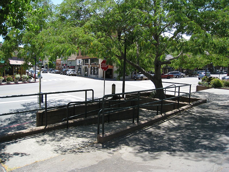


Why visit Fairfax
Townapedia lists 5 museums and landmarks, 23 parks and trails, 25 places to eat, 1 place to stay and 4 attractions in and around town.
Highlights include Bald Hill, Fairfax 5 Theaters, Bradford House and Marin County Civic Center.
August is the warmest month, with average highs of 81°F; December lows average 42°F.
Weather in Fairfax
Forecast from the National Weather Service. Full forecast
About Fairfax
Fairfax is an incorporated town in Marin County, California, United States. As of the 2020 census, its population was 7,605. Fairfax is bordered on the east by San Anselmo and is located 3.25 miles (5.2 km) west-northwest of San Rafael, at an elevation of 115 feet (35 m).
From the Wikipedia article Fairfax, California (this version), under CC BY-SA 4.0.
Things to do4



Museums and landmarks5

Bradford House
Monument and historic site · National Register of Historic Places · 3.3 mi
House in San Rafael, California

Marin County Civic Center
Monument and historic site · National Register of Historic Places · 3.6 mi
Building in California, designed by F.L.Wright


Robert Dollar House
Monument and historic site · National Register of Historic Places · 3.0 mi
Historic house in San Rafael, California, United States


San Rafael Improvement Club
Monument and historic site · National Register of Historic Places · 3.2 mi
Historic building in San Rafael, California, United States
Parks, trails and playgrounds23



11 more on the map.
Restaurants and cafes25

Barefoot Cafe
Diner · American · 0.4 mi
1900 Sir Francis Drake Boulevard
Mo-Su 08:00-21:00; Fr,Sa 08:00-22:00

Cafe Lotus
Restaurant · Indian · 0.4 mi
1912 Sir Francis Drake Boulevard
Mo-Su 11:30-14:30,17:00-21:30
Ghiringhelli’s Pizzeria
Restaurant · Pizza
45 Broadway
Mo-Th 16:00-20:00; Fr 16:00-21:00; Sa 12:00-21:00; Su 12:00-20:00
My Thai
Restaurant · Thai · 0.4 mi
25 Broadway, Fairfax
Mo-Fr 11:00-15:00,17:00-21:00; Sa-Su 12:00-16:00,17:00-21:00
Más Masa
Restaurant · Mexican · 0.4 mi
31 Bolinas Fairfax Road, Fairfax
We-Sa 11:00-20:30; Su 11:00-20:00
Way Station
Restaurant · Barbecue
2001 Sir Francis Drake Boulevard
Tu-Fr 16:00-21:00; Sa 11:30-21:00; Su 11:30-20:00



Swirl
Ice cream · 1.6 mi
916 Sir Francis Drake Boulevard, San Anselmo
Su-Th 12:00-20:00; Fr-Sa 12:00-21:00
13 more on the map.
History
The Coast Miwok Native Americans occupied stretches along local creeks, spring and seep areas; moreover, prehistoric habitations were usually chosen near permanent and seasonal drainages, typically along flat ridges and terraces.
The town was named for Lord Charles Snowden Fairfax, American hereditary peer and California Assembly speaker. In 1861, Fairfax was the site of the last political duel in California. Daniel Showalter and Charles W. Piercy, both former assemblymen in the state legislature, decided to settle a political dispute at the home of Lord Fairfax, a mutual friend. Although Fairfax provided lunch to both men and tried to talk them out of it, they eventually headed to an open field nearby and dueled, with Showalter killing Piercy.
The first post office opened in 1910. Fairfax became an incorporated town in 1931.
On May 16, 1946, a B-17 Flying Fortress bomber, crashed on White's Hill just west of Fairfax.
From the History section of Fairfax, California on Wikipedia, under CC BY-SA 4.0.
Where to stay1
Churches and places of worship5
Shopping7
Gas and EV charging2
Schools, colleges and libraries47
Anthony G. Bacich Elementary
School · 4.0 mi
699 Sir Francis Drake Blvd., Kentfield
Healthcare1
Map of Fairfax
120 places. The map loads OpenStreetMap tiles when you open it.
Climate by month
Monthly table
| Month | High | Low | Rain | Snow |
|---|---|---|---|---|
| Jan | 57°F | 43°F | 7.1 in | 0.0 in |
| Feb | 61°F | 44°F | 6.9 in | 0.0 in |
| Mar | 65°F | 46°F | 4.4 in | 0.0 in |
| Apr | 68°F | 48°F | 2.0 in | 0.0 in |
| May | 72°F | 51°F | 0.9 in | 0.0 in |
| Jun | 78°F | 54°F | 0.1 in | 0.0 in |
| Jul | 81°F | 55°F | 0.0 in | 0.0 in |
| Aug | 81°F | 56°F | 0.1 in | 0.0 in |
| Sep | 81°F | 54°F | 0.1 in | 0.0 in |
| Oct | 75°F | 51°F | 1.5 in | 0.0 in |
| Nov | 65°F | 46°F | 3.5 in | 0.0 in |
| Dec | 57°F | 42°F | 7.8 in | 0.0 in |
U.S. Climate Normals 1991-2020 for San Rafael Civic Ctr (3 mi away), NOAA NCEI.
People and cost of living
American Community Survey 5-year estimates, 2020-2024, U.S. Census Bureau. Estimates have margins of error, larger for small towns.
Disaster history
Marin County has had 12 federal disaster declarations since 2000, most often for severe storms.
- 2023-04-03: Severe Winter Storms, Straight-Line Winds, Flooding, Landslides, And Mudslides (Severe Storm)
- 2023-01-14: Severe Winter Storms, Flooding, Landslides, And Mudslides (Flood)
- 2023-01-09: Severe Winter Storms, Flooding, And Mudslides (Flood)
- 2020-03-22: Covid-19 Pandemic (Biological)
- 2020-03-13: Covid-19 (Biological)
- 2019-05-17: Severe Winter Storms, Flooding, Landslides, And Mudslides (Severe Storm)
OpenFEMA disaster declarations summaries.
Getting there and nearby towns
San Rafael Airport (SRF) is the nearest airport with scheduled flights listed in OpenStreetMap, 4 miles away.
- San Anselmo 1 mi east, about 2 min by car
- Sleepy Hollow 2 mi north, about 3 min by car
- Ross 3 mi southeast, about 4 min by car
- Woodacre 3 mi northwest, about 4 min by car
- San Rafael 5 mi east, about 8 min by car
- Larkspur 5 mi southeast, about 8 min by car
- Santa Venetia 5 mi east, about 8 min by car
- Mill Valley 6 mi southeast, about 10 min by car
- Corte Madera 6 mi southeast, about 10 min by car
- Lagunitas-Forest Knolls 6 mi west, about 9 min by car
Drive times are estimates from straight-line distance, not routes.
Local news
Headlines from INDB, the NEMICO news database.
Reviews, tips and questions
Loading what members have shared...
Sources and licences
- NCES EDGE (Public domain): public schools
- NOAA NCEI U.S. Climate Normals 1991-2020 (Public domain): climate by month
- OpenFEMA (Public domain): disaster declarations
- OpenStreetMap contributors (ODbL 1.0): places, airports, map data
- U.S. Census Bureau (Public domain): population, income, housing, education, commute
- Wikidata (CC0 1.0): elevation, founding date, time zone, website, landmarks and historic places
- Wikimedia Commons (see each image): photos
- Wikipedia (CC BY-SA 4.0): overview and history text
Photo credits
- DowntownFairfaxCAShot1, ERobson at English Wikipedia, CC BY 3.0
- Blessings upon those whom reside at 1 Marin Rd, a quaint corner lot cottage in Fairfax town (51041645392), Dana L. Brown from Lucas Valley, USA, CC BY-SA 2.0
- Fairfax theater, Leocoll, CC BY-SA 4.0
- North Pacific Coast Railroad ROW in Fairfax, April 2018, Pi.1415926535, CC BY-SA 3.0
- Bradford House 333 G St San Rafael CA 3-21-2010 3-15-00 PM, Sanfranman59, CC BY-SA 3.0
- Robert Dollar House 115 J St San Rafael CA 3-21-2010 3-36-55 PM, Sanfranman59, CC BY-SA 3.0
- Marin Civic Center, Fizbin at en.wikipedia, Public domain
- San Rafael Improvement Club 1801 5th Ave San Rafael CA 3-21-2010 3-29-02 PM, Sanfranman59, CC BY-SA 3.0
- Various game and sports balls, top-down, Classroom Camera (Cascade Canyon School), CC BY 2.0
- DSC00187 (39753087734), Classroom Camera (Cascade Canyon School), CC BY 2.0
- Various game and sports balls, side view, Classroom Camera (Cascade Canyon School), CC BY 2.0
- Scorpion Mom with babies, Tbodle, CC BY 4.0
- Marin Museum of Bicycling (44618533914), Timothy Vollmer from Oakland, USA, CC BY 2.0
- Marin Museum of Bicycling (30401951147), Timothy Vollmer from Oakland, USA, CC BY 2.0
- Marin Museum of Bicycling (44618533144), Timothy Vollmer from Oakland, USA, CC BY 2.0
- Marin Museum of Bicycling (45341493571), Timothy Vollmer from Oakland, USA, CC BY 2.0
- Porcellio dilatatus 9038801, Sam Kieschnick, CC BY 4.0
- Stereum ochraceoflavum 138723849, Alan Rockefeller, CC BY 4.0
- Eclipse - A Piece for Assorted Lunatics (5673256342), EddieBerman, CC BY 2.0
- Fantasy Football League Commissioner's Official Playbook 1976, Alanjosephs, CC BY-SA 4.0
- Sir Francis Drake Boulevard, Francis Storr, CC BY-SA 2.0
- ISS053-E-90403 - View of Earth, Earth Science and Remote Sensing Unit , Lyndon B. Johnson Space Center, Public domain
- ISS056-E-62788 - View of Earth, Earth Science and Remote Sensing Unit, NASA Johnson Space Center, Public domain
- ISS065-E-236011 - View of Earth, Earth Science and Remote Sensing Unit , Lyndon B. Johnson Space Center, Public domain
- ISS053-E-82278 - View of Earth, Earth Science and Remote Sensing Unit , Lyndon B. Johnson Space Center, Public domain
- ISS063-E-98792 - View of Earth, Earth Science and Remote Sensing Unit, NASA Johnson Space Center, Public domain
- ISS047-E-82387 - View of Earth, Earth Science and Remote Sensing Unit , Lyndon B. Johnson Space Center, Public domain
- ISS063-E-98791 - View of Earth, Earth Science and Remote Sensing Unit, NASA Johnson Space Center, Public domain
- ISS063-E-98793 - View of Earth, Earth Science and Remote Sensing Unit, NASA Johnson Space Center, Public domain
- ISS065-E-236012 - View of Earth, Earth Science and Remote Sensing Unit , Lyndon B. Johnson Space Center, Public domain
- ISS047-E-82386 - View of Earth, Earth Science and Remote Sensing Unit , Lyndon B. Johnson Space Center, Public domain
- ISS006-E-24965 - View of California, Earth Science and Remote Sensing Unit , Lyndon B. Johnson Space Center, Public domain
- 2009 candidate chariot race 1200, Btphelps, CC BY-SA 3.0
- Acmispon brachycarpus 374516344, Peter Brastow, CC BY 4.0
- Archie Williams High School in 2024, Mx. Granger, CC0
- Sir Francis Drake High School, Rbear2000, CC BY-SA 4.0
- Breithorn traverse, Victoria Lunyak, CC0
- Tauschia kelloggii 34282512, Jim Kingdon, CC0
- Agaricus albolutescens Zeller 707213, This image was created by user Ron Pastorino (Ronpast) at Mushroom Observer , a source for mycological images. You can contact this user here ., CC BY-SA 3.0
- California common scorpion - Paruroctonus silvestrii - Flickr - GregTheBusker, Greg Schechter from San Francisco, USA, CC BY 2.0


Page built October 30, 2026. Spotted a mistake? Tell us or suggest a place.