
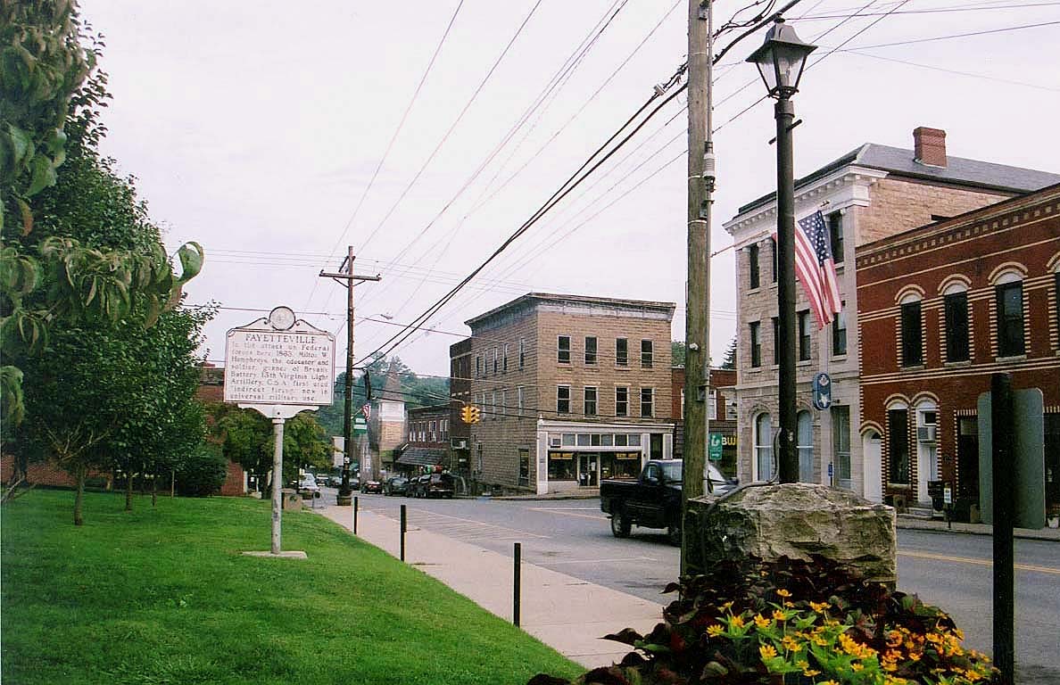


Fayetteville, West Virginia
Fayetteville is a town of 2,817 people in Fayette County, West Virginia.
Why visit Fayetteville
Townapedia lists 11 museums and landmarks, 7 parks and trails, 21 places to eat, 4 places to stay and 4 attractions in and around town.
Highlights include New River Gorge Bridge, Tunney Hunsaker Bridge, Altamont Hotel and E. B. Hawkins House.
July is the warmest month, with average highs of 84°F; January lows average 23°F.
Weather in Fayetteville
Forecast from the National Weather Service. Full forecast
About Fayetteville
Fayetteville is a town in and the county seat of Fayette County, West Virginia, United States. The population was 2,887 at the 2020 census.
From the Wikipedia article Fayetteville, West Virginia (this version), under CC BY-SA 4.0.
Things to do4

New River Gorge Bridge
Bridge · National Register of Historic Places · 1.5 mi
Steel arch bridge over New River Gorge near Fayetteville, West Virginia, USA



Museums and landmarks11

Altamont Hotel
Monument and historic site · National Register of Historic Places · 0.9 mi
Hotel building in Fayetteville, West Virginia
E. B. Hawkins House
Monument and historic site · National Register of Historic Places · 1.0 mi
Historic house in West Virginia, United States

Fayette County Courthouse
Monument and historic site · National Register of Historic Places · 0.8 mi
Historic courthouse located at Fayetteville, Fayette County, West Virginia
Fayetteville Historic District
Monument and historic site · National Register of Historic Places · 0.9 mi
Listed on the National Register of Historic Places in Fayette County, West Virginia

Hawks Nest State Park
Monument and historic site · National Register of Historic Places · 4.2 mi
State park in West Virginia, United States of America

Kay Moor
Monument and historic site · National Register of Historic Places · 2.6 mi
Human settlement in Fayette County, West Virginia, United States of America


Nuttallburg Coal Mining Complex and Town Historic District
Monument and historic site · National Register of Historic Places · 3.7 mi
Human settlement in West Virginia, United States of America

Parks, trails and playgrounds7


Restaurants and cafes21

Pies & Pints - Craft Pizza & Beer
Restaurant · Pizza, Salad, Flatbread, Beer · 0.9 mi
219 Maple Avenue, Fayetteville
Mo-Th, Su 11:00-21:00; Fr, Sa 11:00-22:00
Namaste Blends & Bites
Restaurant · Nepalese, Juice, Smoothie · 0.8 mi
115 East Maple Avenue, Fayetteville
Mo 09:00-17:00; We 09:00-15:00; Th-Su 08:00-20:00

Southside Junction Taphouse
Restaurant · 0.8 mi
Mo-Fr 16:00-23:00; Sa 12:00-23:00; Su 12:00-21:00
Wanderlust CreativeFoods
Restaurant · 0.8 mi
Su,Mo 16:00-20:00; Tu,We off; Th 16:00-20:00; Fr,Sa 16:00-21:00


9 more on the map.
History
Fayetteville was founded as Vandalia by Abraham Vandall, a Revolutionary War veteran and local farmer, on farmland that Vandall owned. In 1837, the county seat of government was moved from New Haven in the Mountain Cove District to Vandalia. Later, the town's name was changed to Fayetteville after the Revolutionary War hero, Marquis de Lafayette who toured the US in 1824–25.
During the Civil War, the majority of the people in Fayetteville were in sympathy with the Confederacy. With neighboring counties being predominantly Unionist, however, Fayetteville changed hands several times during the war and was partially destroyed during the fighting. (See Battle of Fayetteville)
In 1897, the Fayette County Courthouse was completed on part of the original Vandall farm and was a remarkable example of the Romanesque Revival architectural style. The Altamont Hotel was built the same year. Both are listed on the National Register of Historic Places, along with the E. B. Hawkins House. The Fayetteville Historic District was designated in 1990.
From the History section of Fayetteville, West Virginia on Wikipedia, under CC BY-SA 4.0.
Where to stay4
Churches and places of worship5
Shopping8
Gas and EV charging2
Schools, colleges and libraries11
Healthcare1
Map of Fayetteville
74 places. The map loads OpenStreetMap tiles when you open it.
Climate by month
Monthly table
| Month | High | Low | Rain |
|---|---|---|---|
| Jan | 42°F | 23°F | 3.3 in |
| Feb | 46°F | 25°F | 3.0 in |
| Mar | 55°F | 31°F | 4.2 in |
| Apr | 68°F | 40°F | 4.3 in |
| May | 75°F | 50°F | 5.0 in |
| Jun | 81°F | 58°F | 4.7 in |
| Jul | 84°F | 62°F | 5.9 in |
| Aug | 83°F | 61°F | 4.2 in |
| Sep | 78°F | 54°F | 3.6 in |
| Oct | 68°F | 42°F | 3.1 in |
| Nov | 56°F | 33°F | 3.1 in |
| Dec | 46°F | 27°F | 3.7 in |
U.S. Climate Normals 1991-2020 for Anstead Hawks Nest Sp (4 mi away), NOAA NCEI.
People and cost of living
American Community Survey 5-year estimates, 2020-2024, U.S. Census Bureau. Estimates have margins of error, larger for small towns.
Disaster history
Fayette County has had 20 federal disaster declarations since 2000, most often for severe storms.
- 2026-10-07: Severe Storms And Flooding (Severe Storm)
- 2026-01-24: Severe Winter Storm (Winter Storm)
- 2024-05-22: Severe Storms, Straight-Line Winds, Tornadoes, Flooding, Landslides, And Mudslides (Severe Storm)
- 2022-11-28: Severe Storms, Flooding, Landslides, And Mudslides (Severe Storm)
- 2020-04-03: Covid-19 Pandemic (Biological)
- 2020-03-13: Covid-19 (Biological)
OpenFEMA disaster declarations summaries.
Getting there and nearby towns
Raleigh County Memorial Airport (BKW) is the nearest airport with scheduled flights listed in OpenStreetMap, 19 miles away.
- Ansted 5 mi north, about 8 min by car
- Bradley 15 mi southwest, about 24 min by car
- Beckley 20 mi south, about 33 min by car
- Crab Orchard 23 mi south, about 37 min by car
- Daniels 24 mi south, about 38 min by car
- Chesapeake 26 mi northwest, about 41 min by car
- Belle 26 mi northwest, about 42 min by car
- Coal Fork 29 mi northwest, about 47 min by car
- Craigsville 31 mi northeast, about 50 min by car
- Charleston 35 mi northwest, about 56 min by car
Drive times are estimates from straight-line distance, not routes.
Local news
Headlines from INDB, the NEMICO news database.
Reviews, tips and questions
Loading what members have shared...
Sources and licences
- NCES EDGE (Public domain): public schools
- NOAA NCEI U.S. Climate Normals 1991-2020 (Public domain): climate by month
- OpenFEMA (Public domain): disaster declarations
- OpenStreetMap contributors (ODbL 1.0): places, airports, map data
- U.S. Census Bureau (Public domain): population, income, housing, education, commute
- Wikidata (CC0 1.0): elevation, founding date, time zone, website, landmarks and historic places
- Wikimedia Commons (see each image): photos
- Wikipedia (CC BY-SA 4.0): overview and history text
Photo credits
- CourtSt FayettevilleWV, A.E. Crane, Attribution
- Fayetteville, West Virginia on Bridge Day 2009 - panoramio, Idawriter, CC BY-SA 3.0
- Fayetteville Historic District 2021c, Antony-22, CC BY-SA 4.0
- Fayetteville Historic District 2021b, Antony-22, CC BY-SA 4.0
- Fayetteville Historic District 2021d, Antony-22, CC BY-SA 4.0
- Fayetteville Historic District 2021a, Antony-22, CC BY-SA 4.0
- Fayetteville Post Office WV 2021, Antony-22, CC BY-SA 4.0
- Fayetteville Soldiers and Sailors Memorial Building, Nyttend, Public domain
- Altamont Hotel in Fayetteville, Nyttend, Public domain
- Fayetteville Esso Station, Nyttend, Public domain
- Bridge Day Fayetteville, WV October 15th - panoramio, driver-services, CC BY 3.0
- New River Gorge Bridge, JaGa, CC BY-SA 4.0
- Kay Moor conveyor, Jet Lowe, Public domain
- Hawks Nest, NKS22, Public domain
- Nuttallburg Coal Tipple, Bestbudbrian, CC BY-SA 4.0
- FayetteCtyCourthouse FayettevilleWV, Unknown author, Public domain
- Fayette Stn Rd River level Truss P6160556, Chris Light, CC BY-SA 4.0
- The Roadside in Fall - panoramio, Idawriter, CC BY-SA 3.0
- Fayette County Courthouse WV 2021b, Antony-22, CC BY-SA 4.0
- Fayette County Courthouse WV 2021a, Antony-22, CC BY-SA 4.0
- Fayette County Courthouse WV 2021c, Antony-22, CC BY-SA 4.0
- West Virginia - panoramio (2), 巫迪文, CC BY 3.0
- Old steel bridge (Unsplash), Ashley Knedler aknedler, CC0
- E.B. Hawkins House, Nyttend, Public domain
- Tree Frog, Bergvind, CC BY 3.0
- New River Gorge Bridge 2025d, Antony-22, CC BY-SA 4.0
- Rollin on the River - panoramio, Jeffery Roberts, CC BY-SA 3.0
- New River West Virginia - panoramio, 巫迪文, CC BY 3.0
- New River Gorge Bridge - under, Jarek Tuszyński, CC BY-SA 3.0
- New River Gorge Bridge 2025b, Antony-22, CC BY-SA 4.0
- CSX Under the New River Bridge, jpmueller99 from Columbus, OH, USA, CC BY 2.0
- New River Gorge Bridge Overlook, Gabor Eszes ( UED77 ), CC BY-SA 3.0
- New River Gorge Bridge 2025e, Antony-22, CC BY-SA 4.0
- Respres - Butterfly at New River Gorge National River (by), Jeff Turner from Santa Clarita, CA, United States, CC BY 2.0
- Diospyros virginiana 444100658, Ryan Watson, CC BY 4.0
- Diospyros virginiana 444100650, Ryan Watson, CC BY 4.0
- New River Gorge Bridge WV 8465 (7534786898), bobistraveling, CC BY 2.0
- New River Gorge Bridge WV 8464 (7534780522), bobistraveling, CC BY 2.0
- New River Gorge Bridge WV 8473 (7534825252), bobistraveling, CC BY 2.0
- New River Gorge Bridge WV 8475 (7534834922), bobistraveling, CC BY 2.0


Page built October 30, 2026. Spotted a mistake? Tell us or suggest a place.