



Ferndale, California
Ferndale is a city of 1,552 people in Humboldt County, California, founded in August 28, 1893.
Why visit Ferndale
Townapedia lists 8 museums and landmarks, 2 parks and trails, 5 places to eat, 3 places to stay and 2 attractions in and around town.
Highlights include Ferndale Museum, A. Berding House and Russ Park.
September is the warmest month, with average highs of 72°F; December lows average 42°F.
Weather in Ferndale
Forecast from the National Weather Service. Full forecast
About Ferndale
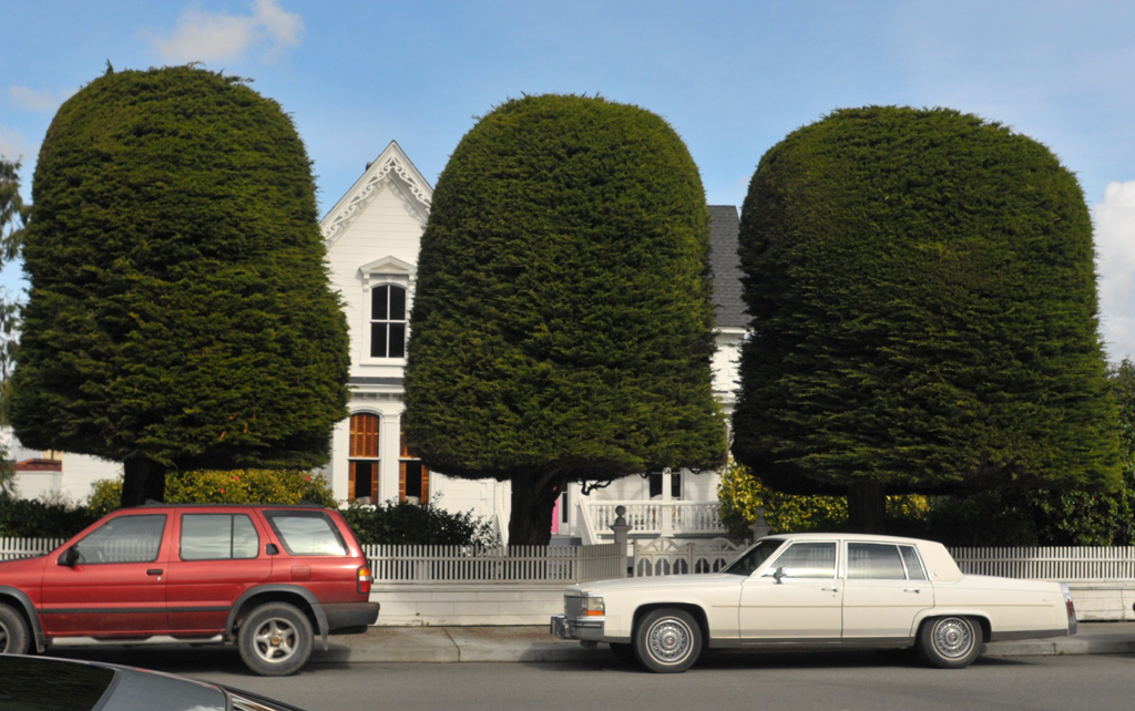
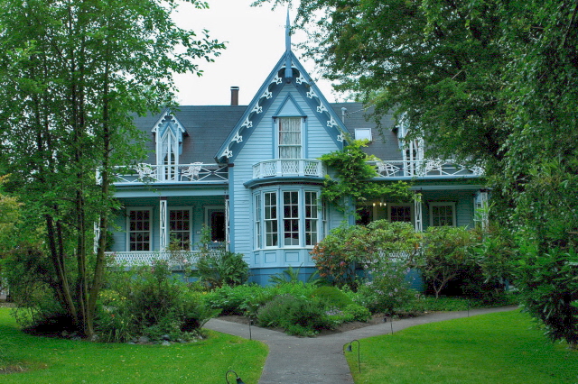
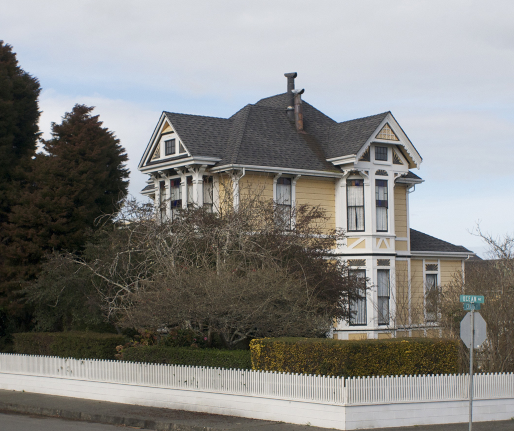
Ferndale is a city in Humboldt County, California, United States. Its population was 1,398 at the 2020 census, up from 1,371 at the 2010 census. The city is well known for its dozens of well-preserved Victorian storefronts and homes. Ferndale is the northern gateway to California's Lost Coast and the city, which is sited on the edge of a wide plain near the mouth of the Eel River, is also located near extensive preserves of coast redwood forests.
From the Wikipedia article Ferndale, California (this version), under CC BY-SA 4.0.
Things to do2


Museums and landmarks8

Ferndale Museum
Museum
Nonprofit history museum in Humboldt County, California
515 Shaw Avenue
We-Sa 11:00-16:00
A. Berding House
Monument and historic site · National Register of Historic Places
Historic house in California, United States

Alford-Nielson House
Monument and historic site · National Register of Historic Places
Single-family detached home in Ferndale, California

F. W. Andreasen-John Rossen House
Monument and historic site · National Register of Historic Places · 1.2 mi
United States historic place
Ferndale Library
Monument and historic site · National Register of Historic Places
Public library in Ferndale, California, USA
Shaw House
Monument and historic site · National Register of Historic Places
Historic house in California, United States

Parks, trails and playgrounds2

Restaurants and cafes5




History
Before American settlement, Ferndale was a glade of giant ferns reaching more than six feet (1.8 m), surrounded by alder, willow, Sitka spruce, Douglas fir, coast redwood, swampy land, and windswept prairies. The area was populated by the southern Wiyot people, and centered along the Eel River, where they caught lamprey eels, salmon and sturgeon in iris leaf fish nets and collected shellfish along the river and at its mouth, while cultivating a California species of tobacco.
The town was established in 1852 from settlement by Willard Allard, Seth Louis Shaw, and his brother, American portrait painter Stephen William Shaw. The settlement was incorporated in 1893.
From the History section of Ferndale, California on Wikipedia, under CC BY-SA 4.0.
Where to stay3
Churches and places of worship6
Rectory, Catholic Church of the Assumption
Church · National Register of Historic Places
Shopping2
Gas and EV charging2
Schools, colleges and libraries9
Map of Ferndale
39 places. The map loads OpenStreetMap tiles when you open it.
Climate by month
Monthly table
| Month | High | Low | Rain |
|---|---|---|---|
| Jan | 57°F | 43°F | 8.6 in |
| Feb | 58°F | 43°F | 7.8 in |
| Mar | 59°F | 44°F | 6.9 in |
| Apr | 62°F | 45°F | 3.9 in |
| May | 64°F | 49°F | 1.9 in |
| Jun | 67°F | 51°F | 0.6 in |
| Jul | 70°F | 54°F | 0.1 in |
| Aug | 72°F | 54°F | 0.1 in |
| Sep | 72°F | 52°F | 0.5 in |
| Oct | 69°F | 48°F | 2.4 in |
| Nov | 61°F | 45°F | 5.2 in |
| Dec | 55°F | 42°F | 9.7 in |
U.S. Climate Normals 1991-2020 for Scotia (11 mi away), NOAA NCEI.
People and cost of living
American Community Survey 5-year estimates, 2020-2024, U.S. Census Bureau. Estimates have margins of error, larger for small towns.
Disaster history
Humboldt County has had 11 federal disaster declarations since 2000, most often for severe storms.
- 2023-04-03: Severe Winter Storms, Straight-Line Winds, Flooding, Landslides, And Mudslides (Severe Storm)
- 2023-03-10: Severe Winter Storms, Flooding, Landslides, And Mudslides (Flood)
- 2023-01-14: Severe Winter Storms, Flooding, Landslides, And Mudslides (Flood)
- 2023-01-09: Severe Winter Storms, Flooding, And Mudslides (Flood)
- 2020-03-22: Covid-19 Pandemic (Biological)
- 2020-03-13: Covid-19 (Biological)
OpenFEMA disaster declarations summaries.
Getting there and nearby towns
Murray Field (EKA) is the nearest airport with scheduled flights listed in OpenStreetMap, 17 miles away.
- Loleta 5 mi northeast, about 8 min by car
- Fortuna 6 mi east, about 10 min by car
- Hydesville 9 mi east, about 15 min by car
- Rio Dell 10 mi southeast, about 15 min by car
- Humboldt Hill 11 mi north, about 17 min by car
- Bayview 14 mi north, about 22 min by car
- Cutten 14 mi northeast, about 23 min by car
- Eureka 16 mi north, about 26 min by car
- Arcata 22 mi northeast, about 35 min by car
- McKinleyville 28 mi north, about 44 min by car
Drive times are estimates from straight-line distance, not routes.
Local news
Headlines from INDB, the NEMICO news database.
Reviews, tips and questions
Loading what members have shared...
Sources and licences
- NCES EDGE (Public domain): public schools
- NOAA NCEI U.S. Climate Normals 1991-2020 (Public domain): climate by month
- OpenFEMA (Public domain): disaster declarations
- OpenStreetMap contributors (ODbL 1.0): places, airports, map data
- U.S. Census Bureau (Public domain): population, income, housing, education, commute
- Wikidata (CC0 1.0): elevation, founding date, time zone, website, landmarks and historic places
- Wikimedia Commons (see each image): photos
- Wikipedia (CC BY-SA 4.0): overview and history text
Photo credits
- Main Street Ferndale 2015, Ellin Beltz, CC BY-SA 3.0
- Happy Gas Ferndale CA, Ellin Beltz, CC BY-SA 3.0
- Ferndale CA Berding House Gum Drop Trees, Ellin Beltz, Public domain
- Shaw House Ferndale CA frontview, Ellin Beltz, Public domain
- Ferndale CA Public Library, Ellin Beltz, Public domain
- Ferndale CA Rectory 563 Ocean, Ellin Beltz, Public domain
- Alford-Nielson House 1992 EarthquakeDamages, United States Geological Survey, Public domain
- Ferndale CA Andreasen-Rossen House, Ellin Beltz, Public domain
- Knights of Pythian Parade 1896, W.H. Root (no dates available), Public domain
- Patches' Pastries - December 2024 - Sarah Stierch, Missvain, CC0
- 2015July4-Parade007, Ellin Beltz, CC BY-SA 4.0
- 2015July4-Parade001, Ellin Beltz, CC BY-SA 4.0
- 2015July4-Parade039, Ellin Beltz, CC BY-SA 4.0
- 2015July4-Parade061, Ellin Beltz, CC BY-SA 4.0
- 2015July4-Parade009, Ellin Beltz, CC BY-SA 4.0
- 2015July4-Parade004, Ellin Beltz, CC BY-SA 4.0
- 2015July4-Parade049, Ellin Beltz, CC BY-SA 4.0
- 2015July4-Parade048, Ellin Beltz, CC BY-SA 4.0
- 2015July4-Parade057, Ellin Beltz, CC BY-SA 4.0
- 2015July4-Parade054, Ellin Beltz, CC BY-SA 4.0
- 2015July4-Parade031, Ellin Beltz, CC BY-SA 4.0
- 2015July4-Parade044, Ellin Beltz, CC BY-SA 4.0
- 2015July4-Parade020, Ellin Beltz, CC BY-SA 4.0
- 2015July4-Parade046, Ellin Beltz, CC BY-SA 4.0
- 2015July4-Parade064, Ellin Beltz, CC BY-SA 4.0
- 2015July4-Parade008, Ellin Beltz, CC BY-SA 4.0
- 2015July4-Parade027, Ellin Beltz, CC BY-SA 4.0
- 2015July4-Parade013, Ellin Beltz, CC BY-SA 4.0
- 2015July4-Parade036, Ellin Beltz, CC BY-SA 4.0
- 2015July4-Parade059, Ellin Beltz, CC BY-SA 4.0
- 2015July4-Parade034, Ellin Beltz, CC BY-SA 4.0
- 2015July4-Parade042, Ellin Beltz, CC BY-SA 4.0
- 2015July4-Parade043, Ellin Beltz, CC BY-SA 4.0
- 2015July4-Parade029, Ellin Beltz, CC BY-SA 4.0
- 2015July4-Parade038, Ellin Beltz, CC BY-SA 4.0
- 2015July4-Parade060, Ellin Beltz, CC BY-SA 4.0
- 2015July4-Parade022, Ellin Beltz, CC BY-SA 4.0
- 2015July4-Parade052, Ellin Beltz, CC BY-SA 4.0
- 2015July4-Parade033, Ellin Beltz, CC BY-SA 4.0
- 2015July4-Parade041, Ellin Beltz, CC BY-SA 4.0


Page built October 30, 2026. Spotted a mistake? Tell us or suggest a place.