




Ferrysburg, Michigan
Ferrysburg is a city of 2,959 people in Ottawa County, Michigan, founded in 1963.
Why visit Ferrysburg
Townapedia lists 16 museums and landmarks, 30 parks and trails, 45 places to eat, 3 places to stay and 4 attractions in and around town.
Highlights include Grand Haven South Pierhead Entrance Light, Grand Haven South Pierhead Inner Light, Aloys Bilz House and Edward P. Ferry House.
July is the warmest month, with average highs of 80°F; January lows average 19°F.
Weather in Ferrysburg
Forecast from the National Weather Service. Full forecast
About Ferrysburg
Ferrysburg is a city in Ottawa County in the U.S. state of Michigan. As of the 2020 census, Ferrysburg had a population of 2,952.
From the Wikipedia article Ferrysburg, Michigan (this version), under CC BY-SA 4.0.
Things to do4

Grand Haven South Pierhead Entrance Light
Lighthouse · 2.6 mi
Lighthouse in Michigan, United States
Grand Haven South Pierhead Inner Light
Lighthouse · 2.5 mi
Lighthouse in Michigan, United States

Mulligan's Hollow Ski Bowl
Ski area · 2.2 mi
Ski area in Michigan, United States

Museums and landmarks16

Aloys Bilz House
Monument and historic site · National Register of Historic Places · 1.5 mi
House in Spring Lake, Michigan
Edward P. Ferry House
Monument and historic site · National Register of Historic Places · 1.9 mi
House in Grand Haven, Michigan
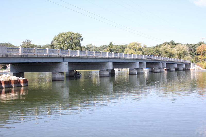
Fruitport Road–Pettys Bayou Bridge
Bridge · National Register of Historic Places · 2.6 mi
Bridge in Ottawa County, Michigan, USA
Grand Haven Historic District
Monument and historic site · National Register of Historic Places · 1.6 mi
Historic district in Grand Haven, Michigan
Grand Trunk Western Railroad Grand Haven Coal Tipple
Monument and historic site · National Register of Historic Places · 1.4 mi
Coaling tower in Grand Haven, Michigan
Nathaniel and Esther (Savidge) Robbins House
Monument and historic site · National Register of Historic Places · 1.8 mi
Historic house in Grand Haven, Michigan
Pere Marquette 1223
Monument and historic site · National Register of Historic Places · 1.4 mi
Preserved PM N-1 class 2-8-4 locomotive
Piers and Revetments at Grand Haven, Michigan
Monument and historic site · National Register of Historic Places · 2.5 mi
Historic navigational structures located at the mouth of the Grand River in Grand Haven, Michigan, United States
Pere Marquette Railroad Locomotive 1223
Monument and historic site · 1.4 mi

4 more on the map.
Parks, trails and playgrounds30

Coast Guard Park
Park · 0.7 mi
A Coast Guard rifle range until 1973, this park offers baseball and soccer fields, basketball courts, tennis courts, a picnic shelter, a...

North Ottawa Dunes County Park
Park · 1.4 mi
This property offers 593 acres of wooded dunes located just off the Lake Michigan shoreline and uniquely situated between state, county...
18201 North Shore Road, Ferrysburg

18 more on the map.
Restaurants and cafes45

Brooklyn's
Cafe · Bagel, Coffee Shop, Tea · 1.4 mi
411 West Savidge Street
Mo-Fr 06:00-18:00; Sa-Su 07:00-18:00

Morning Star Cafe
Restaurant · Sandwich, Breakfast, Burger, American, Regional, Salad, Dessert, Local · 1.8 mi
711 Washington Avenue
06:30-14:30

12 Corners Vineyards
Brewery and winery · 1.6 mi
41 Washington Avenue, Grand Haven
Fr,Sa 12:00-19:00; Su 12:00-17:00; Mo-Th off
kiwami
Restaurant · Japanese · 1.4 mi
510 West Savidge Street
Mo-Th 11:30-21:30; Fr-Sa 11:30-22:00; Su 16:30-21:30
The Blue Porch Bar & Grill
Restaurant · Burger, Sandwich, American, Regional · 1.8 mi
21 North Beacon Boulevard

Fuel Bar + Refuge
Restaurant · Seafood, Burger, Pizza, Asian, American · 1.5 mi
228 West Savidge Street, Spring Lake
The Coffee Grounds
Cafe · Coffee Shop, Coffee, Tea, Cookie, Espresso, Smoothie · 1.6 mi
41 Washington Avenue, Grand Haven

The Pump House
Ice cream · 1.6 mi
Mo-Th 11:30-22:00; Su 10:00-21:00; Sa 11:00-23:00
33 more on the map.
History
Before colonization and European settlement, the region had been inhabited by Ottawa and Potawotami peoples. Settlement in the area of Ferrysburg began in the 1830s by William Montague Ferry and his family. It was platted in 1857. Originally a village within Spring Lake Township, it incorporated as a city in 1963. Per Michigan law, it separated from Spring Lake Township. However, the two share a police department.
From the History section of Ferrysburg, Michigan on Wikipedia, under CC BY-SA 4.0.
Where to stay3
Holiday Inn Grand Haven-Spring Lake
Motel and hotel · 1.1 mi
940 West Savidge Street, Spring Lake
Churches and places of worship1
Shopping6
Gas and EV charging7
Schools, colleges and libraries31
Healthcare3
Map of Ferrysburg
146 places. The map loads OpenStreetMap tiles when you open it.
Climate by month
Monthly table
| Month | High | Low | Rain |
|---|---|---|---|
| Jan | 32°F | 19°F | 2.8 in |
| Feb | 33°F | 20°F | 2.0 in |
| Mar | 42°F | 26°F | 2.3 in |
| Apr | 55°F | 36°F | 3.7 in |
| May | 67°F | 47°F | 3.8 in |
| Jun | 76°F | 57°F | 3.5 in |
| Jul | 80°F | 62°F | 3.6 in |
| Aug | 79°F | 60°F | 3.1 in |
| Sep | 73°F | 52°F | 3.5 in |
| Oct | 60°F | 42°F | 3.8 in |
| Nov | 47°F | 33°F | 3.1 in |
| Dec | 36°F | 25°F | 2.4 in |
U.S. Climate Normals 1991-2020 for Grand Haven Wwtp (2 mi away), NOAA NCEI.
People and cost of living
American Community Survey 5-year estimates, 2020-2024, U.S. Census Bureau. Estimates have margins of error, larger for small towns.
Disaster history
Ottawa County has had 7 federal disaster declarations since 2000, most often for biologicals.
- 2020-03-27: Covid-19 Pandemic (Biological)
- 2020-03-13: Covid-19 (Biological)
- 2013-06-18: Flooding (Flood)
- 2008-07-14: Severe Storms, Tornadoes, And Flooding (Severe Storm)
- 2005-09-07: Hurricane Katrina Evacuation (Hurricane)
- 2004-06-30: Severe Storms, Tornadoes, And Flooding (Severe Storm)
OpenFEMA disaster declarations summaries.
Getting there and nearby towns
Muskegon County Airport (MKG) is the nearest airport with scheduled flights listed in OpenStreetMap, 6 miles away.
- Grand Haven 2 mi south, about 4 min by car
- Norton Shores 6 mi north, about 9 min by car
- Muskegon 10 mi north, about 16 min by car
- Allendale 16 mi southeast, about 26 min by car
- Beechwood 21 mi south, about 33 min by car
- Holland 23 mi south, about 37 min by car
- Jenison 24 mi southeast, about 39 min by car
- Walker 25 mi east, about 40 min by car
- Grand Rapids 30 mi east, about 49 min by car
- Wyoming 30 mi southeast, about 48 min by car
Drive times are estimates from straight-line distance, not routes.
Local news
Headlines from INDB, the NEMICO news database.
Reviews, tips and questions
Loading what members have shared...
Sources and licences
- NCES EDGE (Public domain): public schools
- NOAA NCEI U.S. Climate Normals 1991-2020 (Public domain): climate by month
- OpenFEMA (Public domain): disaster declarations
- OpenStreetMap contributors (ODbL 1.0): places, airports, map data
- U.S. Census Bureau (Public domain): population, income, housing, education, commute
- Wikidata (CC0 1.0): elevation, founding date, time zone, website, landmarks and historic places
- Wikimedia Commons (see each image): photos
- Wikipedia (CC BY-SA 4.0): overview and history text
Photo credits
- North Beach Park on Lake Michigan near Ferrysburg, Gpwitteveen, CC BY-SA 4.0
- Pere-marquette-1223, Dwp49423 ( talk ), CC BY-SA 3.0
- Petty's Bayou Bridge, rossograph, CC BY-SA 3.0
- Ferry House, rossograph, CC BY-SA 3.0
- Allendale Monument Slave Child, Cnctina, CC BY-SA 4.0
- Allendale, MI Confederate Monument, Cnctina, CC BY-SA 4.0
- Cicindela formosa generosa, Owen VanAntwerpen, CC BY-SA 4.0
- Grand Trunk Western Railroad Grand Haven Coal Tipple, Jim Roberts, CC BY-SA 4.0
- Grand Trunk Western Caboose in Grand Haven, Michigan - June 2015, H. Michael Miley, CC BY-SA 2.0
- Pere Marquette No. 1223 in Grand Haven, Michigan - July 2010, H. Michael Miley, CC BY-SA 2.0
- Nose of Pere Marquette No. 1223 in Grand Haven, Michigan - July 2010, H. Michael Miley, CC BY-SA 2.0
- Front view of Pere Marquette No. 1223 in Grand Haven, Michigan - June 2015, H. Michael Miley, CC BY-SA 2.0
- Elise swinging, wsilver, CC BY 2.0
- Jack and Elise jumping off swings, wsilver, CC BY 2.0
- Dune restoration at north beach park, Gpwitteveen, CC BY-SA 4.0
- Aloys Bilz House, rossograph, CC BY-SA 3.0
- First Reformed Church, Grand Haven Historic District, Jim Roberts, CC BY-SA 4.0
- ISS047-E-10101 - View of Earth, Earth Science and Remote Sensing Unit , Lyndon B. Johnson Space Center, Public domain
- ISS021-E-35996 - View of Earth, Earth Science and Remote Sensing Unit , Lyndon B. Johnson Space Center, Public domain
- ISS047-E-10100 - View of Earth, Earth Science and Remote Sensing Unit , Lyndon B. Johnson Space Center, Public domain
- ISS047-E-10099 - View of Earth, Earth Science and Remote Sensing Unit , Lyndon B. Johnson Space Center, Public domain
- Robins House, rossograph, CC BY-SA 3.0


Page built October 30, 2026. Spotted a mistake? Tell us or suggest a place.