


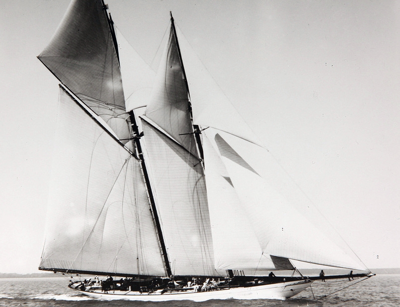


Fisher Island, Florida
Fisher Island is a community of 1,026 people in Miami-Dade County, Florida.
Why visit Fisher Island
Townapedia lists 50 museums and landmarks, 21 parks and trails, 114 places to eat, 82 places to stay and 5 attractions in and around town.
Highlights include Brickell Avenue Bridge, MacArthur Causeway, Jewish Museum of Florida and Alfred I. DuPont Building.
August is the warmest month, with average highs of 88°F; January lows average 61°F.
Weather in Fisher Island
Forecast from the National Weather Service. Full forecast
About Fisher Island
Fisher Island is a census-designated place in Miami-Dade County, Florida, United States, located on a barrier island of the same name in the Miami metropolitan area of South Florida. As of the 2020 census, it had a population of 561.
From the Wikipedia article Fisher Island, Florida (this version), under CC BY-SA 4.0.
Things to do5

Brickell Avenue Bridge
Bridge · 2.9 mi
Bridge in Florida, United States
MacArthur Causeway
Bridge · 1.8 mi
Bridge crossing Biscayne Bay, Florida, United States of America
Rickenbacker Causeway
Bridge · 2.3 mi
Bridge in United States of America


Museums and landmarks50


Alfred I. DuPont Building
Monument and historic site · National Register of Historic Places · 3.1 mi
Skyscraper in Miami, Florida, U.S.A.
Beth Jacob Social Hall and Congregation
Monument and historic site · National Register of Historic Places · 0.9 mi
Historic former synagogue in Miami Beach, Florida, USA
Brickell Mausoleum
Monument and historic site · National Register of Historic Places · 3.0 mi
Historic site in Miami, Florida

City National Bank Building
Monument and historic site · National Register of Historic Places · 3.2 mi
Bank building in Miami, United States of America

Collins Waterfront Architectural District
Monument and historic site · National Register of Historic Places · 2.4 mi
Historic district in Miami Beach, Florida
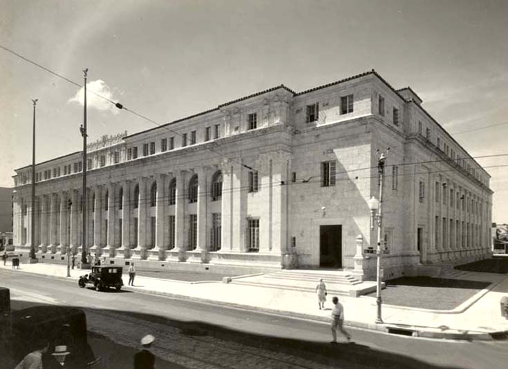
David W. Dyer Federal Building and United States Courthouse
Monument and historic site · National Register of Historic Places · 3.3 mi
Historic courthouse in Miami, Florida

Downtown Miami Historic District
Monument and historic site · National Register of Historic Places · 3.2 mi
Historic district in Florida, United States

Dr. James M. Jackson Office
Monument and historic site · National Register of Historic Places · 3.0 mi
Building in Miami, Florida, United States

Fire Station No. 4
Monument and historic site · National Register of Historic Places · 3.2 mi
Historic fire station in Miami, Florida, United States
Freedom Tower
Monument and historic site · National Register of Historic Places · 3.2 mi
Historic skyscraper in Miami, Florida, U.S.A.


Hahn Building
Monument and historic site · National Register of Historic Places · 3.2 mi
Building in Miami, Florida, United States
38 more on the map.
Parks, trails and playgrounds21

Jungle Island
Park · 2.6 mi
Zoo on Watson Island near downtown Miami, Florida


9 more on the map.
Restaurants and cafes114

Nikki Beach Miami
Restaurant · Seafood, Dessert, Brunch · 0.8 mi
Swanky eatery & club on the beach
1 Ocean Drive, Miami Beach
Mo-Th 12:00-18:00; Fr-Sa 12:00-20:00; Su 11:00-20:00
11th Street Diner
Restaurant · American, Burger, Diner · 1.5 mi
1065 Washington Avenue, Miami Beach
Su-Th 07:30-23:00; Fr-Sa 07:30-23:30
El Patio Restaurant – Bar Habana – La Terraza Rooftop
Restaurant · Mediterranean · 1.1 mi
660 Washington Avenue, Miami Beach
Su-We 07:00-22:30; Th-Sa 07:00-23:00
Estiatorio Milos Miami
Restaurant · Greek, Mediterranean · 0.7 mi
730 1st Street, Miami Beach
Mo-Th 12:00-15:00, 17:30-23:00; Fr 12:00-15:30, 17:30-00:00; Sa...
Fogo de Chão
Restaurant · Brazilian, Steak House · 0.7 mi
836 1st Street, Miami Beach
Mo-Th 12:00-22:00; Fr-Sa 12:00-22:30; Su 12:00-21:00
Macchialina
Restaurant · Italian · 1.2 mi
820 Alton Road, Miami Beach
Su-We 18:00-23:00; Th-Sa 18:00-23:30
Mega Pizza
Restaurant · Pizza · 1.4 mi
865 Collins Avenue, Miami Beach
Mo-We 10:00-03:30; Th 10:00-04:30; Fr-Su 10:00-05:00

News Cafe
Cafe · International, Italian, American, Sandwich, Salad, Coffee Shop, Tea, Dessert, Brunch · 1.3 mi
800 Ocean Drive, Miami Beach
Su-Th 08:00-22:45; Fr-Sa 08:00-23:45
Pizza Rústica
Restaurant · Italian Pizza, Pizza · 1.4 mi
863 Washington Avenue
Mo-We 11:00-04:00; Th-Su 11:00-06:00
102 more on the map.
History
Fisher Island was created through the dredging of Government Cut, which separated the landmass from the barrier island that later became Miami Beach. Dredging began in 1905 and was completed in 1911.
In May 1918, businessman and real estate developer Dana A. Dorsey purchased what was then known as Terminal Island. Dorsey, described by the City of Miami Beach as one of the first Black millionaires in Florida and the American South, reportedly envisioned the island as a resort destination for Black families and professionals during the segregation era. The project was not realized, and the island was sold the following year to Carl G. Fisher.
In 1919, Fisher's Alton Beach Realty Company acquired the island from Dorsey and began expanding it for real-estate development. In the late 1920s, Fisher traded part of the island to William Kissam Vanderbilt II in exchange for Vanderbilt's yacht Eagle. Vanderbilt later expanded his holdings and built a private winter estate designed by architect Maurice Fatio.
Following Vanderbilt's death in 1944, his widow sold the estate to U.S. Steel heir Edward S. Moore. After Moore's death, the property was acquired by speedboat racer and inventor Gar Wood, who retained it as a private retreat. In 1963, Wood sold his estate to an investment group led by Bebe Rebozo that included Richard Nixon, George Smathers, and several other investors.
From the History section of Fisher Island, Florida on Wikipedia, under CC BY-SA 4.0.
Where to stay82
Churches and places of worship5
Central Baptist Church
Church · National Register of Historic Places · 3.2 mi
Shopping11
Gas and EV charging4
Schools, colleges and libraries48
Healthcare7
Map of Fisher Island
250 places. The map loads OpenStreetMap tiles when you open it.
Climate by month
Monthly table
| Month | High | Low | Rain | Snow |
|---|---|---|---|---|
| Jan | 74°F | 61°F | 2.3 in | 0.0 in |
| Feb | 75°F | 63°F | 2.3 in | 0.0 in |
| Mar | 76°F | 65°F | 2.5 in | 0.0 in |
| Apr | 80°F | 70°F | 3.4 in | 0.0 in |
| May | 83°F | 74°F | 4.9 in | 0.0 in |
| Jun | 86°F | 76°F | 7.8 in | 0.0 in |
| Jul | 88°F | 78°F | 6.0 in | 0.0 in |
| Aug | 88°F | 78°F | 7.5 in | 0.0 in |
| Sep | 87°F | 77°F | 8.4 in | 0.0 in |
| Oct | 84°F | 74°F | 6.5 in | 0.0 in |
| Nov | 79°F | 69°F | 3.3 in | 0.0 in |
| Dec | 76°F | 65°F | 2.2 in | 0.0 in |
U.S. Climate Normals 1991-2020 for Miami Beach (3 mi away), NOAA NCEI.
People and cost of living
American Community Survey 5-year estimates, 2020-2024, U.S. Census Bureau. Estimates have margins of error, larger for small towns.
Disaster history
Miami-Dade County has had 27 federal disaster declarations since 2000, most often for hurricanes.
- 2024-10-11: Hurricane Milton (Hurricane)
- 2024-10-07: Hurricane Milton (Hurricane)
- 2022-12-13: Hurricane Nicole (Hurricane)
- 2022-11-08: Tropical Storm Nicole (Tropical Storm)
- 2022-09-29: Hurricane Ian (Hurricane)
- 2022-09-24: Tropical Storm Ian (Hurricane)
OpenFEMA disaster declarations summaries.
Getting there and nearby towns
Miami Seaplane Base (MPB) is the nearest airport with scheduled flights listed in OpenStreetMap, 2 miles away.
- Miami Beach 3 mi north, about 6 min by car
- Miami 4 mi west, about 7 min by car
- Key Biscayne 5 mi south, about 8 min by car
- Brownsville 7 mi northwest, about 12 min by car
- El Portal 7 mi northwest, about 12 min by car
- Miami Shores 8 mi north, about 12 min by car
- Gladeview 8 mi northwest, about 13 min by car
- West Little River 9 mi northwest, about 14 min by car
- Pinewood 9 mi northwest, about 14 min by car
- North Miami 10 mi north, about 16 min by car
Drive times are estimates from straight-line distance, not routes.
Local news
Headlines from INDB, the NEMICO news database.
Reviews, tips and questions
Loading what members have shared...
Sources and licences
- NCES EDGE (Public domain): public schools
- NOAA NCEI U.S. Climate Normals 1991-2020 (Public domain): climate by month
- OpenFEMA (Public domain): disaster declarations
- OpenStreetMap contributors (ODbL 1.0): places, airports, map data
- U.S. Census Bureau (Public domain): population, income, housing, education, commute
- Wikidata (CC0 1.0): elevation, founding date, time zone, website, landmarks and historic places
- Wikimedia Commons (see each image): photos
- Wikipedia (CC BY-SA 4.0): overview and history text
Photo credits
- Fisher Island Miami Beach, Alexf, CC BY-SA 3.0
- South Pointe promenade, iJammin, CC BY 2.0
- Miami FL Palm Cottage01, Ebyabe, CC BY-SA 3.0
- 1908 SY Germania, Sir James, Public domain
- Miami FL Downtown HD Gesu Church sq pano01, Ebyabe, CC BY-SA 3.0
- Miami FL Central Baptist Church01, Ebyabe, CC BY-SA 3.0
- Seybold Building (Miami, Florida) 1, Tamanoeconomico, CC BY-SA 4.0
- HuntingtonBuilding, SebasTorrente, CC BY-SA 3.0
- Olympia Theatre Miami exterior 2016, Phillip Pessar, CC BY 2.0
- Miami FL Fire Station 4-01, Ebyabe, CC BY-SA 3.0
- Collins District, MosheA, CC BY-SA 3.0
- Miami Circle 20110307, Averette, CC BY 3.0
- FL-Miami 1933 Ref, National Archives, Public domain
- Virginia Key - Miami Marine Stadium -, Bumbiti, CC BY-SA 4.0
- Dr.JamesM.JacksonOffice, SebasTorrente, CC BY-SA 3.0
- HahnBuilding, SebasTorrente, CC BY-SA 3.0
- Miami FL Downtown HD City Natl Bank Bldg01, Ebyabe, CC BY-SA 3.0
- 9) Edison (1935), Elisa.rolle, CC BY-SA 4.0


_Edison_(1935).jpg)
Page built October 30, 2026. Spotted a mistake? Tell us or suggest a place.