




Fort Bragg, California
Fort Bragg is a city of 7,032 people in Mendocino County, California.
Why visit Fort Bragg
Townapedia lists 9 museums and landmarks, 14 parks and trails, 40 places to eat, 17 places to stay and 5 attractions in and around town.
Highlights include Glass Beach, Noyo River Bridge, Weller House and Noyo Center for Marine Science.
August is the warmest month, with average highs of 65°F; December lows average 40°F.
Weather in Fort Bragg
Forecast from the National Weather Service. Full forecast
About Fort Bragg
Fort Bragg is a city along the North Coast of California in Mendocino County. The city is 24 miles (39 km) west of Willits, at an elevation of 85 feet (26 m). Its population was 6,983 at the 2020 census.
From the Wikipedia article Fort Bragg, California (this version), under CC BY-SA 4.0.
Things to do5


Noyo River Bridge
Bridge · 0.9 mi
Bridge in Fort Bragg, California, United States

Museums and landmarks9
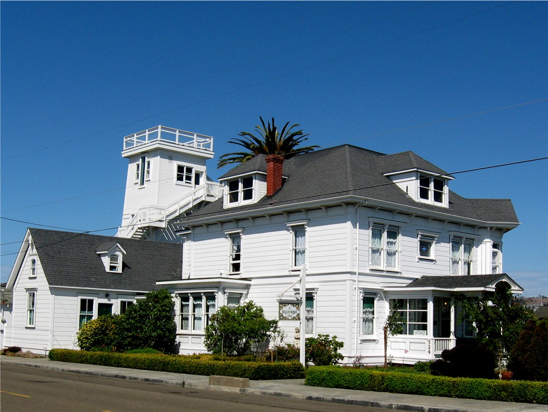
Weller House
Monument and historic site · National Register of Historic Places · 0.6 mi
Historic house in Fort Bragg, California, United States


Pudding Creek School House
Monument and historic site · 1.0 mi
31971 Pudding Creek Road, Fort Bragg
Parks, trails and playgrounds14




2 more on the map.
Restaurants and cafes40


Mountain Mike's
Restaurant · Pizza · 0.7 mi
898 South Main Street, Fort Bragg
Mo-Th 11:00-21:00; Fr-Sa 11:00-22:00; Su 11:00-21:00
Sea Pal Cove
Restaurant · Fish And Chips · 1.0 mi
32390 North Harbor Drive, Fort Bragg
Mo-Th 11:00-21:00; Fr-Sa 11:00-22:00; Su 11:00-21:00

Cowlick's Ice Cream
Ice cream · Ice Cream · 0.4 mi
250 North Main Street, Fort Bragg
Mo-Su 11:00-21:00
North Coast Brewing Company Taproom & Grill
Restaurant · Burger, Fish And Chips · 0.5 mi
Mo-Su 11:30-21:30

Overtime Brewing
Brewery and winery · 0.8 mi
190 East Elm Street, Fort Bragg

La Palapa
Restaurant · Mexican
647 East Oak Street
Tu-Fr 10:00-20:00; Su 09:00-15:00; Sa 09:00-20:00
28 more on the map.
History
The area known as Fort Bragg was home to Native Americans since before Western expansion, most of whom belong to the Pomo tribe. They historically were hunter-gatherers who lived along the northern coast of California.
From the History section of Fort Bragg, California on Wikipedia, under CC BY-SA 4.0.
Where to stay17
Country Inn Bed and Breakfast
Motel and hotel · 0.6 mi
632 North Main Street, Fort Bragg
Holiday Inn Express Fort Bragg
Motel and hotel · 1.4 mi
250 West Highway 20, Fort Bragg
Churches and places of worship9
Calvary Chapel Fort Bragg
Church · Evangelical · 0.9 mi
900 North Main Street, Fort Bragg
Shopping20
Racine's Art & Office Supplies
Shop · 0.4 mi
344 North Franklin Street, Fort Bragg
Gas and EV charging7
Schools, colleges and libraries16
Healthcare3
Map of Fort Bragg
140 places. The map loads OpenStreetMap tiles when you open it.
Climate by month
Monthly table
| Month | High | Low | Rain | Snow |
|---|---|---|---|---|
| Jan | 52°F | 40°F | 7.7 in | 0.0 in |
| Feb | 54°F | 40°F | 7.3 in | 0.0 in |
| Mar | 55°F | 41°F | 6.4 in | 0.0 in |
| Apr | 57°F | 42°F | 3.6 in | 0.0 in |
| May | 60°F | 45°F | 1.6 in | 0.0 in |
| Jun | 63°F | 47°F | 0.7 in | 0.0 in |
| Jul | 65°F | 49°F | 0.1 in | 0.0 in |
| Aug | 65°F | 50°F | 0.1 in | 0.0 in |
| Sep | 65°F | 49°F | 0.2 in | 0.0 in |
| Oct | 62°F | 46°F | 2.3 in | 0.0 in |
| Nov | 56°F | 43°F | 4.5 in | 0.0 in |
| Dec | 52°F | 40°F | 8.7 in | 0.0 in |
U.S. Climate Normals 1991-2020 for Ft Bragg 5 N Hcn (5 mi away), NOAA NCEI.
People and cost of living
American Community Survey 5-year estimates, 2020-2024, U.S. Census Bureau. Estimates have margins of error, larger for small towns.
Disaster history
Mendocino County has had 18 federal disaster declarations since 2000, most often for fires.
- 2023-04-03: Severe Winter Storms, Straight-Line Winds, Flooding, Landslides, And Mudslides (Severe Storm)
- 2023-03-10: Severe Winter Storms, Flooding, Landslides, And Mudslides (Flood)
- 2023-01-14: Severe Winter Storms, Flooding, Landslides, And Mudslides (Flood)
- 2023-01-09: Severe Winter Storms, Flooding, And Mudslides (Flood)
- 2020-10-16: Wildfires (Fire)
- 2020-08-22: Wildfires (Fire)
OpenFEMA disaster declarations summaries.
Getting there and nearby towns
Fort Bragg Airport (FOB) is the nearest airport with scheduled flights listed in OpenStreetMap, 2 miles away.
- Brooktrails 22 mi east, about 35 min by car
- Willits 24 mi east, about 39 min by car
- Ukiah 38 mi southeast, about 1 h by car
- Covelo 38 mi northeast, about 1 h by car
- Talmage 40 mi southeast, about 1 h by car
- Garberville 46 mi north, about 1 h 15 min by car
- Redway 47 mi north, about 1 h 15 min by car
- Upper Lake 52 mi east, about 1 h 30 min by car
- North Lakeport 54 mi southeast, about 1 h 30 min by car
- Lakeport 55 mi southeast, about 1 h 30 min by car
Drive times are estimates from straight-line distance, not routes.
Local news
Headlines from INDB, the NEMICO news database.
Reviews, tips and questions
Loading what members have shared...
Sources and licences
- NCES EDGE (Public domain): public schools
- NOAA NCEI U.S. Climate Normals 1991-2020 (Public domain): climate by month
- OpenFEMA (Public domain): disaster declarations
- OpenStreetMap contributors (ODbL 1.0): places, airports, map data
- U.S. Census Bureau (Public domain): population, income, housing, education, commute
- Wikidata (CC0 1.0): elevation, founding date, time zone, website, landmarks and historic places
- Wikimedia Commons (see each image): photos
- Wikipedia (CC BY-SA 4.0): overview and history text
Photo credits
- Fort Bragg California aerial view, Robert Campbell, CC BY-SA 3.0
- U.S. Post Office at Fort Bragg California (54584726605), Tony Webster, CC BY 2.0
- Weller House, Fort Bragg, California, W Nowicki, CC BY-SA 3.0
- Glass Beach Fort Bragg, Ggerdel - Foto de: Gustavo Gerdel, CC BY-SA 4.0
- Noyo river bridge, W Nowicki, CC BY-SA 3.0
- Milano Bar - March 2024 - Sarah Stierch 08, Missvain, CC BY 4.0
- Milano Bar - March 2024 - Sarah Stierch 09, Missvain, CC BY 4.0
- Milano Bar - March 2024 - Sarah Stierch 10, Missvain, CC BY 4.0
- Milano Bar - March 2024 - Sarah Stierch 11, Missvain, CC BY 4.0
- Milano Bar - March 2024 - Sarah Stierch 07, Missvain, CC BY 4.0
- Milano Bar - March 2024 - Sarah Stierch 12, Missvain, CC BY 4.0
- Milano Bar - March 2024 - Sarah Stierch 04, Missvain, CC BY 4.0
- Milano Bar - March 2024 - Sarah Stierch 01, Missvain, CC BY 4.0
- Milano Bar - March 2024 - Sarah Stierch 03, Missvain, CC BY 4.0
- Milano Bar - March 2024 - Sarah Stierch 05, Missvain, CC BY 4.0
- Milano Bar - March 2024 - Sarah Stierch, Missvain, CC BY 4.0
- Milano Bar - March 2024 - Sarah Stierch 02, Missvain, CC BY 4.0
- Milano Bar - March 2024 - Sarah Stierch 13, Missvain, CC BY 4.0
- Milano Bar - March 2024 - Sarah Stierch 06, Missvain, CC BY 4.0
- D'Aurelios - October 2022 - Sarah Stierch 05, Missvain, CC BY 4.0
- D'Aurelios - October 2022 - Sarah Stierch 03, Missvain, CC BY 4.0
- D'Aurelios - October 2022 - Sarah Stierch 01, Missvain, CC BY 4.0
- D'Aurelios - October 2022 - Sarah Stierch 02, Missvain, CC BY 4.0
- D'Aurelios - October 2022 - Sarah Stierch 04, Missvain, CC BY 4.0
- Los Gallitos - October 31 2022 - Sarah Stierch 03, Missvain, CC BY 4.0
- Mitsubishi 3000GT - August 2024 - Sarah Stierch, Missvain, CC0
- Los Gallitos - October 2022 - Sarah Stierch 10, Missvain, CC BY 4.0
- Los Gallitos - October 2022 - Sarah Stierch 06, Missvain, CC BY 4.0
- Los Gallitos - October 2022 - Sarah Stierch 11, Missvain, CC BY 4.0
- Los Gallitos - October 2022 - Sarah Stierch 09, Missvain, CC BY 4.0
- Los Gallitos - October 2022 - Sarah Stierch 07, Missvain, CC BY 4.0
- Los Gallitos - October 2022 - Sarah Stierch 05, Missvain, CC BY 4.0
- Los Gallitos - October 2022 - Sarah Stierch 04, Missvain, CC BY 4.0
- Los Gallitos - October 31 2022 - Sarah Stierch 04, Missvain, CC BY 4.0
- Los Gallitos - October 2022 - Sarah Stierch 03, Missvain, CC BY 4.0
- Shrimp tacos at Los Gallitos - April 2023 - Sarah Stierch, Missvain, CC BY 4.0
- Los Gallitos - March 2024 - Sarah Stierch 01, Missvain, CC BY 4.0
- Los Gallitos - October 2022 - Sarah Stierch 02, Missvain, CC BY 4.0
- Los Gallitos - October 31 2022 - Sarah Stierch 01, Missvain, CC BY 4.0
- Los Gallitos - March 2024 - Sarah Stierch 02, Missvain, CC BY 4.0


Page built October 30, 2026. Spotted a mistake? Tell us or suggest a place.