




Fort Collins, Colorado
Fort Collins is a city of 170,229 people in Larimer County, Colorado, founded in 1864.
Why visit Fort Collins
Townapedia lists 30 museums and landmarks, 46 parks and trails, 296 places to eat, 13 places to stay and 8 attractions in and around town.
Highlights include Cinema Saver 6, Lincoln Center, Avery House and Botanical and Horticultural Laboratory.
Weather in Fort Collins
Forecast from the National Weather Service. Full forecast
About Fort Collins
Fort Collins is a home rule city in Larimer County, Colorado, United States, and serves as the county seat and most populous municipality of the county. It is the fourth-most populous city in Colorado with a population of 169,810 in the 2020 census, while the Fort Collins, CO Metropolitan Statistical Area has an estimated 375,000 residents.
From the Wikipedia article Fort Collins, Colorado (this version), under CC BY-SA 4.0.
Things to do8


Colorado State University
School · 2.0 mi
Public land-grant research university in Fort Collins, Colorado, United States
Cinemark Movie Bistro and XD
Cinema and theater · 0.6 mi
335 East Foothills Parkway, Fort Collins
Museums and landmarks30

Avery House
Monument and historic site · National Register of Historic Places · 2.8 mi
Historic house in Fort Collins, Colorado, United States
Botanical and Horticultural Laboratory
Monument and historic site · National Register of Historic Places · 2.1 mi
Historic build in Fort Collins, Colorado, United States
Fort Collins Armory
Monument and historic site · National Register of Historic Places · 2.7 mi
Armory in Fort Collins, United States of America
Laurel School Historic District
Monument and historic site · National Register of Historic Places · 2.1 mi
Historic district in Fort Collins, Colorado, United States
McHugh–Andrews House
Monument and historic site · National Register of Historic Places · 2.6 mi
Historic house in Colorado, United States
Montezuma Fuller House
Monument and historic site · National Register of Historic Places · 2.5 mi
Historic house in Colorado, United States
Mosman House
Monument and historic site · National Register of Historic Places · 2.6 mi
Historic house in Colorado, United States
Old Town Fort Collins
Monument and historic site · National Register of Historic Places · 2.9 mi
Historic district in Fort Collins, Colorado, United States
Peter Anderson House
Monument and historic site · National Register of Historic Places · 2.6 mi
United States historic place
Fort Collins Municipal Railway Birney Safety Streetcar No. 21
Monument and historic site · National Register of Historic Places · 3.5 mi
Kissock Block Building
Monument and historic site · National Register of Historic Places · 2.7 mi

18 more on the map.
Parks, trails and playgrounds46

Fort Fun
Sports field and stadium · 2.3 mi
1513 East Mulberry Street
Su-Th 10:00-22:00; Fr-Sa 10:00-24:00



English Ranch Playground
Playground · 2.1 mi
Children meet and play with purity and spontaneity
Power Trail
Park · 1.5 mi
Power Trail from Golden Meadows Park to Horsetooth Road

34 more on the map.
Restaurants and cafes296

The Thai Pepper
Restaurant · Thai · 2.1 mi
Bangorn Authentic Thai Food
109 East Laurel Street, Fort Collins
Mo-Fr 11:00-21:00; Sa 12:00-21:00; Su 17:00-21:00
Asian Grill Express
Restaurant · Asian · 1.1 mi
3663 South College Avenue, Fort Collins
Mo-Th 11:00-21:00; Fr 11:00-21:30; Sa 11:00-21:00
Bad Daddy’s Burger Bar
Restaurant · Burger · 0.6 mi
347 East Foothills Parkway, Fort Collins
Mo-Th 11:00-22:00; Fr-Sa 11:00-23:00
Bawarchi Biryanis
Restaurant · Indian · 1.4 mi
1611 South College Avenue, Fort Collins
Mo-Th 11:00-21:30; Fr, Sa 11:00-22:00; Su 11:00-21:30

Bindle Coffee
Cafe · Coffee Shop · 1.7 mi
1933 Jessup Drive, Fort Collins
Mo-Fr 06:00-18:00; Sa 08:00-18:00; Su 08:00-15:00
Buffalo Wild Wings
Restaurant · Wings · 1.8 mi
150 East Harmony Road, Fort Collins
Mo-Sa 11:00-01:00, Su 11:00-00:00
Cafe Rio
Restaurant · Mexican · 1.7 mi
4414 South College Avenue, Fort Collins
Mo-Th 10:30-22:00; Fr-Sa 10:30-23:00; Su 11:00-21:00
Charco Broiler
Restaurant · Steak House · 2.5 mi
1716 East Mulberry Street, Fort Collins
Mo-We 06:00-21:00; Th-Sa 06:00+; Su 08:30-21:00
Chili House
Restaurant · Asian · 1.4 mi
4200 South College Avenue, Fort Collins
Mo-Fr 11:00-21:30; Sa-Su 12:00-21:30
Chili's
Restaurant · Tex-Mex · 0.9 mi
3524 South College Avenue, Fort Collins
Mo-Th 11:00-22:00; Fr-Sa 11:00-23:00; Su 11:00-22:00
College Cafe
Restaurant · Asian · 2.2 mi
647 South College Avenue, Fort Collins
Mo-Th 11:00-21:00; Fr-Sa 11:00-21:30; Su 11:00-21:00
Domenic's Bistro & Wine Bar
Restaurant · Italian · 1.8 mi
921 East Harmony Road, Fort Collins
Su 16:00-21:00; Mo-Th 11:00-21:00; Fr 11:00-22:00
284 more on the map.
History
The Northern Arapaho were centered in the Cache la Poudre River Valley near present-day Fort Collins. Friday, who attended school in St. Louis, Missouri in his youth, was a leader of the band of Arapahos as well as an interpreter, negotiator, and peacemaker. He made friends of white settlers who moved into the area, but was pushed out of Colorado in the 1860s.
Fort Collins was founded as a military outpost of the United States Army in 1864. It succeeded a previous encampment, known as Camp Collins, on the Cache la Poudre River, near what is known today as Laporte. Camp Collins was erected during the Indian wars of the mid-1860s to protect the Overland mail route that had been recently relocated through the region. Travelers crossing the county on the Overland Trail would camp there, but a flood destroyed the camp in June 1864. Afterward, the commander of the fort wrote to the commandant of Fort Laramie in southeast Wyoming, Colonel William O. Collins, suggesting that a site several miles farther down the river would make a good location for the fort. The post was manned originally by two companies of the 11th Ohio Volunteer Cavalry and never had walls. The Fort Collins, Colorado Territory, post office opened on June 27, 1865.
From the History section of Fort Collins, Colorado on Wikipedia, under CC BY-SA 4.0.
Where to stay13
Home2 Suites by Hilton Fort Collins
Motel and hotel · 2.2 mi
4715 South Timberwood Drive, Fort Collins
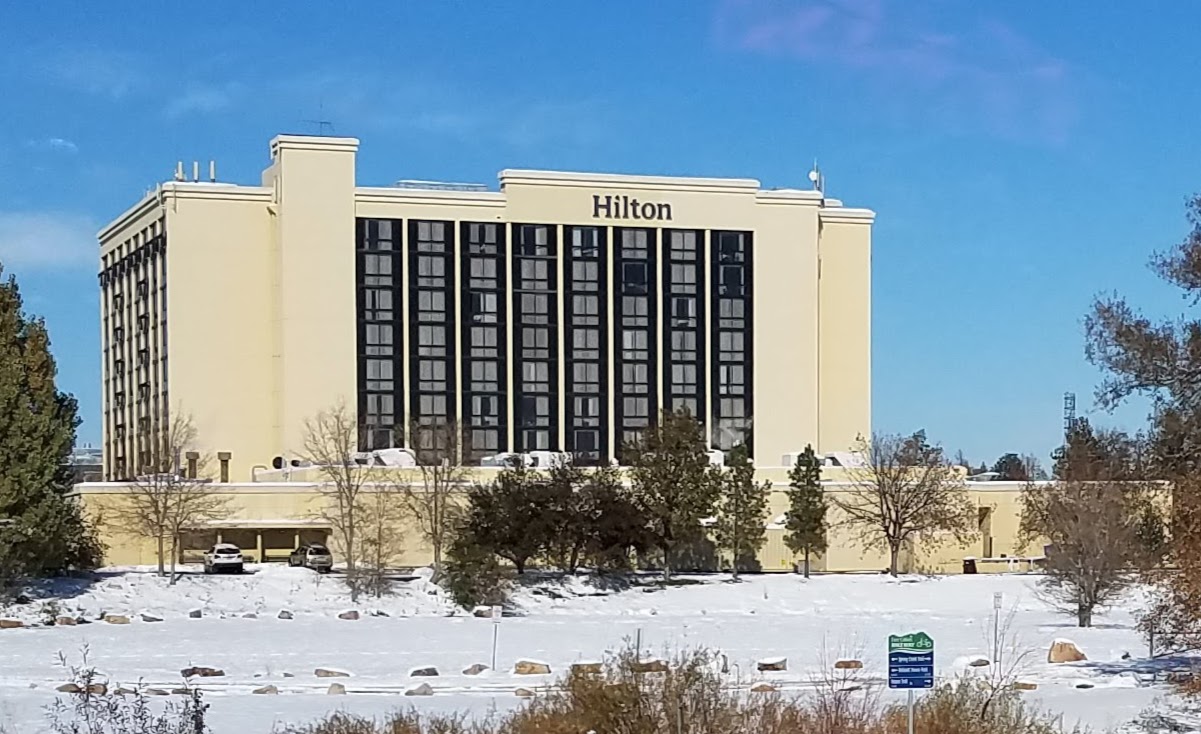
Hilton Fort Collins
Motel and hotel · 1.5 mi
425 West Prospect Road, Fort Collins
Churches and places of worship47
Heruka Buddhist Center
Place of worship · New Kadampa Tradition · 0.7 mi
149 West Harvard Street, Fort Collins
Shopping62
Gas and EV charging29
Schools, colleges and libraries71
Healthcare26
Good Day Pharmacy - Spring Creek
Clinic and pharmacy · 1.9 mi
2001 South Shields Street, Fort Collins
King Soopers Pharmacy
Clinic and pharmacy · 0.8 mi
2535 South College Avenue, Fort Collins
King Soopers Pharmacy
Clinic and pharmacy · 1.4 mi
2602 South Timberline Road, Fort Collins
King Soopers Pharmacy
Clinic and pharmacy · 1.7 mi
4503 John F Kennedy Parkway, Fort Collins
Map of Fort Collins
250 places. The map loads OpenStreetMap tiles when you open it.
People and cost of living
American Community Survey 5-year estimates, 2020-2024, U.S. Census Bureau. Estimates have margins of error, larger for small towns.
Disaster history
Larimer County has had 23 federal disaster declarations since 2000, most often for fires.
- 2024-07-31: Stone Mountain Fire (Fire)
- 2024-07-31: Alexander Mountain Fire (Fire)
- 2021-01-15: Wildfires (Fire)
- 2020-09-06: Cameron Peak Fire (Fire)
- 2020-03-28: Covid-19 Pandemic (Biological)
- 2020-03-13: Covid-19 (Biological)
OpenFEMA disaster declarations summaries.
Getting there and nearby towns
Northern Colorado Regional Airport (FNL) is the nearest airport with scheduled flights listed in OpenStreetMap, 7 miles away.
- Timnath 5 mi east, about 9 min by car
- Laporte 7 mi northwest, about 12 min by car
- Loveland 9 mi south, about 15 min by car
- Windsor 9 mi southeast, about 15 min by car
- Wellington 11 mi north, about 17 min by car
- Severance 11 mi east, about 18 min by car
- Ault 17 mi east, about 28 min by car
- Greeley 18 mi southeast, about 29 min by car
- Johnstown 19 mi southeast, about 30 min by car
- Berthoud 19 mi south, about 30 min by car
Drive times are estimates from straight-line distance, not routes.
Local news
Headlines from INDB, the NEMICO news database.
Reviews, tips and questions
Loading what members have shared...
Sources and licences
- NCES EDGE (Public domain): public schools
- OpenFEMA (Public domain): disaster declarations
- OpenStreetMap contributors (ODbL 1.0): places, airports, map data
- U.S. Census Bureau (Public domain): population, income, housing, education, commute
- Wikidata (CC0 1.0): elevation, founding date, time zone, website, landmarks and historic places
- Wikimedia Commons (see each image): photos
- Wikipedia (CC BY-SA 4.0): overview and history text
Photo credits
- Fort Collins Historic District, Wusel007, CC BY-SA 3.0
- Juniperus scopulorum Fort Collins, Chet Thomas from Fort Collins, CO, CC BY 2.0
- Welcome to Fort Collins, Colorado - panoramio, Walter Powers, CC BY 3.0
- Hilton Fort Collins, south side, Xnatedawgx, CC BY-SA 4.0
- Marcasite with Calcite (47911668501), Pacific Museum of Earth from Canada, CC BY-SA 2.0
- Arcade game at the mall (224123437), Paul L Dineen, CC BY 2.0
- Crosby Garrett train station and viaduct, Bakerbh, CC BY-SA 4.0
- Crosby Garrett main station, Bakerbh, CC BY-SA 4.0
- Crosby Garrett train station tracks, Bakerbh, CC BY-SA 4.0
- Crosby Garrett village, Bakerbh, CC BY-SA 4.0
- Ridgeview Classical Schools, Ijon, CC BY-SA 3.0
- "Back to Our Roots" in Colorado (20180516-OSEC-LSC-0244), USDAgov, Public domain
- "Back to Our Roots" in Colorado (20180516-OSEC-LSC-0255), USDAgov, Public domain
- "Back to Our Roots" in Colorado (20180516-OSEC-LSC-0323), USDAgov, Public domain
- "Back to Our Roots" in Colorado (20180516-OSEC-LSC-0321), USDAgov, Public domain
- "Back to Our Roots" in Colorado (20180516-OSEC-LSC-0290), USDAgov, Public domain
- "Back to Our Roots" in Colorado (20180516-OSEC-LSC-0314), USDAgov, Public domain
- "Back to Our Roots" in Colorado (20180516-OSEC-LSC-0287), USDAgov, Public domain
- "Back to Our Roots" in Colorado (20180516-OSEC-LSC-0313), USDAgov, Public domain
- "Back to Our Roots" in Colorado (20180516-OSEC-LSC-0297), USDAgov, Public domain
- Columbine Cafe - panoramio, FlashBuddy, CC BY-SA 3.0
- ConvolvulusArv4, Douglas Goldman, CC BY-SA 4.0
- ConvolvulusArv3, Douglas Goldman, CC BY-SA 4.0
- ConvolvulusArv1, Douglas Goldman, CC BY-SA 4.0
- ConvolvulusArv7, Douglas Goldman, CC BY-SA 4.0
- ConvolvulusArv8, Douglas Goldman, CC BY-SA 4.0
- ConvolvulusArv2, Douglas Goldman, CC BY-SA 4.0
- ConvolvulusArv6, Douglas Goldman, CC BY-SA 4.0
- ConvolvulusArv5, Douglas Goldman, CC BY-SA 4.0
- MAX Bus Rapid Transit (Colorado), Jeffrey Beall, CC BY 4.0
- Donald Trump, Jr. (48955249502), Gage Skidmore from Surprise, AZ, United States of America, CC BY-SA 2.0
- Donald Trump, Jr., Kimberly Guilfoyle & Charlie Kirk (48954511103), Gage Skidmore from Surprise, AZ, United States of America, CC BY-SA 2.0
- Donald Trump, Jr., Kimberly Guilfoyle & Charlie Kirk (48955043781), Gage Skidmore from Surprise, AZ, United States of America, CC BY-SA 2.0
- Donald Trump, Jr. (48954510483), Gage Skidmore from Surprise, AZ, United States of America, CC BY-SA 2.0
- Donald Trump, Jr., Kimberly Guilfoyle & Charlie Kirk (48955254112), Gage Skidmore from Surprise, AZ, United States of America, CC BY-SA 2.0
- Donald Trump, Jr., Kimberly Guilfoyle & Charlie Kirk (48954499378), Gage Skidmore from Surprise, AZ, United States of America, CC BY-SA 2.0
- Culture War attendees (48955078646), Gage Skidmore from Surprise, AZ, United States of America, CC BY-SA 2.0
- Donald Trump, Jr. & Kimberly Guilfoyle (48955255227), Gage Skidmore from Surprise, AZ, United States of America, CC BY-SA 2.0
- Donald Trump, Jr., Kimberly Guilfoyle & Charlie Kirk with attendees (48954511548), Gage Skidmore from Surprise, AZ, United States of America, CC BY-SA 2.0
- Donald Trump, Jr., Kimberly Guilfoyle & Charlie Kirk with attendees (48955253447), Gage Skidmore from Surprise, AZ, United States of America, CC BY-SA 2.0


Page built October 30, 2026. Spotted a mistake? Tell us or suggest a place.