

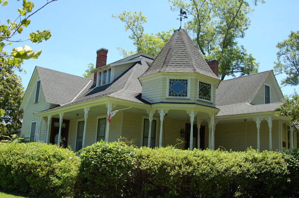


Franklinton, Louisiana
Franklinton is a town of 3,602 people in Washington Parish, Louisiana, founded in 1819.
Why visit Franklinton
Townapedia lists 7 museums and landmarks and 8 places to eat in and around town.
Highlights include D.A. Varnado and Son Store and Franklinton High School.
August is the warmest month, with average highs of 92°F; January lows average 37°F.
Weather in Franklinton
Forecast from the National Weather Service. Full forecast
About Franklinton
Franklinton is a town in, and the parish seat of Washington Parish, Louisiana, United States. As of the 2020 census, Franklinton had a population of 3,662. The elevation is an average of 155 feet (47 m) above sea level. Franklinton is located 61 miles (98 km) north of New Orleans.
From the Wikipedia article Franklinton, Louisiana (this version), under CC BY-SA 4.0.
Museums and landmarks7
D.A. Varnado and Son Store
Monument and historic site · National Register of Historic Places · 0.6 mi
Commercial building in Franklinton, Louisiana

Franklinton High School
Monument and historic site · National Register of Historic Places · 0.7 mi
High school in Louisiana, United States
Greenlaw House
Monument and historic site · National Register of Historic Places · 0.7 mi
Historic house in Franklinton in Washington Parish, Louisiana

Knight Cabin
Monument and historic site · National Register of Historic Places · 1.3 mi
Historic cabin in Franklinton, Louisiana, United States
Robert H. Babington House
Monument and historic site · National Register of Historic Places · 0.7 mi
Historic house in Franklinton, Louisiana, United States
Sylvest House
Monument and historic site · National Register of Historic Places · 1.3 mi
House in Franklinton, Louisiana
Thomas M. Babington House
Monument and historic site · National Register of Historic Places · 0.7 mi
House in Franklinton, Louisiana
Restaurants and cafes8


Burger King
Fast food · Burger · 0.7 mi
739 Washington Street, Franklinton
Mo-Sa 06:00-22:00; Su 07:00-22:00
Churches and places of worship4



Shopping3


History
Franklinton was founded in 1819, originally under the name of Franklin. It was designated as the parish seat of government on February 10, 1821, two years after the parish was carved out from St. Tammany Parish.
In 1826 the town's name was changed to Franklinton, as there was already another town named Franklin in St. Mary Parish. In 1826, representatives and citizens from both communities showed up in then-state-capital New Orleans to state their cases for keeping the name "Franklin." The legislature allowed Franklin in St. Mary Parish to retain its name, while changing the Washington Parish's newer seat to Franklinton. The parish was largely rural, based in extensive pine forests.
From the History section of Franklinton, Louisiana on Wikipedia, under CC BY-SA 4.0.
Gas and EV charging3
Schools, colleges and libraries8
Healthcare1
Map of Franklinton
34 places. The map loads OpenStreetMap tiles when you open it.
Climate by month
Monthly table
| Month | High | Low | Rain | Snow |
|---|---|---|---|---|
| Jan | 60°F | 37°F | 6.2 in | 0.0 in |
| Feb | 64°F | 40°F | 5.4 in | 0.0 in |
| Mar | 71°F | 47°F | 5.2 in | 0.1 in |
| Apr | 77°F | 53°F | 5.7 in | 0.0 in |
| May | 84°F | 62°F | 4.5 in | 0.0 in |
| Jun | 90°F | 68°F | 4.9 in | 0.0 in |
| Jul | 91°F | 71°F | 5.7 in | 0.0 in |
| Aug | 92°F | 71°F | 6.3 in | 0.0 in |
| Sep | 88°F | 66°F | 4.3 in | 0.0 in |
| Oct | 80°F | 55°F | 4.8 in | 0.0 in |
| Nov | 69°F | 45°F | 4.2 in | 0.0 in |
| Dec | 62°F | 40°F | 5.2 in | 0.1 in |
U.S. Climate Normals 1991-2020 for Tylertown 5Ese (17 mi away), NOAA NCEI.
People and cost of living
American Community Survey 5-year estimates, 2020-2024, U.S. Census Bureau. Estimates have margins of error, larger for small towns.
Disaster history
Washington Parish has had 33 federal disaster declarations since 2000, most often for hurricanes.
- 2026-01-24: Severe Winter Storm (Winter Storm)
- 2024-09-16: Hurricane Francine (Hurricane)
- 2024-09-10: Tropical Storm Francine (Hurricane)
- 2021-09-13: Tropical Storm Nicholas (Coastal Storm)
- 2021-08-29: Hurricane Ida (Hurricane)
- 2021-08-27: Tropical Storm Ida (Hurricane)
OpenFEMA disaster declarations summaries.
Getting there and nearby towns
George R Carr Memorial Air Field (BXA) is the nearest airport with scheduled flights listed in OpenStreetMap, 17 miles away.
- Bogalusa 18 mi east, about 28 min by car
- Amite City 23 mi west, about 38 min by car
- Covington 26 mi south, about 41 min by car
- Hammond 30 mi southwest, about 48 min by car
- Mandeville 33 mi south, about 53 min by car
- McComb 33 mi northwest, about 54 min by car
- Picayune 36 mi southeast, about 58 min by car
- Slidell 44 mi southeast, about 1 h 15 min by car
- Eden Isle 47 mi southeast, about 1 h 15 min by car
- Brookhaven 54 mi north, about 1 h 30 min by car
Drive times are estimates from straight-line distance, not routes.
Local news
Headlines from INDB, the NEMICO news database.
Reviews, tips and questions
Loading what members have shared...
Sources and licences
- NCES EDGE (Public domain): public schools
- NOAA NCEI U.S. Climate Normals 1991-2020 (Public domain): climate by month
- OpenFEMA (Public domain): disaster declarations
- OpenStreetMap contributors (ODbL 1.0): places, airports, map data
- U.S. Census Bureau (Public domain): population, income, housing, education, commute
- Wikidata (CC0 1.0): elevation, founding date, time zone, website, landmarks and historic places
- Wikimedia Commons (see each image): photos
- Wikipedia (CC BY-SA 4.0): overview and history text
Photo credits
- Franklinton Middle School in Louisiana (former Franklinton High School), Z28scrambler, CC BY-SA 3.0
- GreenLawWM, Z28scrambler, CC BY-SA 3.0
- TomBabWM, Z28scrambler, CC BY-SA 3.0
- SylvestWM, Z28scrambler, CC BY-SA 3.0
- VarnadoWM, Z28scrambler, CC BY-SA 3.0
- KnightCabin1, Z28scrambler, CC BY-SA 4.0
Page built October 30, 2026. Spotted a mistake? Tell us or suggest a place.