


Fremont, Michigan
Fremont is a city of 4,568 people in Newaygo County, Michigan, founded in 1855.
Why visit Fremont
Townapedia lists 2 museums and landmarks, 14 parks and trails, 13 places to eat, 1 place to stay and 1 attraction in and around town.
Highlights include Fremont Cinemas, Fremont High School, Waters Edge Golf Course and Arboretum Park.
July is the warmest month, with average highs of 80°F; January lows average 16°F.
Weather in Fremont
Forecast from the National Weather Service. Full forecast
About Fremont
Fremont is a city in Newaygo County, Michigan, United States. The population was 4,516 at the time of the 2020 census.
From the Wikipedia article Fremont, Michigan (this version), under CC BY-SA 4.0.
Things to do1

Museums and landmarks2
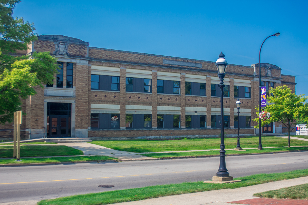
Fremont High School
Monument and historic site · National Register of Historic Places · 0.8 mi
Former school in Michigan

Parks, trails and playgrounds14





2 more on the map.
Restaurants and cafes13

The Blind Squirrel Tavern
Restaurant · American, Bar And Grill · 0.6 mi
19 West Main Street, Fremont
Mo-Th 11:00-00:00; Fr-Sa 11:00-02:00

El Burrito Feliz
Restaurant · Mexican, Bar · 0.9 mi
1448 West 48th Street, Fremont

Burger King
Fast food · Burger · 0.7 mi
1255 West Main Street, Fremont
Mo-Sa 06:00-22:00; Su 06:30-22:00
Taco Bell
Fast food · Tex-Mex · 0.7 mi
1305 West Main Street, Fremont
Mo-Fr 06:00-01:00; Sa-Su 07:00-01:00
1 more on the map.
History
The first inhabitants of the Fremont area were Native Americans. A group of settlers led by Daniel Weaver first settled the area in 1855, with the Weaver homestead serving as the first post office and public school. In November 1855, Fremont Township was established and named in honor of John C. Frémont, western explorer and Republican Party candidate for United States President. Weaver and his fellow settlers cleared the dense timber in order to farm. Early in the 1870s, Dutch immigrant families came from Holland and Muskegon, Michigan; and Fremont continues to recognize its early Dutch heritage in local festivals and pageants.
Due to rich stands of virgin timber, lumbering became a major industry, and a railroad spur soon linked Fremont to the national rail network. The lumbering industry declined in the 1860s because of the American Civil War; and in 1871, Fremont experienced a major forest fire that caused extensive damage, especially to the lumber mills. Nevertheless, Fremont rebuilt and was even able to supply some lumber to rebuild Chicago after the Great Fire of 1871.
From the History section of Fremont, Michigan on Wikipedia, under CC BY-SA 4.0.
Where to stay1
Churches and places of worship6
Shopping4
Gas and EV charging7
Schools, colleges and libraries12
Education And Activity Center
School · 2.1 mi
4554 West Career Pathway Ct, Fremont
Newaygo County Career Tech Center
School · 2.0 mi
4645 West Career Pathway Ct, Fremont
Healthcare2
Map of Fremont
62 places. The map loads OpenStreetMap tiles when you open it.
Climate by month
Monthly table
| Month | High | Low | Rain |
|---|---|---|---|
| Jan | 30°F | 16°F | 2.5 in |
| Feb | 32°F | 16°F | 1.9 in |
| Mar | 42°F | 23°F | 2.4 in |
| Apr | 55°F | 33°F | 3.8 in |
| May | 67°F | 44°F | 3.9 in |
| Jun | 76°F | 54°F | 3.6 in |
| Jul | 80°F | 58°F | 3.3 in |
| Aug | 78°F | 56°F | 3.4 in |
| Sep | 71°F | 50°F | 3.4 in |
| Oct | 59°F | 39°F | 3.9 in |
| Nov | 45°F | 30°F | 3.1 in |
| Dec | 34°F | 22°F | 2.5 in |
U.S. Climate Normals 1991-2020 for Fremont 4 Wsw (4 mi away), NOAA NCEI.
People and cost of living
American Community Survey 5-year estimates, 2020-2024, U.S. Census Bureau. Estimates have margins of error, larger for small towns.
Disaster history
Newaygo County has had 6 federal disaster declarations since 2000, most often for floods.
- 2026-06-30: Severe Storms, Tornadoes, And Flooding (Flood)
- 2020-03-27: Covid-19 Pandemic (Biological)
- 2020-03-13: Covid-19 (Biological)
- 2013-06-18: Flooding (Flood)
- 2005-09-07: Hurricane Katrina Evacuation (Hurricane)
- 2004-06-30: Severe Storms, Tornadoes, And Flooding (Severe Storm)
OpenFEMA disaster declarations summaries.
Getting there and nearby towns
Muskegon County Airport (MKG) is the nearest airport with scheduled flights listed in OpenStreetMap, 25 miles away.
- Newaygo 8 mi east, about 14 min by car
- White Cloud 11 mi northeast, about 18 min by car
- Grant 11 mi southeast, about 18 min by car
- Whitehall 20 mi west, about 32 min by car
- Montague 21 mi west, about 33 min by car
- Muskegon 22 mi southwest, about 36 min by car
- North Muskegon 22 mi southwest, about 35 min by car
- Shelby 23 mi northwest, about 37 min by car
- Norton Shores 25 mi southwest, about 40 min by car
- Cedar Springs 26 mi southeast, about 42 min by car
Drive times are estimates from straight-line distance, not routes.
Local news
Headlines from INDB, the NEMICO news database.
Reviews, tips and questions
Loading what members have shared...
Sources and licences
- NCES EDGE (Public domain): public schools
- NOAA NCEI U.S. Climate Normals 1991-2020 (Public domain): climate by month
- OpenFEMA (Public domain): disaster declarations
- OpenStreetMap contributors (ODbL 1.0): places, airports, map data
- U.S. Census Bureau (Public domain): population, income, housing, education, commute
- Wikidata (CC0 1.0): elevation, founding date, time zone, website, landmarks and historic places
- Wikimedia Commons (see each image): photos
- Wikipedia (CC BY-SA 4.0): overview and history text
Photo credits
- Fremont Michigan grain elevator, Discountfrozenpizza, CC BY-SA 4.0
- Fremont Lake Park and campground, Discountfrozenpizza, CC BY-SA 4.0
- Fremont Lake Park playground, Discountfrozenpizza, CC BY-SA 4.0
- Fremont Lake Park playground 2, Discountfrozenpizza, CC BY-SA 4.0
- Fremont, Michigan main street, Discountfrozenpizza, CC BY-SA 4.0
- Tree with pink and white blooms in Fremont, Michigan, Capvideo, CC BY 4.0
- Fremont High School, rossograph, CC BY-SA 4.0
- Pioneer Sugar float, Discountfrozenpizza, CC BY-SA 4.0
- Gerber Baby Food Festival parade 01, Discountfrozenpizza, CC BY-SA 4.0
- On the Conservation Trail with Chief Buckley – Michigan, Ohio, Pennsylvania and Maryland (20260721-NRCS-P-0006), USDAgov, Public domain
- On the Conservation Trail with Chief Buckley – Michigan, Ohio, Pennsylvania and Maryland (20260721-NRCS-P-0008), USDAgov, Public domain
- On the Conservation Trail with Chief Buckley – Michigan, Ohio, Pennsylvania and Maryland (20260721-NRCS-P-0007), USDAgov, Public domain
- Dandelion puffballs in a field of grass, Capvideo, CC BY 4.0
- Branstrom Park Treetops, Capvideo, CC BY 4.0
- Branstrom Park Morning, Capvideo, CC BY 4.0


Page built October 30, 2026. Spotted a mistake? Tell us or suggest a place.