


Fruitridge Pocket, California
Fruitridge Pocket is a community of 6,095 people in Sacramento County, California.
Why visit Fruitridge Pocket
Townapedia lists 25 museums and landmarks, 22 parks and trails, 53 places to eat, 5 places to stay and 6 attractions in and around town.
Highlights include California State University, Sacramento, Guy West Bridge, Alhambra Theatre and Anne Hathaway Cottage.
July is the warmest month, with average highs of 94°F; December lows average 41°F.
Weather in Fruitridge Pocket
Forecast from the National Weather Service. Full forecast
About Fruitridge Pocket
Fruitridge Pocket is a census-designated place in Sacramento County, California, United States. Fruitridge Pocket sits at an elevation of 33 feet (10 m). The 2020 United States census reported Fruitridge Pocket's population as 6,102.
From the Wikipedia article Fruitridge Pocket, California (this version), under CC BY-SA 4.0.
Things to do6
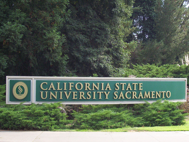
California State University, Sacramento
School · 2.8 mi
Public university in Sacramento, California, United States

Guy West Bridge
Bridge · 2.8 mi
Bridge in Sacramento County, California



Museums and landmarks25

Alhambra Theatre
Monument and historic site · National Register of Historic Places · 2.7 mi
Former movie theater in Sacramento, California, United States

Anne Hathaway Cottage
Monument and historic site · National Register of Historic Places · 1.6 mi
House in Sacramento, California, United States

C. K. McClatchy High School
Monument and historic site · National Register of Historic Places · 2.3 mi
High school in California, United States

Dunlap's Dining Room
Monument and historic site · National Register of Historic Places · 1.0 mi
Historic house-restaurant in Sacramento, California

Eastern Star Hall
Monument and historic site · National Register of Historic Places · 2.9 mi
Building in California, United States

Edward P. Howe Jr. House
Monument and historic site · National Register of Historic Places · 2.6 mi
House in Sacramento, California, United States

Fire Station No. 6
Monument and historic site · National Register of Historic Places · 1.4 mi
Historic firehouse in Sacramento, California, USA

Firehouse No. 3
Monument and historic site · National Register of Historic Places · 3.2 mi
Historic firehouse in Sacramento, California

George & Mabel Barr House
Monument and historic site · National Register of Historic Places · 1.5 mi
House in Sacramento, California, United States

J. C. Carly House
Monument and historic site · National Register of Historic Places · 1.6 mi
Historic house in California, United States

John T. Greene House
Monument and historic site · National Register of Historic Places · 2.9 mi
House in Sacramento, California, United States

Julia Morgan House
Monument and historic site · National Register of Historic Places · 1.9 mi
Mansion in Sacramento, California, US
13 more on the map.
Parks, trails and playgrounds22

McKinley Park
Park · National Register of Historic Places · 3.0 mi
Historic park in Sacramento, California, United States



William Land Park
Park · 2.4 mi
City park in Sacramento, California, United States
10 more on the map.
Restaurants and cafes53



Oak Park Brewing Company
Diner · American · 1.4 mi
3514 Broadway, Sacramento
Mo off; Tu-Th 11:30-22:00; Fr,Sa 11:30-24:00; Su 11:00-22:00

Orale Cantina
Restaurant · Mexican · 0.6 mi
3701 Stockton Boulevard
Th-Mo 11:00-21:00
41 more on the map.
Where to stay5
Hotel Med Park, Ascend Hotel Collection
Motel and hotel · 1.5 mi
2356 Stockton Boulevard, Sacramento
Churches and places of worship58
Shiloh Baptist Church
Church · Baptist · National Register of Historic Places · 1.1 mi
Saint Stephen The First Martyr Catholic Church
Church · Roman Catholic · 0.4 mi
5461 44th Street, Sacramento
Saint Peter and All Hallows Catholic Church
Church · Roman Catholic · 0.9 mi
5501 14th Avenue, Sacramento
City Church of Sacramento
Church · Nondenominational · 1.2 mi
3860 4th Avenue, Sacramento
Shopping16
Gas and EV charging11
Schools, colleges and libraries68
Father Keith B. Kenny Elementary School
School · 0.8 mi
3525 Martin Luther King Junior Boulevard, Sacramento
Healthcare11
Shriners Hospitals for Children — Northern California
Hospital · 1.4 mi
2425 Stockton Boulevard, Sacramento
UC Davis Same Day Surgery Center
Clinic and pharmacy · 1.3 mi
4845 2nd Avenue, Sacramento
Ernest E. Tschannen Eye Institute
Clinic and pharmacy · 1.4 mi
4860 Y Street, Sacramento
Lawrence J. Ellison Ambulatory Care Center
Clinic and pharmacy · 1.4 mi
4860 Y Street, Sacramento
UC Davis Cancer Center North Building
Clinic and pharmacy · 1.5 mi
2279 45th Street, Sacramento
UC Davis Cancer Center South Building
Clinic and pharmacy · 1.5 mi
2279 45th Street, Sacramento
Map of Fruitridge Pocket
250 places. The map loads OpenStreetMap tiles when you open it.
Climate by month
Monthly table
| Month | High | Low | Rain | Snow |
|---|---|---|---|---|
| Jan | 56°F | 41°F | 3.9 in | 0.0 in |
| Feb | 62°F | 44°F | 3.6 in | 0.0 in |
| Mar | 68°F | 47°F | 2.8 in | 0.0 in |
| Apr | 74°F | 49°F | 1.4 in | 0.0 in |
| May | 81°F | 54°F | 0.9 in | 0.0 in |
| Jun | 89°F | 59°F | 0.2 in | 0.0 in |
| Jul | 94°F | 61°F | 0.0 in | 0.0 in |
| Aug | 94°F | 61°F | 0.0 in | 0.0 in |
| Sep | 89°F | 59°F | 0.1 in | 0.0 in |
| Oct | 79°F | 53°F | 0.9 in | 0.0 in |
| Nov | 65°F | 45°F | 1.8 in | 0.0 in |
| Dec | 56°F | 41°F | 3.5 in | 0.0 in |
U.S. Climate Normals 1991-2020 for Sacramento 5 Ese (3 mi away), NOAA NCEI.
People and cost of living
American Community Survey 5-year estimates, 2020-2024, U.S. Census Bureau. Estimates have margins of error, larger for small towns.
Disaster history
Sacramento County has had 11 federal disaster declarations since 2000, most often for floods.
- 2023-04-03: Severe Winter Storms, Straight-Line Winds, Flooding, Landslides, And Mudslides (Severe Storm)
- 2023-03-10: Severe Winter Storms, Flooding, Landslides, And Mudslides (Flood)
- 2023-01-14: Severe Winter Storms, Flooding, Landslides, And Mudslides (Flood)
- 2023-01-09: Severe Winter Storms, Flooding, And Mudslides (Flood)
- 2020-03-22: Covid-19 Pandemic (Biological)
- 2020-03-13: Covid-19 (Biological)
OpenFEMA disaster declarations summaries.
Getting there and nearby towns
Sacramento Executive Airport (SAC) is the nearest airport with scheduled flights listed in OpenStreetMap, 2 miles away.
- Lemon Hill 1 mi south, about 2 min by car
- Parkway 2 mi south, about 4 min by car
- Sacramento 3 mi north, about 4 min by car
- Florin 4 mi southeast, about 7 min by car
- West Sacramento 5 mi west, about 8 min by car
- Rosemont 6 mi east, about 9 min by car
- Arden-Arcade 6 mi northeast, about 10 min by car
- La Riviera 6 mi northeast, about 10 min by car
- Vineyard 8 mi southeast, about 13 min by car
- Elk Grove 9 mi southeast, about 14 min by car
Drive times are estimates from straight-line distance, not routes.
Local news
Headlines from INDB, the NEMICO news database.
Reviews, tips and questions
Loading what members have shared...
Sources and licences
- NCES EDGE (Public domain): public schools
- NOAA NCEI U.S. Climate Normals 1991-2020 (Public domain): climate by month
- OpenFEMA (Public domain): disaster declarations
- OpenStreetMap contributors (ODbL 1.0): places, airports, map data
- U.S. Census Bureau (Public domain): population, income, housing, education, commute
- Wikidata (CC0 1.0): elevation, founding date, time zone, website, landmarks and historic places
- Wikimedia Commons (see each image): photos
- Wikipedia (CC BY-SA 4.0): overview and history text
Photo credits
- Shiloh Baptist Church, Sacramento, Caifornia By Oscar Mostofi, Oscarmostofi, CC BY-SA 3.0
- Old Tavern Sacramento California By Oscar Mostofi, Oscarmostofi, CC BY-SA 3.0
- SMUD Headquarters Building Front Facade Panorama, Asilvero, CC BY-SA 3.0
- Eastern Star Hall (1), JinCA, CC BY-SA 3.0
- Fire station no 6, Irneh, CC BY-SA 3.0
- Spring at McKinley Park, Ingawh, CC BY-SA 4.0
- C.K. McClatchy High School, User:Ronbo76, CC BY 2.5
- John T- Greene House 2012-09-23 12-24-16, Earl Paden, CC BY-SA 3.0
- George & Mabel Barr House on Montgomery Street in Sacramento, CA, Ingawh, CC BY-SA 4.0
- Firehouse No. 3, 1215 19th St. Sacramento, Irneh, CC BY-SA 3.0
- Sacramento Historic City Cemetery view, CSvBibra, CC0
- Full view - Ann Hathaway Cottage in Sacramento, CA, Ingawh, CC BY-SA 4.0
- Winters House, Irneh, CC BY-SA 3.0
- Libby, McNeill and Libby Fruit and Vegetable Cannery, Alhambra Sacramento CA Oscar Mostofi p1, Oscarmostofi, CC BY-SA 3.0
- Theodore Judah School (1), JinCA, CC BY-SA 3.0
- Dunlap's Dining Room, Joan McHale, CC BY-SA 3.0
- Sacramento Bank Building, 3418 Broadway Sacramento, CA., Oscarmostofi, CC BY-SA 3.0
- Julia morgan house, Irneh, CC BY-SA 3.0
- J.C. Carly House, Joan McHale, CC BY-SA 3.0
- Lawrence warehouse, Sacramento, Oscarmostofi, CC BY-SA 3.0
- ISH WC SuttersFort4, Ian Howard, CC BY 2.5
- Edward P. Howe, Jr., House, Irneh, CC BY-SA 3.0
- Sacramento Jefferson School, 2021, T71024, CC BY-SA 4.0
- Sac State North Entrance, DevinCook at English Wikipedia, Public domain
- LWBSacramentoZoo, L Wade Brown ( Grubbycup ), CC BY-SA 3.0
- Saint Peter and All Hallows Catholic Church in Sacramento California 01, Always dreamin, CC BY-SA 4.0


Page built October 30, 2026. Spotted a mistake? Tell us or suggest a place.