



Gig Harbor, Washington
Gig Harbor is a city of 12,424 people in Pierce County, Washington, founded in 1946.
Why visit Gig Harbor
Townapedia lists 12 museums and landmarks, 36 parks and trails, 64 places to eat, 7 places to stay and 3 attractions in and around town.
Highlights include Fort Nisqually, Purdy Bridge, Sehmel Homestead Park and Point Defiance Park.
August is the warmest month, with average highs of 76°F; December lows average 36°F.
Weather in Gig Harbor
Forecast from the National Weather Service. Full forecast
About Gig Harbor
Gig Harbor (Lushootseed: txʷaalqəɬ) is the name of both a bay on Puget Sound and a city on its shore in Pierce County, Washington. The population was 12,029 at the 2020 census.
From the Wikipedia article Gig Harbor, Washington (this version), under CC BY-SA 4.0.
Things to do3



Museums and landmarks12
Fort Nisqually
Monument and historic site · National Register of Historic Places · 3.8 mi
An important fur trading and farming post of the Hudson's Bay Company

Purdy Bridge
Bridge · National Register of Historic Places · 3.5 mi
Bridge in United States of America




Galloping Gertie Light Pole
Monument and historic site
Historic light pole salvaged from collapse of Tacoma Narrows Bridge in November 1940.
The Puyallup Tribe / sx̌ʷəbabš | The Swift Water People
Monument and historic site
Parks, trails and playgrounds36

Sehmel Homestead Park
Park · 2.2 mi
98-acre park with many amenities, including baseball fields, football field, children's playground, tennis courts, etc.
10123 78th Avenue Northwest, Gig Harbor
Mo-Su 07:00-sunset


Wilkinson Farm Park
Park · 0.6 mi
No restrooms on-site parking 16-acre wildlife park wetlands holly grove meadows community garden | greenhouse trails waterfountain...
4118 Rosedale Street Northwest, Gig Harbor

24 more on the map.
Restaurants and cafes64

Cutter's Point Coffee
Cafe · Coffee Shop · 2.3 mi
5500 Olympic Drive Northwest
Mo-Sa 06:00-19:00; Su 07:00-18:00

Il Lucano Ristorate Italiano
Restaurant · Italian · 1.0 mi
3119 Judson Street, Gig Harbor
Tu-Sa 11:30-21:00
Anthony's at Gig Harbor
Restaurant · Seafood · 0.4 mi
Mo-Th 11:30-21:00; Fr-Sa 11:30-22:00; Su 10:00-21:00
Brimstone PNW Smokehouse
Restaurant · 1.0 mi
7707 Pioneer Way
Th 12:00-21:00; Fr, Sa 12:00-22:00; Su 12:00-20:00; Mo 12:00-21:00


Evergreen State Brewing Co Taproom
Bar and pub · 0.9 mi
3155 Harborview Drive
Tu-Th 15:00-20:00; Fr, Sa 14:00-21:00; Su 14:00-18:00
Java & Clay Cafe
Cafe · Coffee Shop · 0.9 mi
Espresso cafe & pottery painting shop
3210 Harborview Drive, Gig Harbor
Hop Pharm
Bar and pub · 1.0 mi
3216 Judson Street, Gig Harbor
Tu-We 14:00-20:00; Th-Sa 14:00-21:00; Su 14:00-19:00
52 more on the map.
History
The Gig Harbor is the traditional homeland of S'Homamish or Homamish (Lushootseed: sxʷəbabš), an ancestral band of the modern-day Puyallup people. The area is known in their Lushootseed language as txʷaalqəɬ, meaning "place where game exists". There was a Puyallup settlement at the mouth of the harbor that included six houses, and a large longhouse. This village existed until the late 19th century, with the longhouse finally being torn down by settlers in 1915. The band was later relocated to the Puyallup Indian Reservation.
During a heavy storm in 1840, Captain Charles Wilkes brought the captain's gig (small boat) into the harbor for protection. Later, with the publication of Wilkes' 1841 map of the Oregon Territory, the sheltered bay was named in English as Gig Harbor by George Sinclair for his boat.
In 1867, fisherman Samuel Jerisich came to the Gig Harbor area, along with many other immigrants from Sweden, Norway, and Croatia. The town was platted in 1888 by Alfred M. Burnham, the owner of a local general store and native of Albert Lea, Minnesota, where he advertised opportunities in Gig Harbor.
From the History section of Gig Harbor, Washington on Wikipedia, under CC BY-SA 4.0.
Where to stay7
Churches and places of worship12
Believers Fellowship
Church · Nondenominational · 1.5 mi
4112 Hunt Street Northwest, Gig Harbor
Gig Harbor United Methodist Church
Church · Methodist · 0.9 mi
7400 Pioneer Way, Gig Harbor
The Church of Jesus Christ of Latter-day Saints
Church · Latter Day Saints · 0.7 mi
The Church of Jesus Christ of Latter-day Saints
Church · Latter Day Saints · 2.2 mi
Shopping25
Beach Basket Gift, Clothing & Christmas Shop
Shop
4102 Harborview Drive, Gig Harbor
Gas and EV charging7
Schools, colleges and libraries28
Healthcare5
Harbor Health and Apothecary
Clinic and pharmacy · 1.0 mi
3216 Judson Street, Gig Harbor
Map of Gig Harbor
199 places. The map loads OpenStreetMap tiles when you open it.
Climate by month
Monthly table
| Month | High | Low | Rain |
|---|---|---|---|
| Jan | 46°F | 36°F | 6.1 in |
| Feb | 48°F | 36°F | 4.1 in |
| Mar | 53°F | 38°F | 4.6 in |
| Apr | 58°F | 41°F | 3.4 in |
| May | 64°F | 46°F | 2.1 in |
| Jun | 70°F | 51°F | 1.4 in |
| Jul | 76°F | 54°F | 0.7 in |
| Aug | 76°F | 54°F | 0.9 in |
| Sep | 70°F | 51°F | 1.5 in |
| Oct | 59°F | 46°F | 4.3 in |
| Nov | 50°F | 40°F | 7.2 in |
| Dec | 46°F | 36°F | 5.8 in |
U.S. Climate Normals 1991-2020 for Tacoma Narrows Ap (5 mi away), NOAA NCEI.
People and cost of living
American Community Survey 5-year estimates, 2020-2024, U.S. Census Bureau. Estimates have margins of error, larger for small towns.
Disaster history
Pierce County has had 13 federal disaster declarations since 2000, most often for severe storms.
- 2026-04-07: Severe Storms, Straight-Line Winds, Flooding, Landslides, And Mudslides (Flood)
- 2025-12-12: Severe Storms, Straight-Line Winds, Flooding, Landslides, And Mudslides (Flood)
- 2020-09-09: Sumner Grade Fire (Fire)
- 2020-03-22: Covid-19 Pandemic (Biological)
- 2020-03-13: Covid-19 (Biological)
- 2012-03-05: Severe Winter Storm, Flooding, Landslides, And Mudslides (Severe Storm)
OpenFEMA disaster declarations summaries.
Getting there and nearby towns
Tacoma Narrows Airport (TIW) is the nearest airport with scheduled flights listed in OpenStreetMap, 5 miles away.
- Artondale 3 mi southwest, about 6 min by car
- Tacoma 9 mi southeast, about 14 min by car
- Federal Way 12 mi east, about 20 min by car
- Des Moines 14 mi east, about 22 min by car
- Fife 14 mi southeast, about 22 min by car
- Bremerton 15 mi north, about 24 min by car
- Burien 15 mi northeast, about 25 min by car
- Edgewood 16 mi southeast, about 26 min by car
- Kent 18 mi east, about 30 min by car
- Auburn 18 mi east, about 29 min by car
Drive times are estimates from straight-line distance, not routes.
Local news
Headlines from INDB, the NEMICO news database.
Reviews, tips and questions
Loading what members have shared...
Sources and licences
- NCES EDGE (Public domain): public schools
- NOAA NCEI U.S. Climate Normals 1991-2020 (Public domain): climate by month
- OpenFEMA (Public domain): disaster declarations
- OpenStreetMap contributors (ODbL 1.0): places, airports, map data
- U.S. Census Bureau (Public domain): population, income, housing, education, commute
- Wikidata (CC0 1.0): elevation, founding date, time zone, website, landmarks and historic places
- Wikimedia Commons (see each image): photos
- Wikipedia (CC BY-SA 4.0): overview and history text
Photo credits
- Gig Harbor, Ken Lund from Reno, NV, USA, CC BY-SA 2.0
- Purdy Bridge, Jet Lowe, Public domain
- The Fort Nisqually Granary, Steven Pavlov, CC BY-SA 3.0
- Gig Harbor History Museum 2018 03, Thorsten Lindner, CC BY-SA 4.0
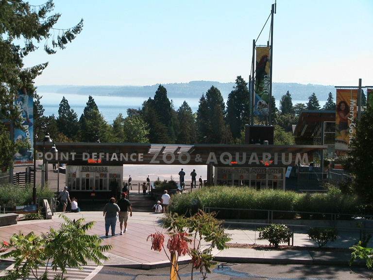
- PDZA Entrance, Takinzinnia, CC0
- Dalcopassage.from.Owensbeach.looking.north, Crash Dalco, CC BY-SA 3.0
- Camp Six Logging Museum 3, Ben Cody, Public domain
Page built October 30, 2026. Spotted a mistake? Tell us or suggest a place.