
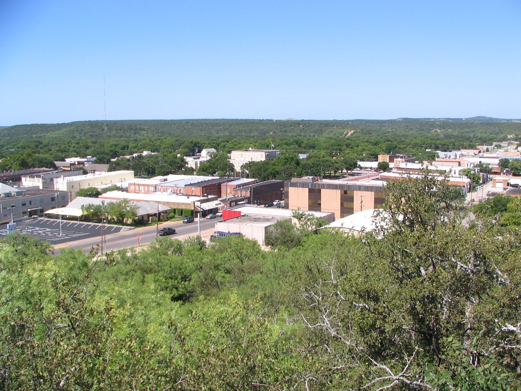


Why visit Graham
Townapedia lists 16 museums and landmarks, 6 parks and trails, 8 places to eat, 7 places to stay and 3 attractions in and around town.
Highlights include Graham Drive-In Theatre, National Theater and Brazos Indian Reservation School.
July is the warmest month, with average highs of 98°F; January lows average 30°F.
Weather in Graham
Forecast from the National Weather Service. Full forecast
About Graham
Graham is the county seat of and the largest city in Young County, Texas, United States. As of the 2020 census, Graham had a population of 8,732.
From the Wikipedia article Graham, Texas (this version), under CC BY-SA 4.0.
Things to do3


Museums and landmarks16




4 more on the map.
Parks, trails and playgrounds6


Restaurants and cafes8




History
The site was first settled in 1871 by brothers Gustavus A. and Edwin S. Graham, primary shareholders in the Texas Emigration and Land Company of Louisville, Kentucky. The brothers moved to Texas after the Civil War, and after buying 125,000 acres (510 km2) in then-vast Young County, helped to revitalize the area, the population of which had become badly depleted during the war. During that same year as when Graham was settled, the Warren Wagon Train raid occurred about 12 miles north of the city. In 1872, the Graham brothers purchased a local saltworks, established the town of Graham, and set up the Graham Land Office. The saltworks were not a profitable venture, as the salt was too expensive to ship, and were closed in a few years.
New families started to arrive, and the brothers began promoting the sale of homesites and doing civic improvements. A post office opened in 1873, and after Young County reorganized the following year, Graham became the county seat. The town's newspaper, known as The Graham Leader and still in existence today, was first printed in 1876, the same year that the first temporary courthouse was built. Other businesses from these early years included a gristmill, sawmill, cotton gin, and brick kiln, two hotels, and several stores.
From the History section of Graham, Texas on Wikipedia, under CC BY-SA 4.0.
Where to stay7
Churches and places of worship15
Faith Center Assembly of God
Church · Assemblies Of God · 1.5 mi
1601 US 380 Bypass, Graham
First Presbyterian Church
Church · Presbyterian · 1.1 mi
1400 Randy Drive, Graham
Shopping3
Gas and EV charging2
Schools, colleges and libraries15
Healthcare2
Map of Graham
77 places. The map loads OpenStreetMap tiles when you open it.
Climate by month
Monthly table
| Month | High | Low | Rain |
|---|---|---|---|
| Jan | 57°F | 30°F | 1.2 in |
| Feb | 62°F | 33°F | 1.7 in |
| Mar | 70°F | 41°F | 3.0 in |
| Apr | 78°F | 49°F | 2.1 in |
| May | 85°F | 60°F | 3.8 in |
| Jun | 93°F | 69°F | 3.8 in |
| Jul | 98°F | 73°F | 2.0 in |
| Aug | 97°F | 72°F | 2.2 in |
| Sep | 90°F | 64°F | 3.1 in |
| Oct | 80°F | 51°F | 3.7 in |
| Nov | 68°F | 39°F | 1.6 in |
| Dec | 59°F | 32°F | 1.8 in |
U.S. Climate Normals 1991-2020 for Graham (1 mi away), NOAA NCEI.
People and cost of living
American Community Survey 5-year estimates, 2020-2024, U.S. Census Bureau. Estimates have margins of error, larger for small towns.
Disaster history
Young County has had 14 federal disaster declarations since 2000, most often for fires.
- 2021-02-19: Severe Winter Storms (Severe Ice Storm)
- 2021-02-14: Severe Winter Storm (Severe Ice Storm)
- 2020-03-25: Covid-19 Pandemic (Biological)
- 2020-03-13: Covid-19 (Biological)
- 2015-05-29: Severe Storms, Tornadoes, Straight-Line Winds And Flooding (Severe Storm)
- 2011-07-01: Wildfires (Fire)
OpenFEMA disaster declarations summaries.
Getting there and nearby towns
Olney Municipal Airport (ONY) is the nearest airport with scheduled flights listed in OpenStreetMap, 22 miles away.
- Olney 21 mi northwest, about 34 min by car
- Jacksboro 26 mi east, about 41 min by car
- Breckenridge 31 mi southwest, about 49 min by car
- Archer City 34 mi north, about 55 min by car
- Mineral Wells 35 mi southeast, about 56 min by car
- Ranger 44 mi south, about 1 h 15 min by car
- Bridgeport 47 mi east, about 1 h 15 min by car
- Chico 47 mi east, about 1 h 15 min by car
- Weatherford 53 mi southeast, about 1 h 30 min by car
- Wichita Falls 56 mi north, about 1 h 30 min by car
Drive times are estimates from straight-line distance, not routes.
Local news
Headlines from INDB, the NEMICO news database.
Reviews, tips and questions
Loading what members have shared...
Sources and licences
- NCES EDGE (Public domain): public schools
- NOAA NCEI U.S. Climate Normals 1991-2020 (Public domain): climate by month
- OpenFEMA (Public domain): disaster declarations
- OpenStreetMap contributors (ODbL 1.0): places, airports, map data
- U.S. Census Bureau (Public domain): population, income, housing, education, commute
- Wikidata (CC0 1.0): elevation, founding date, time zone, website
- Wikimedia Commons (see each image): photos
- Wikipedia (CC BY-SA 4.0): overview and history text
Photo credits
- GrahamSquare, Bus114, Public domain
- Young County courthouse in Graham, Texas, Larry D. Moore, CC BY 4.0
- Addie M Graham (37753151306), QuesterMark from Where the West Begins, United States, CC BY-SA 2.0
- Brazos Indian Reservation School Texas Historical Marker, Pi3.124, CC BY-SA 3.0
- Brazos Indian Reservation Texas Historical Marker, Pi3.124, CC BY-SA 3.0
- ISS018-E-6322 - View of Oklahoma, Earth Science and Remote Sensing Unit , Lyndon B. Johnson Space Center, Public domain
Page built October 30, 2026. Spotted a mistake? Tell us or suggest a place.