


Why visit Gray
Townapedia lists 6 museums and landmarks, 3 parks and trails, 20 places to eat and 2 places to stay in and around town.
Highlights include Old Clinton Historic District and Jones County Courthouse.
July is the warmest month, with average highs of 93°F; January lows average 33°F.
Weather in Gray
Forecast from the National Weather Service. Full forecast
About Gray
Gray is a city in Jones County, Georgia, United States. The population was 3,436 at the 2020 census, up from 3,276 at the 2010 census. In 2025, its population was estimated at 3,555. The city is the county seat of Jones County.
From the Wikipedia article Gray, Georgia (this version), under CC BY-SA 4.0.
Museums and landmarks6

Old Clinton Historic District
Monument and historic site · National Register of Historic Places · 1.2 mi
Clinton, GA, listed on the NRHP in Georgia

Jones County Courthouse
Monument and historic site · National Register of Historic Places · 0.6 mi
Courthouse in Georgia, United States


Jones County High School
Monument and historic site · National Register of Historic Places · 0.4 mi
High school in Gray, Jones County, Georgia
Roberts-Bush-Roberts House
Monument and historic site · National Register of Historic Places · 1.0 mi
Historic house in Georgia, United States
Main Street of Gray
Monument and historic site · 0.6 mi
106 West Clinton Street, Gray
Parks, trails and playgrounds3


Restaurants and cafes20

Agave Azul
Restaurant · Mexican · 0.4 mi
106 Bill Conn Parkway, Gray
Su-We 11:00-21:00; Th-Sa 11:00-22:00
Chevys
Restaurant · Mexican · 0.6 mi
115 West Clinton Street, Gray
Mo-Th, Su 11:00-21:00; Fr, Sa 11:00-22:00
Old Clinton Bar-B-Q
Restaurant · Barbecue · 1.4 mi
4214 Gray Highway, Gray
Mo-Th 10:00-20:00; Fr-Sa 10:00-21:00; Su 10:00-16:00
Pizza Hut
Restaurant · Pizza · 0.5 mi
609 West Clinton Road, Gray
Fr, Sa 11:00-23:00; Mo-Th, Su 11:00-22:00
Bent Axle Neighborhood Grille
Restaurant · American, Grill · 0.5 mi
125 West Clinton Street, Gray
We, Th 11:00-22:00; Fr, Sa 11:00-23:00; Su 11:00-20:00
I Love Country Buffet
Restaurant · 0.6 mi
300 West Clinton Street, Gray
Mo-We 11:00-20:00; Th-Sa 11:00-21:00; Su 11:00-16:00


8 more on the map.
Where to stay2

Gray Motel
Motel and hotel · 0.7 mi
112 East Clinton Street, Gray
History
Gray was founded in 1851 and named for local wealthy cotton planter and landowner James M. Gray. In 1905, the seat of Jones County was transferred to Gray and in 1911 it was incorporated as a town.
From the History section of Gray, Georgia on Wikipedia, under CC BY-SA 4.0.
Churches and places of worship3
First Baptist Church of Gray;First Baptist Gray
Church · 0.5 mi
134 W Clinton St;West Clinton Street, Gray
Shopping5
Gas and EV charging5
Schools, colleges and libraries9
Healthcare3
Map of Gray
56 places. The map loads OpenStreetMap tiles when you open it.
Climate by month
Monthly table
| Month | High | Low | Rain | Snow |
|---|---|---|---|---|
| Jan | 58°F | 33°F | 4.2 in | 0.3 in |
| Feb | 62°F | 36°F | 4.1 in | 0.2 in |
| Mar | 69°F | 42°F | 4.8 in | 0.0 in |
| Apr | 77°F | 49°F | 3.9 in | 0.0 in |
| May | 84°F | 58°F | 3.2 in | 0.0 in |
| Jun | 90°F | 67°F | 4.3 in | 0.0 in |
| Jul | 93°F | 70°F | 4.2 in | 0.0 in |
| Aug | 91°F | 70°F | 4.7 in | 0.0 in |
| Sep | 86°F | 64°F | 4.2 in | 0.0 in |
| Oct | 78°F | 52°F | 2.8 in | 0.0 in |
| Nov | 68°F | 40°F | 3.4 in | 0.0 in |
| Dec | 60°F | 36°F | 4.5 in | 0.1 in |
U.S. Climate Normals 1991-2020 for Milledgeville Hcn (18 mi away), NOAA NCEI.
People and cost of living
American Community Survey 5-year estimates, 2020-2024, U.S. Census Bureau. Estimates have margins of error, larger for small towns.
Disaster history
Jones County has had 13 federal disaster declarations since 2000, most often for hurricanes.
- 2026-01-24: Severe Winter Storm (Winter Storm)
- 2024-09-26: Hurricane Helene (Tropical Storm)
- 2020-03-29: Covid-19 Pandemic (Biological)
- 2020-03-13: Covid-19 (Biological)
- 2018-10-14: Hurricane Michael (Hurricane)
- 2018-10-10: Hurricane Michael (Hurricane)
OpenFEMA disaster declarations summaries.
Getting there and nearby towns
Macon Downtown Airport (MAC) is the nearest airport with scheduled flights listed in OpenStreetMap, 12 miles away.
- Macon-Bibb County 16 mi southwest, about 26 min by car
- Milledgeville 18 mi east, about 30 min by car
- Eatonton 24 mi north, about 39 min by car
- Forsyth 25 mi west, about 40 min by car
- Centerville 27 mi south, about 43 min by car
- Byron 27 mi southwest, about 44 min by car
- Flovilla 27 mi northwest, about 44 min by car
- Warner Robins 29 mi south, about 46 min by car
- Barnesville 35 mi west, about 57 min by car
- Perry 38 mi south, about 1 h by car
Drive times are estimates from straight-line distance, not routes.
Local news
Headlines from INDB, the NEMICO news database.
Reviews, tips and questions
Loading what members have shared...
Sources and licences
- NCES EDGE (Public domain): public schools
- NOAA NCEI U.S. Climate Normals 1991-2020 (Public domain): climate by month
- OpenFEMA (Public domain): disaster declarations
- OpenStreetMap contributors (ODbL 1.0): places, airports, map data
- U.S. Census Bureau (Public domain): population, income, housing, education, commute
- Wikidata (CC0 1.0): elevation, founding date, time zone, website, landmarks and historic places
- Wikimedia Commons (see each image): photos
- Wikipedia (CC BY-SA 4.0): overview and history text
Photo credits
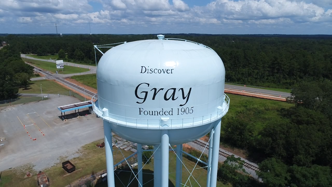
- Gray, GA Water Tower, Mihand35, CC BY-SA 4.0
- EB West Clinton Street 35 mph then 25mph school zone, Gray dashcam, Michael Rivera, CC BY 4.0
- Bell in front of Jones County Courthouse, Gray, Michael Rivera, CC BY 4.0
- EB Gordon Street at Railroad Street Intersection, Gray dashcam, Michael Rivera, CC BY 4.0
- War memorials, Gray, Jones County, Michael Rivera, CC BY 4.0
- Jones County Courthouse, Gray, Mjrmtg, CC BY 4.0
- EB Gordon Street at Railroad Crossing 733403N, Gray dashcam, Michael Rivera, CC BY 4.0
- First Baptist Church, Gray, Jones County, Michael Rivera, CC BY 4.0
- Little free library courthouse side, Gray, Michael Rivera, CC BY 4.0
- Jones County Courthouse corner stone, Gray, Michael Rivera, CC BY 4.0
- EB Gordon Street at James Street Intersection, Gray dashcam, Michael Rivera, CC BY 4.0
- Blue Star Memorial, Gray, Jones County, Michael Rivera, CC BY 4.0
- Jones County historical marker, Gray, Michael Rivera, CC BY 4.0
- James Madison Gray historical marker, Gray, Michael Rivera, CC BY 4.0
- Jones County Courthouse marker, Gray, Mjrmtg, CC BY 4.0
- Dixie Highway marker, Gray, Michael Rivera, CC BY 4.0
- Gray Fire Department, Jones County, Michael Rivera, CC BY 4.0
- City Hall, Gray, Jones County, Michael Rivera, CC BY 4.0
- NB GA44 at East Clinton Street Intersection, Gray dashcam, Michael Rivera, CC BY 4.0
- James C. Roberts Municipal Complex historical marker, Gray, Michael Rivera, CC BY 4.0
- NB Childs Street Speed hump and street light, Gray dashcam, Michael Rivera, CC BY 4.0
- NB Childs Street Speed hump 137, Gray dashcam, Mjrmtg, CC BY 4.0
- NB Childs Street at East Clinton Street Intersection, Gray dashcam, Michael Rivera, CC BY 4.0
- NB Cedarline Drive at first Speed Hump, Gray dashcam, Mjrmtg, CC BY 4.0
- NB Cedarline Drive at second Speed Hump, Gray dashcam, Michael Rivera, CC BY 4.0
- Roberts House, Gray, GA, US, Jud McCranie, CC BY-SA 4.0
- Jones County High School, Gray, GA, US (02), Bubba73, CC BY-SA 3.0
- Jones County Courthouse, Gray, GA, US (08), Bubba73, CC BY-SA 3.0
- EB West Clinton Street at Washburn Drive Intersection dashcam, Michael Rivera, CC BY 4.0
- W. E. Knox Civic Center - panoramio, csmith/dbb1, CC BY-SA 3.0
- EB GA18 at Bill Conn Parkway Intersection dashcam, Mjrmtg, CC BY 4.0
- Highview Cemetery - panoramio, csmith/dbb1, CC BY-SA 3.0
- Veterans of Jones County - panoramio, csmith/dbb1, CC BY-SA 3.0
- Blue Star Memorial - panoramio, csmith/dbb1, CC BY-SA 3.0
- Jones County Courthouse - panoramio (1), csmith/dbb1, CC BY-SA 3.0
- Home of the Georgia Peach - panoramio, csmith/dbb1, CC BY-SA 3.0
- Jones County Courthouse 2012-10-04 14-37-17, Cdharrison, CC BY-SA 3.0
- Ocmulgee Piedmont Scenic ByWay - panoramio, csmith/dbb1, CC BY-SA 3.0
- EB GA18 MM 13 dashcam, Mjrmtg, CC BY 4.0
- EB GA18 at Lite-N-Tie Road Intersection dashcam, Mjrmtg, CC BY 4.0


Page built October 30, 2026. Spotted a mistake? Tell us or suggest a place.