


Great Falls, Montana
Great Falls is a city of 60,329 people in Cascade County, Montana, founded in 1883.
Why visit Great Falls
Townapedia lists 26 museums and landmarks, 81 parks and trails, 185 places to eat, 39 places to stay and 16 attractions in and around town.
Highlights include Tenth Street Bridge, University of Providence, Paris Gibson Square Museum of Art and C. M. Russell Museum.
July is the warmest month, with average highs of 86°F; January lows average 18°F.
Weather in Great Falls
Forecast from the National Weather Service. Full forecast
About Great Falls
Great Falls is the third most populous city in the U.S. state of Montana and the county seat of Cascade County. The population was 60,442 according to the 2020 census. The city covers an area of 22.9 square miles (59 km2) and is the principal city of the Great Falls, Montana, Metropolitan Statistical Area, which encompasses all of Cascade County. The Great Falls MSA's population was 84,414 according to the 2020 census.
From the Wikipedia article Great Falls, Montana (this version), under CC BY-SA 4.0.
Things to do16

Tenth Street Bridge
Bridge · National Register of Historic Places · 1.4 mi
Bridge in United States of America

University of Providence
School · 1.5 mi
Private Roman Catholic university in Great Falls, Montana, United States

Colter Falls
Waterfall · 4.6 mi
One of the Great Falls of the Missouri River in Montana, United States

Fifteenth Street Bridge
Bridge · 1.5 mi
Bridge in Black Eagle, Montana
Great Falls College Montana State University
School · 1.8 mi
Community college in Great Falls, Montana, U.S.
Rainbow Falls
Waterfall · 4.9 mi
Waterfall on the Missouri River, Montana, US


4 more on the map.
Museums and landmarks26

Paris Gibson Square Museum of Art
Museum · National Register of Historic Places · 0.8 mi
Art museum in Great Falls, Montana
1400
Tu 10:00-21:00; We-Fr 10:00-17:00; Sa 10:00-15:00; Dec 25-Jan 1 off


Great Falls High School
Monument and historic site · National Register of Historic Places · 1.2 mi
High school in Great Falls, Cascade County, Montana

Ursuline Academy
Monument and historic site · National Register of Historic Places · 1.5 mi
Historic building in Montana, United States

Arvon Block
Monument and historic site · National Register of Historic Places
Historic building in Great Falls, Montana, USA

C. M. Russell Museum Complex
Museum · National Register of Historic Places · 0.8 mi
Art museum in Great Falls, Montana

Cascade County Courthouse
Monument and historic site · National Register of Historic Places · 0.4 mi
County courthouse in Great Falls, United States of America
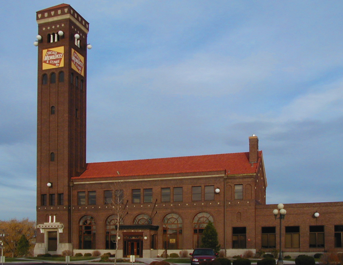
Chicago, Milwaukee and St. Paul Passenger Depot
Monument and historic site · National Register of Historic Places · 0.5 mi
Railway station in Great Falls, the United States of America

Lee M. Ford House
Monument and historic site · National Register of Historic Places · 0.5 mi
Historic house in Great Falls, Montana

Margaret Block
Monument and historic site · National Register of Historic Places
Historic three-story building in Great Falls, Montana


Masonic Temple
Monument and historic site · National Register of Historic Places · 0.4 mi
Masonic temple in Great Falls, United States of America
Timothy Edwards Collins Mansion
Monument and historic site · National Register of Historic Places · 1.4 mi
Historic house in Montana, United States
14 more on the map.
Parks, trails and playgrounds81



69 more on the map.
Restaurants and cafes185




173 more on the map.
History
For much of prehistory, no permanent settlements existed at or near Great Falls, though Salish Indians seasonally hunted bison in the region. Around 1600, Piegan Blackfeet Indians, migrating west, entered the area, pushing the Salish back into the Rocky Mountains and claiming the area now occupied by Great Falls. The area remained territory of the Blackfeet until long after the United States claimed the region in 1803 as part of the Louisiana Purchase.
Meriwether Lewis and William Clark led the Lewis and Clark Expedition into the newly purchased territory from 1804 to 1806. The expedition came upon the "Great Falls of the Missouri River" on June 13, 1805.
Politically, the future site of Great Falls passed through numerous hands in the 19th century. It was part of the unincorporated frontier until May 30, 1854, when Congress established the Nebraska Territory. On March 2, 1861, the site became part of the Dakota Territory. The Great Falls area was incorporated into the Idaho Territory on March 4, 1863, and then into the Montana Territory on May 28, 1864. It became part of the state of Montana upon that territory's admission to statehood on November 8, 1889.
From the History section of Great Falls, Montana on Wikipedia, under CC BY-SA 4.0.
Where to stay39
Comfort Inn & Suites Market Place Great Falls
Motel and hotel · 2.6 mi
1801 Market Place Drive, Great Falls
Churches and places of worship79
Corpus Christi Catholic Church
Church · Roman Catholic · 1.6 mi
410 22nd Avenue Northeast, Great Falls
Saints Constantine & Helen Greek Orthodox Church
Church · Greek Orthodox · 0.6 mi
1101 1st Avenue North, Great Falls
Our Lady of Lourdes Catholic Church
Church · Roman Catholic · 0.7 mi
409 13th Street South, Great Falls
Harvest Springs Community Church
Church · Evangelical · 2.6 mi
1001 36th Avenue Northeast, Great Falls
St. Mark the Evangelist Orthodox Christian Mission
Church · Orthodox · 1.3 mi
821 10th Avenue Southwest, Great Falls
Shopping43
Gas and EV charging32
Schools, colleges and libraries46
Core School At Morningside Elementary
School · 3.1 mi
4119 7Th Ave N, Great Falls
Healthcare28
Map of Great Falls
250 places. The map loads OpenStreetMap tiles when you open it.
Climate by month
Monthly table
| Month | High | Low | Rain |
|---|---|---|---|
| Jan | 37°F | 18°F | 0.6 in |
| Feb | 39°F | 19°F | 0.6 in |
| Mar | 48°F | 25°F | 0.6 in |
| Apr | 58°F | 33°F | 1.8 in |
| May | 67°F | 42°F | 2.7 in |
| Jun | 75°F | 50°F | 2.7 in |
| Jul | 86°F | 55°F | 1.3 in |
| Aug | 84°F | 53°F | 1.3 in |
| Sep | 73°F | 45°F | 1.4 in |
| Oct | 59°F | 36°F | 1.1 in |
| Nov | 45°F | 26°F | 0.7 in |
| Dec | 37°F | 20°F | 0.6 in |
U.S. Climate Normals 1991-2020 for Great Falls 16St (1 mi away), NOAA NCEI.
People and cost of living
American Community Survey 5-year estimates, 2020-2024, U.S. Census Bureau. Estimates have margins of error, larger for small towns.
Disaster history
Cascade County has had 5 federal disaster declarations since 2000, most often for biologicals.
- 2020-03-31: Covid-19 Pandemic (Biological)
- 2020-03-13: Covid-19 (Biological)
- 2011-06-17: Severe Storms And Flooding (Severe Storm)
- 2005-09-13: Hurricane Katrina Evacuation (Hurricane)
- 2000-08-30: Wildfires (Fire)
OpenFEMA disaster declarations summaries.
Getting there and nearby towns
Great Falls International Airport (GTF) is the nearest airport with scheduled flights listed in OpenStreetMap, 4 miles away.
- Black Eagle 3 mi northeast, about 4 min by car
- Malmstrom AFB 5 mi east, about 9 min by car
- Sun Prairie 9 mi west, about 15 min by car
- Ulm 12 mi southwest, about 19 min by car
- Vaughn 13 mi west, about 20 min by car
- Belt 19 mi southeast, about 31 min by car
- Cascade 25 mi southwest, about 40 min by car
- Simms 31 mi west, about 49 min by car
- Fairfield 33 mi west, about 53 min by car
- Fort Benton 37 mi northeast, about 1 h by car
Drive times are estimates from straight-line distance, not routes.
Local news
Headlines from INDB, the NEMICO news database.
Reviews, tips and questions
Loading what members have shared...
Sources and licences
- NCES EDGE (Public domain): public schools
- NOAA NCEI U.S. Climate Normals 1991-2020 (Public domain): climate by month
- OpenFEMA (Public domain): disaster declarations
- OpenStreetMap contributors (ODbL 1.0): places, airports, map data
- U.S. Census Bureau (Public domain): population, income, housing, education, commute
- Wikidata (CC0 1.0): elevation, founding date, time zone, website, landmarks and historic places
- Wikimedia Commons (see each image): photos
- Wikipedia (CC BY-SA 4.0): overview and history text
Photo credits
- Panorama Great Falls, Montanabw, CC BY-SA 3.0
- Great Falls, MT, USA - panoramio (34), Eric Friedebach, CC BY 3.0
- Great Falls, MT, USA - panoramio (35), Eric Friedebach, CC BY 3.0
- Great Falls, MT, USA - panoramio (31), Eric Friedebach, CC BY 3.0
- Great Falls, MT, USA - panoramio (32), Eric Friedebach, CC BY 3.0
- Great Falls, MT, USA - panoramio (39), Eric Friedebach, CC BY 3.0
- Great Falls, MT, USA - panoramio (37), Eric Friedebach, CC BY 3.0
- Great Falls, MT, USA - panoramio (33), Eric Friedebach, CC BY 3.0
- Great Falls, MT, USA - panoramio (36), Eric Friedebach, CC BY 3.0
- Great Falls, MT, USA - panoramio (38), Eric Friedebach, CC BY 3.0
- Great Falls, MT, USA - panoramio (27), Eric Friedebach, CC BY 3.0
- Great Falls, MT, USA - panoramio (29), Eric Friedebach, CC BY 3.0
- Great Falls, MT, USA - panoramio (28), Eric Friedebach, CC BY 3.0
- Great Falls, MT, USA - panoramio (26), Eric Friedebach, CC BY 3.0
- Hooten hallers in great falls june 2019, Dirtbag Venture, CC BY-SA 4.0
- Great Falls, MT, USA - panoramio (3), Eric Friedebach, CC BY 3.0
- Great Falls, MT, USA - panoramio, Eric Friedebach, CC BY 3.0
- Great Falls, MT, USA - panoramio (1), Eric Friedebach, CC BY 3.0
- Great Falls, MT, USA - panoramio (23), Eric Friedebach, CC BY 3.0
- Great Falls, MT, USA - panoramio (25), Eric Friedebach, CC BY 3.0
- Paris Gibson Square, Montanabw, CC BY-SA 3.0
- Tenth Street Bridge, Spanning Missouri River, Great Falls (Cascade County, Montana), Jet Lowe, Public domain
- Ursuline Academy (2012) - Cascade County, Montana, Robstutz, CC BY-SA 3.0
- Great Falls - C. M. Russell Museum, Roger Wollstadt, CC BY-SA 2.0
- Masonic Lodge Great Falls, Montana, Joseph Thiebes, CC BY-SA 3.0
- Lee M. Ford House, Great Falls, Cascade County, Montana, JERRYE AND ROY KLOTZ MD, CC BY-SA 3.0
- Milwaukee Road Station (Great Falls) 2002-05, Loren T. Vine, CC BY-SA 2.5
- US Post Office and Courthouse-Great Falls (2012) - Cascade County, Montana, Robstutz, CC BY-SA 3.0
- Cascade Co Courthouse outside 3, Montanabw, CC BY-SA 3.0
- Arvon Block 2013, Montanabw, CC BY-SA 3.0
- Margaret Building, Montanabw, CC BY-SA 3.0
- Montana Expo Park 34, Montanabw, CC BY-SA 3.0
- Holy Spirit Catholic Church in Great Falls Montana, Always dreamin, CC0
- Baatz Block2 NRHP 100010108 Cascade County, MT, Jon Roanhaus, CC BY-SA 4.0
- Baatz Block NRHP 100010108 Cascade County, MT, Jon Roanhaus, CC BY-SA 4.0
- ISS053-E-261874 - View of Earth, Earth Science and Remote Sensing Unit , Lyndon B. Johnson Space Center, Public domain
- ISS047-E-116236 - View of Earth, Earth Science and Remote Sensing Unit , Lyndon B. Johnson Space Center, Public domain
- ISS053-E-59318 - View of Earth, Earth Science and Remote Sensing Unit , Lyndon B. Johnson Space Center, Public domain
- ISS053-E-56850 - View of Earth, Earth Science and Remote Sensing Unit , Lyndon B. Johnson Space Center, Public domain
- ISS047-E-116237 - View of Earth, Earth Science and Remote Sensing Unit , Lyndon B. Johnson Space Center, Public domain


Page built October 30, 2026. Spotted a mistake? Tell us or suggest a place.