


Green Tree, Pennsylvania
Green Tree is a borough of 4,833 people in Allegheny County, Pennsylvania, founded in July 14, 1885.
Why visit Green Tree
Townapedia lists 67 museums and landmarks, 34 parks and trails, 46 places to eat, 7 places to stay and 7 attractions in and around town.
Highlights include Byham Theater, Fort Duquesne Bridge, 109-115 Wood Street and Allegheny High School.
July is the warmest month, with average highs of 85°F; January lows average 20°F.
Weather in Green Tree
Forecast from the National Weather Service. Full forecast
About Green Tree
Green Tree is a borough in Allegheny County, Pennsylvania, United States. The population was 4,941 at the 2020 census. It is a suburb of the Pittsburgh metropolitan area. Green Tree is connected to Pittsburgh via the Fort Pitt Tunnel.
From the Wikipedia article Green Tree, Pennsylvania (this version), under CC BY-SA 4.0.
Things to do7

Byham Theater
Cinema and theater · 3.3 mi
Theater and movie theater in Pittsburgh, Pennsylvania, United States

Fort Duquesne Bridge
Bridge · 3.0 mi
Bridge in Pittsburgh, Pennsylvania
Fort Pitt Bridge
Bridge · 2.7 mi
Bridge over the Monongahela River in Pittsburgh, Pennsylvania
O'Reilly Theater
Cinema and theater · 3.3 mi
Theater in Pittsburgh, Pennsylvania, United States
Ohio Connecting Railroad Bridge
Bridge · 3.2 mi
Bridge in Pittsburgh, United States of America
Panhandle Bridge
Bridge · 3.2 mi
Bridge over the Monongahela River in Pittsburgh, Pennsylvania

Museums and landmarks67

109-115 Wood Street
Monument and historic site · National Register of Historic Places · 3.1 mi
Historic buildings in Pittsburgh, Pennsylvania, United States

Allegheny High School
Monument and historic site · National Register of Historic Places · 3.4 mi
Historic school building in Pittsburgh, Pennsylvania, USA

Allegheny Post Office
Monument and historic site · National Register of Historic Places · 3.5 mi
Historic post office building for the former city of Allegheny; annexed by Pittsburgh, in 1907
Andrew Carnegie Free Library
Monument and historic site · National Register of Historic Places · 1.8 mi
Carnegie library in Carnegie, Pennsylvania, United States

Andy Warhol Bridge
Monument and historic site · National Register of Historic Places · 3.4 mi
Bridge over the Allegheny River in Pittsburgh
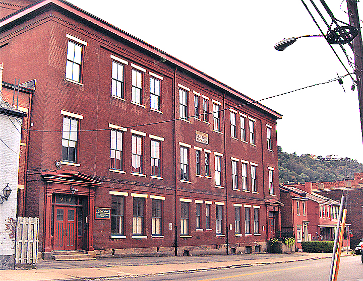
Bedford School
Monument and historic site · National Register of Historic Places · 3.5 mi
School building in Pittsburgh, Pennsylvania
Beechwood Elementary School
Monument and historic site · National Register of Historic Places · 1.8 mi
Primary school in Pittsburgh, United States of America
Bell Telephone Company of Pennsylvania Western Headquarters Building
Monument and historic site · National Register of Historic Places · 3.0 mi
Building in Pittsburgh, Pennsylvania, United States
Beltzhoover Elementary School
Monument and historic site · National Register of Historic Places · 2.8 mi
School building in Pittsburgh, United States of America

Benedum Center
Monument and historic site · National Register of Historic Places · 3.4 mi
Theater and concert hall, formerly a movie theater, in Pittsburgh, United States
Boggs Avenue Elementary School
Monument and historic site · National Register of Historic Places · 2.1 mi
Historic building in Pittsburgh, Pennsylvania


Buhl Building
Monument and historic site · National Register of Historic Places · 3.2 mi
Building in Pittsburgh, United States of America
55 more on the map.
Parks, trails and playgrounds34

Allegheny Riverfront Park
Park · 3.2 mi
Small municipal park in Pittsburgh, Pennsylvania along the south bank of the Allegheny River
Mellon Green
Park · 3.5 mi
Park in Pittsburgh, United States of America
Miniature Railroad & Village
Park · 2.7 mi
Diorama of western Pennsylvania in Pittsburgh
National Aviary
Park · 3.4 mi
The only independent indoor nonprofit aviary in the United States

22 more on the map.
Restaurants and cafes46

Beto's Pizza
Restaurant · Pizza, Italian, Sandwich, Salad · 1.3 mi
1473 Banksville Road, Pittsburgh
"Due to staff shortages, hours may vary. Please call for daily hours"
Big Shot Bob's
Restaurant · Wings, American · 1.5 mi
2102 Broadway Avenue, Pittsburgh
Mo-Th 11:00-22:00, Fr-Sa 11:00-23:00, Su 12:00-21:00
Chicken Latino
Restaurant · Peruvian, Latin American · 1.5 mi
2100 Broadway Avenue, Pittsburgh
Su 11:00-17:00, Mo-Tu 11:00-16:00, We-Sa 11:00-19:00
Coach's Bottleshop & Grille
Restaurant · American, Burger, Grill · 1.3 mi
3105 Banksville Road
Mo-Th 11:30-00:00; Fr 11:30-02:00; Sa 11:00-02:00; Su 11:00-00:00

Crafton Ice Cream Delite
Ice cream · Hot Dog · 1.7 mi
38 West Steuben Street, Pittsburgh
Mo-Su 11:00-22:00

Pabellón
Restaurant · Mexican, Venezuelan · 1.2 mi
2957 Banksville Road, Pittsburgh
Mo-Tu,Th,Su 11:30-20:00; Fr-Sa 11:30-21:00
Pittsburgh Barbecue Company
Restaurant · Barbecue · 1.3 mi
1000 Banksville Avenue, Pittsburgh
We-Su 11:00-20:00

Starbucks
Cafe · Coffee Shop · 1.3 mi
3145 Banksville Road, Pittsburgh
Mo-Th 04:30-21:30; Fr 04:30-22:00; Sa 05:00-22:00; Su 05:00-21:00
1930 by Atria's
Diner · American · 1.7 mi
110 Beverly Road, Pittsburgh
Su-Th 11:00-21:00; Fr,Sa 11:00-22:00
Olive Garden
Restaurant · Italian · 0.5 mi
971 Greentree Road, Pittsburgh
Mo 11:00-22:00
34 more on the map.
History
Settled in 1793, the area stayed rural until the late 1800s, with paintings of the time showing farmland and a vineyard. The borough, chartered in 1885, is named after "a large sycamore tree along Greentree Road where the stagecoaches would deliver mail," according to The Historical Society of Green Tree. Rook Station on the Wabash Pittsburgh Terminal Railway opened in 1904 which heralded an industrialisation of the area and the opening of a railroad yard and roundhouse.
From the History section of Green Tree, Pennsylvania on Wikipedia, under CC BY-SA 4.0.
Where to stay7
Churches and places of worship23
Beechview United Methodist Church
Church · Methodist · 1.6 mi
1600 Methyl Street, Pittsburgh
Covenant-Community Presbyterian Church
Church · Presbyterian · 1.2 mi
1630 Greentree Road, Pittsburgh
Saint Stephen Lutheran Church
Church · Lutheran · 1.3 mi
55 Forsythe Road, Pittsburgh
Shopping5
Gas and EV charging7
Schools, colleges and libraries54
Healthcare4
Map of Green Tree
250 places. The map loads OpenStreetMap tiles when you open it.
Climate by month
Monthly table
| Month | High | Low | Rain |
|---|---|---|---|
| Jan | 39°F | 20°F | 3.4 in |
| Feb | 42°F | 22°F | 2.8 in |
| Mar | 51°F | 29°F | 3.2 in |
| Apr | 64°F | 39°F | 3.2 in |
| May | 74°F | 50°F | 3.5 in |
| Jun | 81°F | 59°F | 3.5 in |
| Jul | 85°F | 64°F | 3.6 in |
| Aug | 84°F | 62°F | 3.2 in |
| Sep | 78°F | 55°F | 3.2 in |
| Oct | 66°F | 44°F | 2.8 in |
| Nov | 54°F | 33°F | 2.8 in |
| Dec | 43°F | 26°F | 3.0 in |
U.S. Climate Normals 1991-2020 for Emsworth L/D Ohio Rvr (6 mi away), NOAA NCEI.
People and cost of living
American Community Survey 5-year estimates, 2020-2024, U.S. Census Bureau. Estimates have margins of error, larger for small towns.
Disaster history
Allegheny County has had 8 federal disaster declarations since 2000, most often for hurricanes.
- 2020-03-30: Covid-19 Pandemic (Biological)
- 2020-03-13: Covid-19 (Biological)
- 2013-10-01: Severe Storms, Tornadoes, And Flooding (Severe Storm)
- 2012-10-29: Hurricane Sandy (Hurricane)
- 2010-04-16: Severe Winter Storms And Snowstorms (Snowstorm)
- 2005-09-10: Hurricane Katrina (Hurricane)
OpenFEMA disaster declarations summaries.
Getting there and nearby towns
Allegheny County Airport (AGC) is the nearest airport with scheduled flights listed in OpenStreetMap, 8 miles away.
- Crafton 1 mi northwest, about 2 min by car
- Carnegie 2 mi west, about 3 min by car
- Dormont 2 mi southeast, about 3 min by car
- Glendale 2 mi southwest, about 4 min by car
- Heidelberg 3 mi southwest, about 4 min by car
- Pittsburgh 4 mi east, about 7 min by car
- Castle Shannon 4 mi southeast, about 6 min by car
- Whitehall 5 mi southeast, about 8 min by car
- Bridgeville 5 mi southwest, about 8 min by car
- Bellevue 5 mi north, about 9 min by car
Drive times are estimates from straight-line distance, not routes.
Local news
Headlines from INDB, the NEMICO news database.
Reviews, tips and questions
Loading what members have shared...
Sources and licences
- NCES EDGE (Public domain): public schools
- NOAA NCEI U.S. Climate Normals 1991-2020 (Public domain): climate by month
- OpenFEMA (Public domain): disaster declarations
- OpenStreetMap contributors (ODbL 1.0): places, airports, map data
- U.S. Census Bureau (Public domain): population, income, housing, education, commute
- Wikidata (CC0 1.0): landmarks and historic places
- Wikimedia Commons (see each image): photos
- Wikipedia (CC BY-SA 4.0): overview and history text
Photo credits
- Water Tower in Green Tree, Pennsylvania, Generic1139, CC BY-SA 3.0
- DollarBank4thAve, Dollar Bank, CC BY-SA 4.0
- Gateway Building Pittsburgh, HoboJones, CC BY-SA 3.0
- Grand Concourse Pitts inside jeh, Jim.henderson, Public domain
- Woodville plantation house, Heidelberg, PA, Daniel Case, CC BY-SA 3.0
- Pittsburgh, Pennsylvania (8482574559), Doug Kerr from Albany, NY, United States, CC BY-SA 2.0
- Emmanuel Episcopal Church in Pittsburgh, rear and western side, Nyttend, Public domain
- Century Building in Pittsburgh, Nyttend, Public domain
- Pittsburgh benedumcenter, PerryPlanet, Public domain
- Bridges over the Ohio River, Andrewwinn, CC BY 2.0
- William Penn Hotel, 2015-04-23, Cbaile19, CC0
- Conroy Junior High School, Nyttend, Public domain
- Greensrt, Ainulindale, CC BY-SA 3.0
- Allegheny High School, Aij, CC BY-SA 3.0
- Bedford School, Pittsburgh (exterior), Schneider22, CC BY-SA 3.0
- Hartley-Rose Belting Company Building, Nyttend, Public domain
- Allegheny Post Office front, Aij, CC BY-SA 3.0
- Burke Building, Nyttend, Public domain
- Frederick J. Osterling Office and Studio, Nyttend, Public domain
- SalvationArmyBuilding-BlvdAllies-Pittsburgh-2019-west, Minnaert, CC BY-SA 4.0
- AndyWarholBridgePittsburgh, TheZachMorrisExperience, CC BY-SA 3.0
- Duquesne Incline from top, Plastikspork, CC BY-SA 3.0
- Pittsburgh LRT 4305 47L Gateway to Library April 2008, Luke H. Gordon from Greenwood Lake, NY, USA, CC BY 2.0
- Conestoga Building in the Firstside Historic District, Nyttend, Public domain
- Pittsburgh Ninth Street Bridge, Scillystuff at English Wikipedia, CC BY-SA 3.0
- Roberto Clemente bridge, David Trainer from Mosteiros, Cape Verde, CC BY-SA 2.0
- Penn Avenue in the Penn-Liberty Historic District, Nyttend, Public domain
- FrickBuildingPittsburgh, TheZachMorrisExperience, CC BY-SA 3.0


Page built October 30, 2026. Spotted a mistake? Tell us or suggest a place.