


Hackensack, New Jersey
Hackensack is a city of 46,057 people in Bergen County, New Jersey, founded in 1665.
Why visit Hackensack
Townapedia lists 42 museums and landmarks, 46 parks and trails, 91 places to eat, 3 places to stay and 9 attractions in and around town.
Highlights include Fairleigh Dickinson University, Teaneck Cinemas, Maywood Station Museum and USS Ling.
July is the warmest month, with average highs of 87°F; January lows average 26°F.
Weather in Hackensack
Forecast from the National Weather Service. Full forecast
About Hackensack
Hackensack is the most populous municipality in and the county seat of Bergen County, in the U.S. state of New Jersey. The area was officially named New Barbadoes Township until 1921, but has informally been known as Hackensack since at least the 18th century. As of the 2020 United States census, the city's population was 46,030, its highest decennial count ever and an increase of 3,020 (+7.0%) from the 2010 census count of 43,010, which in turn reflected an increase of 333 (+0.8%) from the 42,677 counted in the 2000 census.
From the Wikipedia article Hackensack, New Jersey (this version), under CC BY-SA 4.0.
Things to do9

Fairleigh Dickinson University
School · 1.0 mi
Private university in New Jersey, United States


Anderson Street Bridge
Bridge · 0.5 mi
Bridge in United States of America
Bergen Performing Arts Center
Cinema and theater · 3.7 mi
Theater and former movie theater in Englewood, New Jersey, United States
Court Street Bridge
Bridge · 0.8 mi
Bridge in Hackensack and Bogota, New Jersey
Monroe Street Bridge
Bridge · 3.8 mi
Bridge in Passaic and Garfield, New Jersey, United States
Passaic Street Bridge
Bridge · 3.8 mi
Steel girder road bridge across the Lower Passaic River in northern New Jersey
Museums and landmarks42

Maywood Station Museum
Monument and historic site · National Register of Historic Places · 1.2 mi
Railway station in Maywood, the United States of America
269 Maywood Avenue, Maywood
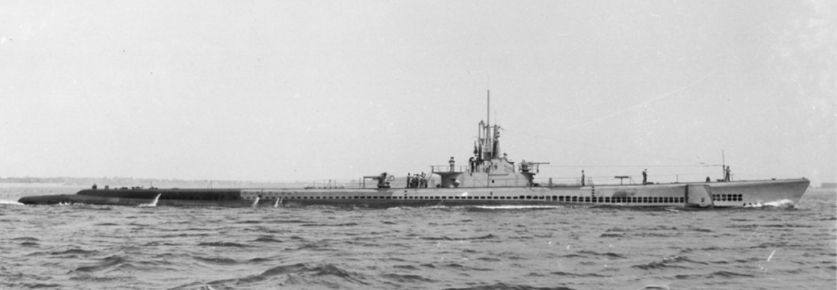
USS Ling
Monument and historic site · National Register of Historic Places · 0.7 mi
1943 Balao-class submarine
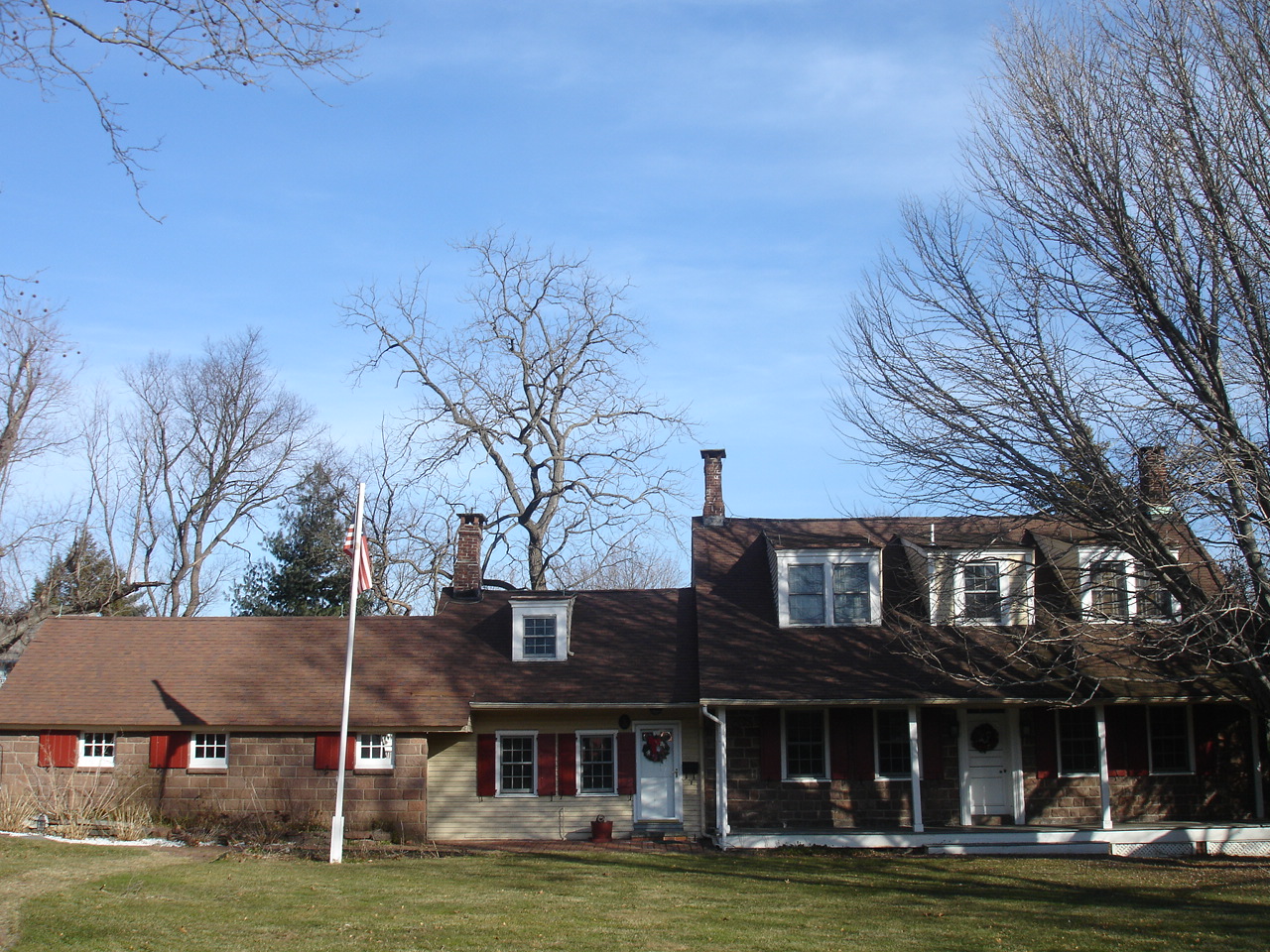
Adam Vandelinda House
Monument and historic site · National Register of Historic Places · 1.9 mi
House in Teaneck, New Jersey

Anderson Outkitchen
Monument and historic site · National Register of Historic Places
House in Hackensack, New Jersey

Anderson Street
Monument and historic site · National Register of Historic Places
Rail station in NJ

Banta-Coe House
Monument and historic site · National Register of Historic Places · 0.9 mi
Historic house in New Jersey, United States

Beauclaire-Vreeland House
Monument and historic site · National Register of Historic Places · 3.6 mi
Historic house in New Jersey, United States

Bergen County Court House
Monument and historic site · National Register of Historic Places · 0.8 mi
Municipal edifice in New Jersey
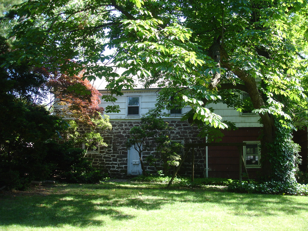
Bogert House
Monument and historic site · National Register of Historic Places · 0.8 mi
Historic house in New Jersey, United States

Brinkerhoff House
Monument and historic site · National Register of Historic Places · 3.4 mi
Historic house in Wood-Ridge, New Jersey, USA

Brinkerhoff-Demarest House
Monument and historic site · National Register of Historic Places · 2.0 mi
Teaneck, New Jersey, listed on the NRHP in Bergen County


Campbell-Christie House
Museum · National Register of Historic Places · 1.8 mi
Historic house in River Edge, New Jersey
30 more on the map.
Parks, trails and playgrounds46

Urban Air Trampoline & Adventure Park
Playground · 1.4 mi
Trampoline Park in South Hackensack.
69 Wesley Street, South Hackensack

34 more on the map.
Restaurants and cafes91

Canton Rodeo
Restaurant · Chinese, Cantonese · 1.9 mi
605 Bergen Town Center, Paramus
Mo-Sa 11:00-22:00; Su 11:00-21:00
Luka's Italian Cuisine
Restaurant · Italian · 1.6 mi
10 River Road, Bogota
Mo-Th 11:30-22:00; Fr 11:30-23:00; Sa 15:00-23:00


Pho Saigon
Restaurant · Vietnamese
296 Main Street, Hackensack
Mo-Sa 11:00-16:00,17:00-21:00; Su 12:00-16:00,17:00-20:30

Edible Arrangements
Restaurant
350 Main Street, Hackensack
Mo-Sa 09:00-19:00; Su 09:00-15:00
LongHorn Steakhouse
Restaurant · Steak House · 1.6 mi
160 Route 17 North, Rochelle Park
79 more on the map.
History
The earliest known inhabitants of the area were the Lenni Lenape, an Algonquian people who became known to settlers as 'the Delaware Indians.' They lived along a river they called Achinigeu-hach, or "Ackingsah-sack", which translates to stony ground—today this river is more commonly known by the name 'the Hackensack River.' A representation of Chief Oratam of the Achkinhenhcky appears on the Hackensack municipal seal. The most common explanation is that the city was named for the Native American tribe, though other sources attribute it to a Native American word variously translated as meaning "hook mouth", "stream that unites with another on low ground", "on low ground" or "land of the big snake", while another version described as "more colorful than probable" attributes the name to an inn called the "Hock and Sack".
Settlement by the Dutch West India Company in New Netherland on the west banks of the Hudson River across from New Amsterdam (present-day lower Manhattan) began in the 1630s at Pavonia, eventually leading to the establishment of Bergen (at today's Bergen Square in Jersey City) in 1660.
From the History section of Hackensack, New Jersey on Wikipedia, under CC BY-SA 4.0.
Where to stay3
Hilton Hasbrouck Heights / Meadowlands
Motel and hotel · 1.5 mi
650 Terrace Avenue, Hasbrouck Heights
Churches and places of worship49
South Schraalenburgh Church
Church · National Register of Historic Places · 3.5 mi
St. Paul's Episcopal Church
Church · National Register of Historic Places · 4.0 mi
Shopping26
Gas and EV charging15
Schools, colleges and libraries76
Bergen County Technical High School - Paramus
School · 4.8 mi
E.285 Pascack Road, Paramus
Healthcare12
Map of Hackensack
250 places. The map loads OpenStreetMap tiles when you open it.
Climate by month
Monthly table
| Month | High | Low | Rain |
|---|---|---|---|
| Jan | 40°F | 26°F | 3.3 in |
| Feb | 43°F | 27°F | 2.8 in |
| Mar | 51°F | 34°F | 4.1 in |
| Apr | 62°F | 44°F | 4.0 in |
| May | 73°F | 53°F | 3.9 in |
| Jun | 82°F | 63°F | 4.2 in |
| Jul | 87°F | 69°F | 4.5 in |
| Aug | 85°F | 67°F | 4.2 in |
| Sep | 78°F | 60°F | 4.1 in |
| Oct | 67°F | 48°F | 3.7 in |
| Nov | 56°F | 38°F | 3.3 in |
| Dec | 45°F | 31°F | 4.1 in |
U.S. Climate Normals 1991-2020 for Teterboro Ap (3 mi away), NOAA NCEI.
People and cost of living
American Community Survey 5-year estimates, 2020-2024, U.S. Census Bureau. Estimates have margins of error, larger for small towns.
Disaster history
Bergen County has had 21 federal disaster declarations since 2000, most often for hurricanes.
- 2021-09-05: Remnants Of Hurricane Ida (Hurricane)
- 2021-09-02: Remnants Of Hurricane Ida (Hurricane)
- 2020-12-11: Tropical Storm Isaias (Hurricane)
- 2020-03-25: Covid-19 Pandemic (Biological)
- 2020-03-13: Covid-19 (Biological)
- 2018-06-08: Severe Winter Storm And Snowstorm (Severe Storm)
OpenFEMA disaster declarations summaries.
Getting there and nearby towns
Teterboro Airport (TEB) is the nearest airport with scheduled flights listed in OpenStreetMap, 3 miles away.
- Maywood 1 mi northwest, about 2 min by car
- Hasbrouck Heights 2 mi southwest, about 4 min by car
- River Edge 3 mi north, about 4 min by car
- Ridgefield Park 3 mi southeast, about 4 min by car
- Bergenfield 3 mi northeast, about 5 min by car
- Little Ferry 3 mi south, about 5 min by car
- Wood-Ridge 3 mi southwest, about 6 min by car
- Englewood 4 mi east, about 6 min by car
- Elmwood Park 4 mi west, about 6 min by car
- Wallington 4 mi southwest, about 7 min by car
Drive times are estimates from straight-line distance, not routes.
Local news
Headlines from INDB, the NEMICO news database.
Reviews, tips and questions
Loading what members have shared...
Sources and licences
- NCES EDGE (Public domain): public schools
- NOAA NCEI U.S. Climate Normals 1991-2020 (Public domain): climate by month
- OpenFEMA (Public domain): disaster declarations
- OpenStreetMap contributors (ODbL 1.0): places, airports, map data
- U.S. Census Bureau (Public domain): population, income, housing, education, commute
- Wikidata (CC0 1.0): elevation, founding date, time zone, website, landmarks and historic places
- Wikimedia Commons (see each image): photos
- Wikipedia (CC BY-SA 4.0): overview and history text
Photo credits
- Bergen County Court House, Stephdurante, CC BY-SA 4.0
- Second Reformed Church Hackensack, Potjiekossie ( talk ) ( Uploads ), CC BY-SA 3.0
- 2018-09-23 13 16 43 View south along Bergen County Route 503 (River Street) at Salem Street in Hackensack, Bergen County, New Jersey, Famartin, CC BY-SA 4.0
- 2021-09-19 14 25 17 View north along Bergen County Route 503 (River Street) from the overpass for the rail line between Mercer Street and Midtown Bridge Approach in Hackensack, Bergen County, New..., Famartin, CC BY-SA 4.0
- 2021-09-19 14 20 39 View south along Bergen County Route 503 (River Street) from the overpass for the rail line between Mercer Street and Midtown Bridge Approach in Hackensack, Bergen County, New..., Famartin, CC BY-SA 4.0
- Hackensack Bus Terminal, Oknazevad, CC BY-SA 3.0
- COVID19 deceased in Hackensack NJ April 27, Lawrence Purce, CC0
- Target Hackensack, NJ (27913788894), Mike Kalasnik from Jersey City, USA, CC BY-SA 2.0
- Bumper block on spur at Essex Street station, Hackensack, NJ, Daniel Case, CC BY-SA 3.0
- Train arriving at Essex Street station, Hackensack, NJ, Daniel Case, CC BY-SA 3.0
- Hackensack banner Fairleigh Dickinson University Footbridge, Jag9889, CC BY-SA 4.0
- USS Ling;0829702, USN, Public domain
- Maywood Station April 2014, Adam Moss, CC BY-SA 2.0
- CASPAR WESTERVELT HOUSE, TEANECK, BERGEN COUNTY, NJ, JERRYE & ROY KLOTZ, M.D., CC BY-SA 4.0
- LeoniaDrillHall, KForce at en.wikipedia, CC BY-SA 3.0
- TeaneckNJ BrinkerhoffDemarestHouse, Magicpiano, CC BY-SA 4.0
- Cambell Christie House c.1774 with Outkitchen Historic New Bridge Landing River Edge, NJ, JILLIEE, CC BY-SA 4.0
- BantaCoe, KForce, CC BY-SA 3.0
- ANDERSON OUTKITCHEN, HACKENSACK, BERGEN COUNTY, JERRYE & ROY KLOTZ, M.D., CC BY-SA 4.0
- Anderson Street Station April 2014, Adam Moss, CC BY-SA 2.0
- DEBAUN-DEMAREST HOUSE, RIVER EDGE, BERGEN COUNTY, JERRYE & ROY KLOTZ, M.D., CC BY-SA 4.0
- Demarest House Museum c.1794, JILLIEE, CC BY-SA 4.0
- DEMAREST-BLOOMER HOUSE, NEW MILFORD, BERGEN COUNTY NJ, JERRYE & ROY KLOTZ, M.D., CC BY-SA 4.0
- BEAUCLAIRE-VREELAND HOUSE, BERGENFIELD, BERGEN COUNTY, User:KLOTZPLATE JERRYE & ROY KLOTZ, M.D., CC BY-SA 4.0
- BogertHouse, KForce at en.wikipedia, CC BY-SA 3.0
- AdamVandelindaHouse, KForce at en.wikipedia, CC BY-SA 3.0
- Wood-Ridge library, TimSPC at English Wikipedia, Public domain
- EnglewoodNJ GarretLydeckerHouse1, Magicpiano, CC BY-SA 4.0
- James VandelindaHouse, KForce at en.wikipedia, CC BY-SA 3.0
- Zabriskie-Kipp-Cadmus House, Alansohn at en.wikipedia, CC BY-SA 3.0
- JOHN G. BENSON HOUSE, ENGLEWOOD, BERGEN COUNTY, NJ, JERRYE & ROY KLOTZ, M.D., CC BY-SA 4.0
- JACOBUS DESMAREST HOUSE, NEW MILFORD, BERGEN COUNTY, NJ, JERRYE & ROY KLOTZ, M.D., CC BY-SA 4.0
- ST. PAUL'S EPISCOPAL CHURCH, ENGLEWOOD, BERGEN COUNTY, NJ, JERRYE & ROY KLOTZ M.D., CC BY-SA 4.0
- HackensackChurchOnTheGreen, The original uploader was KForce at English Wikipedia ., CC BY-SA 3.0
- SteubenHouse2019MR, DSPowell, CC BY-SA 4.0
- GETHSEMANE CEMETERY, LITTLE FERRY, BERGEN COUNTY, JERRYE & ROY KLOTZ, M.D., CC BY-SA 4.0
- ThomasDemarestHouse, Unknown author Unknown author, Public domain
- TUNIS RICHARD COOPER HOUSE, SAW MILL, BERGENFIELD, BERGEN COUNTY, JERRYE & ROY KLOTZ, M.D., CC BY-SA 4.0
- SOUTH SCHRAALENBURGH CHURCH, BERGENFIELD, BERGEN COUNTY, JERRYE & ROY KLOTZ, M.D., CC BY-SA 4.0
- SOUTH CHURCH MANSE, BERGENFIELD, BERGEN COUNTY, JERRYE & ROY KLOTZ M.D., CC BY-SA 4.0


Page built October 30, 2026. Spotted a mistake? Tell us or suggest a place.