


Why visit Hamilton
Townapedia lists 21 museums and landmarks, 12 parks and trails, 54 places to eat, 9 places to stay and 2 attractions in and around town.
Highlights include Allison-Reinkeh House, Charles Granke House, Hieronymus Park and River Park.
July is the warmest month, with average highs of 84°F; December lows average 18°F.
Weather in Hamilton
Forecast from the National Weather Service. Full forecast
About Hamilton
Hamilton is a city that serves as the county seat of Ravalli County, Montana, United States. The population was 4,659 at the 2020 census.
From the Wikipedia article Hamilton, Montana (this version), under CC BY-SA 4.0.
Things to do2

Museums and landmarks21

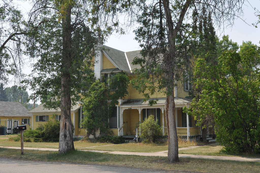
Allison-Reinkeh House
Monument and historic site · National Register of Historic Places
United States historic place

Charles Granke House
Monument and historic site · National Register of Historic Places · 0.7 mi
Historic house in Montana, United States

Conway House
Monument and historic site · National Register of Historic Places · 1.0 mi
Historic log house in Hamilton, Montana, United States
Daniel V. Bean House
Monument and historic site · National Register of Historic Places
House in Hamilton, Montana
E.G. Ellis House
Monument and historic site · National Register of Historic Places
Historic house in Hamilton, Montana

Erick Trosdahl House
Monument and historic site · National Register of Historic Places · 0.5 mi
House in Hamilton, United States of America

Frank Wallin House
Monument and historic site · National Register of Historic Places
Historic house in Montana, United States

Goff House
Monument and historic site · National Register of Historic Places · 0.4 mi
Historic house in Hamilton, Montana, United States

John Stout House
Monument and historic site · National Register of Historic Places · 1.1 mi
Historic house in Hamilton, Montana

Marcus Daly Memorial Hospital
Monument and historic site · National Register of Historic Places · 0.5 mi
Building in Hamilton, United States of America

Oliver Blood House
Monument and historic site · National Register of Historic Places · 0.8 mi
Historic house in Hamilton, Montana


Other C. Wamsley House
Monument and historic site · National Register of Historic Places
Historic house in Montana, United States
9 more on the map.
Parks, trails and playgrounds12

Hieronymus Park
Park · 0.7 mi
196 Hieronymus Park Dr, Hamilton
Apr-Sep 05:00-23:00, Oct-Mar 07:00-19:00
River Park
Park · 0.9 mi
401 South 9th Street, Hamilton
Apr-Sep 05:00-23:00, Oct-Mar 07:00-19:00
Skalkaho Bend Park
Park · 1.4 mi
505 Bailey Ave, Hamilton
Apr-Sep 05:00-23:00, Oct-Mar 07:00-19:00

Restaurants and cafes54

Pizza Hut
Restaurant · Pizza · 0.4 mi
1002 North 1st Street, Hamilton
Mo-Fr 10:30-21:30; Sa-Su 10:30-22:00

Big Creek Coffee Roasters
Cafe · 0.4 mi
301 West Main Street, Hamilton
Mo-Fr 07:00-18:00; Sa-Su 07:00-16:00
A Thaiger
Restaurant · Thai · 0.4 mi
102 South 2nd Street, Hamilton
Tu-Sa 11:30-14:00,17:00-20:00

Florence Coffee
Cafe · Coffee Shop · 0.7 mi
1300 North 1st Street
Mo-Fr 05:30-19:00; Sa, Su 06:00-19:00


Maria's
Restaurant · Mexican · 0.4 mi
217 West Main Street, Hamilton
42 more on the map.
History
Hamilton was founded by copper king Marcus Daly in the late 19th century. It was named for J.W. Hamilton, who provided the right-of-way to the railroad. Daly is said to have wanted to begin business in Grantsdale, but was denied the opportunity.
In the summer of 2000, forest fires throughout the Bitterroot Valley filled the area with smoke and prompted the evacuation of many residents. President Clinton declared a state of emergency in the area and dispatched National Guard troops to assist with fighting the fires.
From the History section of Hamilton, Montana on Wikipedia, under CC BY-SA 4.0.
Where to stay9
Bitterroot River Inn and Conference Center
Motel and hotel · 0.9 mi
139 Bitterroot Plaza Drive, Hamilton
Churches and places of worship23
Saint Francis of Assisi Catholic Church
Church · Roman Catholic · 0.7 mi
411 South 5th Street, Hamilton
Shopping21
Gas and EV charging5
Schools, colleges and libraries17
Rise Charter And Distance Learning Academy
School · 5.0 mi
1151 Eastside Highway, Corvallis
Rise Charter And Pathways Learning Academy
School · 5.0 mi
1151 Eastside Highway, Corvallis
Healthcare8
Map of Hamilton
172 places. The map loads OpenStreetMap tiles when you open it.
Climate by month
Monthly table
| Month | High | Low | Rain |
|---|---|---|---|
| Jan | 35°F | 19°F | 1.0 in |
| Feb | 39°F | 20°F | 1.2 in |
| Mar | 49°F | 25°F | 1.0 in |
| Apr | 56°F | 31°F | 1.1 in |
| May | 66°F | 38°F | 1.5 in |
| Jun | 73°F | 45°F | 1.6 in |
| Jul | 84°F | 50°F | 0.8 in |
| Aug | 82°F | 48°F | 0.8 in |
| Sep | 72°F | 40°F | 0.8 in |
| Oct | 57°F | 31°F | 0.9 in |
| Nov | 43°F | 23°F | 1.4 in |
| Dec | 34°F | 18°F | 1.3 in |
U.S. Climate Normals 1991-2020 for Hamilton Hcn (1 mi away), NOAA NCEI.
People and cost of living
American Community Survey 5-year estimates, 2020-2024, U.S. Census Bureau. Estimates have margins of error, larger for small towns.
Disaster history
Ravalli County has had 11 federal disaster declarations since 2000, most often for fires.
- 2026-04-07: Severe Winter Storm And Straight-Line Winds (Straight-Line Winds)
- 2020-03-31: Covid-19 Pandemic (Biological)
- 2020-03-13: Covid-19 (Biological)
- 2017-08-17: Lolo Peak Fire (Fire)
- 2016-08-01: Roaring Lion Fire (Fire)
- 2014-04-17: Ice Jams And Flooding (Flood)
OpenFEMA disaster declarations summaries.
Getting there and nearby towns
Missoula International Airport (MSO) is the nearest airport with scheduled flights listed in OpenStreetMap, 46 miles away.
- Corvallis 5 mi northeast, about 8 min by car
- Pinesdale 6 mi northwest, about 10 min by car
- Victor 11 mi north, about 18 min by car
- Darby 16 mi south, about 25 min by car
- Stevensville 18 mi north, about 29 min by car
- Florence 27 mi north, about 43 min by car
- Carlton 31 mi north, about 49 min by car
- Missoula 43 mi north, about 1 h 15 min by car
- East Missoula 45 mi north, about 1 h 15 min by car
- Bonner-West Riverside 45 mi north, about 1 h 15 min by car
Drive times are estimates from straight-line distance, not routes.
Local news
Headlines from INDB, the NEMICO news database.
Reviews, tips and questions
Loading what members have shared...
Sources and licences
- NCES EDGE (Public domain): public schools
- NOAA NCEI U.S. Climate Normals 1991-2020 (Public domain): climate by month
- OpenFEMA (Public domain): disaster declarations
- OpenStreetMap contributors (ODbL 1.0): places, airports, map data
- U.S. Census Bureau (Public domain): population, income, housing, education, commute
- Wikidata (CC0 1.0): elevation, founding date, time zone, website, landmarks and historic places
- Wikimedia Commons (see each image): photos
- Wikipedia (CC BY-SA 4.0): overview and history text
Photo credits
- Hamilton MT Main Street, Itsa Ortiz, CC BY 2.0
- Granke House NRHP 88001278 Ravalli County, MT, Jon Roanhaus, CC BY-SA 4.0
- John Stout House NRHP 88001290 Ravalli County, MT, Jon Roanhaus, CC BY-SA 4.0
- HamiltonMT DanielVBeanHouse, Magicpiano, CC BY-SA 4.0
- Oliver Blood House NRHP 88001279 Ravalli County, MT, Jon Roanhaus, CC BY-SA 4.0
- HamiltonMT EGEllisHouse, Magicpiano, CC BY-SA 4.0
- Pine Apartments NRHP 88001295 Ravalli County, MT, Jon Roanhaus, CC BY-SA 4.0
- Frank Wallin House NRHP 88001293 Ravalli County, MT, Jon Roanhaus, CC BY-SA 4.0
- VFW Club NRHP 88001287 Ravalli County, MT, Jon Roanhaus, CC BY-SA 4.0
- Hamilton MT Daly Mansion 2, DAN, CC BY 2.0
- Goff House NRHP 88001283 Ravalli County, MT, Jon Roanhaus, CC BY-SA 4.0
- HamiltonMT AlisonReinkehHouse, Magicpiano, CC BY-SA 4.0
- Ravalli County Courthouse NRHP 79001424 Ravalli County, MT, Jon Roanhaus, CC BY-SA 4.0
- Wamsley House NRHP 88001285 Ravalli County, MT, Jon Roanhaus, CC BY-SA 4.0
- Marcus Daly Memorial Hospital NRHP 78001690 Ravalli County, MT, Jon Roanhaus, CC BY-SA 4.0
- Conway House NRHP 88001291 Ravalli County, MT, Jon Roanhaus, CC BY-SA 4.0
- Erick Trosdahl House NRHP 88001275 Ravalli County, MT, Jon Roanhaus, CC BY-SA 4.0


Page built October 30, 2026. Spotted a mistake? Tell us or suggest a place.