


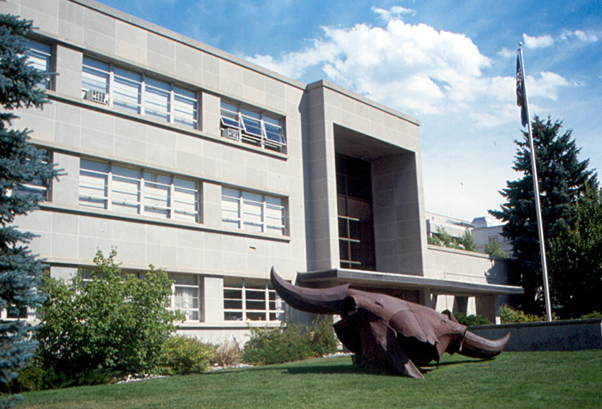

Helena West Side, Montana
Helena West Side is a community of 1,417 people in Lewis and Clark County, Montana.
Why visit Helena West Side
Townapedia lists 22 museums and landmarks, 15 parks and trails, 14 places to eat, 3 places to stay and 5 attractions in and around town.
Highlights include Grandstreet Theatre, Benton Avenue Cemetery, Christmas Gift Evans House and Spring Meadow Lake State Park.
July is the warmest month, with average highs of 86°F; January lows average 14°F, and about 37 inches of snow fall in a normal year.
Weather in Helena West Side
Forecast from the National Weather Service. Full forecast
About Helena West Side
Helena West Side is a census-designated place (CDP) in Lewis and Clark County, Montana, United States. As of the 2020 census, Helena West Side had a population of 1,331. Annexation of part of the CDP by the city of Helena reduced the CDP's population in earlier counts. It is part of the Helena Micropolitan Statistical Area.
From the Wikipedia article Helena West Side, Montana (this version), under CC BY-SA 4.0.
Things to do5

Grandstreet Theatre
Cinema and theater · 3.7 mi
Theater in Helena, Montana, United States

Museums and landmarks22

Benton Avenue Cemetery
Monument and historic site · National Register of Historic Places · 3.6 mi
Historic cemetery in Lewis and Clark County, Montana, US

Christmas Gift Evans House
Monument and historic site · National Register of Historic Places · 3.6 mi
Helena, Montana, listed on the NRHP

Former Montana Executive Mansion
Museum · National Register of Historic Places · 3.9 mi
Former governor's residence in Helena, Montana, United States

Hauser Mansion
Monument and historic site · National Register of Historic Places · 3.4 mi
Historic house in Montana, United States

Helena Civic Center
Monument and historic site · National Register of Historic Places · 3.7 mi
Historic building and community facility in Helena, Montana, USA
Helena Historic District
Monument and historic site · National Register of Historic Places · 3.7 mi
Historic district in Helena, Montana

Helena South-Central Historic District
Monument and historic site · National Register of Historic Places · 3.9 mi
Historic district in Montana, United States

Home of Peace Cemetery
Monument and historic site · National Register of Historic Places · 3.4 mi
Cemetery in Helena, Montana

Lewis and Clark County Hospital Historic District
Monument and historic site · National Register of Historic Places · 4.2 mi
Historic district in Montana, United States

Montana State Capitol
Monument and historic site · National Register of Historic Places · 4.7 mi
State capitol building of the U.S. state of Montana
Montana State Fairgrounds Racetrack
Monument and historic site · National Register of Historic Places · 3.4 mi
Historic horse racing track located on the outskirts of Helena, Montana, in the United States
Montana Veterans and Pioneers Memorial Building
Monument and historic site · National Register of Historic Places · 4.9 mi
Helena, Montana, listed on the NRHP in Lewis and Clark County, Montana
10 more on the map.
Parks, trails and playgrounds15


3 more on the map.
Restaurants and cafes14






2 more on the map.
Where to stay3
Churches and places of worship11
Cathedral of Saint Helena
Church · National Register of Historic Places · 4.0 mi
Shopping3
Gas and EV charging4
Schools, colleges and libraries19
Healthcare4
Map of Helena West Side
100 places. The map loads OpenStreetMap tiles when you open it.
Climate by month
Monthly table
| Month | High | Low | Rain | Snow |
|---|---|---|---|---|
| Jan | 32°F | 14°F | 0.4 in | 6.6 in |
| Feb | 37°F | 17°F | 0.4 in | 6.6 in |
| Mar | 48°F | 25°F | 0.5 in | 4.6 in |
| Apr | 57°F | 32°F | 1.0 in | 2.9 in |
| May | 66°F | 42°F | 1.9 in | 0.1 in |
| Jun | 75°F | 49°F | 2.2 in | 0.0 in |
| Jul | 86°F | 55°F | 1.1 in | 0.0 in |
| Aug | 85°F | 53°F | 1.0 in | 0.3 in |
| Sep | 73°F | 45°F | 1.0 in | 0.2 in |
| Oct | 58°F | 34°F | 0.8 in | 2.8 in |
| Nov | 43°F | 23°F | 0.6 in | 5.4 in |
| Dec | 33°F | 14°F | 0.5 in | 7.7 in |
U.S. Climate Normals 1991-2020 for Helena Rgnl Ap Gsn Hcn 72772 (7 mi away), NOAA NCEI.
People and cost of living
American Community Survey 5-year estimates, 2020-2024, U.S. Census Bureau. Estimates have margins of error, larger for small towns.
Disaster history
Lewis and Clark County has had 13 federal disaster declarations since 2000, most often for fires.
- 2024-07-12: Horse Gulch Fire (Fire)
- 2020-03-31: Covid-19 Pandemic (Biological)
- 2020-03-13: Covid-19 (Biological)
- 2019-07-28: North Hills Fire (Fire)
- 2018-10-31: Flooding (Flood)
- 2017-09-09: Alice Creek Fire (Fire)
OpenFEMA disaster declarations summaries.
Getting there and nearby towns
Helena Regional Airport (HLN) is the nearest airport with scheduled flights listed in OpenStreetMap, 7 miles away.
- Unionville 4 mi southeast, about 6 min by car
- Helena 5 mi east, about 7 min by car
- Helena Valley West Central 5 mi northeast, about 8 min by car
- South Hills 6 mi southeast, about 10 min by car
- East Helena 9 mi east, about 15 min by car
- Helena Valley Northwest 10 mi north, about 15 min by car
- Helena Valley Northeast 11 mi northeast, about 18 min by car
- Boulder 25 mi south, about 40 min by car
- Deer Lodge 32 mi southwest, about 52 min by car
- Butte-Silver Bow (balance) 55 mi southwest, about 1 h 30 min by car
Drive times are estimates from straight-line distance, not routes.
Local news
Headlines from INDB, the NEMICO news database.
Reviews, tips and questions
Loading what members have shared...
Sources and licences
- NCES EDGE (Public domain): public schools
- NOAA NCEI U.S. Climate Normals 1991-2020 (Public domain): climate by month
- OpenFEMA (Public domain): disaster declarations
- OpenStreetMap contributors (ODbL 1.0): places, airports, map data
- U.S. Census Bureau (Public domain): population, income, housing, education, commute
- Wikidata (CC0 1.0): landmarks and historic places
- Wikimedia Commons (see each image): photos
- Wikipedia (CC BY-SA 4.0): overview and history text
Photo credits
- MontanaOriginalGovernorsMansion, Parkerdr, CC BY-SA 3.0
- Temple Emanu-El 02, Montanabw, CC BY-SA 3.0
- Wick-Seiler from North, Chris59601, CC BY-SA 4.0
- Atlas Block, Montanabw, CC BY-SA 3.0
- Helena - Montana Historical Society, Roger Wollstadt from Sarasota, Florida, CC BY-SA 2.0
- Helena Cathedral, SWD at English Wikipedia, Public domain
- MK01799 Montana State Capitol, Martin Kraft, CC BY-SA 3.0
- Algeria Shrine Temple (2012) - Lewis and Clark County, Montana, Robstutz, CC BY-SA 3.0
- Olsen House (2012) - Lewis and Clark County, Montana, Robstutz, CC BY-SA 3.0
- Kleinschmidt House (2012) - Lewis and Clark County, Montana, Robstutz, CC BY-SA 3.0
- Porter Flats Apartments (2012) - Lewis and Clark County, Montana, Robstutz, CC BY-SA 3.0
- Christmas Gift Evans House NRHP 80004271 Lewis And Clark County, MT, Jon Roanhaus, CC BY-SA 4.0
- Benton Avenue Cemetery (2012) - Lewis and Clark County, Montana, Robstutz, CC BY-SA 3.0
- Home of Peace Helena 4, Montanabw, CC BY-SA 3.0
- Young Women's Christian Association (Independent) (2012) - Lewis and Clark County, Montana, Robstutz, CC BY-SA 3.0
- Hauser Mansion, Helena, Al Huntsman, Public domain
- Fisk-house, KingJeff1970, CC BY-SA 3.0
- Silverman-house, KingJeff1970, CC BY-SA 3.0
- Old Cooney Hosp, Montanabw, CC BY-SA 3.0
- Confederate Memorial Fountain (Helena, Montana) 03, Montanabw, CC BY-SA 4.0
- Grandstreet Theatre in Helena, Montana (Front View), Zero Contradictions, CC BY 4.0


Page built October 30, 2026. Spotted a mistake? Tell us or suggest a place.