



Highland, Indiana
Highland is a town of 23,680 people in Lake County, Indiana, founded in 1848.
Why visit Highland
Townapedia lists 15 museums and landmarks, 69 parks and trails, 99 places to eat, 9 places to stay and 5 attractions in and around town.
Highlights include Purdue University Calumet, Sauzer's Kiddieland, E.J. and E. Griffith Interlocking Tower and Forest-Ivanhoe Residential Historic District.
Weather in Highland
Forecast from the National Weather Service. Full forecast
About Highland
Highland is a town in Lake County, Indiana, United States. The population was 23,984 at the 2020 census. The town was incorporated on April 4, 1910. It is a part of the Chicago metropolitan area and North Township, and is surrounded by Hammond to the north, Munster to the west, Schererville to the south and Griffith to the east.
From the Wikipedia article Highland, Lake County, Indiana (this version), under CC BY-SA 4.0.
Things to do5

Purdue University Calumet
School · 2.5 mi
Defunct campus of Purdue University

Sauzer's Kiddieland
Monument and historic site · 3.9 mi
Former amusement park in Schererville, Indiana, United States

Theatre at the Center
Cinema and theater · 2.5 mi
Theater in Munster, Indiana, United States
The Center for Visual and Performing Arts
Cinema and theater · 2.5 mi
1040 Ridge Road, Munster

Museums and landmarks15
E.J. and E. Griffith Interlocking Tower
Monument and historic site · National Register of Historic Places · 2.4 mi
Signalling control in Griffith, United States of America

Forest-Ivanhoe Residential Historic District
Monument and historic site · National Register of Historic Places · 4.2 mi
Historic district in Indiana, United States

George John Wolf House
Monument and historic site · National Register of Historic Places · 4.3 mi
Historic house in Indiana, United States
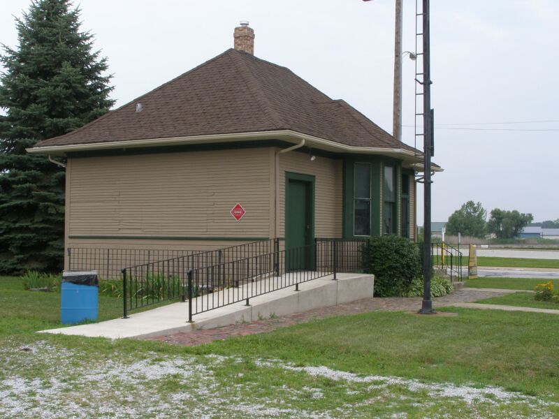
Griffith Grand Trunk Depot
Monument and historic site · National Register of Historic Places · 2.4 mi
Railway station in Griffith, the United States of America
Griffith State Bank
Monument and historic site · National Register of Historic Places · 2.0 mi
Historic building in Griffith, Indiana
Ibach House
Monument and historic site · National Register of Historic Places · 1.5 mi
Historic house in Indiana, United States

Meyer's Castle
Monument and historic site · National Register of Historic Places · 4.3 mi
Building in Indiana, United States

Morse Dell Plain House and Garden
Monument and historic site · National Register of Historic Places · 2.8 mi
Historic house in Indiana, United States


Roselawn-Forest Heights Historic District
Monument and historic site · National Register of Historic Places · 4.4 mi
Historic district in Indiana, United States
Stallbohm Barn-Kaske House
Monument and historic site · National Register of Historic Places · 2.4 mi
Historic house in Indiana, United States

Promise You Art House
Museum · 0.5 mi
8830 Kennedy Avenue, Highland
We, Sa 11:00-16:00; Th-Fr 11:00-17:00
The Artist's Den - Walk-in Ceramic Studio
Museum · 0.6 mi
2817 Jewett Avenue, Highland
We-Sa 13:00-20:00; Su 13:00-18:00
3 more on the map.
Parks, trails and playgrounds69


57 more on the map.
Restaurants and cafes99

Arrenello's Pizza
Restaurant · Pizza · 0.8 mi
2556 45th Street
Su-Mo, We-Th 16:00-20:00; Fr-Sa 16:00-21:00
Aurelio's Pizza
Restaurant · Pizza · 1.6 mi
112E East Ridge Road, Griffith
Su-Th 09:00-21:00; Fr-Sa 11:00-22:00
Boss Man Tacos
Restaurant · Mexican · 0.8 mi
8845 Indianapolis Boulevard, Highland
Mo-Th 10:30-22:00; Fr-Sa 10:30-23:00; Su 11:30-22:00
China Koon
Restaurant · Chinese, Noodles · 1.7 mi
905 North Broad Street, Griffith
Mo-Th 11:15-20:40; Fr-Sa 11:15-21:10

Grindhouse Cafe
Cafe · Coffee Shop, Deli, Local · 2.2 mi
146 North Broad Street, Griffith
Mo-Su 06:00-19:00
Jose's Family Restaurant
Restaurant · Peruvian, Italian · 0.6 mi
2934 Highway Avenue, Highland
Tu-Su 07:00-21:00
Langel's Pizza / Rodney's Sports Bar
Restaurant · Pizza · 0.6 mi
2833 Highway Avenue, Highland
Su-Th 11:00-22:00; Fr-Sa 11:00-23:00
Thaal
Restaurant · Indian · 1.9 mi
827 Main Street, Schererville
Tu, Th-Su 11:00-22:00; We 10:00-22:00
Tomato Bar Pizza Bakery
Restaurant · Pizza · 1.9 mi
79 Indianapolis Boulevard, Schererville
Su-Th 11:00-21:00; Fr-Sa 11:00-22:00
87 more on the map.
History
In 1847, two pioneers from Ohio, Michael and Judith Johnston, became Highland's first settlers. The town slowly expanded until the early 1880s, when the development of Chicago & Atlantic railroad trackage through the town attracted agriculture and manufacturing industries. Dutch settlers began moving to Highland shortly thereafter from nearby Munster. 304 people resided in Highland when it was incorporated in 1910. In 1992, the Indiana Historical Bureau placed a state historical marker at 8941 Kleinman Road (41°33′2″N 87°26′14″W) to recognize the immigration of Dutch in the Calumet Region.
In 1927, President Calvin Coolidge visited and delivered the dedication address for Wicker Memorial Park, located on the west side of the town. Highland, as with other towns along the Little Calumet River, has historically been subject to flooding, particularly during spring, and particularly in areas away from Ridge Road, which runs along the highest land in the town. Significant floods have affected Highland in 2008, 2007, and especially in September 2006.
On October 31, 2008, Barack Obama, who four days later would be elected the 44th President of the United States, stopped in Highland for a rally that drew 40,000 people to Wicker Park. It was the largest crowd there since President Coolidge dedicated the park in 1927.
From the History section of Highland, Lake County, Indiana on Wikipedia, under CC BY-SA 4.0.
Where to stay9
Fairfield Inn & Suites Chicago Southeast/Hammond
Motel and hotel · 1.9 mi
7720 Corrine Drive, Hammond
Churches and places of worship47
Saint Josaphat Ukrainian Catholic Church
Church · Ukrainian Greek Catholic · 1.9 mi
8624 White Oak Avenue, Munster
True Light Fellowship Church
Church · Pentecostal · 1.4 mi
1257 North Cline Avenue, Griffith
Shopping26
Gas and EV charging19
Schools, colleges and libraries65
Griffith Senior High School
School · 1.4 mi
600 North Wiggs Street, Griffith
Healthcare21
Controlled Substance Managers
Clinic and pharmacy · 1.2 mi
Kennedy Avenue, Highland
Map of Highland
250 places. The map loads OpenStreetMap tiles when you open it.
People and cost of living
American Community Survey 5-year estimates, 2020-2024, U.S. Census Bureau. Estimates have margins of error, larger for small towns.
Disaster history
Lake County has had 19 federal disaster declarations since 2000, most often for severe storms.
- 2026-08-25: Severe Storms, Straight-Line Winds, Tornadoes, And Flooding (Flood)
- 2026-08-15: Severe Storms, Straight-Line Winds, Tornadoes, And Flooding (Flood)
- 2026-01-24: Severe Winter Storm (Winter Storm)
- 2023-04-15: Severe Storms, Straight-Line Winds, And Tornadoes (Severe Storm)
- 2020-04-03: Covid-19 Pandemic (Biological)
- 2020-03-13: Covid-19 (Biological)
OpenFEMA disaster declarations summaries.
Getting there and nearby towns
Gary/Chicago International Airport (GYY) is the nearest airport with scheduled flights listed in OpenStreetMap, 6 miles away.
- Griffith 2 mi southeast, about 4 min by car
- Dyer 4 mi southwest, about 7 min by car
- Lansing 5 mi west, about 8 min by car
- Calumet City 5 mi northwest, about 9 min by car
- Gary 6 mi northeast, about 10 min by car
- East Chicago 7 mi north, about 11 min by car
- South Holland 8 mi northwest, about 13 min by car
- Dolton 9 mi northwest, about 15 min by car
- Chicago Heights 9 mi west, about 15 min by car
- Homewood 11 mi west, about 17 min by car
Drive times are estimates from straight-line distance, not routes.
Local news
Headlines from INDB, the NEMICO news database.
Reviews, tips and questions
Loading what members have shared...
Sources and licences
- NCES EDGE (Public domain): public schools
- OpenFEMA (Public domain): disaster declarations
- OpenStreetMap contributors (ODbL 1.0): places, airports, map data
- U.S. Census Bureau (Public domain): population, income, housing, education, commute
- Wikidata (CC0 1.0): elevation, founding date, time zone, website, landmarks and historic places
- Wikimedia Commons (see each image): photos
- Wikipedia (CC BY-SA 4.0): overview and history text
Photo credits
- Shops in Highland, Indiana, Aneekr at English Wikipedia, CC BY-SA 3.0
- Morse Dell Plain House and Garden, Nyttend, Public domain
- EJ&E Interlocking Tower Griffith, IN P7150029 Tower, Chris Light ( talk ), CC BY-SA 3.0
- Roselawn and Forest in Hammond, Nyttend, Public domain
- Grand Trunk Depot Griffith 7150025 Train Station, Chris Light ( talk ), CC BY-SA 3.0
- Forest-Ivanhoe Residential Historic District, Nyttend, Public domain
- Joseph Ernest Meyer House through the trees, Nyttend, Public domain
- George John Wolf House, Nyttend, Public domain
- Michael Poore author, Mikepoore, CC BY-SA 4.0
- MP author photo 2022, Mikepoore, CC BY-SA 4.0
- Ibach House in Munster, Nyttend, Public domain
- Ashwood Ln. in White Oak, Munster, Indiana, Aneekr at en.wikipedia, Public domain
- Melopsittacus undulatus -pet in cage -male-8a, Anne Hornyak from Griffith, IN, USA, CC BY-SA 2.0
- Griffith Sherman Tank 1, Paulmcdonald, CC BY-SA 3.0
- Griffith Sherman Tank 3, Paulmcdonald, CC BY-SA 3.0
- Griffith Sherman Tank 2, Paulmcdonald, CC BY-SA 3.0
- My two dogs, Andrew Feikema, CC BY-SA 4.0
- Griffith July 4th Parade 1, Paulmcdonald, CC BY-SA 3.0
- Griffith July 4th Parade 2, Paulmcdonald, CC BY-SA 3.0
- I-80 EB & I-94 EB at IN 912 exit (June 2025), AlphaBeta135, CC BY 4.0
- I-80 EB & I-94 EB ramp to IN 912 (June 2025), AlphaBeta135, CC BY 4.0
- Enbridge hartsdale hoosier prairie, User:Visviva, Public domain
- Borman and Cline Avenue Interchange, Retaildesigner at en.wikipedia, Public domain
- I-80 WB & I-94 WB ramp to IN 912 (October 2021), AlphaBeta135, CC BY 4.0
- White Oak Woods apartments, Please attribute this image as the work of " DiscoverWithDima .", CC BY-SA 4.0
- Erie Lackawanna Trail trailhead in Griffith, Indiana 20250628 28, David Wilson, CC BY 4.0
- Kaske House in Munster, Nyttend, Public domain


Page built October 30, 2026. Spotted a mistake? Tell us or suggest a place.