



Why visit Hilo
Townapedia lists 31 museums and landmarks, 51 parks and trails, 201 places to eat, 14 places to stay and 23 attractions in and around town.
Highlights include Palace Theater, Mokupāpapa Discovery Center, Pacific Tsunami Museum and East Hawaii Cultural Center.
September is the warmest month, with average highs of 83°F; January lows average 64°F.
Weather in Hilo
Forecast from the National Weather Service. Full forecast
About Hilo
Hilo (, HEE-low; Hawaiian pronunciation: [ˈhilo]) is the largest settlement in and the county seat of Hawaiʻi County, Hawaii, United States, which encompasses the Island of Hawaiʻi. For statistical purposes, the United States Census Bureau has defined the community as a census-designated place (CDP). The population was 44,186 according to the 2020 census. It is the fourth-largest settlement in the state of Hawaiʻi, the largest settlement in the state outside of Oahu, and the largest settlement in the state outside of the Greater Honolulu Area.
From the Wikipedia article Hilo, Hawaii (this version), under CC BY-SA 4.0.
Things to do23





University of Hawaiʻi at Hilo
School · 0.8 mi
University in Hawaiʻi in United States of America

11 more on the map.
Museums and landmarks31

Pacific Tsunami Museum
Museum · 2.6 mi
Museum in Hilo, Hawaii, United States
130 Kamehameha Avenue, Hilo
Mo-Fr off; Sa-Su 10:00-14:00

East Hawaii Cultural Center
Monument and historic site · National Register of Historic Places · 2.5 mi
Cultural center in Hilo, Hawaii

Lyman House Memorial Museum
Monument and historic site · National Register of Historic Places · 2.4 mi
Historic Place in Hawaii County, Hawaii

A.J. Williamson House
Monument and historic site · National Register of Historic Places · 3.4 mi
Historic Place in Hawaii County, Hawaii

Federal Building, United States Post Office and Courthouse
Monument and historic site · National Register of Historic Places · 2.6 mi
Historic Place in Hawaii County, Hawaii

Hilo Masonic Lodge Hall-Bishop Trust Building
Monument and historic site · National Register of Historic Places · 2.6 mi
Historic Place in Hawaii County, Hawaii

Palace Theatre
Monument and historic site · National Register of Historic Places · 2.5 mi
Movie theater in Hilo, Hawaii, United States

S. Hata Building
Monument and historic site · National Register of Historic Places · 2.4 mi
Historic Place in Hawaii County, Hawaii

Volcano Block Building
Monument and historic site · National Register of Historic Places · 2.6 mi
Historic Place in Hawaii County, Hawaii


W. H. Shipman House
Monument and historic site · National Register of Historic Places · 2.7 mi
Historic Place in Hawaii County, Hawaii
East Hawaiʻi Cultural Center
Museum · 2.5 mi
141 Kalakaua Street, Hilo
Tu-Fr 10:00-16:00; Sa 10:00-14:00
Imiloa Astronomy Center of Hawaii
Museum · 0.9 mi
Astronomy and culture education center located in Hilo, Hawaii, United States
19 more on the map.
Parks, trails and playgrounds51

Hoʻolulu Park
Park · 2.4 mi
Park in Hawaii County, Hawaii, United States of America


39 more on the map.
Restaurants and cafes201

Nector Cafe
Cafe · Coffee Shop · 2.5 mi
Located in back of Wild Heartist1
216 Kamehameha Avenue, Hilo
09:00-17:30

Big Island Pearl Tea
Cafe · Bubble Tea · 1.9 mi
578 Hinano Street, Hilo
Mo-Sa 11:00-17:00; Su 10:00-16:00
Coco Cantina
Restaurant · Tex-Mex · 2.3 mi
194 Kilauea Avenue, Hilo
Mo-Th 11:00-20:00; Fr-Sa 11:00-20:30; Su off

Coffee Notes
Cafe · Coffee Shop · 2.6 mi
116 Keawe Street, Hilo
Mo-Th,Sa-Su 07:00-14:30; Fr 07:00-18:00
Cronies Bar & Grill
Diner · American · 2.6 mi
11 Waianuenue Avenue, Hilo
Mo-Th,Su 11:00-20:00; Fr-Sa 11:00-21:00
Hawaiian Style Cafe
Restaurant · Hawaiian · 1.9 mi
681 Manono Street, Hilo
Mo 08:00-14:00; Tu-Th 08:00-14:00,17:00-20:30; Fr-Sa...
Hilo Bay Cafe
Restaurant · American, Regional, Sushi · 2.6 mi
123 Lihiwai Street, Hilo
Tu-Sa 11:00-14:30;17:00-20:30
189 more on the map.
History
Around 1100 AD, the first Hilo inhabitants arrived, bringing with them Polynesian knowledge and traditions. Although archaeological evidence is scant, oral history has many references to people living in Hilo, along the Wailuku and Wailoa rivers during the time of ancient Hawaiʻi. Oral history gives the meaning of Hilo as "to twist".
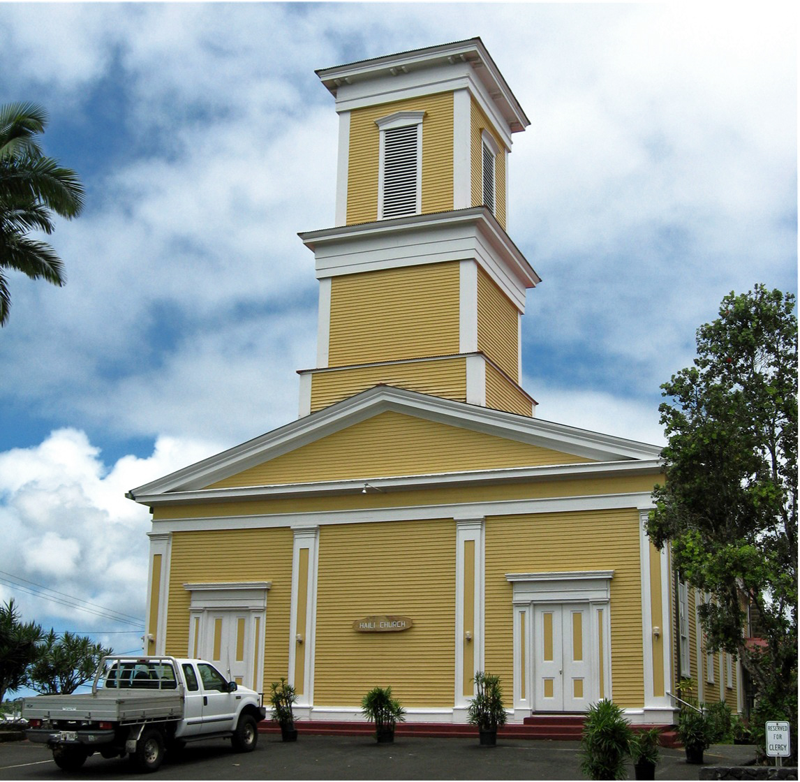
Originally, the name "Hilo" applied to a district encompassing much of the east coast of the island of Hawaiʻi, now divided into the District of South Hilo and the District of North Hilo. When William Ellis visited in 1823, the main settlement there was Waiākea on the south shore of Hilo Bay. Missionaries came to the district in the early-to-middle 19th century, founding Haili Church.
Hilo expanded as sugar plantations in the surrounding area created jobs and drew in many workers from Asia. For example, by 1887, 26,000 Chinese workers worked in Hawai'i's sugar cane plantations, one of which was the Hilo Sugar Mill. At that time, the Hilo Sugar Mill produced 3,500 tons of sugar annually.
From the History section of Hilo, Hawaii on Wikipedia, under CC BY-SA 4.0.
Where to stay14
Churches and places of worship25
Waiakea Mission Station-Hilo Station
Church · National Register of Historic Places · 2.3 mi
Kingdom Hall of Jehovah’s Witnesses
Place of worship · Jehovahs Witness · 5.3 mi
445 Kulana Road, Hilo
Shopping50
Gas and EV charging20
Schools, colleges and libraries36
Healthcare11
Hawaii Shoulder & Orthopedic Institute
Clinic and pharmacy · 2.5 mi
276 Waianuenue Avenue, Hilo
Map of Hilo
250 places. The map loads OpenStreetMap tiles when you open it.
Climate by month
Monthly table
| Month | High | Low | Rain |
|---|---|---|---|
| Jan | 79°F | 64°F | 7.9 in |
| Feb | 78°F | 64°F | 10.2 in |
| Mar | 78°F | 65°F | 12.7 in |
| Apr | 79°F | 66°F | 9.4 in |
| May | 81°F | 67°F | 7.0 in |
| Jun | 82°F | 69°F | 7.3 in |
| Jul | 83°F | 70°F | 9.2 in |
| Aug | 83°F | 70°F | 11.3 in |
| Sep | 83°F | 70°F | 8.7 in |
| Oct | 82°F | 69°F | 10.2 in |
| Nov | 80°F | 68°F | 14.4 in |
| Dec | 79°F | 66°F | 12.1 in |
U.S. Climate Normals 1991-2020 for Hilo Intl Ap Gsn 91285 (3 mi away), NOAA NCEI.
People and cost of living
American Community Survey 5-year estimates, 2020-2024, U.S. Census Bureau. Estimates have margins of error, larger for small towns.
Disaster history
Hawaii County has had 30 federal disaster declarations since 2000, most often for fires.
- 2026-10-07: Hurricane Lala (Hurricane)
- 2026-09-25: Tropical Storm Nolo (Tropical Storm)
- 2026-09-01: Earthquake (Earthquake)
- 2026-08-25: Hurricane Lala (Tropical Storm)
- 2026-07-26: Kawaihae Road Fire (Fire)
- 2026-04-07: Severe Storms, Flooding, Landslides, And Mudslides (Flood)
OpenFEMA disaster declarations summaries.
Getting there and nearby towns
Hilo International Airport (ITO) is the nearest airport with scheduled flights listed in OpenStreetMap, 3 miles away.
- Wainaku 4 mi north, about 6 min by car
- Keaau 5 mi southeast, about 8 min by car
- Paukaa 5 mi north, about 8 min by car
- Kurtistown 7 mi south, about 11 min by car
- Papaikou 7 mi north, about 12 min by car
- Hawaiian Paradise Park 10 mi southeast, about 16 min by car
- Orchidlands Estates 10 mi southeast, about 16 min by car
- Pepeekeo 10 mi north, about 16 min by car
- Hawaiian Acres 11 mi south, about 18 min by car
- Mountain View 13 mi southwest, about 20 min by car
Drive times are estimates from straight-line distance, not routes.
Local news
Headlines from INDB, the NEMICO news database.
Reviews, tips and questions
Loading what members have shared...
Sources and licences
- NCES EDGE (Public domain): public schools
- NOAA NCEI U.S. Climate Normals 1991-2020 (Public domain): climate by month
- OpenFEMA (Public domain): disaster declarations
- OpenStreetMap contributors (ODbL 1.0): places, airports, map data
- U.S. Census Bureau (Public domain): population, income, housing, education, commute
- Wikidata (CC0 1.0): elevation, founding date, time zone, website, landmarks and historic places
- Wikimedia Commons (see each image): photos
- Wikipedia (CC BY-SA 4.0): overview and history text
Photo credits
- Hilo Montage, Please click on the links above to see the authorship and license, CC BY-SA 3.0
- East Hawaii Cultural Center, W Nowicki, CC BY 3.0
- Lyman House Museum, Hilo, W Nowicki, CC BY 3.0
- Halaulani-A-J-Williamson-House, Joel Bradshaw, CC0
- Haili Church, Hilo, W Nowicki, CC BY 3.0
- Palace Theater - Hilo (2441372745), brewbooks from near Seattle, USA, CC BY-SA 2.0
- Volcano-Block-Building, W Nowicki, CC BY 3.0
- S. Hata Building, Hilo, W Nowicki, CC BY 3.0
- Shipman House, Hilo, W Nowicki, CC BY 3.0
- Hilo Masonic Lodge Hall, W Nowicki, CC BY 3.0
- Hilo Federal Building, W Nowicki, CC BY 3.0
Page built October 30, 2026. Spotted a mistake? Tell us or suggest a place.