


Homer, Alaska
Homer is a city of 5,877 people in Kenai Peninsula Borough, Alaska, founded in March 13, 1964.
Why visit Homer
Townapedia lists 10 museums and landmarks, 12 parks and trails, 42 places to eat, 38 places to stay and 3 attractions in and around town.
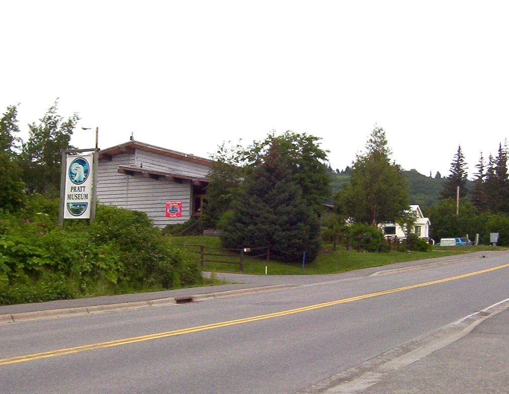
Highlights include Porcupine Theater, Pratt Museum, Thorn-Stingley House and Carl E. Wynn Nature Center.
July is the warmest month, with average highs of 63°F; January lows average 19°F.
Weather in Homer
Forecast from the National Weather Service. Full forecast
About Homer
Homer (Dena'ina: Tuggeght) is a city in Kenai Peninsula Borough in the U.S. state of Alaska. It is 218 mi (351 km) southwest of Anchorage. According to the 2020 census, the population was 5,522, up from 5,003 in 2010. Long known as the "Halibut Fishing Capital of the World", Homer is also nicknamed "the end of the road", and more recently, "the cosmic hamlet by the sea".
From the Wikipedia article Homer, Alaska (this version), under CC BY-SA 4.0.
Things to do3


Museums and landmarks10


Thorn-Stingley House
Monument and historic site · National Register of Historic Places · 1.1 mi
Historic house in Alaska, United States

Alaska Islands & Oceans NWR Visitor Center
Museum · 1.1 mi
95 Sterling Highway, Homer
Jun 01-Sep 07 09:00-17:00; Sep 08-30 Tu-Sa 09:00-17:00; Oct-Mar...

KBBI
Monument and historic site · 1.1 mi
Original site of the public radio station KBBI
Parks, trails and playgrounds12




Restaurants and cafes42

Fat Olive's Restaurant
Restaurant · Italian, Pizza, American · 1.4 mi
276 Ohlson Lane, Homer
Mo-Su 11:00-20:30

The Bagel Shop
Cafe · Sandwich · 3.2 mi
3745 East End Road, Homer
We-Fr 07:00-15:00, Sa-Su 08:00-16:00

Two Sisters Bakery & Cafe
Diner · American · 1.1 mi
233 East Bunnell Avenue, Homer
Mo-Fr 07:00-18:00; Sa 07:00-14:00; Su 09:00-14:00
Vida's Thai Food
Restaurant · Thai · 1.0 mi
397 East Pioneer Avenue, Homer
Mo-Fr 12:00-14:00,15:00-19:30
Don Jose's Mexican Restaurant
Restaurant · Mexican, Tacos, Burrito · 1.3 mi
127 West Pioneer Avenue, Homer

Mike's Alaskan Eatery
Restaurant · Sandwich, Italian · 1.3 mi
158 West Pioneer Avenue, Homer
Mo-Su 10:30-16:00
Twisted Goat
Restaurant · Regional · 1.3 mi
162 Pioneer Avenue, Homer
Th-Tu 12:00-22:00, We off
30 more on the map.
History
Tiller digs indicate that early Alutiiq people probably camped in the Homer area, including on the Homer Spit, although their villages were on the far side of Kachemak Bay. The area has been inhabited by humans for around 8,000 years.
Coal was discovered in the area in the 1890s. The Cook Inlet Coal Fields Company built a town, dock, coal mine, and railroad at Homer. Coal mining in the area continued and was the main pillar of the economy until World War II. An estimated 400 million tons of coal deposits were still present in the area as of 1959.
Homer was named for Homer Pennock, a gold mining company promoter, who arrived in 1896 on the Homer Spit and built living quarters for his crew of 50 men and one woman. However, gold mining was never profitable in the area.
Another earlier settlement, Miller's Landing, was named after Charles Miller, who homesteaded in the area around 1915. According to local historian Janet Klein, he was an employee of the Alaska Railroad and had wintered company horses on the beach grasses on the Homer Spit. He built a landing site in a small bight in Kachemak Bay, where supply barges from Seldovia could land and offload their cargos. Miller's landing was legally considered a census-designated place separate from Homer until it was annexed in 2002, but has always been locally considered part of Homer.
From the History section of Homer, Alaska on Wikipedia, under CC BY-SA 4.0.
Where to stay38
Churches and places of worship18
Shopping23
Gas and EV charging2
Schools, colleges and libraries11
Healthcare9
Clinic of Chiropractic Health
Clinic and pharmacy · 1.3 mi
141 West Pioneer Avenue, Homer
Women Infants Children (WIC)
Clinic and pharmacy · 1.2 mi
3446 Main Street, Homer
Map of Homer
168 places. The map loads OpenStreetMap tiles when you open it.
Climate by month
Monthly table
| Month | High | Low | Rain |
|---|---|---|---|
| Jan | 32°F | 19°F | 2.1 in |
| Feb | 35°F | 22°F | 1.8 in |
| Mar | 37°F | 23°F | 1.3 in |
| Apr | 46°F | 31°F | 1.1 in |
| May | 54°F | 38°F | 0.8 in |
| Jun | 59°F | 45°F | 0.9 in |
| Jul | 63°F | 49°F | 1.4 in |
| Aug | 63°F | 48°F | 2.3 in |
| Sep | 57°F | 42°F | 3.3 in |
| Oct | 47°F | 33°F | 2.6 in |
| Nov | 38°F | 25°F | 2.9 in |
| Dec | 34°F | 21°F | 3.3 in |
U.S. Climate Normals 1991-2020 for Homer Ap Gsn 70341 (1 mi away), NOAA NCEI.
People and cost of living
American Community Survey 5-year estimates, 2020-2024, U.S. Census Bureau. Estimates have margins of error, larger for small towns.
Disaster history
Kenai Peninsula Borough has had 17 federal disaster declarations since 2000, most often for severe storms.
- 2022-07-26: Landslide (Mud/Landslide)
- 2022-01-15: Severe Storms, Straight-Line Winds, Flooding, Landslides, And Mudslides (Severe Storm)
- 2020-04-09: Covid-19 Pandemic (Biological)
- 2020-03-13: Covid-19 (Biological)
- 2019-01-31: Earthquake (Earthquake)
- 2018-11-30: Earthquake (Earthquake)
OpenFEMA disaster declarations summaries.
Getting there and nearby towns
Homer Airport (HOM) is the nearest airport with scheduled flights listed in OpenStreetMap, 1 miles away.
- Kachemak 3 mi northeast, about 6 min by car
- Diamond Ridge 5 mi north, about 7 min by car
- Anchor Point 11 mi northwest, about 17 min by car
- Fritz Creek 11 mi northeast, about 18 min by car
- Happy Valley 20 mi north, about 33 min by car
- Fox River 25 mi northeast, about 39 min by car
- Ninilchik 29 mi north, about 47 min by car
- Cohoe 41 mi north, about 1 h by car
- Kasilof 48 mi north, about 1 h 15 min by car
Drive times are estimates from straight-line distance, not routes.
Local news
Headlines from INDB, the NEMICO news database.
Reviews, tips and questions
Loading what members have shared...
Sources and licences
- NOAA NCEI U.S. Climate Normals 1991-2020 (Public domain): climate by month
- OpenFEMA (Public domain): disaster declarations
- OpenStreetMap contributors (ODbL 1.0): places, airports, map data
- U.S. Census Bureau (Public domain): population, income, housing, education, commute
- Wikidata (CC0 1.0): elevation, founding date, time zone, website, landmarks and historic places
- Wikimedia Commons (see each image): photos
- Wikipedia (CC BY-SA 4.0): overview and history text
Photo credits
- Homerfromslough, Beeblebrox at en.wikipedia ), CC BY-SA 3.0
- Homer Spit AK - beach scene, Brian from California Desert, United States, CC BY 2.0
- No caption. (Homer) (26342409826), The U.S. National Archives, No restrictions
- Arriving at St John the Baptist Church, Homer, Haydn Blackey, CC BY-SA 2.0
- Homer otbp banner 1, runt35, CC BY 3.0
- Homer Spit - panoramio, runt35, CC BY 3.0
- Prattmuseum, Beeblebrox, CC BY-SA 3.0
- Thorn-Stingley House, Beeblebrox, CC BY-SA 4.0
- N544SC (46399322992), Jeroen Stroes Aviation Photography from Netherlands, CC BY 2.0
- Constantinea rosa-marina in the United States 40854858, pynklynx, CC0
- Shorebirds, Kachemak Bay Festival (5699395642), U.S. Fish and Wildlife Service Headquarters, Public domain
- Lesser Sandhill Crane Colt (42603732924), Becky Matsubara from El Sobrante, California, CC BY 2.0
- Lesser Sandhill Crane (42603728104), Becky Matsubara from El Sobrante, California, CC BY 2.0
- Lesser Sandhill Crane (42603728104) (cropped), Becky Matsubara from El Sobrante, California, CC BY 2.0
- 2021 L'iqa land, BuffaloPony, CC BY 4.0
- Tide pool in fog at extreme low tide, Kachemak Bay, Just Step Sideways, CC BY-SA 4.0
- Tom Rush playing guitar in September 2022, Susan Janowitz, CC BY-SA 4.0
- Full Moon On Kachemak Bay - panoramio, runt35, CC BY 3.0


Page built October 30, 2026. Spotted a mistake? Tell us or suggest a place.