
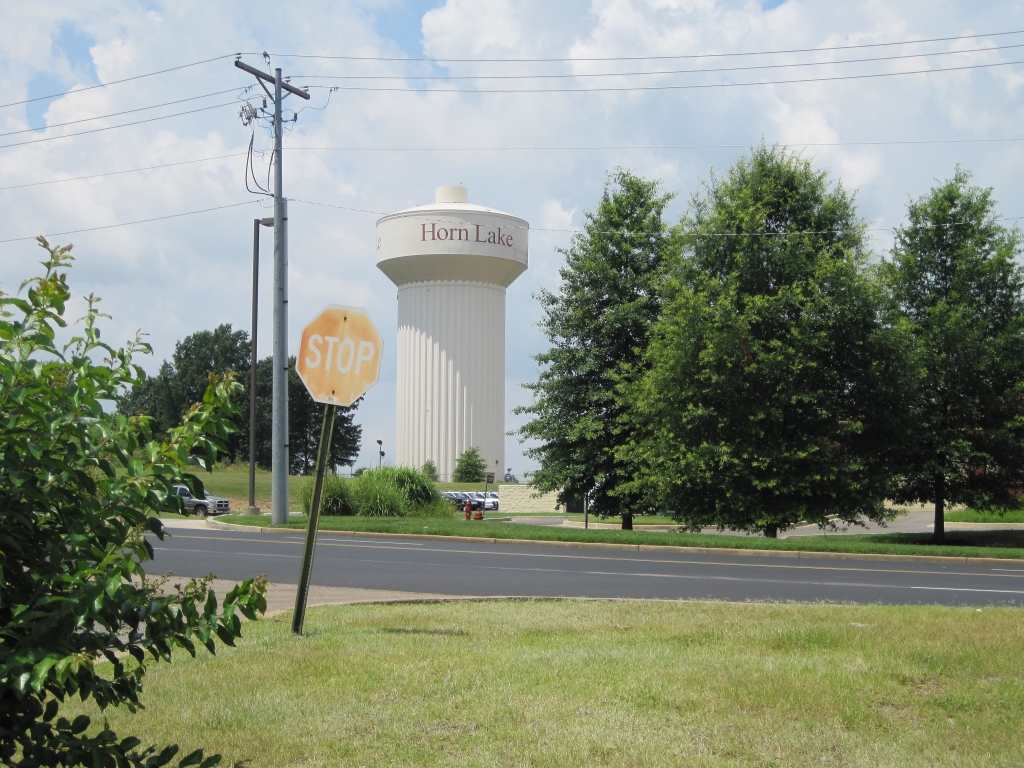


Horn Lake, Mississippi
Horn Lake is a city of 26,647 people in DeSoto County, Mississippi.
Why visit Horn Lake
Townapedia lists 28 parks and trails, 57 places to eat and 22 places to stay in and around town.
Highlights include Landers Center.
July is the warmest month, with average highs of 92°F; January lows average 33°F.
Weather in Horn Lake
Forecast from the National Weather Service. Full forecast
About Horn Lake
Horn Lake is a city in DeSoto County, Mississippi, United States. It is located 1.2 mi (1.9 km) south of Memphis, Tennessee. The population was 26,736 at the 2020 census, and was estimated at 26,574 in 2024. making it the 13th most populous city in Mississippi.
From the Wikipedia article Horn Lake, Mississippi (this version), under CC BY-SA 4.0.
Parks, trails and playgrounds28



16 more on the map.
Restaurants and cafes57





45 more on the map.
Where to stay22

Holiday Inn Express & Suites Southaven Central - Memphis
Motel and hotel · 3.2 mi
7237 Southcrest Parkway, Southaven
10 more on the map.
Churches and places of worship26

Christ the King Catholic Church
Church · Roman Catholic · 3.0 mi
785 Church Road West, Southaven
Christ Fellowship Presbyterian (PCA)
Church · Presbyterian Church In America · 1.8 mi
6341 US-51, Horn Lake
14 more on the map.
History
Horn Lake traces its name to an ox-bow lake, lying three miles west, which was a former riverbed of the Mississippi River. The river changed course over time in the late 18th century, leaving a stranded area that resembles a cow horn. That's how the city got its name, in old maps indicated the origin taking place between 1765 and 1796.
In historical times when the Chickasaw Indians inhabited that area as their land, Hernando de Soto and his party, the first Europeans to encounter the Chickasaws, wintered with them at the time of his discovery of the Mississippi River. The French Explorer, René-Robert Cavelier, Sieur de La Salle, solicited their help on his journey down after Mississippi to the Gulf of Mexico. The area passed through successive Spanish and English rule, finally coming under American governance after the Revolutionary War. In 1832, the Chickasaws had given up all of their claims to land east of the Mississippi River by the terms of the Treaty of Pontotoc Creek.
From the History section of Horn Lake, Mississippi on Wikipedia, under CC BY-SA 4.0.
Shopping17
Gas and EV charging10
Schools, colleges and libraries44
City University School Girls Preparatory
School · 5.0 mi
1475 East Shelby Dr, Memphis
City University School of Independence
School · 5.0 mi
1475 East Shelby Dr, Memphis
City University School of Liberal Arts
School · 5.0 mi
1475 E. Shelby Dr, Memphis
Healthcare2
Oxford Outpatient Treatment Center Southaven
Clinic and pharmacy · 2.5 mi
1150 Church Road West, Southaven
Map of Horn Lake
206 places. The map loads OpenStreetMap tiles when you open it.
Climate by month
Monthly table
| Month | High | Low | Rain | Snow |
|---|---|---|---|---|
| Jan | 51°F | 33°F | 4.1 in | 0.9 in |
| Feb | 56°F | 37°F | 4.5 in | 1.0 in |
| Mar | 64°F | 44°F | 5.7 in | 0.5 in |
| Apr | 73°F | 53°F | 5.9 in | 0.0 in |
| May | 82°F | 62°F | 5.3 in | 0.0 in |
| Jun | 89°F | 70°F | 4.0 in | 0.0 in |
| Jul | 92°F | 74°F | 4.8 in | 0.0 in |
| Aug | 92°F | 73°F | 3.4 in | 0.0 in |
| Sep | 86°F | 66°F | 3.0 in | 0.0 in |
| Oct | 75°F | 54°F | 4.0 in | 0.0 in |
| Nov | 63°F | 43°F | 4.7 in | 0.1 in |
| Dec | 53°F | 36°F | 5.5 in | 0.2 in |
U.S. Climate Normals 1991-2020 for Memphis Intl Ap 72334 (8 mi away), NOAA NCEI.
People and cost of living
American Community Survey 5-year estimates, 2020-2024, U.S. Census Bureau. Estimates have margins of error, larger for small towns.
Disaster history
DeSoto County has had 13 federal disaster declarations since 2000, most often for hurricanes.
- 2026-02-06: Severe Winter Storm (Winter Storm)
- 2026-01-24: Severe Winter Storm (Winter Storm)
- 2021-10-22: Hurricane Ida (Hurricane)
- 2021-08-28: Hurricane Ida (Hurricane)
- 2020-04-05: Covid-19 Pandemic (Biological)
- 2020-03-13: Covid-19 (Biological)
OpenFEMA disaster declarations summaries.
Getting there and nearby towns
Frederick W. Smith International Airport (MEM) is the nearest airport with scheduled flights listed in OpenStreetMap, 7 miles away.
- Lynchburg 3 mi west, about 5 min by car
- Southaven 4 mi east, about 7 min by car
- Lakeview 6 mi northwest, about 9 min by car
- Walls 7 mi west, about 11 min by car
- Hernando 8 mi southeast, about 13 min by car
- Bridgetown 9 mi southeast, about 15 min by car
- Memphis 12 mi northeast, about 19 min by car
- West Memphis 16 mi northwest, about 26 min by car
- Marion 20 mi northwest, about 31 min by car
- Forrest City 42 mi west, about 1 h 15 min by car
Drive times are estimates from straight-line distance, not routes.
Local news
Headlines from INDB, the NEMICO news database.
Reviews, tips and questions
Loading what members have shared...
Sources and licences
- NCES EDGE (Public domain): public schools
- NOAA NCEI U.S. Climate Normals 1991-2020 (Public domain): climate by month
- OpenFEMA (Public domain): disaster declarations
- OpenStreetMap contributors (ODbL 1.0): places, airports, map data
- U.S. Census Bureau (Public domain): population, income, housing, education, commute
- Wikidata (CC0 1.0): elevation, founding date, time zone, website
- Wikimedia Commons (see each image): photos
- Wikipedia (CC BY-SA 4.0): overview and history text
Photo credits
- Watertower Horn Lake MS 02, Thomas R Machnitzki, CC BY-SA 3.0
- Bobby Franklin, Oct. 14, 2019, Apfenn1, CC BY-SA 4.0
- Southaven City Hall (2022), Lrgjr72, CC BY-SA 4.0
Page built October 30, 2026. Spotted a mistake? Tell us or suggest a place.