


Immokalee, Florida
Immokalee is a community of 26,361 people in Collier County, Florida.
Why visit Immokalee
Townapedia lists 3 museums and landmarks, 8 parks and trails, 12 places to eat and 3 places to stay in and around town.
Highlights include Roberts Ranch, Immokalee Airport Park and Immokalee Community Park.
July is the warmest month, with average highs of 92°F; January lows average 52°F.
Weather in Immokalee
Forecast from the National Weather Service. Full forecast
About Immokalee
Immokalee ( ih-MOK-(ə)-lee) is an unincorporated community and census-designated place in Collier County, Florida, United States. The population was 24,557 at the 2020 census, up from 24,154 at the 2010 census. It is part of the Naples–Marco Island metropolitan area.
From the Wikipedia article Immokalee, Florida (this version), under CC BY-SA 4.0.
Museums and landmarks3

Roberts Ranch
Museum · National Register of Historic Places · 0.7 mi
Immokalee, Florida, NRHP-listed


Historical Site: Cemetary of Christ Episcopal Church
Monument and historic site · 0.4 mi
Parks, trails and playgrounds8

Restaurants and cafes12


La Tapatia (La Zeta Mexicana)
Restaurant · 0.4 mi
La Tapatia (La Zeta Mexicana) — 325 New Market Rd W Another pick up spot where workers are picked up in the early morning
325 New Market Road West, Immokalee


Where to stay3



History
The region was settled by the Calusa people. It was inhabited by the Seminole centuries later, after they moved down from northern Florida. Initially the settlement was known as Gopher Ridge by the Seminole and Miccosukee nations. Immokalee means "your home" in the Mikasuki language.
When the swamps were drained in the region, agriculture became the dominant industry. European-American hunters, trappers, Native American traders, cowmen, and missionaries moved in before permanent villages developed. The first permanent settlement was founded in 1872. In 1921, the Atlantic Coast Line Railroad extended its Haines City Branch south to Immokalee. The railroad was removed in 1989.
The Immokalee area is heavily agricultural. It is one of the nation's major centers of tomato growing. In 1960, CBS News anchor Edward R. Murrow reported on the region's farms' working conditions for his Harvest of Shame report for CBS Reports, which described the harsh lives of migrant workers.
From the History section of Immokalee, Florida on Wikipedia, under CC BY-SA 4.0.
Churches and places of worship13
Shopping8
Mr. 99 Supermarket — Lake Trafford Rd
Grocery · 1.2 mi
Lake Trafford Road, Immokalee
Gas and EV charging2
Schools, colleges and libraries17
Healthcare4
Florida State University Immokalee Health Education
Clinic and pharmacy · 1.6 mi
Map of Immokalee
70 places. The map loads OpenStreetMap tiles when you open it.
Climate by month
Monthly table
| Month | High | Low | Rain | Snow |
|---|---|---|---|---|
| Jan | 76°F | 52°F | 2.7 in | 0.0 in |
| Feb | 78°F | 55°F | 1.9 in | 0.0 in |
| Mar | 81°F | 57°F | 2.2 in | 0.0 in |
| Apr | 85°F | 62°F | 2.6 in | 0.0 in |
| May | 90°F | 67°F | 4.2 in | 0.0 in |
| Jun | 91°F | 72°F | 7.9 in | 0.0 in |
| Jul | 92°F | 74°F | 6.8 in | 0.0 in |
| Aug | 92°F | 74°F | 7.4 in | 0.0 in |
| Sep | 90°F | 74°F | 6.0 in | 0.0 in |
| Oct | 87°F | 68°F | 3.2 in | 0.0 in |
| Nov | 81°F | 60°F | 1.5 in | 0.0 in |
| Dec | 78°F | 55°F | 1.8 in | 0.0 in |
U.S. Climate Normals 1991-2020 for Immokalee (3 mi away), NOAA NCEI.
People and cost of living
American Community Survey 5-year estimates, 2020-2024, U.S. Census Bureau. Estimates have margins of error, larger for small towns.
Disaster history
Collier County has had 39 federal disaster declarations since 2000, most often for hurricanes.
- 2024-10-11: Hurricane Milton (Hurricane)
- 2024-10-07: Hurricane Milton (Hurricane)
- 2024-09-28: Hurricane Helene (Hurricane)
- 2024-09-24: Tropical Storm Helene (Tropical Storm)
- 2024-08-10: Hurricane Debby (Tropical Storm)
- 2024-08-03: Tropical Storm Debby (Tropical Storm)
OpenFEMA disaster declarations summaries.
Getting there and nearby towns
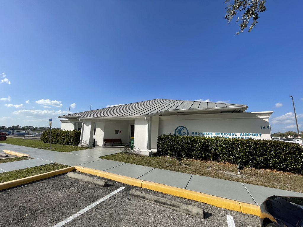
Immokalee Regional Airport (IMM) is the nearest airport with scheduled flights listed in OpenStreetMap, 1 miles away.
- Lehigh Acres 19 mi northwest, about 30 min by car
- Bonita Springs 23 mi west, about 37 min by car
- Estero 23 mi west, about 38 min by car
- Gateway 23 mi northwest, about 37 min by car
- Golden Gate 24 mi southwest, about 39 min by car
- San Carlos Park 25 mi west, about 40 min by car
- Fort Myers 29 mi northwest, about 46 min by car
- Villas 29 mi west, about 46 min by car
- Naples 30 mi southwest, about 48 min by car
- Cypress Lake 31 mi west, about 49 min by car
Drive times are estimates from straight-line distance, not routes.
Local news
Headlines from INDB, the NEMICO news database.
Reviews, tips and questions
Loading what members have shared...
Sources and licences
- NCES EDGE (Public domain): public schools
- NOAA NCEI U.S. Climate Normals 1991-2020 (Public domain): climate by month
- OpenFEMA (Public domain): disaster declarations
- OpenStreetMap contributors (ODbL 1.0): places, airports, map data
- U.S. Census Bureau (Public domain): population, income, housing, education, commute
- Wikidata (CC0 1.0): elevation, founding date, time zone, website, landmarks and historic places
- Wikimedia Commons (see each image): photos
- Wikipedia (CC BY-SA 4.0): overview and history text
Photo credits
- Immokalee-Zocalo Plaza 2018, Declan M Martin, Public domain
- Immokalee page banner, Declan M Martin, Public domain
- Immokalee, FL 34142, USA - panoramio, Eric Friedebach, CC BY 3.0
- Immokalee, FL 34142, USA - panoramio (1), Eric Friedebach, CC BY 3.0
- Immokalee Airport Terminal Interior 2021, Declan M Martin, CC BY 4.0
- Immokalee Airport Terminal 2021, Declan M Martin, CC BY-SA 4.0
- Immokalee FL Roberts Ranch bldg01, Ebyabe, CC BY-SA 3.0
- Blue Light Poles (29527713191), formulanone from Huntsville, United States, CC BY-SA 2.0
- 7 Eleven Slurrpe, Chasetheg, CC BY-SA 4.0
- FL 29 Signs - "Flathandle" (29527712851), formulanone from Huntsville, United States, CC BY-SA 2.0
- CR 846 east, NE2, CC0
- ISS041-E-67974 - View of Earth, Earth Science and Remote Sensing Unit , Lyndon B. Johnson Space Center, Public domain
- ISS022-E-84521 - View of Earth, Earth Science and Remote Sensing Unit , Lyndon B. Johnson Space Center, Public domain
- ISS065-E-8532 - View of Earth, Earth Science and Remote Sensing Unit , Lyndon B. Johnson Space Center, Public domain
- ISS010-E-5158 - View of Florida, Earth Science and Remote Sensing Unit , Lyndon B. Johnson Space Center, Public domain
- ISS060-E-21604 - View of Earth, Earth Science and Remote Sensing Unit, NASA Johnson Space Center, Public domain
- ISS041-E-67975 - View of Earth, Earth Science and Remote Sensing Unit , Lyndon B. Johnson Space Center, Public domain
- Sunset Road (6243487250), formulanone from Huntsville, United States, CC BY-SA 2.0
- Eudocimus albus -Lake Trafford, Florida, USA -juvenile-8, ~Sage~ from USA, CC BY 2.0


Page built October 30, 2026. Spotted a mistake? Tell us or suggest a place.