
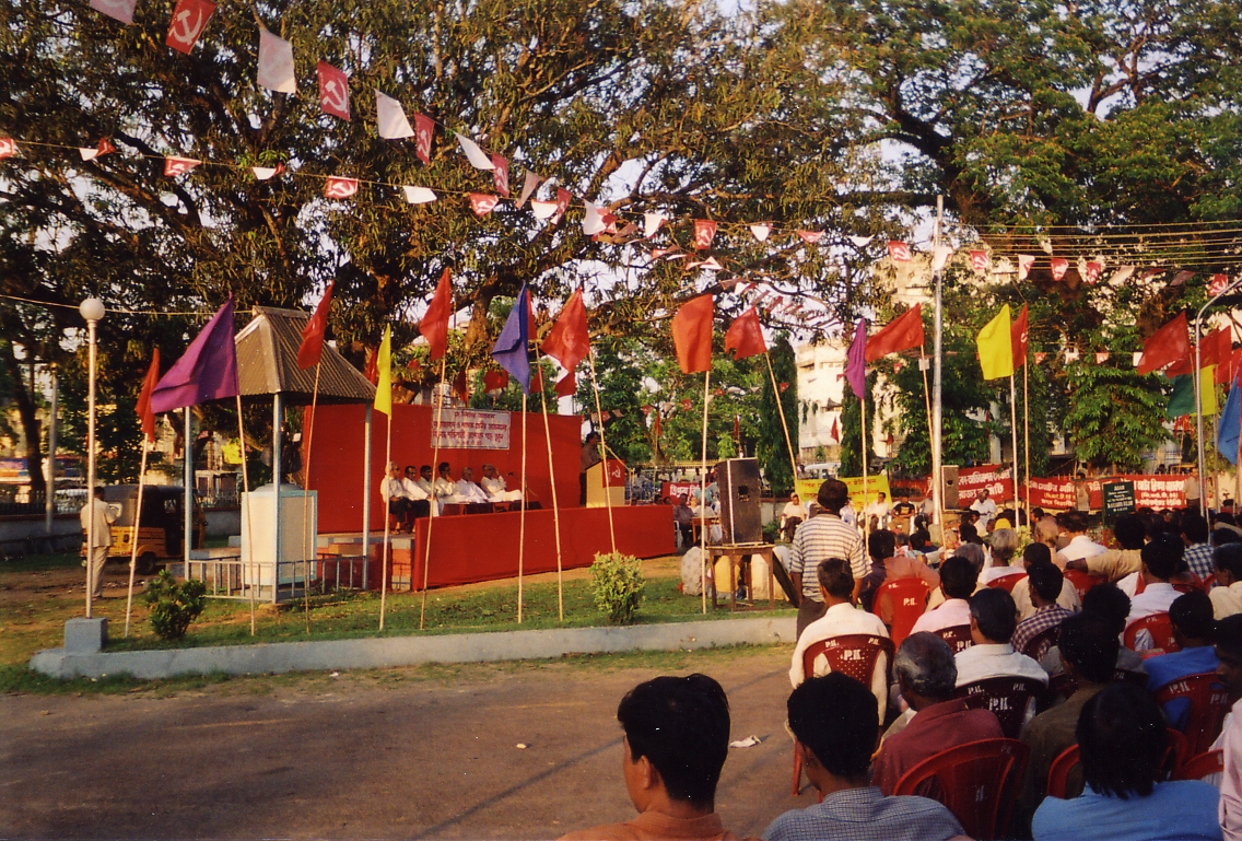


Agartala, India
Agartala is a regional capital of 400,004 people in Tripura, India, founded in 1871.
Why visit Agartala
Townapedia lists 7 museums and landmarks, 22 parks and trails, 6 places to eat, 16 places to stay and 5 attractions in and around town.
Highlights include National Law University Tripura, Agartala Government Dental College, Kharampur Mazar Sharif and Pilak, Tripura.
Weather in Agartala
Forecast from MET Norway (CC BY 4.0). Full forecast
About Agartala
Agartala (, Bengali: [ˈagɔɾˌtɔla] , Kok Borok: [aguli]) is the capital and the largest city of the Indian state of Tripura, situated on the banks of Haora/Saidra River, about 2 kilometres (1.2 mi) east of the border with Bangladesh and about 2,499 km (1,552 mi) from the national capital, New Delhi. According to 2022 AMC data, Agartala is the second most populous city after Guwahati in Northeast India. It is India's third international internet gateway and being developed under the Smart Cities Mission.
From the Wikipedia article Agartala (this version), under CC BY-SA 4.0.
Travel tips from other travellers: Agartala on Wikivoyage (CC BY-SA 4.0).
Things to do5

National Law University Tripura
School · 8.3 km
A National Law university situated in Agarthala capital to the state of Tripura, India


Museums and landmarks7

Kharampur Mazar Sharif
Monument and historic site · 9.0 km
A mazar (mausoleum) in the village of Kharampur, Brahmanbaria District, Bangladesh.

Pilak, Tripura
Monument and historic site · 8.0 km
Archaeological site

Tripura Government Museum
Museum
Cultural and historical museum in Agartala, India




Parks, trails and playgrounds22


Arundhauti Nagar Children Park
Park · 2.8 km
Arundhauti Nagar Ramthakur Para, Agartala

10 more on the map.
Restaurants and cafes6



History
One of the earliest kings of Tripura was Patardan B.C. 1900, long before the Manikya Dynasty. According to folklore, Chitrarath, Drikpati, Dharmapha, Loknath Jivandharan were important kings during the time of B.C. in Agartala.
In the past, Tripura served as the capital to several Hindu kingdoms. Although a timeline of the rulers has not been found, records reveal that the area has been ruled by as many as 179 Hindu rulers, starting from the mythological King Druhya to the last King of Tripura, Kirit Bikram Kishore Manikya. Tripura also came under Mughal rule. The state came under the governance of the British in 1808.
Much later the ancient capital of the then princely state 'Swadhin Tripura' was at Rangamati (Udaipur, South Tripura) by the bank of the Gomati River. In 1760 it was shifted by the Maharaja Krishna Chandra Manikya Bahadur (r.1829–1849) of Manikya Dynasty to present old Agartala by the bank of the river Haora/Saidra and was named 'Haveli'. The capital city of Agartala was founded by Maharaja Krishna Kishore Manikya (1830-49 CE) in 1838 CE. Due to frequent invasion of the Kukis and also to keep easy communication with the British Bengali, the Maharaja Krishna Chandra Manikya started the process of shifting the capital from Old Haveli to New Haveli (present Agartala) in 1849.
From the History section of Agartala on Wikipedia, under CC BY-SA 4.0.
Where to stay16
Churches and places of worship24
Shopping2
Gas and EV charging2
Schools, colleges and libraries18
Healthcare19
Map of Agartala
121 places. The map loads OpenStreetMap tiles when you open it.
Getting there and nearby towns
Maharaja Bir Bikram Airport (IXA) is the nearest airport with scheduled flights listed in OpenStreetMap, 7 km away.
- Charipara 4 km southwest, about 4 min by car
- Dukli 5 km south, about 5 min by car
- Anandanagar 5 km southeast, about 5 min by car
- Madhuban 6 km south, about 6 min by car
- Gandhigram 6 km north, about 6 min by car
- Uttar Champamura 6 km east, about 6 min by car
- Radhakishorenagar 7 km northeast, about 7 min by car
- Briddhanagar 7 km east, about 7 min by car
- Rānīr Bāzār 9 km east, about 9 min by car
- Narsingarh 9 km north, about 9 min by car
Drive times are estimates from straight-line distance, not routes.
Local news
Headlines from INDB.
Reviews, tips and questions
Loading what members have shared...
Sources and licences
- GeoNames (CC BY 4.0): population, coordinates, regions and time zone
- OpenStreetMap contributors (ODbL 1.0): places, airports, map data
- Wikidata (CC0 1.0): elevation, founding date, time zone, website, landmarks and historic places
- Wikimedia Commons (see each image): photos
- Wikipedia (CC BY-SA 4.0): overview and history text
Photo credits
- Agartala-mayday152, No machine-readable author provided. Soman assumed (based on copyright claims)., CC BY-SA 3.0
- Carved Stone Pillar found at Amarpur kept at Ujjayanta Palace, Agartala, Tripura 08, Kingshuk Mondal, CC BY 4.0
- Right Facade of Ujjayanta Palace, Agartala, Tripura 04, Kingshuk Mondal, CC BY 4.0
- Carved Stone Pillar found at Amarpur kept at Ujjayanta Palace, Agartala, Tripura 10, Kingshuk Mondal, CC BY 4.0
- Ujjayanta Palace also known as Nuyungma, Agartala, Tripura 05, Kingshuk Mondal, CC BY 4.0
- Carved Stone Pillar found at Amarpur kept at Ujjayanta Palace, Agartala, Tripura 07, Kingshuk Mondal, CC BY 4.0
- Ujjayanta Palace also known as Nuyungma, Agartala, Tripura 06, Kingshuk Mondal, CC BY 4.0
- Carved Stone Pillar found at Amarpur kept at Ujjayanta Palace, Agartala, Tripura 11, Kingshuk Mondal, CC BY 4.0
- Carved Stone Pillar found at Amarpur kept at Ujjayanta Palace, Agartala, Tripura 01, Kingshuk Mondal, CC BY 4.0
- Central Facade of Ujjayanta Palace, Agartala, Tripura 01, Kingshuk Mondal, CC BY 4.0
- Ujjayanta Palace also known as Nuyungma, Agartala, Tripura 07, Kingshuk Mondal, CC BY 4.0
- Ujjayanta Palace also known as Nuyungma, Agartala, Tripura 04, Kingshuk Mondal, CC BY 4.0
- The main entrance of Ujjayanta Palace, Agartala, Tripura 06, Kingshuk Mondal, CC BY 4.0
- Statue of Khudiram Bose in front of the main entrance of Ujjayanta Palace, Agartala, Tripura 02, Kingshuk Mondal, CC BY 4.0
- Right Facade of Ujjayanta Palace, Agartala, Tripura 01, Kingshuk Mondal, CC BY 4.0
- Statue of Radha Kishore Manikya in front of Ujjayanta Palace, Agartala, Tripura 01, Kingshuk Mondal, CC BY 4.0
- Ujjayanta Palace also known as Nuyungma, Agartala, Tripura 02, Kingshuk Mondal, CC BY 4.0
- The main entrance of Ujjayanta Palace, Agartala, Tripura 05, Kingshuk Mondal, CC BY 4.0
- Tourists at Ujjayanta Palace, Agartala, Tripura 03 v1, Kingshuk Mondal, CC BY 4.0
- Tourists at Ujjayanta Palace, Agartala, Tripura 01 v1, Kingshuk Mondal, CC BY 4.0
- A ghat at the Rajbari Lake in front of Ujjayanta Palace, Agartala, Tripura, Kingshuk Mondal, CC BY 4.0
- Left Facade of Ujjayanta Palace, Agartala, Tripura 02, Kingshuk Mondal, CC BY 4.0
- Statue of Master Da Surya Sen in front of the main entrance of Ujjayanta Palace, Agartala, Tripura 03, Kingshuk Mondal, CC BY 4.0
- Central Facade of Ujjayanta Palace, Agartala, Tripura 02, Kingshuk Mondal, CC BY 4.0
- Statue of Bhimrao Ramji Ambedkar near the entrance of Ujjayanta Palace, Agartala, Tripura 03, Kingshuk Mondal, CC BY 4.0
- Carved Stone Pillar found at Amarpur kept at Ujjayanta Palace, Agartala, Tripura 02, Kingshuk Mondal, CC BY 4.0
- Kolla Shah Majar by Monir, Shrabanmonir, CC BY-SA 4.0
- Buddhist Stupa Shyamsundar Mound, Avishek Datta, CC BY-SA 3.0
- Tripura State Museum Agartala Tripura India, Sharada Prasad CS, CC BY 2.0
- Ujjayanta Palace as seen from the Rajbari Lakes, Swarupskd.wiki, CC BY-SA 3.0
- Tripura Medical College-Top Image, 00SHASH00, CC BY-SA 4.0
- Ujjayanta palace Tripura State Museum Agartala India, Sharada Prasad CS, CC BY 2.0
- B.R. Ambedkar Memorial Teaching Hospital Tripura, Pinak de, CC BY-SA 3.0
- Open wing position of Tanaecia lepidea Butler, 1868 – Grey Count WLB, Subhendukhan, CC BY-SA 4.0
- Close wing position of Iambrix salsala -Chestnut Bob, Subhendukhan, CC BY-SA 4.0
- Uajjayanta Palace, Barunghosh, CC BY-SA 4.0
- Uajjayanta 2, Barunghosh, CC BY-SA 4.0
- Nice look 2, Apnaduniya, CC BY-SA 4.0
- Ujjayanta Palace as seen from the midpoint of the avenue 01, Kingshuk Mondal, CC BY 4.0
- Ujjayanta Palace as seen from the bank of Rajbari Lake 08, Kingshuk Mondal, CC BY 4.0


Page built November 2, 2026. Spotted a mistake? Tell us or suggest a place.