
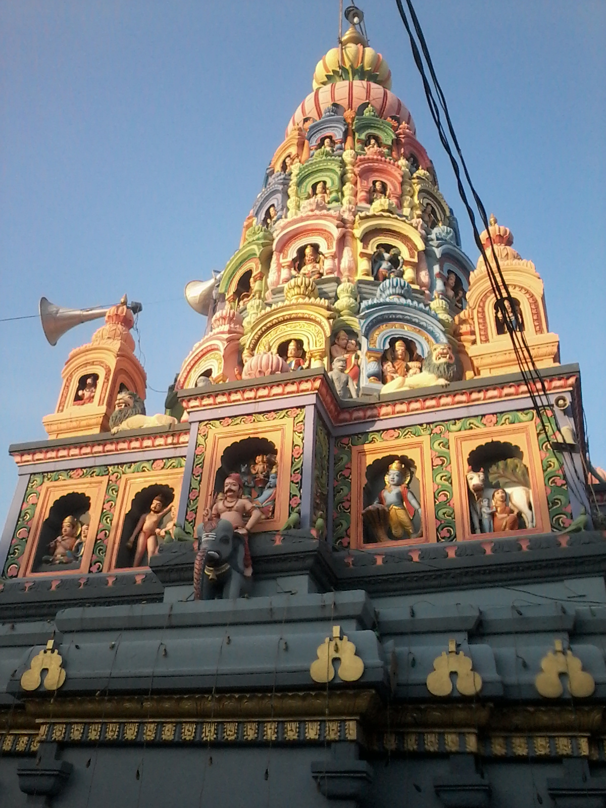


Why visit Ambājogāi
Townapedia lists 3 museums and landmarks and 1 park or trail in and around town.
Weather in Ambājogāi
Forecast from MET Norway (CC BY 4.0). Full forecast
About Ambājogāi
Ambajogai is a city and tehsil in Beed district of Maharashtra State in India. Regarded as the cultural capital of Marathwada, the town features attractions like the Shivleni Caves and monuments honoring Marathi poet Mukundraj, the author of "Viveksindu," the first Marathi literary work, as well as Dasopant.
From the Wikipedia article Ambajogai (this version), under CC BY-SA 4.0.
Travel tips from other travellers: Ambājogāi on Wikivoyage (CC BY-SA 4.0).
Museums and landmarks3

Parks, trails and playgrounds1

Churches and places of worship24

12 more on the map.
Shopping1

Randad Steel
Shopping center
Rajdhani Plaza, Ambajogai
Mo-Su 09:00-21:00
History
The town has been a cultural center in the region from the ancient times. The Yogeshwari temple, Kholeshwar temple and Barakhambi temple hints the cultural prosperity of the town dating back to 10th century CE. It was formerly known as Amrapur, Jayantipur, Jogaiambe.
Ambajogai named by The Amba – (Goddess Parvati / Durga) by his birthplace (jogai), who appeared at this place to finish Dantasura (a devil). It was also known as Jaywantinagar by name of King (Raja) Jaywant and river's name Jayawanti, turned to Mominabad under the regime of Nizam of Hyderabad before the annexation of Hyderabad state to the dominion of India. Many heritage sites and temples were harmed during this period. It was a military base of the Hyderabad state army. The stable of the horses of the cavalry of the Hyderabad army was later turned into a hospital and medical college which later was named as Swami Ramanand Teerth Rural Medical College.
From the History section of Ambajogai on Wikipedia, under CC BY-SA 4.0.
Schools, colleges and libraries1
Healthcare17
Map of Ambājogāi
47 places. The map loads OpenStreetMap tiles when you open it.
Getting there and nearby towns
Latur Airport (LTU) is the nearest airport with scheduled flights listed in OpenStreetMap, 37 km away.
- Parli Vaijnāth 20 km northeast, about 20 min by car
- Dhārūr 31 km west, about 31 min by car
- Kaij 34 km west, about 34 min by car
- Sonpet 34 km north, about 34 min by car
- Latur 42 km southeast, about 42 min by car
- Kallam 42 km southwest, about 42 min by car
- Gangākher 46 km northeast, about 46 min by car
- Majalgaon 50 km north, about 50 min by car
- Ausa 55 km south, about 55 min by car
- Beed 72 km northwest, about 1 h 15 min by car
Drive times are estimates from straight-line distance, not routes.
Local news
Headlines from INDB.
Reviews, tips and questions
Loading what members have shared...
Sources and licences
- GeoNames (CC BY 4.0): population, coordinates, regions and time zone
- OpenStreetMap contributors (ODbL 1.0): places, airports, map data
- Wikidata (CC0 1.0): elevation, founding date, time zone, website
- Wikimedia Commons (see each image): photos
- Wikipedia (CC BY-SA 4.0): overview and history text
Photo credits
- Ambajogai Yogeshwari Temple, Mahajandeepakv, CC BY-SA 3.0
- Barakhanbi 3, Jayesh B Chavan, CC BY-SA 4.0
- Barakhanbi 4, Jayesh B Chavan, CC BY-SA 4.0
- Barakhanbi1, Jayesh B Chavan, CC BY-SA 4.0
- Barakhanbi 2, Jayesh B Chavan, CC BY-SA 4.0
- Yogeshwari Temple, Geet13, CC BY-SA 4.0
- Yogeshwari Temple 2, Geet13, CC BY-SA 4.0
- A nursery in Ambejogai, Maharshtra, Pamathai, CC BY-SA 4.0
- Barakhambi temple 2, Ganeshmitkari7, CC BY-SA 4.0
- Barakhambi temple 6, Ganeshmitkari7, CC BY-SA 4.0
- Barakhambi Temple2 Ambajogai Maharashtra, Abhijit Lohiya, CC BY-SA 4.0
- Barakhambi temple 5, Ganeshmitkari7, CC BY-SA 4.0
- Barakhambi temple, Ganeshmitkari7, CC BY-SA 4.0
- Barakhambi temple 4, Ganeshmitkari7, CC BY-SA 4.0
- Barakhambi temple 3, Ganeshmitkari7, CC BY-SA 4.0
- श्री नागनाथ शिवालय मंदिरा जवळचा निसर्ग, Ratnakar Jagannath Nikam, CC BY-SA 4.0


Page built November 3, 2026. Spotted a mistake? Tell us or suggest a place.