


Weather in Bāramūla
Forecast from MET Norway (CC BY 4.0). Full forecast
About Bāramūla
Baramulla (Urdu pronunciation: [bɑːɾɑːmuːlɑː]), also known as Varmul (Kashmiri pronunciation: [ʋarmul]) in Kashmiri, is a city and municipality of the Baramulla district of the Indian-administered Jammu and Kashmir in the disputed Kashmir region. It is also the administrative headquarters of the Baramulla district, located on the banks of the River Jhelum downstream from Srinagar, the summer capital of Jammu and Kashmir. The city was earlier known as gateway of Kashmir, serving as the major distribution centre for goods arriving in Kashmir valley through the Jhelum valley cart road. It is located within the Kashmir Valley on the foothills of the Pir Panjal Range.
From the Wikipedia article Baramulla (this version), under CC BY-SA 4.0.
Travel tips from other travellers: Bāramūla on Wikivoyage (CC BY-SA 4.0).
Churches and places of worship2

Schools, colleges and libraries2

Healthcare9


Map of Bāramūla
13 places. The map loads OpenStreetMap tiles when you open it.
Getting there and nearby towns
Sheikh ul-Alam International Airport (SXR) is the nearest airport with scheduled flights listed in OpenStreetMap, 47 km away.
- Shitlu 3 km north, about 3 min by car
- Watargām 13 km north, about 13 min by car
- Sopur 15 km northeast, about 15 min by car
- Hāmre 15 km east, about 15 min by car
- Gulmarg 18 km south, about 18 min by car
- Pattan 20 km east, about 20 min by car
- Kupwāra 21 km south, about 21 min by car
- Handwāra 22 km north, about 22 min by car
- Srinagar 45 km east, about 45 min by car
- Pulwama 63 km southeast, about 1 h by car
Drive times are estimates from straight-line distance, not routes.
Local news
Headlines from INDB.
Reviews, tips and questions
Loading what members have shared...
Sources and licences
- GeoNames (CC BY 4.0): population, coordinates, regions and time zone
- OpenStreetMap contributors (ODbL 1.0): places, airports, map data
- Wikidata (CC0 1.0): elevation, founding date, time zone, website
- Wikimedia Commons (see each image): photos
- Wikipedia (CC BY-SA 4.0): overview and history text
Photo credits
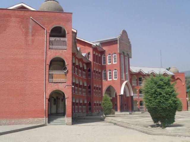
- Baramulla Public School, Afferninja, CC BY-SA 4.0
- Royal interiors and designs, Royal interior and designs, CC BY-SA 4.0
- A foot bridge in fog., Ayaan07, CC BY-SA 4.0
- Nisar Azam, Shah Nassar Ahmad, CC BY-SA 4.0
- View of Buddhist Tope near Baramala, Henry Hardy Cole, CC BY 4.0
- Montex Hy-Power Curve, JUNGAL9992, CC BY-SA 1.0
- Kashmiri chef, JK01R 8147, CC BY-SA 4.0
- REYNOLDS 040 pens, JUNGAL9992, CC BY 2.5
- Calcutta-mail-low-res, Unknown author Unknown author, Public domain
- Reynolds 040 pen set (8 pens), JUNGAL9992, CC BY 3.0
- Audi Q3 2025-04-10, JUNGAL9992, GFDL 1.2
- Tata City Ride Bus school bus Cambridge school 09.10.2025, JUNGAL2488, CC BY-SA 2.0
- Kashmiri Pheran, JUNGAL9992, CC BY-SA 4.0
- Pen collection 1990s india, JUNGAL9992, CC BY 2.5
- Tata ACE HT, JUNGAL9992, CC BY 2.5
- Reynolds Gel Racer, JUNGAL9992, CC BY 2.5
- Reynolds Liquiflo, JUNGAL9992, CC BY 2.0
- Reynolds 040 bureau N BOLD ball pen 2025, JUNGAL9992, CC BY 3.0
- Micromax ezpad Q3, JK01R 8147, CC BY-SA 4.0
- Broken loquat tree, JUNGAL9992, CC BY 2.0


Page built November 3, 2026. Spotted a mistake? Tell us or suggest a place.