
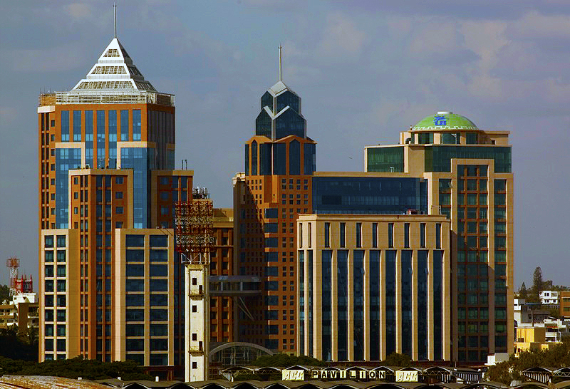


Bengaluru, India
Bengaluru is a regional capital of 8,495,492 people in Karnataka, India, founded in 1537.
Why visit Bengaluru
Townapedia lists 71 museums and landmarks, 28 parks and trails, 284 places to eat, 41 places to stay and 28 attractions in and around town.
Highlights include Acharya Institute of Management and Sciences, Acharya Pathasala Public School, Visvesvaraya Industrial and Technological Museum and Gallery G.
Weather in Bengaluru
Forecast from MET Norway (CC BY 4.0). Full forecast
About Bengaluru
Bengaluru, also known as Bangalore (its official name until 1 November 2014), is the capital and largest city of the southern Indian state of Karnataka. As per the 2011 census, the city had a population of 8.4 million, making it the third most populous city in India and the most populous in South India. The Bengaluru metropolitan area had a population of around 8.5 million, making it the fifth most populous urban agglomeration in the country. It is located towards the southern end of the Deccan Plateau, at an altitude of 900 m (3,000 ft) above sea level.
From the Wikipedia article Bengaluru (this version), under CC BY-SA 4.0.
Travel tips from other travellers: Bengaluru on Wikivoyage (CC BY-SA 4.0).
Things to do28

Acharya Institute of Management and Sciences
School · 10.8 km
Educational institution in Bangalore, India

Bangalore University
School · 10.2 km
State public university in Bengaluru Urban, Karnataka, India

Bengaluru Aquarium
Monument and historic site · 0.7 km
Aquarium in Bangalore, India
Jawaharlal Nehru Centre for Advanced Scientific Research
School · 10.8 km
Research institute in Bangalore, India

Karnataka Samskrit University
School · 2.7 km
State public university in Bengaluru Urban, Karnataka, India
Karnataka State Law University
School · 10.5 km
State public university in Dharwad, Karnataka, India
Mount Carmel University
School · 2.4 km
(Deemed-to-be-University) in Bengaluru, India

Plaza Theatre (Bangalore)
Cinema and theater · 1.4 km
Building in India
Rajarajeswari Medical College and Hospital
School · 16.6 km
Medical college in India

Ranga Shankara
Cinema and theater · 6.8 km
Theater in Bangalore, India
St. Claret College
School · 9.7 km
College affiliated to the University of Bangalore
16 more on the map.
Museums and landmarks71

Visvesvaraya Industrial and Technological Museum
Museum
Industrial and technological museum in Bangalore
Mo-Su 10:00-18:00


Agara inscriptions and hero stones
Monument and historic site
Inscription stones in Bengaluru

Allalasandra inscriptions and hero stones
Monument and historic site · 12.8 km
Inscription stones in bengaluru

Basavanagudi inscriptions and hero stones
Monument and historic site · 4.3 km
Inscription stones in Bengaluru



Hebbal Kittaya Inscription
Monument and historic site · 7.6 km
Inscription stone in Bangalore
Indian Music Experience Museum
Museum · 13.4 km
The Indian Music Experience Museum (IME) is India's first interactive music museum, located in JP Nagar, Bengaluru, Karnataka.

Inscription Stones of Bengaluru
Monument and historic site · 11.2 km
A heritage project focused on rediscovering and preserving ancient stone inscriptions in Bengaluru, documenting the city's historical legacy

Karnataka Chitrakala Parishath College of Fine Arts
Museum · 2.5 km
College affiliated to the University of Bangalore
59 more on the map.
Parks, trails and playgrounds28



Cornerstone Park, Bangalore
Park · 5.2 km
Public park in Bangalore, Karnataka, India


National Military Memorial
Park · 1.6 km
Indian memorial in Bangalore
Puttenahalli Lake Birds Conservation Reserve
Park · 15.6 km
Lake in Yelahanka, India


16 more on the map.
Restaurants and cafes284

Homiga
Restaurant · Korean · 1.4 km
202 Brigade Road, Bangalore
Mo-Fr 12:00-16:00,18:00-00:00; Sa-Su 12:00-24:00
IDC Idli Dosa Coffee Central Kitchen
Restaurant · Regional · 0.7 km
Sri Ram Mandir Road, Bengaluru
Mo-Su 08:00-20:00




Ebony
Restaurant · Indian · 1.3 km
84 Mahatma Gandhi Road
Mo-Su 12:30-15:00,19:30-22:30; Fr-Sa 12:30-15:00,19:30-23:30
Konark Kanteerava
Restaurant · North Indian, Chinese
Kasturba Road, Bangalore
06:30-22:30
272 more on the map.
Where to stay41
Churches and places of worship48
Shopping29
Acme Fitness
Shop · 0.7 km
Shop No. 17 & 18, Devatha Plaza, Residency Road, Opp. Bishop Cotton Boys School, Ashok Nagar, Bangalore
Sports Shoppee
Shop · 1.0 km
Ranka Park, Near Richmond Circle, Richmond Road, Richmond Road,, Bangalore
Twenty Twenty sports
Shop · 1.3 km
44 Ground Floor, 80/1 Shrungar Shopping Center,, MG Road, Shanthala Nagar, Ashok Nagar,, Bangalore
Gas and EV charging8
Schools, colleges and libraries52
Government Pharmacy College
School · 1.2 km
Mission Road (Kalinga Rao Road), Bengaluru
Healthcare47
Bangalore Fetal Medicine Centre
Clinic and pharmacy · 1.0 km
5/1 2nd Floor, Rich Homes, Richmond Road, Shanthala Nagar, Ashok Nagar, Shanthala Nagar, Ashok Nagar, Bengaluru
elbitdiagnostics
Clinic and pharmacy · 1.3 km
1 1/2 Indian Express Building, 3rd Floor,, Queens Rd, Vasanth Nagar, Bangalore
Sanjeevani Netralaya
Clinic and pharmacy · 1.2 km
141 Infantry Road, Shivaji Nagar, Bengaluru,, Bangalore
St. Martha's Heart Centre
Hospital · 1.1 km
5 Nrupathunga Rd, RBI Colony, Sampangi Rama Nagar, Bangalore
Map of Bengaluru
250 places. The map loads OpenStreetMap tiles when you open it.
Getting there and nearby towns
Kempegowda International Airport (BLR) is the nearest airport with scheduled flights listed in OpenStreetMap, 28 km away.
- Yelahanka 14 km north, about 14 min by car
- Electronic City Phase I 15 km southeast, about 15 min by car
- Chikkabidarakallu 14 km northwest, about 14 min by car
- koppana Agrahara 15 km southeast, about 15 min by car
- Chik Bānavar 16 km northwest, about 16 min by car
- Maragondahalli 17 km southeast, about 17 min by car
- Madanayakahalli 17 km northwest, about 17 min by car
- Hebbagodi 19 km southeast, about 19 min by car
- Hunasamaranahalli 19 km north, about 19 min by car
- Kumbalgod 19 km southwest, about 19 min by car
Drive times are estimates from straight-line distance, not routes.
Local news
Headlines from INDB.
Reviews, tips and questions
Loading what members have shared...
Sources and licences
- GeoNames (CC BY 4.0): population, coordinates, regions and time zone
- OpenStreetMap contributors (ODbL 1.0): places, airports, map data
- Wikidata (CC0 1.0): elevation, founding date, time zone, website, landmarks and historic places
- Wikimedia Commons (see each image): photos
- Wikipedia (CC BY-SA 4.0): overview and history text
Photo credits
- UB City, Unknown author, CC BY-SA 2.0
- Buildings near UB city, Bengaluru (January 2019) 4, IM3847, CC BY-SA 4.0
- Tree canopy at Cubbon park, Bengaluru (2026) 01, Gpkp, CC BY-SA 4.0
- Tree canopy at Cubbon park, Bengaluru (2026) 02, Gpkp, CC BY-SA 4.0
- Buildings near UB city, Bengaluru (January 2019) 3, IM3847, CC BY-SA 4.0
- Bengaluru, India (Unsplash zMWfRUiFqq0), Jaydeep Gajera jaydeepgajera, CC0
- Bengaluru, India (Unsplash n81tfAKH3fY), hash whole.studios hashwhole, CC0
- Bengaluru, India (Unsplash), Shajan Jacob shajanjp, CC0
- Retro cream car in Bengaluru (Unsplash), Aatur Harsh aaturharsh, CC0
- Bangaloreuniversity, Blueyonder1978, Public domain
- Namma Bengaluru Aquarium (2025) 122, Gpkp, CC BY-SA 4.0
- Plaza theatre balcony, Jackerhack, CC BY 3.0
- Ranga Shankara, Bangalore (2024) 22, Gpkp, CC BY-SA 4.0
- Visvesvaraya Industrial and Technological Museum, Bangalore (2025) 02, Gpkp, CC BY-SA 4.0
- Gallery G, Bangalore (2025) 16, Gpkp, CC BY-SA 4.0
- Venkatappa Art Gallery, Bengaluru (2026) 05, Gpkp, CC BY-SA 4.0
- Digital Image of the Agara 1363CE Kamaiya Nayaka's Donation Inscription - Back, Mythic Society Inscriptions 3D Scanning Project, CC BY-SA 4.0
- Digital Image Obtained by 3D Scanning of The Allalasandra 1544CE Rachura Narasapaya kannada inscription 01, Mythic Society Inscriptions 3D Scanning Project team, CC BY-SA 4.0
- Digital Image of the Basavanagudi 1600CE Birth of Vrishabhavathi River Boulder Inscription, Mythic Society Inscriptions 3D Scanning Project, CC BY-SA 4.0
- Government Museum Banglore 305, PP Yoonus, CC BY-SA 3.0
- Flour trace of the 750CE Hebbal-Kittayya inscription, Pluday (Udaya Kumar P L), CC BY-SA 4.0
- Digital image obtained by 3D scanning of The Beguru Bengaluru 900CE Kannada Inscription, Mythic Society Inscriptions 3D Scanning Project team, CC BY-SA 4.0
- ChitrakalaParishatCampus, Rajesh_dangi ( talk ) ( Uploads ), CC BY 3.0
- Cubbon Park W, Augustus Binu / facebook, CC BY-SA 3.0
- Freedom Park Entrance, Diham, CC BY 3.0
- MiG-27 Ground-attack aircraft. (48904309783), Mohit S from Mumbai, India, CC BY 2.0
- Sattva Global City, Rajarajeshwari Nagar, Bangalore (2024) 13, Gpkp, CC BY-SA 4.0
- Bangalore. Wesleyan Church. East Parade, C H Doveton, CC BY-SA 3.0
- Fort Church Bangalore, Frank Penny, Public domain
- Holy Trinity Church, Bangalore Inside, Charles Haynes, CC BY-SA 2.0
- Hudson Memorial Church, Saswata Naha, CC BY-SA 4.0
- InfantJesus Church Blr1, Johnchacks, CC BY-SA 3.0
- 100 3786 (768x1024), WestCoastMusketeer, CC BY-SA 4.0
- UB City Bangalore, Rameshng at Malayalam Wikipedia, CC BY-SA 3.0
- Kanteerava Indoor 40, Sanyam Bahga, CC BY-SA 3.0
- Koshys, Atr hugo, CC BY-SA 4.0
- St. Marks Cathedral, Bangalore. (Old Postcard Re-print), India Post (2014), India Post, Public domain
- UVCE Main Building, Rahul Sandhli Ramesh, CC BY-SA 4.0
- SJBHS Bangalore, Anonymous8010, CC BY-SA 4.0
- Quadrangle in Bishop Cotton's Girls' High School, Arunaparandhama, CC BY-SA 4.0
- Cornerstone Park, Veritas77777, CC BY-SA 3.0
- KSU 4th Convocation, Higher officers, CC BY-SA 2.5
- Rice Memorial Church, Bangalore, WestCoastMusketeer, CC BY-SA 4.0
- Bangalore Mormon Temple, Wilhelm Tell DCCXLVI, CC0


Page built November 2, 2026. Spotted a mistake? Tell us or suggest a place.