
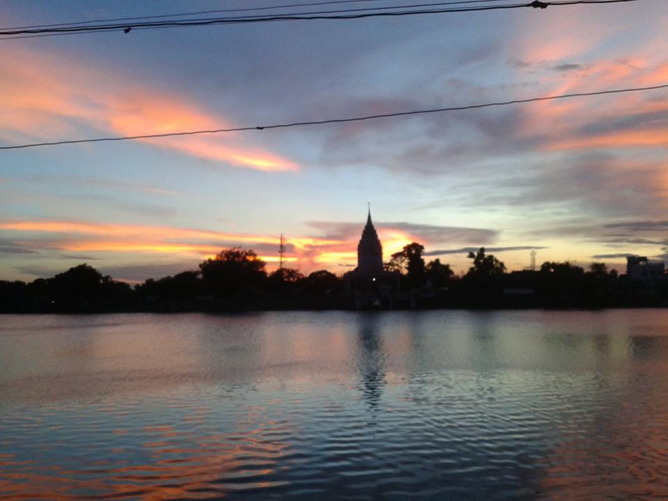


Why visit Bettiah
Townapedia lists 2 parks and trails, 1 place to eat and 2 places to stay in and around town.
Weather in Bettiah
Forecast from MET Norway (CC BY 4.0). Full forecast
About Bettiah
Bettiah is a city and the administrative headquarters of West Champaran district (Tirhut Division) in the Indian state of Bihar. It is near the Indo-Nepal border, 225 kilometres (140 mi) northwest of Patna.
From the Wikipedia article Bettiah (this version), under CC BY-SA 4.0.
Travel tips from other travellers: Bettiah on Wikivoyage (CC BY-SA 4.0).
Parks, trails and playgrounds2


Restaurants and cafes1

Rasoi Ki Rani (Queen of Kitchen)
Restaurant · Pizza, Indian, Coffee Shop · 0.9 km
123 sagar pokhra, bettiah
Mo-Su 09:00-21:00
Where to stay2

Churches and places of worship1

History
In 1244 A.D., Gangeshwar Dev, a Bhumihar of the Jaitharia clan, Now known as Bhumihar Brahmin. settled at Jaithar in Champaran. One of his descendants, Agar Sen, acquired large territories during the reign of Emperor Jahangir, and was bestowed the title of 'Raja' by Emperor Shah Jahan. In 1659, he was succeeded by his son Raja Gaj Singh, who built the palace of the family at Bettiah. He died in 1694 A.D. The palace stands today and is used as a marketplace.
In 1740, a Roman Catholic mission was founded in the city. On 7 December 1745 AD, Father Joseph Mary, Father Cassen, and Nepali Christian Michael arrived in Bettiah from Nepal. The King of Bettiah provided them with a house located in front of the royal court. This three-room house became the center of their activities. One room served as a clinic where free medicines were distributed to the general public, the second room was a Christian prayer house—a small church, and the third room was dedicated to providing religious education. From this modest setting, the propagation of Christianity began in Bettiah, laying the foundation for what would later become the presence of the Catholic Church in the northern Indian subcontinent, as well as the foundation of the Bettiah Christian community.
From the History section of Bettiah on Wikipedia, under CC BY-SA 4.0.
Shopping2
Gas and EV charging2
Schools, colleges and libraries3
Healthcare4
Map of Bettiah
17 places. The map loads OpenStreetMap tiles when you open it.
Getting there and nearby towns
Kushinagar International Airport (KBK) is the nearest airport with scheduled flights listed in OpenStreetMap, 61 km away.
- Hāt Saraiyā 2 km southwest, about 2 min by car
- Kargahiā Purab 3 km southeast, about 3 min by car
- Tola Mansārāut 4 km east, about 4 min by car
- Tola Rāmpurwā Motalke Kurwa Mathiā 7 km north, about 7 min by car
- Chanpatia 16 km north, about 16 min by car
- Sagauli 24 km east, about 24 min by car
- Narkatiāganj 34 km north, about 34 min by car
- Areraj 33 km southeast, about 33 min by car
- Mothīhāri 44 km southeast, about 44 min by car
- Siwān 66 km south, about 1 h by car
Drive times are estimates from straight-line distance, not routes.
Local news
Headlines from INDB.
Reviews, tips and questions
Loading what members have shared...
Sources and licences
- GeoNames (CC BY 4.0): population, coordinates, regions and time zone
- OpenStreetMap contributors (ODbL 1.0): places, airports, map data
- Wikidata (CC0 1.0): elevation, founding date, time zone, website
- Wikimedia Commons (see each image): photos
- Wikipedia (CC BY-SA 4.0): overview and history text
Photo credits
- Temple beside Sagar Pokhra at Dusk, Saurav9999, CC BY-SA 3.0
- Shiv Temple, Bettiah, Pathak.anshuman, CC BY-SA 4.0
- ISS023-E-15079 - View of Earth, Earth Science and Remote Sensing Unit , Lyndon B. Johnson Space Center, Public domain
- ISS054-E-62268 - View of Earth, Earth Science and Remote Sensing Unit, NASA Johnson Space Center, Public domain
- Mediawiki task showcasing, Adityakumar0545, CC BY-SA 4.0
Page built November 2, 2026. Spotted a mistake? Tell us or suggest a place.