


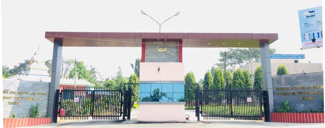

Why visit Bhadrāvati
Townapedia lists 1 museum or landmark, 10 places to eat and 2 places to stay in and around town.
Weather in Bhadrāvati
Forecast from MET Norway (CC BY 4.0). Full forecast
About Bhadrāvati
Bhadravati or Bhadrāvathi is an industrial city or Steel Town and taluk in the Shivamogga District of the Indian state of Karnataka. It is situated at a distance of about 255 kilometres (158 mi) from the state capital Bengaluru and at about 20 kilometres (12 mi) from the district headquarters, Shivamogga. The town is spread over an area of 67.0536 square kilometres (25.8895 sq mi) and has a population of 151,102 as per the census held in 2011.
From the Wikipedia article Bhadravati, Karnataka (this version), under CC BY-SA 4.0.
Travel tips from other travellers: Bhadrāvati on Wikivoyage (CC BY-SA 4.0).
Museums and landmarks1


Restaurants and cafes10

Where to stay2

Churches and places of worship12

Kotthamma Temple
Place of worship · Hindu · 6.8 km
near Honnavile road. Nandhi basaveshwar Lake Navile basavapura, Navile basavapura
Sathyamma Temple
Place of worship · Hindu · 6.7 km
3rd cross bhovi colony, Navile Basavapura
Shri Navile Basawesvara Temple
Place of worship · Hindu · 6.7 km
Navile basawesvara temple road, Navile Basavapura
History
Bhadravati derives its name from the Bhadra River which flows through the city. It was earlier known as Benkipura, which in English means "city of fire", and earlier Benki Pattana'. At some point in history, it was probably also known as Venkipura ('venki' means 'turn' in Sanksrit), as it is situated at the place where Bhadra river takes a 90 degree turn to the west, and then to the east. Hoysalas ruled the city. The Goddess "Haladammadevi & Antaragattammadevi" have guarded the city since past time. The sacred temples are still present in the city.
In 1413, Yerelakka nayaka (ಎರೆಲಕ್ಕನಾಯಕ) who was ruling the two cities called Dumma and Banuru (ದುಮ್ಮ, ಬಾಣೂರು), built two more cities, after clearing some of the wild forest, and named them, Narasimha Pura and Lakshmipura. Subsequently, these two cities became Benkipura or Venkipura and then Bhadravathi, as it is situated on the banks of Bhadra river.
Iron ore from the hill station of Kemmannugundi and water from the Bhadra River helped the establishment of an iron mill in 1918 Known as Mysore Iron and Steel Limited (MISL). Bhadravathi's reputation as an industrial town was further enhanced with the establishment of a paper manufacturing firm, the Mysore Paper Mills Limited in 1936.
From the History section of Bhadravati, Karnataka on Wikipedia, under CC BY-SA 4.0.
Gas and EV charging5
Schools, colleges and libraries3
Government primary and high School
School · 6.6 km
Navile basawesvara temple road, Navile Basavapura
Healthcare20
Map of Bhadrāvati
53 places. The map loads OpenStreetMap tiles when you open it.
Getting there and nearby towns
Shivamogga Airport (RQY) is the nearest airport with scheduled flights listed in OpenStreetMap, 9 km away.
- Shivamogga 17 km northwest, about 17 min by car
- Tarikere 19 km southeast, about 19 min by car
- Channagiri 31 km northeast, about 31 min by car
- Narasimharājapura 34 km southwest, about 34 min by car
- Ajjampur 35 km east, about 35 min by car
- Nyāmti 36 km northwest, about 36 min by car
- Birūr 40 km southeast, about 40 min by car
- Kumsi 40 km northwest, about 40 min by car
- Chikmagalūr 59 km south, about 59 min by car
- Davangere 73 km north, about 1 h 15 min by car
Drive times are estimates from straight-line distance, not routes.
Local news
Headlines from INDB.
Reviews, tips and questions
Loading what members have shared...
Sources and licences
- GeoNames (CC BY 4.0): population, coordinates, regions and time zone
- OpenStreetMap contributors (ODbL 1.0): places, airports, map data
- Wikidata (CC0 1.0): elevation, founding date, time zone, website
- Wikimedia Commons (see each image): photos
- Wikipedia (CC BY-SA 4.0): overview and history text
Photo credits
- Iron City, Manjeshpv, CC BY-SA 3.0
- Pond water flowing area, Appu__M_K, CC BY-SA 4.0
- Shimul, https://www.shimul.coop/, CC BY-SA 4.0
- Lakshminarasimha temple, Bhadravati Karnataka, Ms Sarah Welch, CC0
Page built November 2, 2026. Spotted a mistake? Tell us or suggest a place.