


Why visit Bikaner
Townapedia lists 20 museums and landmarks, 25 parks and trails, 41 places to eat, 26 places to stay and 9 attractions in and around town.
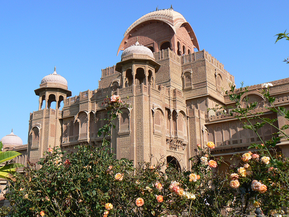
Highlights include Bhandasar Jain Temple, Dungar College, Rajasthan State Archives and Lallgarh Palace.
Weather in Bikaner
Forecast from MET Norway (CC BY 4.0). Full forecast
About Bikaner
Bikaner (IPA: [biːkaːneːɾ] ) is a city in the Indian state of Rajasthan. It is situated approximately 330 kilometres (205 mi) northwest of the state capital, Jaipur, in the Thar Desert region of western Rajasthan. Bikaner serves as the administrative headquarters of Bikaner District and Bikaner division. Formerly the capital of the princely Bikaner State, the city was founded in 1488 CE by Rao Bika, a Rajput chief of the Rathore dynasty.
From the Wikipedia article Bikaner (this version), under CC BY-SA 4.0.
Travel tips from other travellers: Bikaner on Wikivoyage (CC BY-SA 4.0).
Things to do9

Bhandasar Jain Temple
Monument and historic site · 2.0 km
Śvetāmbara Jain temple in Rajasthan, India

Swami Keshwanand Rajasthan Agricultural University
School · 7.1 km
State public university in Bikaner, Rajasthan, India
Veterinary College, Bikaner
School · 2.1 km
College of Rajasthan University of Veterinary and Animal Sciences

ICAR - National Camel Research Centre
Zoo and aquarium · 6.3 km
Apr-Sep 14:00-18:30, Oct-Mar 12:00-18:30

Carnival Cinema
Cinema and theater · 2.8 km
Rani bazar industrial area Road no 5, Bikaner
24/7
Museums and landmarks20

Rajasthan State Archives
Museum · 1.3 km
An archive located in Bikaner city of Rajasthan



8 more on the map.
Parks, trails and playgrounds25


13 more on the map.
Restaurants and cafes41

Sunder Restaurant & Mess Canteen
Restaurant · Burger, Sandwich, Noodle, Snacks · 4.9 km
ECB Campus Rd, Karni Industrial Area
Shri Shiv Sagar Restaurant
Restaurant · Italian Pizza, Diner, Asian, Italian, Thai, Coffee Shop, Curry, Ice Cream, Local, Chinese, Tea, Pizza, Cake, International, Breakfast, Indian
29 more on the map.
History
Prior to the mid 15th century, the region that is now Bikaner was a barren wilderness called Jangladesh.
Rao Bika established the city of Bikaner in 1488. He was the first son of Maharaja Rao Jodha of the Rathore clan, the founder of Jodhpur and conquered the largely arid country in the north of Rajasthan. As the first son of Jodha he wanted to have his own kingdom, not inheriting Jodhpur from his father or the title of Maharaja. He therefore decided to build his own kingdom in what is now the state of Bikaner, in the area of Jangladesh. Though it was in the Thar Desert, Bikaner was considered an oasis on the trade route between Central Asia and the Gujarat coast as it had adequate spring water. Bika's name was attached to the city he built and to the state of Bikaner ("the settlement of Bika") that he established. Bika built a fort in 1478, which is now in ruins, and a hundred years later a new fort was built about 1.5 km from the city centre, known as the Junagarh Fort.
From the History section of Bikaner on Wikipedia, under CC BY-SA 4.0.
Where to stay26
The Prince Haveli
Motel and hotel · 1.6 km
Mawa Paatti, Joshiwara, Old Bikaner, Bikaner, Rajasthan 334001, India
Churches and places of worship22
Guru Jasnath Ji Temple
Place of worship · Jasnathi · 4.5 km
Guru Jasnath Marg, Jasnathpura, Gangashahr
Shree Bajrang Dhora Dham Hanuman Temple
Place of worship · 6.3 km
Sharah Nathaniya, Bikaner
Shopping6
Gas and EV charging5
Schools, colleges and libraries19
Institute of Management Studies, B.J.S. Rampuria Jain College, Bikaner
School · 3.3 km
Healthcare73
Map of Bikaner
246 places. The map loads OpenStreetMap tiles when you open it.
Getting there and nearby towns
Bikaner Nal Air Force Station (BKB) is the nearest airport with scheduled flights listed in OpenStreetMap, 12 km away.
- Deshnoke 25 km south, about 25 min by car
- Napāsar 25 km east, about 25 min by car
- Kolāyat 40 km southwest, about 40 min by car
- Nokha 53 km south, about 53 min by car
- Jasrāsar 60 km southeast, about 1 h by car
- Sri Dūngargarh 69 km east, about 1 h 15 min by car
- 1 Arm (Surjanwali) 83 km north, about 1 h 30 min by car
- 4 Arm (Kharwali) 85 km north, about 1 h 30 min by car
Drive times are estimates from straight-line distance, not routes.
Local news
Headlines from INDB.
Reviews, tips and questions
Loading what members have shared...
Sources and licences
- GeoNames (CC BY 4.0): population, coordinates, regions and time zone
- OpenStreetMap contributors (ODbL 1.0): places, airports, map data
- Wikidata (CC0 1.0): elevation, founding date, time zone, website, landmarks and historic places
- Wikimedia Commons (see each image): photos
- Wikipedia (CC BY-SA 4.0): overview and history text
Photo credits
- Bikaner Junction Railway Station, Kishlay RF, CC BY-SA 4.0
- Bikaner Railways station, Kishlay RF, CC BY-SA 4.0
- Daal Bati at Bikaner, Deepak Giri, CC BY-SA 4.0
- Bikaner Junction, Kishlay RF, CC BY-SA 4.0
- Bikaner Jn, Kishlay RF, CC BY-SA 4.0
- Inde Bikaner Vieille Ville Marche 28022015 - panoramio, rene boulay, CC BY-SA 3.0
- Bikaner Junction station, Kishlay RF, CC BY-SA 4.0
- 20191212 Shardul Singh Statue, Bikaner 1553 8248, Jakub Hałun, CC BY-SA 4.0
- Bikaner Railway Station, Rajasthan, Bharat, Amitbalani, CC0
- Bikaner, Junagarh (6272113088), Arian Zwegers, CC BY 2.0
- Le fort Junagarh (Bikaner) (8444850773), Jean-Pierre Dalbéra from Paris, France, CC BY 2.0
- Le fort Junagarh (Bikaner) (8442396226), Jean-Pierre Dalbéra from Paris, France, CC BY 2.0
- Le fort Junagarh (Bikaner) (8441314623), Jean-Pierre Dalbéra from Paris, France, CC BY 2.0
- Le fort Junagarh (Bikaner) (8441311127), Jean-Pierre Dalbéra from Paris, France, CC BY 2.0
- Le fort Junagarh (Bikaner) (8441312717), Jean-Pierre Dalbéra from Paris, France, CC BY 2.0
- Le fort Junagarh (Bikaner) (8442399734), Jean-Pierre Dalbéra from Paris, France, CC BY 2.0
- Le fort Junagarh (Bikaner) (8442397940), Jean-Pierre Dalbéra from Paris, France, CC BY 2.0
- Le fort Junagarh (Bikaner) (8442404276), Jean-Pierre Dalbéra from Paris, France, CC BY 2.0
- Le fort Junagarh (Bikaner) (8442407866), Jean-Pierre Dalbéra from Paris, France, CC BY 2.0
- Le fort Junagarh (Bikaner) (8441318179), Jean-Pierre Dalbéra from Paris, France, CC BY 2.0
- Le fort Junagarh (Bikaner) (8441306431), Jean-Pierre Dalbéra from Paris, France, CC BY 2.0
- Le fort Junagarh (Bikaner) (8442398440), Jean-Pierre Dalbéra from Paris, France, CC BY 2.0
- Le fort Junagarh (Bikaner) (8442400248), Jean-Pierre Dalbéra from Paris, France, CC BY 2.0
- Le fort Junagarh (Bikaner) (8442407288), Jean-Pierre Dalbéra from Paris, France, CC BY 2.0
- Le fort Junagarh (Bikaner) (8442398888), Jean-Pierre Dalbéra from Paris, France, CC BY 2.0
- Le fort Junagarh (Bikaner) (8442405130), Jean-Pierre Dalbéra from Paris, France, CC BY 2.0
- Salle daudience dans le fort Junagarh (Bikaner, Inde) (8385741095) (2), dalbera from Paris, France, CC BY 2.0
- Le fort Junagarh (Bikaner) (8442401204), Jean-Pierre Dalbéra from Paris, France, CC BY 2.0
- Le fort Junagarh (Bikaner) (8441306001), Jean-Pierre Dalbéra from Paris, France, CC BY 2.0
- Le fort Junagarh (Bikaner) (8442408522), Jean-Pierre Dalbéra from Paris, France, CC BY 2.0
- Le fort Junagarh (Bikaner) (8441318779), Jean-Pierre Dalbéra from Paris, France, CC BY 2.0
- Le fort Junagarh (Bikaner) (8441315235), Jean-Pierre Dalbéra from Paris, France, CC BY 2.0
- Lalgarh palace bikaner2, Madelon van de Water Noledam, CC BY-SA 3.0
- Bhanda Shah JainTemple, Yash Khajanchi, CC BY-SA 3.0
- Bhandasar Jain temple exterior - 1, Vivek B Govindaraju, CC BY-SA 4.0
- The Laxmi Niwas Palace, Bikaner, Rajasthan, DevUbc, CC BY-SA 4.0
- India Bikaner Junagarh Fort, user:Flicka, CC BY-SA 3.0
- Sankhla's kesher kulfi shop...... - panoramio, 999yeeshu, CC BY-SA 3.0
- Iphone 11 promax, Yash vardhan singh bhati, CC BY-SA 4.0
- Friends cheers, Amitnotfound, CC BY-SA 4.0


Page built November 2, 2026. Spotted a mistake? Tell us or suggest a place.