


Chennai, India
Chennai is a regional capital of 4,681,087 people in Tamil Nadu, India, founded in 1639.
Why visit Chennai
Townapedia lists 42 museums and landmarks, 26 parks and trails, 216 places to eat, 56 places to stay and 30 attractions in and around town.
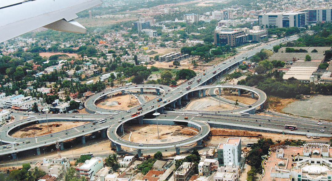
Highlights include Anna Flyover, Anna University, Victory War Memorial and Ambedkar Manimandapam, Chennai.
Weather in Chennai
Forecast from MET Norway (CC BY 4.0). Full forecast
About Chennai
Chennai, also known as Madras, is the capital and largest city of Tamil Nadu, the southernmost state of India. It is located on the Coromandel Coast of the Bay of Bengal. As per the 2011 Indian census, Chennai is the sixth-most-populous city in India and forms the fourth-most-populous urban agglomeration. The city is coterminous with Chennai district, which together with the adjoining suburbs constitutes the Chennai Metropolitan Area, one of the largest metropolitan areas of India.
From the Wikipedia article Chennai (this version), under CC BY-SA 4.0.
Travel tips from other travellers: Chennai on Wikivoyage (CC BY-SA 4.0).
Things to do30


Anna University
School · 9.5 km
State-run university in Guindy, Tamil Nadu


Central Polytechnic Chennai
School · 10.3 km
Government polytechnic college in Chennai, Tamil Nadu, India



Elphinstone Bridge, Chennai
Bridge · 8.6 km
Built in 19th century, the Elphinstone Bridge enabled crucial access across the Adyar River & spurred southern Madras’ growth. Though...

Indian Institute of Technology Madras
School · 11.7 km
Autonomous public engineering and research institution located in Chennai, Tamil Nadu

18 more on the map.
Museums and landmarks42

Victory War Memorial
Monument and historic site · 1.8 km
Memorial in Chennai, India

Ambedkar Manimandapam, Chennai
Monument and historic site · 7.7 km
Monument in Chennai

Anna Memorial
Monument and historic site · 2.6 km
Memorial in Chennai, India

Birla Planetarium
Museum · 9.2 km
Planetarium museum in Chennai, India.

Fort St. George
Monument and historic site · 1.1 km
The first British fortress built in India, established in 1644, with a museum & 17th-century church.
Rajaji Salai, Chennai

Government Museum, Chennai
Museum · 3.0 km
Museum of human history and culture in India

Karl Schmidt Memorial
Monument and historic site · 9.9 km
Monument in Chennai, India

MGR and Jayalalitha Memorial
Monument and historic site · 2.7 km
Memorial complex in Chennai, Tamil Nadu, India

National Art Gallery, Chennai
Museum · 3.2 km
Museum in Chennai, India

Ramanujan Math Park
Museum · 3.1 km
Indian museum and activity center

Sivaji Ganesan Memorial
Monument and historic site · 8.2 km
Memorial for Sivaji Ganesan in Chennai, India

Tamil Nadu Police Museum
Museum · 2.3 km
Police history museum in Chennai, Tamil Nadu, India
30 more on the map.
Parks, trails and playgrounds26

Anna Nagar Tower Park
Park · 6.9 km
Urban park in the suburb of Anna Nagar, Chennai





Panagal Park
Park · 7.1 km
Park and locality in Thyagaraya Nagar, Chennai
People's Park, Chennai
Park · 1.7 km
Recreational park in the city of Chennai, India


Perambur Flyover Park
Park · 4.5 km
Murasoli Maran Flyover Park, in Perambur, in Chennai, in Tamil Nadu, in India.
14 more on the map.
Restaurants and cafes216



204 more on the map.
History
Stone Age implements have been found near Pallavaram in Chennai, and according to the Archaeological Survey of India, Pallavaram was a megalithic cultural establishment, with evidence of pre-historic settlements. The region around Chennai was an important administrative, military, and economic centre for many centuries. During the 1st century CE, Tamil poet Thiruvalluvar lived in the town of Mylapore, a neighbourhood of present-day Chennai. In the 2nd century CE, the region was part of Tondaimandalam ruled by the Early Cholas, who subdued the Kurumbas, the original inhabitants of the region. The Pallavas of Kanchi became the independent rulers of the region from 3rd to 9th century CE, and the areas of Mahabalipuram and Pallavaram were developed during the reign of Pallava king Mahendravarman I. In 879 CE, the Pallavas were defeated by the Later Cholas led by Aditya I. Jatavarman Sundara Pandyan later brought the region under the Pandya rule in 1264 CE. The region came under the influence of the Vijayanagara Empire in the 15th century CE.
From the History section of Chennai on Wikipedia, under CC BY-SA 4.0.
Where to stay56
Churches and places of worship88
Shopping57
Gas and EV charging3
Schools, colleges and libraries55
District Branch Library, Choolai
Library · 1.6 km
3 Chockkavel Subramanian Koil Street, Choolai, Chennai
St. Mary's Anglo-Indian Higher Secondary School
School · Catholic · 1.0 km
110 Armenian Street, Chennai
Healthcare84
The Arya Vysya Meternity Home and Child Welfare Centre
Hospital
Govindappa Naicken Street
Map of Chennai
250 places. The map loads OpenStreetMap tiles when you open it.
Getting there and nearby towns
Chennai International Airport (MAA) is the nearest airport with scheduled flights listed in OpenStreetMap, 16 km away.
- Tiruvottiyūr 8 km north, about 8 min by car
- Nerkunram 8 km west, about 8 min by car
- Madhavaram 8 km northwest, about 8 min by car
- Chinnasekkadu 8 km north, about 8 min by car
- Manali 9 km north, about 9 min by car
- Mathur 10 km north, about 10 min by car
- Kattrivedu 10 km northwest, about 10 min by car
- Puzhal 12 km northwest, about 12 min by car
- Ambattur 13 km west, about 13 min by car
- Ramapuram 12 km southwest, about 12 min by car
Drive times are estimates from straight-line distance, not routes.
Local news
Headlines from INDB.
Reviews, tips and questions
Loading what members have shared...
Sources and licences
- GeoNames (CC BY 4.0): population, coordinates, regions and time zone
- OpenStreetMap contributors (ODbL 1.0): places, airports, map data
- Wikidata (CC0 1.0): elevation, founding date, time zone, website, landmarks and historic places
- Wikimedia Commons (see each image): photos
- Wikipedia (CC BY-SA 4.0): overview and history text
Photo credits
- Ripon Building aerial view, Saiphani02, CC BY-SA 4.0
- Chennai Ekambareswarar Kovil, Rsmn, CC BY 4.0
- Annadurai statue, Srinath1905, CC BY-SA 3.0
- Adyar Broken Bridge, Kartnutmegs, CC BY-SA 4.0
- Elphinstone Bridge as seen from Thiru vi ka road, DevikaJRK, CC BY-SA 4.0
- IITMmensa, Mzwirlein, CC0
- Kathipara, Guru coolguy ( talk ), Public domain
- Chennai Victory War Memorial, This Image was created by User:PlaneMad . If you are using the image under the creative commons share alike license please credit the photo CC-by-sa PlaneMad/Wikimedia and include a link to this..., CC BY-SA 2.5
- Ambedkar Manimandapam, Irfanahmed605, CC BY-SA 4.0
- AnnaMemorial FullView, Rasnaboy, CC BY-SA 3.0
- Periyar Science and Technology Centre and Birla Planetarium, Chennai 46, Sivahari, CC BY-SA 4.0
- Madras museum theatre in October 2007, L.vivian.richard at English Wikipedia, Public domain
- Karl Schmidt Memorial at Elliots Beach, Chennai, India, Salemjones, CC BY-SA 4.0
- Jayalalitha Memorial, Bhagya sri113, CC BY-SA 4.0
- Chennai National Art Gallery, slasha, CC BY 2.0
- TN Police museum 41, Balajijagadesh, CC BY 3.0
- Annanagar Tower, Acvasagam, CC BY-SA 3.0
- AnnieBesantPark Triplicane Chennai, Rasnaboy, CC BY-SA 3.0
- Elliots Beach at Besant Nagar, Chennai, KARTY JazZ, CC BY-SA 4.0
- Guindy national park, abhidg, CC BY 2.0
- Dr Natesan, User:Commons_sibi, CC BY-SA 3.0
- Panagal Park, Balajijagadesh, CC BY-SA 3.0
- St. Mary's Co-cathedral Church, Chennai, Tamil Nadu, in India, Helppublic, CC BY-SA 4.0
- Anderson Church, Chennai, L.vivian.richard, CC BY-SA 3.0
- Armenian Church Madras, Svs99n, CC BY-SA 3.0
- Luz church, Chennai, Simply CVR, CC BY 2.0
- Mizpah, Mizpah Church, CC BY-SA 4.0
- Santhome Basilica, w:user:PlaneMad, CC BY-SA 2.5
- St Andrews Church - The Kirk, This Image was created by User:PlaneMad . If you are using the image under the creative commons share alike license please credit the photo CC-by-sa PlaneMad/Wikimedia and include a link to this..., CC BY-SA 3.0
- Fort St. George, Chennai 2, L.vivian.richard at English Wikipedia, Public domain
- Govt Fine Arts College Madras, Chandrachoodan Gopalakrishnan, CC BY-SA 3.0
- Inside madras law college old building, Sep 2013, Darkxblade1, CC BY-SA 3.0
- Rajiv Gandhi Government General Hospital in Chennai, IM3847, CC BY-SA 4.0
- Madras Veterinary College, சத்திரத்தான், CC BY-SA 4.0
- Mmc-new, சத்திரத்தான், CC BY-SA 4.0
- Gemini Flyover-Mount road-Chennai, Gsnewid, CC BY-SA 3.0
- GovernmentHospitalChennai, No machine-readable author provided. SwiftRakesh assumed (based on copyright claims)., CC BY-SA 3.0
- Kodambakkam overbridge, L.vivian.richard, Public domain
- Guruswami Mudaliar bridge, Scintillatingstuffs, CC BY-SA 3.0
- Perambur Flyover Park (Murasoli Maran Flyover Park) Chennai Tamil Nadu India, Helppublic, CC BY-SA 4.0
- Besant Nagar Basilica, Ronherry, CC0
- View from Chennai Lighthouse, Dprzvhar, CC BY-SA 4.0


Page built November 2, 2026. Spotted a mistake? Tell us or suggest a place.