


Why visit Cherrapunjee
Townapedia lists 1 museum or landmark and 11 attractions in and around town.
Highlights include Ka Likai and Nohkalikai Falls.
Weather in Cherrapunjee
Forecast from MET Norway (CC BY 4.0). Full forecast
About Cherrapunjee
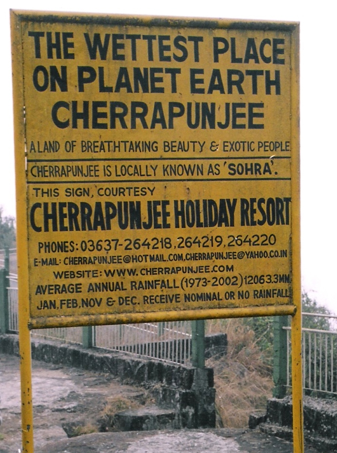
Cherrapunji, also known as Sohra, is a sub-divisional town (Proposed District) in the East Khasi Hills district in the Indian state of Meghalaya. It was the traditional capital of ka hima Sohra (Khasi tribal kingdom).
From the Wikipedia article Cherrapunji (this version), under CC BY-SA 4.0.
Travel tips from other travellers: Cherrapunjee on Wikivoyage (CC BY-SA 4.0).
Things to do11





Museums and landmarks1

Map of Cherrapunjee
12 places. The map loads OpenStreetMap tiles when you open it.
Getting there and nearby towns
Shillong Airport (SHL) is the nearest airport with scheduled flights listed in OpenStreetMap, 53 km away.
- Shella 15 km southwest, about 15 min by car
- Chhātak 29 km south, about 29 min by car
- Mairang 30 km north, about 30 min by car
- Nongumlong 32 km northeast, about 32 min by car
- Shillong 35 km northeast, about 35 min by car
- Nongthymmai 36 km northeast, about 36 min by car
- Laitumkhrah 36 km northeast, about 36 min by car
- Sunāmganj 39 km southwest, about 39 min by car
- Mawlai-Mawïong 40 km northeast, about 40 min by car
- Sylhet 48 km south, about 48 min by car
Drive times are estimates from straight-line distance, not routes.
Local news
Headlines from INDB.
Reviews, tips and questions
Loading what members have shared...
Sources and licences
- GeoNames (CC BY 4.0): population, coordinates, regions and time zone
- OpenStreetMap contributors (ODbL 1.0): places, airports, map data
- Wikidata (CC0 1.0): elevation, founding date, time zone, website, landmarks and historic places
- Wikimedia Commons (see each image): photos
- Wikipedia (CC BY-SA 4.0): overview and history text
Photo credits
- Cherrapunji, No machine-readable author provided. RMehra~commonswiki assumed (based on copyright claims)., CC BY-SA 3.0
- Cherrapunjee Landscape, Meghalaya, Ashwin Kumar, CC BY-SA 2.0
- Cherrapunjee Landscape (7344206740), Ashwin Kumar from Bangalore, India, CC BY-SA 2.0
- Cherrapunjee Landscape (7344206642), Ashwin Kumar from Bangalore, India, CC BY-SA 2.0
- Nohkalikai fall, Sohel78bd at en.wikipedia, CC BY-SA 3.0
- Wah Kaba falls 01, Hkaay, CC BY-SA 4.0
- NohKaLikai Falls V2 Wiki, Vikramjit Kakati, CC BY-SA 4.0
- Wei Sawdong Waterfall 3, Shreekanth Ramasamy, CC0
- Close wing position of Lethe confusa Aurivillius, 1898 – Banded Treebrown WLB, Gayatri_dutta, CC BY 4.0
- Caterpillar of Cirrochroa tyche (C. & R.Felder,1861)-Common Yeoman, Atanu Bose Photography, CC BY-SA 4.0
- Pupa of Cirrochroa tyche (C. & R. Felder,1861)- Common Yeoman, Atanu Bose Photography, CC BY-SA 4.0
- Pupa of Cirrochroa tyche (C. & R. Felder, 1861) - Common Yeoman, Atanu Bose Photography, CC BY-SA 4.0
- Close wing position of Faunis eumeus Drury, 1773 – Large Faun, Subhendukhan, CC BY-SA 4.0
- Open wing position of Heliophorus brahma Moore, 1857 – Golden Sapphire, Gayatri_dutta, CC BY 4.0
- Close wing Nectaring activity of Pieris melete (Ménétriés, 1857) - Asian Green-veined White, Atanu Bose Photography, CC BY-SA 4.0
- Close wing Mud puddling activity of Symbrenthia hypselis (Godart,1824) – Spotted Jester (Male), Atanu Bose Photography, CC BY-SA 4.0
- Close wing basking position of Neope bhadra (Moore,1858) – Tailed Labyrinth, Atanu Bose Photography, CC BY-SA 4.0
- Close wing puddling position of Meandrusa payeni (Boisduval, 1836) - Yellow Gorgon, Atanu Bose Photography, CC BY-SA 4.0
- Close wing resting position of Mycalesis visala Moore, 1858 - Long-branded Bushbrown WLB, Das Sampurna, CC BY-SA 4.0
- ISS053-E-165348 - View of Earth, Earth Science and Remote Sensing Unit , Lyndon B. Johnson Space Center, Public domain
- Open wing basking position of Junonia orithya (Linnaeus, 1758) - Blue Pansy (Female) WLB, Atanu Bose Photography, CC BY-SA 4.0
- Caterpillar of Cirrochroa tyche (C. & R. Felder,1861)- Common Yeoman, Atanu Bose Photography, CC BY-SA 4.0
- Close wing Basking posture of Hypolycaena erylus (Godart, 1824) - Common Tit WLB, Das Sampurna, CC BY-SA 4.0
- Open wing basking position of Euripus nyctelius (Doubleday, 1845) – Courtesan, Atanu Bose Photography, CC BY-SA 4.0
- Close wing position of Halpe filda (Evans,1949) – Absent Ace (Male), Atanu Bose Photography, CC BY-SA 4.0
- Close wing Mudpuddling position of Atrophaneura varuna (White, 1842) – Common Batwing (Male), Atanu Bose Photography, CC BY-SA 4.0
- Close wing Mud puddling position of Lamproptera curius (Fabricius,1787) – White Dragontail, Atanu Bose Photography, CC BY-SA 4.0
- Close wing basking of Cethosia cyane (Drury, 1773) - Leopard Lacewing WLB, Das Sampurna, CC BY-SA 4.0
- Open wing position of Satarupa gopala (Moore,1866) - Large White Flat, Atanu Bose Photography, CC BY-SA 4.0
- Close wing position of Faunis eumeus Drury, 1773 – Large Faun 2, Gayatri_dutta, CC BY 4.0
- Close wing basking position of Faunis eumeus (Drury,1773) – Large Faun, Atanu Bose Photography, CC BY-SA 4.0
- Close wing puddling of Stichophthalma camadeva (Westwood, 1848) - Northern Junglequeen WLB, Das Sampurna, CC BY-SA 4.0
- Close wing basking position of Orinoma damaris (Gray,1846) – Tigerbrown (Male), Atanu Bose Photography, CC BY-SA 4.0
- Open wing basking position of Athyma selenophora (Kollar,1844) – Staff Sergeant (Male), Atanu Bose Photography, CC BY-SA 4.0
- ISS053-E-152615 - View of Earth, Earth Science and Remote Sensing Unit , Lyndon B. Johnson Space Center, Public domain
- Lyngksiar route in Sohra Meghalaya, Chirag1745, CC0
- Wei Sawdong Waterfall 2, Shreekanth Ramasamy, CC0
- Lyngksiar, Sohra, India, Chirag1745, CC0
- Wei Sawdong Waterfall 1, Shreekanth Ramasamy, CC0
- View from Mawkdok Dympep Valley View Point, Cherrapunji, Meghalaya, India in April 2017, BroKholi94, CC BY-SA 4.0
- Janailar in Cherrapunji India, Chirag1745, CC0


Page built November 3, 2026. Spotted a mistake? Tell us or suggest a place.