

Why visit Dīg
Townapedia lists 1 museum or landmark in and around town.
Weather in Dīg
Forecast from MET Norway (CC BY 4.0). Full forecast
About Dīg
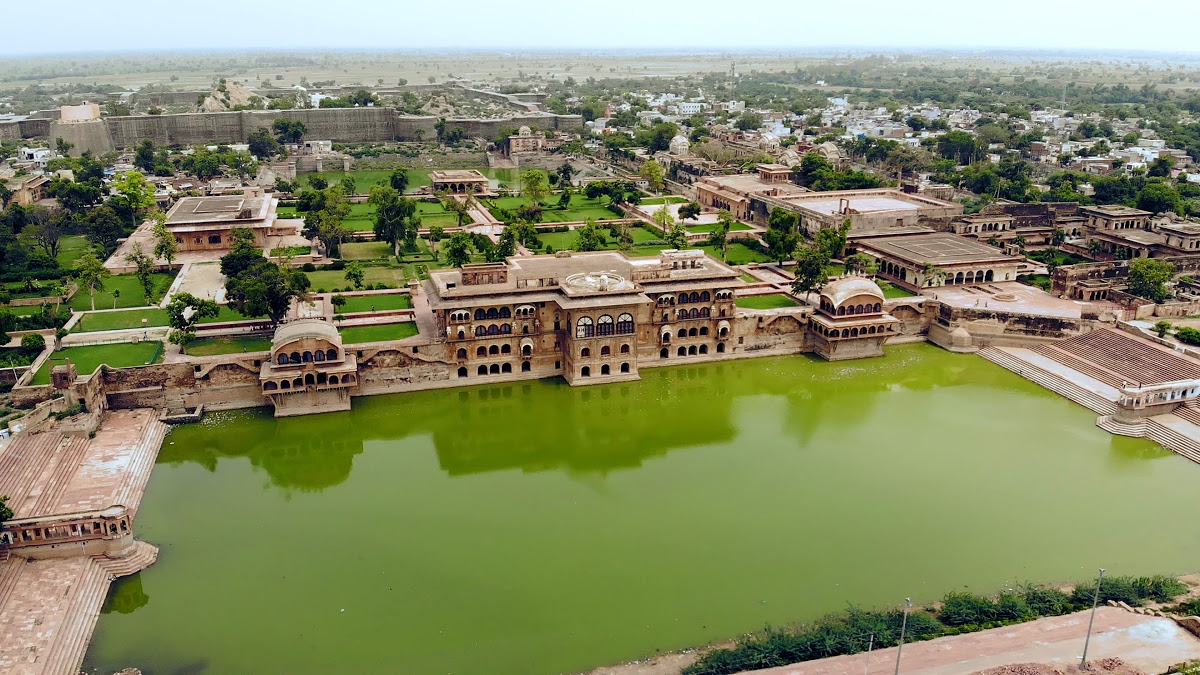
Deeg is a historical city in the Deeg district of the Indian state of eastern Rajasthan. It is renowned for its architectural heritage, including palaces, forts, gardens, and fountains. Historically, Deeg became the first capital of the Hindu Jats of Bharatpur. It played a significant role in the region's political and cultural development due to its proximity to Agra.
From the Wikipedia article Deeg (this version), under CC BY-SA 4.0.
Travel tips from other travellers: Dīg on Wikivoyage (CC BY-SA 4.0).
Museums and landmarks1

Churches and places of worship1

History
After acquiring the throne, Jat ruler Maharaja Badan Singh chose Deeg as the place for his stronghold and capital. Hence, he initiated the construction of the Deeg Palace here. Being the capital of the Jat rulers and located at a distance of just about 32 km from Bharatpur, his palace served as a summer mansion for the royal family. He became the founder of the Jat House in Bharatpur and under his reign, Deeg gained immense prosperity and urbanisation. In fact, Maharaja Suraj Mal, son of Badan Singh, is often considered a role model for modern Jats. Owing to its great location, architectural beauty and grandeur, the palace caught the attention of many contemporary empires and states. Deeg was almost constantly under the threat of a Mughal invasion. Hence, in order to protect the Deeg Palace, Maharaja Suraj Mal ordered the construction of a fortress around the palace.
During 1804, both the Battle of Deeg and the Siege of Deeg brought the British East India Company into conflict with Bharatpur's Jat rulers and their Maratha allies for control of the area.
From the History section of Deeg on Wikipedia, under CC BY-SA 4.0.
Map of Dīg
2 places. The map loads OpenStreetMap tiles when you open it.
Getting there and nearby towns
Agra Airport (AGR) is the nearest airport with scheduled flights listed in OpenStreetMap, 71 km away.
- Govardhan 14 km east, about 14 min by car
- Kūmher 18 km south, about 18 min by car
- Rādhākund 17 km east, about 17 min by car
- Kāman 21 km north, about 21 min by car
- Barsāna 20 km north, about 20 min by car
- Nagar 23 km west, about 23 min by car
- Nandgaon 27 km north, about 27 min by car
- Mathura 34 km east, about 34 min by car
- Agra 75 km southeast, about 1 h 15 min by car
- Alīgarh 87 km northeast, about 1 h 30 min by car
Drive times are estimates from straight-line distance, not routes.
Local news
Headlines from INDB.
Reviews, tips and questions
Loading what members have shared...
Sources and licences
- GeoNames (CC BY 4.0): population, coordinates, regions and time zone
- OpenStreetMap contributors (ODbL 1.0): places, airports, map data
- Wikidata (CC0 1.0): elevation, founding date, time zone, website
- Wikimedia Commons (see each image): photos
- Wikipedia (CC BY-SA 4.0): overview and history text
Photo credits
- Drone shot of deeg palace, Sainiikshank1410, CC BY-SA 4.0
Page built November 3, 2026. Spotted a mistake? Tell us or suggest a place.