


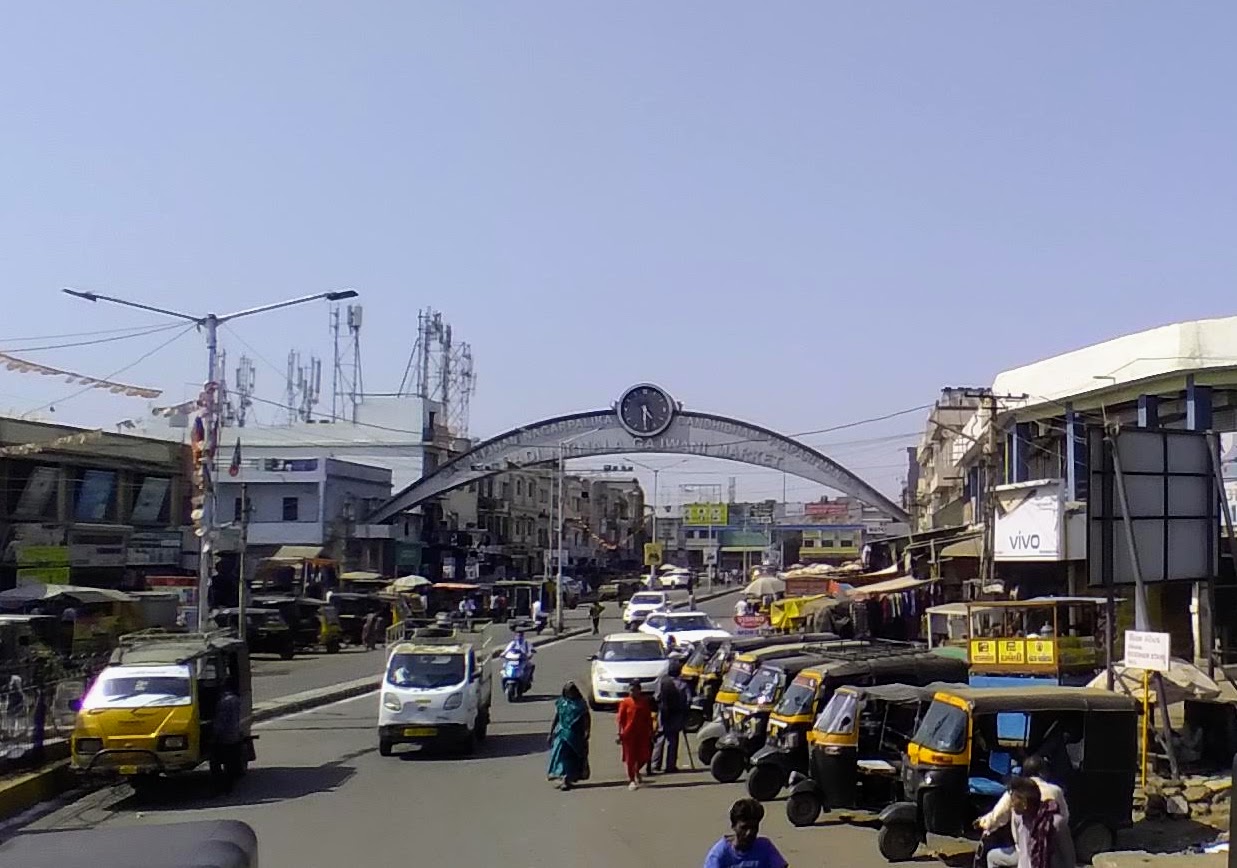


Why visit Gāndhīdhām
Townapedia lists 1 park or trail, 1 place to eat, 1 place to stay and 1 attraction in and around town.
Weather in Gāndhīdhām
Forecast from MET Norway (CC BY 4.0). Full forecast
About Gāndhīdhām
Gandhidham is located in the eastern part of Kutch district, in the state of Gujarat. It is the largest and most populous city in (Kachchh) Kutch District, Gujarat, India. It was created in the early 1950s for the resettlement of Sindhi Hindu refugees from Sindh, Pakistan, in the aftermath of the partition of India. The city was named after M K Gandhi.
From the Wikipedia article Gandhidham (this version), under CC BY-SA 4.0.
Travel tips from other travellers: Gāndhīdhām on Wikivoyage (CC BY-SA 4.0).
Things to do1

Parks, trails and playgrounds1

Restaurants and cafes1

Where to stay1

History
Soon after the Partition of India, in 1947, a large group of Sindhi Hindus refugees from Sindh of Pakistan migrated to India. The maharaja of Kutch Vijayaraji donated 15,000 acres (61 km2) of land to Bhai Pratap, who founded the Sindhu Resettlement Corporation Ltd. (SRC) to rehabilitate Sindhi Hindus that migrated from Sindh in Pakistan.
The Sindhu Resettlement Corporation Ltd was formed with Acharya Kriplani as chairman and Bhai Pratap Dialdas as managing director. The corporation's primary goal was to help displaced people find new dwellings by building a new township. The original plan was prepared by a team of planners headed by Otto H. Königsberger, director of the division of housing in the Government of India. Later, the plan was revised by Adams, Howard and Greeley Company in 1952. The foundation stone of the town was laid with the blessings of Mahatma Gandhi in 1947. Hence, the town was named Gandhidham. To clean the desert where it was built, Pratap gave an incentive of 25 paise to kill scorpions and 50 paise to kill snakes. The original plan envisaged 400,000 as of the ultimate population of the town, expecting half of it to be reached in the mid-1970s. A revised plan envisaged three stages of town development with the mid-stage lasting longer with a population of around 150,000.
From the History section of Gandhidham on Wikipedia, under CC BY-SA 4.0.
Churches and places of worship4
Shopping3
Schools, colleges and libraries1
Healthcare62
Map of Gāndhīdhām
74 places. The map loads OpenStreetMap tiles when you open it.
Getting there and nearby towns
Kandla Airport (IXY) is the nearest airport with scheduled flights listed in OpenStreetMap, 5 km away.
- Galpadar 2 km northwest, about 2 min by car
- Antarjal 6 km southwest, about 6 min by car
- Kāndla 10 km southeast, about 10 min by car
- Anjār 11 km west, about 11 min by car
- Bhachāu 32 km northeast, about 32 min by car
- Jodiya Bandar 44 km south, about 44 min by car
- Madhapar 48 km west, about 48 min by car
- Mundra 50 km southwest, about 50 min by car
- Bhuj 51 km west, about 51 min by car
- Jamnagar 68 km south, about 1 h 15 min by car
Drive times are estimates from straight-line distance, not routes.
Local news
Headlines from INDB.
Reviews, tips and questions
Loading what members have shared...
Sources and licences
- GeoNames (CC BY 4.0): population, coordinates, regions and time zone
- OpenStreetMap contributors (ODbL 1.0): places, airports, map data
- Wikidata (CC0 1.0): elevation, founding date, time zone, website
- Wikimedia Commons (see each image): photos
- Wikipedia (CC BY-SA 4.0): overview and history text
Photo credits
- Gandhidham Junction stationboard, Superfast1111, CC BY-SA 3.0
- Me and my friend, Bansuriwala Raman, CC BY-SA 4.0
- Gandhidham Gate, Vijay8808, CC BY-SA 4.0
- Tagore Road, Vijay8808, CC BY-SA 4.0
- SRI GURUNANAK DEV JI MARG, Vijay8808, CC BY-SA 4.0
Page built November 2, 2026. Spotted a mistake? Tell us or suggest a place.