


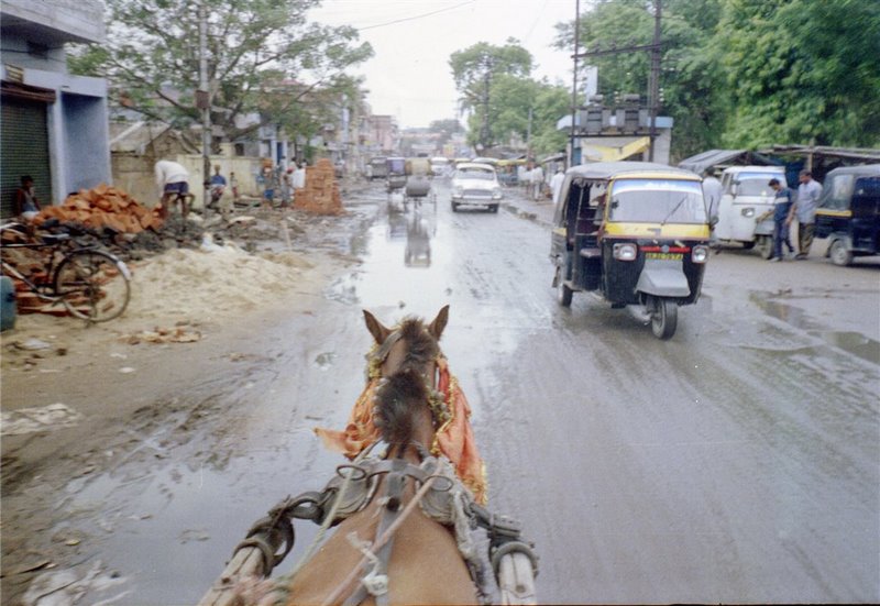


Why visit Gaya
Townapedia lists 3 museums and landmarks, 19 parks and trails, 22 places to eat, 4 places to stay and 5 attractions in and around town.
Highlights include Gaya College and Gandhi Maidan.
Weather in Gaya
Forecast from MET Norway (CC BY 4.0). Full forecast
About Gaya
Gaya (IAST: Gayā) is a city, municipal corporation and the administrative headquarters of Gaya district and Magadh division of the Indian state of Bihar. Gaya is 116 kilometres (72 mi) south of Patna and is the state's second-largest city, with a population of 470,839. The city is surrounded on three sides by small, rocky hills (Mangla-Gauri, Shringa-Sthan, Ram-Shila, and Brahmayoni), with the Phalgu River on its eastern side.
From the Wikipedia article Gaya, India (this version), under CC BY-SA 4.0.
Travel tips from other travellers: Gaya on Wikivoyage (CC BY-SA 4.0).
Things to do5




Museums and landmarks3

Parks, trails and playgrounds19


7 more on the map.
Restaurants and cafes22



10 more on the map.
Where to stay4
Shree Ram SIA Residency (Hotel and Banquets)
Motel and hotel · 0.8 km
1 Pitamaheshwar, Rina Mandal Road, Gaya
Churches and places of worship47
Shopping10
Gas and EV charging1
Schools, colleges and libraries22
Healthcare32
Map of Gaya
165 places. The map loads OpenStreetMap tiles when you open it.
Getting there and nearby towns
Gaya International Airport (GAY) is the nearest airport with scheduled flights listed in OpenStreetMap, 8 km away.
- Pahārpur 6 km southwest, about 6 min by car
- Bodh Gaya 11 km south, about 11 min by car
- Lāu 21 km northwest, about 21 min by car
- Bāra 22 km west, about 22 min by car
- Tekāri 23 km northwest, about 23 min by car
- Men 28 km northwest, about 28 min by car
- Bagaha 30 km south, about 30 min by car
- Makhdumpur 30 km north, about 30 min by car
- Sherghāti 34 km southwest, about 34 min by car
- Patna 90 km north, about 1 h 30 min by car
Drive times are estimates from straight-line distance, not routes.
Local news
Headlines from INDB.
Reviews, tips and questions
Loading what members have shared...
Sources and licences
- GeoNames (CC BY 4.0): population, coordinates, regions and time zone
- OpenStreetMap contributors (ODbL 1.0): places, airports, map data
- Wikidata (CC0 1.0): elevation, founding date, time zone, website, landmarks and historic places
- Wikimedia Commons (see each image): photos
- Wikipedia (CC BY-SA 4.0): overview and history text
Photo credits
- Vishnupad Temple, Keymaker31, CC BY-SA 3.0
- Ancient idol of Adinath Bhagwan (Rishabhanatha), the first Tirthankar of Jainism, located in Gaya, Bihar., Hiten Jain (Glory of Jainism), CC BY-SA 4.0
- Chatta Masjid Gaya, Derivator2017, CC BY-SA 4.0
- Gaya - panoramio, yamarhythm, CC BY 3.0
- Howrah Rajdhani at Gaya Junction, Theharryy, CC BY-SA 4.0
- Gaya Junction railway station 3, Gannu03, CC BY-SA 4.0
- Gaya Junction railway station 2, Gannu03, CC BY-SA 4.0
- Rubber Dam Gaya Ji on the Phalgu River at Night – Illuminated Bridge, Ayush Raj, CC BY-SA 4.0
- Sudha Milk Parlour in Gaya, Bihar (33614736712) (cropped), juggadery, CC BY-SA 2.0
- Dodha Burfi – Punjabi Milk Fudge 2 (32545969456), juggadery, CC BY-SA 2.0
- Dodha Burfi – Punjabi Milk Fudge 1 (31742858114), juggadery, CC BY-SA 2.0
- Bihar MLA Shri Virendra Singh with ex VC of JPU Saran Dr. Lakshmi Narayan Singh, Bhanunarayan20, CC BY 4.0
- Peda Sweet from Bihar, Gannu03, CC BY-SA 4.0
- Kachori from Bihar, Gannu03, CC BY-SA 4.0
- Kachori from Bihar 2, Gannu03, CC BY-SA 4.0
- Streets of Bihar, Gannu03, CC BY-SA 4.0
- Streets of Bihar 4, Gannu03, CC BY-SA 4.0
- Streets of Bihar 2, Gannu03, CC BY-SA 4.0
- Streets of Bihar 3, Gannu03, CC BY-SA 4.0
- Streets of Bihar 6, Gannu03, CC BY-SA 4.0
- Streets of Bihar 7, Gannu03, CC BY-SA 4.0
- Streets of Bihar 5, Gannu03, CC BY-SA 4.0
- सूर्य मंदिर कुजापी, Pkkaemail, CC BY-SA 4.0
- Chole bhature 2, Abhineshchandra1234, CC BY-SA 4.0
- Vishnupad Temple - panoramio, Neil Satyam, CC BY-SA 3.0
- Vishnu Pad Mandir - panoramio, Neil Satyam, CC BY-SA 3.0
- Bell at Vishnupad Temple - panoramio, Neil Satyam, CC BY-SA 3.0
- Manpur junction rail station IMG 20200208 092706, Sumita Roy Dutta, CC BY-SA 4.0
- Somewhere in Bihar 1 (33614736712), juggadery, CC BY-SA 2.0
- Somewhere in Bihar 2 (32958325923), juggadery, CC BY-SA 2.0
- Sunrise in Forest, Navinkr214, CC BY-SA 4.0
- Somewhere in Bihar 3 - gents beauty parlour (33614737672), juggadery, CC BY-SA 2.0


Page built November 2, 2026. Spotted a mistake? Tell us or suggest a place.