


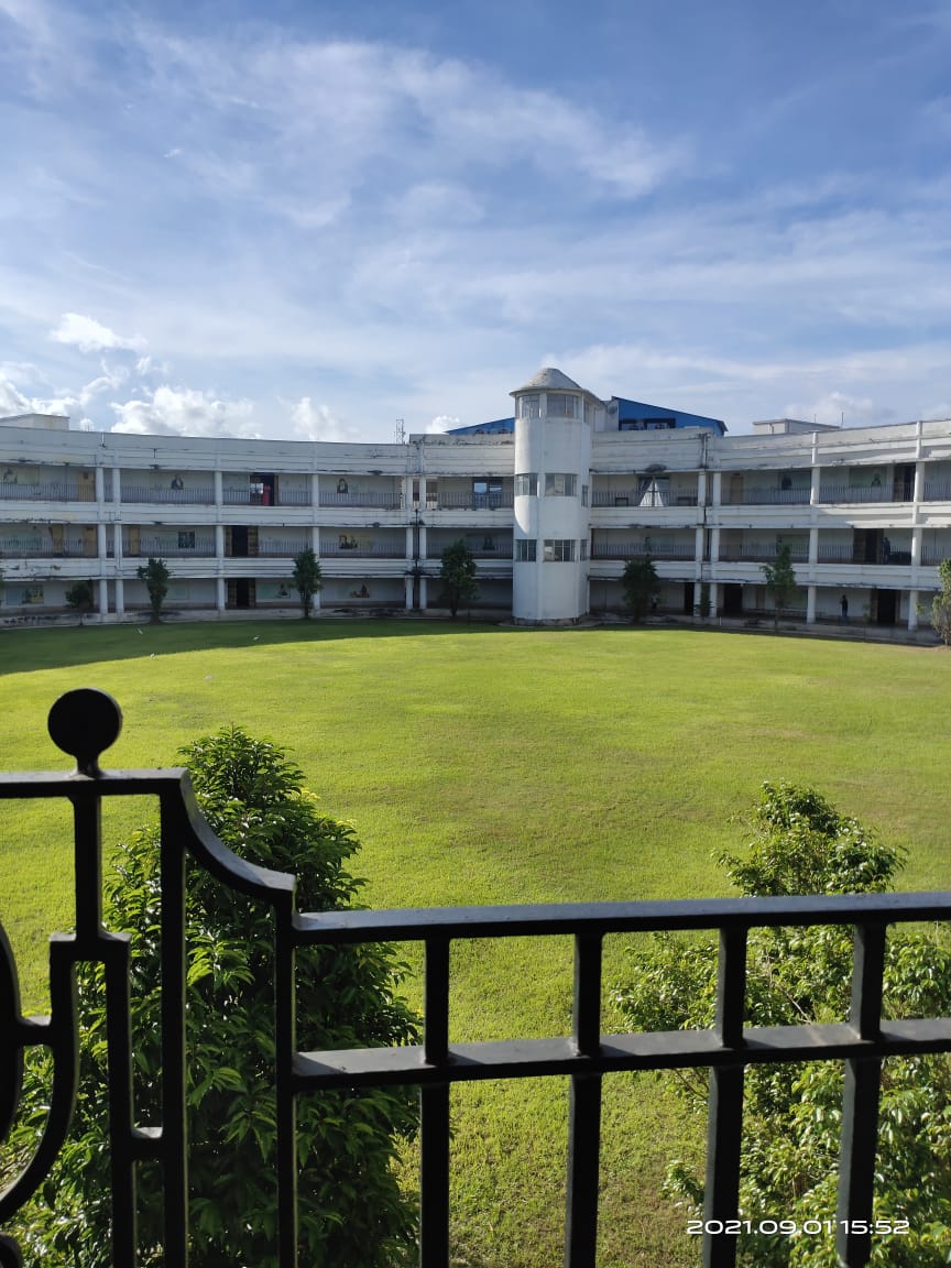


Why visit Haldia
Townapedia lists 1 museum or landmark, 12 parks and trails, 10 places to eat, 8 places to stay and 2 attractions in and around town.
Weather in Haldia
Forecast from MET Norway (CC BY 4.0). Full forecast
About Haldia
Haldia (Bengali: [ɦɔld̪ija]) is an industrial port city in Purba Medinipur district in the Indian state of West Bengal. It has a major sea port and industrial belt located approximately 124 km (77 mi) southwest of Kolkata near the mouth of the Hooghly River, one of the distributaries of the Ganges. The Haldia Township is bordered by the Haldi River, an offshoot of the Ganges River. Haldia is a centre for petrochemical businesses, and is a major trade port for Kolkata.
From the Wikipedia article Haldia (this version), under CC BY-SA 4.0.
Travel tips from other travellers: Haldia on Wikivoyage (CC BY-SA 4.0).
Things to do2

Museums and landmarks1

Parks, trails and playgrounds12



Restaurants and cafes10

The Golden Harvest and China valley
Restaurant · Indian · 3.7 km
Golden Retreat Balughata-City Center Road, Haldia
Aala
Restaurant · Regional · 3.7 km
City Center, Debhog Balughata-City Center Road, Haldia
Chakhle Haldia
Restaurant · Regional · 6.0 km
Haldia Township Haldia Township Road, Haldia
Harroj
Restaurant · Regional · 3.7 km
City Center, Debhog Balughata-City Center Road, Haldia

Star Cafe
Cafe · Coffee Shop · 3.5 km
City center mall Haldia City Center Road, Haldia

Hangout
Fast food · Regional · 3.5 km
City Center mall Haldia City Center Road, Haldia
History
The history of Haldia city is closely associated with the Calcutta Port, officially commissioned in 1870 under the Calcutta Port Act. It has its roots in the Mughal Emperor Aurangzeb's granting of trading privileges to the British. Following independence, the port began to cater to Indian business interests. Haldia was selected as the location for an additional port close to Calcutta, in part for supplying crude oil to the Barauni refinery via a riverside pier, as India's industrialization and marine trade volumes increased due to capacity restrictions and growing costs. As a result, the Haldia Dock Complex was created, which drew significant Indian and international corporations, such as IOCL, Exide, Shaw Wallace, Tata Chemicals, Haldia Petrochemicals, and Hindustan Lever, to build the Haldia Industrial Complex.
From the History section of Haldia on Wikipedia, under CC BY-SA 4.0.
Where to stay8
Golden Retreat
Motel and hotel · 3.7 km
Debhod, City Center, Beside City Center mall Haldia Balughata_Citycentre, Haldia
Akash Guest House & Tourist Dormitory
Motel and hotel · 3.5 km
In front of City Center Mall Haldia Balughata-City Center Road, Haldia
Churches and places of worship2
Shopping7
Gas and EV charging6
Schools, colleges and libraries20
Haldia Institute of Technology
School · 4.1 km
I.C.A.R.E Complex, H.I.T Campus, Hatiberia, HIT Midnapore East West Bengal khudiram nagar road, Haldia
Debhog Shamyacharan Milan Vidyapith
School · 4.3 km
Milan Haldia Mecheda Highway, Haldia
Dr. Meghnath Saha Institute of Science & Technology
School · 3.8 km
HIT college-City center road, Haldia
Global Institute of Science and Technology
School · 3.8 km
Kshudiram Nagar HIT College-City Center Road, Haldia
Halda Institute of Marine Studies
School · 3.8 km
Ranichak Haldia Institute of Technology Road, Haldia
Haldia Institute of Dental Sciences & Research & Education
School · 7.6 km
Banbishnupur, Balughata, Haldia
Healthcare8
Bhakta Medical Store
Clinic and pharmacy · 7.8 km
Brajalalchak-Kukrahati Road, Brajalalchak
Dr.Bidhan Chandra Roy Hospital
Hospital · 7.6 km
Balughata-Dental Hospital Road, Haldia
Map of Haldia
76 places. The map loads OpenStreetMap tiles when you open it.
Getting there and nearby towns
Netaji Subhash Chandra Bose International Airport (CCU) is the nearest airport with scheduled flights listed in OpenStreetMap, 75 km away.
- Rajpur Sonarpur 54 km northeast, about 54 min by car
- Kolkata 62 km northeast, about 1 h by car
- Howrah 61 km north, about 1 h by car
- Bāli 70 km north, about 1 h 15 min by car
- Dam Dam 71 km northeast, about 1 h 15 min by car
- Kāmārhāti 73 km north, about 1 h 15 min by car
- Pānihāti 75 km north, about 1 h 15 min by car
- Madhyamgram 78 km northeast, about 1 h 15 min by car
- Rishra 78 km north, about 1 h 15 min by car
- Khardah 78 km north, about 1 h 15 min by car
Drive times are estimates from straight-line distance, not routes.
Local news
Headlines from INDB.
Reviews, tips and questions
Loading what members have shared...
Sources and licences
- GeoNames (CC BY 4.0): population, coordinates, regions and time zone
- OpenStreetMap contributors (ODbL 1.0): places, airports, map data
- Wikidata (CC0 1.0): elevation, founding date, time zone, website
- Wikimedia Commons (see each image): photos
- Wikipedia (CC BY-SA 4.0): overview and history text
Photo credits
- On the road in Haldia (5578188054), Jean-Etienne Minh-Duy Poirrier from Bruxelles, Belgium, CC BY-SA 2.0
- Haldia river bank, Jean-Etienne Minh-Duy Poirrier, CC BY-SA 2.0
- De (on the extreme right among the three in uniform) in Haldia with his friends, Informative3456, CC BY-SA 4.0
- Water Hyacinth choking the Haldia Municipality Pool at South Bengal, Invitrosantanu, CC BY-SA 4.0
- Haldia Institute of Technology, Ayan184, CC BY-SA 4.0
- Hithaldia, Unknown author, CC BY-SA 4.0
- Sunset on a plate, Mukherjee anjan, CC BY-SA 4.0
- Young Earwig at 4th instar, invitrosantanu, CC BY-SA 4.0
- Young Earwig at 4th instar strolling on wooden door, invitrosantanu, CC BY-SA 4.0
- Prayukti 2022, Ayan184, CC BY-SA 4.0
- Team Asphalt Racing, Asphalt-haldia, CC BY-SA 4.0
- Dscn, Sonu Bhowmik, CC0
- ISS047-E-60776 - View of Earth, Earth Science and Remote Sensing Unit , Lyndon B. Johnson Space Center, Public domain
- ISS066-E-30955 - View of Earth, Earth Science and Remote Sensing Unit , Lyndon B. Johnson Space Center, Public domain
- ISS066-E-30956 - View of Earth, Earth Science and Remote Sensing Unit , Lyndon B. Johnson Space Center, Public domain
- ISS066-E-30954 - View of Earth, Earth Science and Remote Sensing Unit , Lyndon B. Johnson Space Center, Public domain
- ISS066-E-30953 - View of Earth, Earth Science and Remote Sensing Unit , Lyndon B. Johnson Space Center, Public domain
- Nanigopal Mandal Morning Walk, Nanigopal.Mandal, CC BY-SA 4.0
- Radhagobinda jiu Mandir, Santanulove, CC BY-SA 4.0
- ISS046-E-11714 - View of Earth, Earth Science and Remote Sensing Unit , Lyndon B. Johnson Space Center, Public domain
- ISS046-E-11713 - View of Earth, Earth Science and Remote Sensing Unit , Lyndon B. Johnson Space Center, Public domain
- ISS037-E-12731 - View of Earth, Earth Science and Remote Sensing Unit , Lyndon B. Johnson Space Center, Public domain
- ISS030-E-113110 - View of Earth, Earth Science and Remote Sensing Unit , Lyndon B. Johnson Space Center, Public domain
- ISS037-E-12733 - View of Earth, Earth Science and Remote Sensing Unit , Lyndon B. Johnson Space Center, Public domain
- ISS037-E-12730 - View of Earth, Earth Science and Remote Sensing Unit , Lyndon B. Johnson Space Center, Public domain
- ISS037-E-12732 - View of Earth, Earth Science and Remote Sensing Unit , Lyndon B. Johnson Space Center, Public domain
- A typical Village Mela or Fair, Bodhadityamukherjee, CC BY-SA 4.0
- HIDSAR Library 2, Krishnendu Debnath, CC BY-SA 4.0
- Library HIDSAR, Krishnendu Debnath, CC BY-SA 4.0


Page built November 2, 2026. Spotted a mistake? Tell us or suggest a place.