


Why visit Hāngal
Townapedia lists 2 attractions in and around town.
Weather in Hāngal
Forecast from MET Norway (CC BY 4.0). Full forecast
About Hāngal
Hangal is a historic town in Karnataka. It is 80 km (50 mi) away from Hubli through NH 766E.
From the Wikipedia article Hangal (this version), under CC BY-SA 4.0.
Things to do2

Churches and places of worship6

Gas and EV charging2

Schools, colleges and libraries3

History
Hungal is recorded as Panungal in early documents. It was once the capital of a feudatory of the Kadambas. The Kadambas built temples in Hangal in the Jain tradition. In medieval epigraphs. According to local legends, it is believed to be the place where the Pandavas spent the thirteenth year of their exile.
Around 1031, the Hoysalas took and held Hangal. In 1060, Mallikarjuna of the Shilahara laid siege to Hangal.
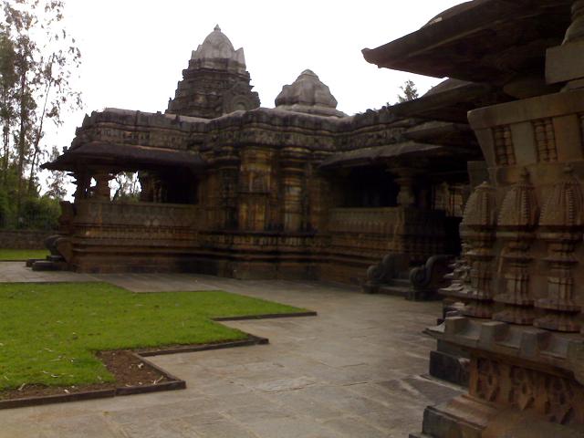
In the 12th century, Hangal was held by the Kalalyani Chalukyas, rulers of the Deccan. The Chalukyas built temples in the Gadag architectural style, from grey-green coloured chloritic schist.
On 14 July 1800, English forces took Hangal from Dhoondia Punt Gocklah, a Marhatta rebel deserter.
Hangal is the birthplace of the renowned Hindustani classical vocalist Gangubai Hangal (1913–2009), one of the foremost exponents of the Kirana gharana and a recipient of the Padma Vibhushan.
From the History section of Hangal on Wikipedia, under CC BY-SA 4.0.
Map of Hāngal
13 places. The map loads OpenStreetMap tiles when you open it.
Getting there and nearby towns
Hubballi Airport (HBX) is the nearest airport with scheduled flights listed in OpenStreetMap, 66 km away.
- Bankāpur 23 km northeast, about 23 min by car
- Mundgod 25 km north, about 25 min by car
- Shiggaon 27 km northeast, about 27 min by car
- Hāveri 30 km east, about 30 min by car
- Savanūr 33 km northeast, about 33 min by car
- Sirsi 35 km southwest, about 35 min by car
- Byādgi 40 km east, about 40 min by car
- Sorab 43 km south, about 43 min by car
- Hirekerūr 45 km southeast, about 45 min by car
- Hubballi 65 km north, about 1 h by car
Drive times are estimates from straight-line distance, not routes.
Local news
Headlines from INDB.
Reviews, tips and questions
Loading what members have shared...
Sources and licences
- GeoNames (CC BY 4.0): population, coordinates, regions and time zone
- OpenStreetMap contributors (ODbL 1.0): places, airports, map data
- Wikidata (CC0 1.0): elevation, founding date, time zone, website
- Wikimedia Commons (see each image): photos
- Wikipedia (CC BY-SA 4.0): overview and history text
Photo credits
- Hangal Tarakeshwara temple half (back), Manjunath Doddamani Gajendragad at en.wikipedia, Public domain
- Tarakeshwara temple, hangal, Harshavardhan S Jamakhandi, CC BY-SA 4.0
Page built November 3, 2026. Spotted a mistake? Tell us or suggest a place.