
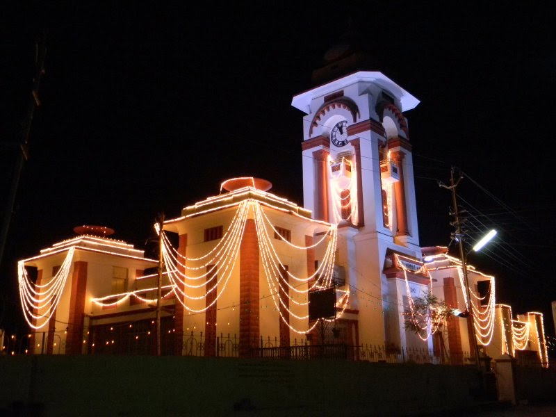

Why visit Himatnagar
Townapedia lists 3 museums and landmarks, 3 parks and trails, 2 places to eat, 6 places to stay and 1 attraction in and around town.
Highlights include Dowlat Villas Palace.
Weather in Himatnagar
Forecast from MET Norway (CC BY 4.0). Full forecast
About Himatnagar
Himatnagar or Himmatnagar is a city and the headquarters of Sabarkantha district in the Indian state of Gujarat. The city is on the bank of the river Hathmati.
From the Wikipedia article Himatnagar (this version), under CC BY-SA 4.0.
Travel tips from other travellers: Himatnagar on Wikivoyage (CC BY-SA 4.0).
Things to do1

Museums and landmarks3

Dowlat Villas Palace
Monument and historic site · 0.8 km
Dowlat Villas Palace, a heritage hotel and a homestay property is located at Himmatnagar, Gujarat, India at an hours drive from...
Parks, trails and playgrounds3

Restaurants and cafes2

History
Himatnagar was founded in by Ahmad Shah of Gujarat Sultanate and named it Ahmednagar after himself. He founded the town to keep Raos of Idar State in check.
From the History section of Himatnagar on Wikipedia, under CC BY-SA 4.0.
Where to stay6
Hotel Raka Palace
Motel and hotel · 1.0 km
First Floor, Harihar Near Bus Station, Himmatnagar
Dave Guest House
Motel and hotel · 1.0 km
Kalidas Market Opp. Railway Station, Himmatnagar
Churches and places of worship10
Shopping2
Gas and EV charging2
Schools, colleges and libraries3
Healthcare49
Map of Himatnagar
81 places. The map loads OpenStreetMap tiles when you open it.
Getting there and nearby towns
Sardar Vallabhbhai Patel International Airport (AMD) is the nearest airport with scheduled flights listed in OpenStreetMap, 67 km away.
- Parabada 2 km west, about 2 min by car
- Savgadh 3 km northwest, about 3 min by car
- Prāntij 22 km southwest, about 22 min by car
- Vijāpur 23 km west, about 23 min by car
- Idar 27 km north, about 27 min by car
- Talod 28 km south, about 28 min by car
- Modāsa 37 km southeast, about 37 min by car
- Gandhinagar 51 km southwest, about 51 min by car
- Mahesāna 59 km west, about 59 min by car
- Ahmedabad 75 km southwest, about 1 h 15 min by car
Drive times are estimates from straight-line distance, not routes.
Local news
Headlines from INDB.
Reviews, tips and questions
Loading what members have shared...
Sources and licences
- GeoNames (CC BY 4.0): population, coordinates, regions and time zone
- OpenStreetMap contributors (ODbL 1.0): places, airports, map data
- Wikidata (CC0 1.0): elevation, founding date, time zone, website
- Wikimedia Commons (see each image): photos
- Wikipedia (CC BY-SA 4.0): overview and history text
Photo credits
- Himatnagar Public Library and Towerclock, Viral A Dave, Public domain
Page built November 3, 2026. Spotted a mistake? Tell us or suggest a place.