


Hyderabad, India
Hyderabad is a regional capital of 6,993,262 people in Telangana, India, founded in 1592.
Why visit Hyderabad
Townapedia lists 29 museums and landmarks, 45 parks and trails, 111 places to eat, 60 places to stay and 39 attractions in and around town.
Highlights include Jawaharlal Nehru Architecture and Fine Arts University, Nayapul, B M Birla Science Museum and Birla Science Museum.
Weather in Hyderabad
Forecast from MET Norway (CC BY 4.0). Full forecast
About Hyderabad
Hyderabad is the capital and largest city of the Indian state of Telangana. It occupies 650 km2 (250 sq mi) on the Deccan Plateau along the banks of the Musi River, in the northern part of Southern India. With an average altitude of 536 m (1,759 ft), much of Hyderabad is situated on hilly terrain around artificial lakes, including the Hussain Sagar lake, predating the city's founding, in the north of the city centre. According to the 2011 census of India, Hyderabad is the fourth-most populous city in India, with a population of 6.9 million residents within the city limits and 9.7 million residents in the metropolitan region, making it the sixth-most populous metropolitan area in India.
From the Wikipedia article Hyderabad (this version), under CC BY-SA 4.0.
Travel tips from other travellers: Hyderabad on Wikivoyage (CC BY-SA 4.0).
Things to do39

Jawaharlal Nehru Architecture and Fine Arts University
School · 2.1 km
State public university in Ranga Reddy, Telangana, India


Acharya N. G. Ranga Agricultural University
School · 8.5 km
State public university in Guntur, Andhra Pradesh, India
Avinash College of Commerce
School · 6.7 km
Educational institute specialising in commerce and professional courses

Dr. B. R. Ambedkar Open University
School · 8.4 km
Public university in Hyderabad, Telangana


English and Foreign Languages University
School · 8.5 km
Public Central University in Hyderabad, Telangana, India
Indian Institute of Chemical Technology
School · 9.8 km
Research institute in Hyderabad, Telangana

International Institute of Information Technology, Hyderabad
School · 13.2 km
Public engineering institution in Hyderabad, Telangana

Jawaharlal Nehru Technological University, Hyderabad
School · 14.0 km
State public university in Hyderabad, Telangana, India
27 more on the map.
Museums and landmarks29


Charminar
Monument and historic site · 3.2 km
Mosque in Hyderabad, India

Golconda
Monument and historic site · 5.5 km
Fortified citadel and former city in central Hyderabad, Telangana, India


Raymond's Tomb
Monument and historic site · 6.6 km
Tomb of Michel Jocahim Marie Raymond

Salar Jung Museum
Museum · 2.9 km
Art museum in Hyderabad, Telangana, India

Sudha Cars Museum
Museum · 3.0 km
Automobile museum located in Hyderabad, India

Telangana State Archaeology Museum
Museum · 3.2 km
Archaeological museum in Hyderabad, Telangana

Telangana State Archaeology Museum
Museum · 2.2 km
It's a historic museum. It's original name was Andhra Pradesh Archaeology Museum before Telengana and Andhra Pradesh were separated.
5-10-193, H A C A Bhavan P G Road, Near Control Room, H500004, India, hyderabad
Sa-Th 10:30-17:00

17 more on the map.
Parks, trails and playgrounds45



Kothwalguda Eco Park
Park · 11.6 km
Eco Park in Kothwalguda, Hyderabad, Telangana

Kotla Vijayabhaskara Reddy Botanical Gardens
Park · 13.2 km
Botanical garden in Cyberabad, Telangana, India


Nehru Zoological Park
Park · 3.7 km
Zoo located near Mir Alam Tank in Hyderabad, Telangana, India


33 more on the map.
Restaurants and cafes111

Aqeeq Multi Cuisine Restaurant & Cafe 555
Restaurant · Indian · 2.3 km
Shop No.5 Road Number 1
Mo-Su 10:00-23:00
Banjara 9
Restaurant · Multi-Cuisine · 2.6 km
banjara hills Road Number 1, hyderabad
mo-su 12:00- 24:00


Santhi Bakers
Cafe · Sweets And Bakery, Fast Food · 1.7 km
Opp to Sai baba temple, Gudimalkapur crossroads, Mehedipatmam
08:00-23:00 open
Shadab Hotel
Restaurant · Indian, Kebab, Steak House, Ice Cream, Barbecue, Regional, Chicken, Coffee Shop · 2.7 km
Mo-Su 06:00-24:00
Rayalaseema Ruchulu
Restaurant · Indian · 2.2 km
PH,Mo-Su 12:00-16:00,19:00-23:00
Empala Hotel
Restaurant · Fast Food · 2.3 km
Opposite JNTU Beside Golconda Hotel, Masab Tank, Hyderabad
99 more on the map.
Where to stay60
Red Rose Palace
Motel and hotel · 2.1 km
5-9-113, Chapel Road, Bagher Complex, Fateh Maidan, Nampally, Hyderabad, Telangana 500001
Itsy Hotels Arastu Inn
Motel and hotel · 1.7 km
Bazaar 8822Ghat6704 Main72 Rd, Burhanuddin Community, Red Hills, Lakdikapul, Hyderabad, Telangana 50
Churches and places of worship85
Basilica of Our Lady of the Assumption, Secunderabad
Church · 8.1 km
Hanuman Temple
Place of worship · Hindu · 2.0 km
Redhills to Khairtabad Road, Hyderabad
Shopping29
Falcon Medical Books
Shop · 2.7 km
9FMJ+6V Hyderabad, Telangana Ground Floor, Pushpanjali Complex, Opp. Osmania Medical College, Near 94-95, Bus Stand, Putlibowli Road, Koti, Hyderabad, Telangana 500095
Gas and EV charging19
HP Gas Station (Petrol pump)
Gas station · 1.8 km
Karwan Rd, Gudimalkapur, Mehedipatnam, Hyderabad
Schools, colleges and libraries84
Goverment Polytechnic College, Masab Tank
School · 2.2 km
Masab Tank, Hyderabad, Asif Nagar, Mandal, Telangana 500028
Peace Angels High School
School · 1.6 km
Door No. 12-2-830, Near Amba Theatre, Mehdipatnam, Hyderabad, Telangana 500028
Sunrise High School
School · 1.5 km
12-2-322/A/1, Murad Nagar Rd, Alapathi Nagar, Mehdipatnam, Hyderabad, Telangana 500028
Astrokids Techno School
School · 1.6 km
Alapati Nagar, Murad Nagar, Mehdipatnam, Hyderabad, Telangana 500028
BHARATHI HIGH SCHOOL
School · 2.3 km
13-6-267, 92/2, Karwan Rd, NMDC Colony, Satyanarayan Nagar, Talla Gadda, Gudimalkapur, Hyderabad, Telangana 500006
Dew Drops High School
School · 1.4 km
13-5-744, Karwan Rd, Mustaidpura, Laxmi Nagar, Ramanthapur, Hyderabad, Telangana 500006
Healthcare106
MK Dentistry
Hospital · 1.2 km
10-2-229/A, opposite Al-Saba hotel above ICICI Bank, Syed Azam Colony, Vijaya Nagar Colony, Hyderabad
Map of Hyderabad
250 places. The map loads OpenStreetMap tiles when you open it.
Getting there and nearby towns
Begumpet Airport (BPM) is the nearest airport with scheduled flights listed in OpenStreetMap, 8 km away.
- Gaddi Annaram 7 km east, about 7 min by car
- Bandlaguda 8 km southwest, about 8 min by car
- Osmania University 8 km northeast, about 8 min by car
- Kismatpur 9 km southwest, about 9 min by car
- Malkajgiri 10 km northeast, about 10 min by car
- Jilādiguda 9 km southeast, about 9 min by car
- Kottapeta 9 km southeast, about 9 min by car
- Bālāpur 9 km southeast, about 9 min by car
- Lal Bahadur Nagar 11 km east, about 11 min by car
- Uppal Kalan 11 km east, about 11 min by car
Drive times are estimates from straight-line distance, not routes.
Local news
Headlines from INDB.
Reviews, tips and questions
Loading what members have shared...
Sources and licences
- GeoNames (CC BY 4.0): population, coordinates, regions and time zone
- OpenStreetMap contributors (ODbL 1.0): places, airports, map data
- Wikidata (CC0 1.0): elevation, founding date, time zone, website, landmarks and historic places
- Wikimedia Commons (see each image): photos
- Wikipedia (CC BY-SA 4.0): overview and history text
Photo credits
- Nampally Area Hospital, Hyderabad, adbh266, CC BY-SA 4.0
- Tek e masjid, Mallepally, Hyderabad, adbh266, CC BY-SA 4.0
- Graves of Dagh Dehlavi and his wife at Dargah Yusufain, Hyderabad, Arshsultanpuri, CC BY 4.0
- Dargha Yousfain, Mallepally, Hyderabad, adbh266, CC BY-SA 4.0
- Rusa resource center, Hyderabad, adbh266, CC BY-SA 4.0
- MAM junior school for Girls, Nampally, Hyderabad, adbh266, CC BY-SA 4.0
- (Hyderabad - Mumbai) Express with a WDM 3A Locomotive at Hyderabad, Adityamadhav83, CC BY-SA 4.0
- (Hyderabad - Gulbarga) Intercity Express at Hyderabad Deccan 01, Adityamadhav83, CC BY-SA 4.0
- Shadab hotel, Randhir. The original uploader was Randhirreddy at English Wikipedia ., Public domain
- Puranapul, Aditya369, CC BY-SA 3.0
- Acharya N G Ranga Agriculture university, Munna Aawara, CC BY-SA 4.0
- Entrance of Dr. B. R. Ambedkar Open University, Hyderabad, Veeven, CC BY-SA 4.0
- Durgam Cheruvu Cable bridge 02102020, Nikhil B, CC BY 3.0
- Golden shower tree (46945), Wikibantu, CC0
- Charminar-Pride of Hyderabad, Gopikrishna Narla, CC BY-SA 3.0
- Golkonda Fort 12, Khadeeja Henna, CC BY-SA 4.0
- Nizam museum, Randhirreddy, Public domain
- Lonely on top, Sapna Gopal, CC BY-SA 3.0
- Collections of the Nizam's Salarjung Museum in Hyderabad 04, Pinakpani, CC BY-SA 4.0
- Snap from Sudha Cars Museum Hyderabad 3767, Rameshng, CC BY-SA 3.0
- STONE GATES, Daniyal2404, CC BY-SA 4.0
- Biodiversity Park Hyderabad, Rajasekhar1961, CC BY-SA 4.0
- MindSpace campus in Hyderabad, India, peculiar235, CC BY-SA 2.0
- Indira Park Hyderabad-Dr Murali Mohan Gurram (13), Dr Murali Mohan Gurram, CC BY-SA 4.0
- Green Bee-eater (Merops orientalis) in Hyderabad, AP W IMG 1351, J.M.Garg, CC BY-SA 4.0
- Lumbini Park, Hyderabad, TripodStories- AB, CC BY-SA 4.0
- Hyderabad zoo, Cephas 405 at en.wikipedia ), CC BY-SA 3.0
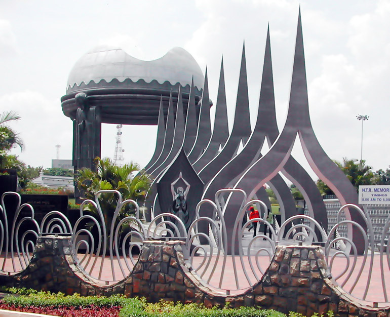
- NTR Memorial, Saikiranstuffguy, CC BY-SA 3.0
- Public Gardens Secunderabad, Deen Dayal, Public domain
- St Jospeh Cathedral Hyderabad, Sriharsha, CC BY-SA 2.0
- Basilica of Our Lady of the Assumption, Secunderabad, Jayarathina, CC BY-SA 3.0
- CBC tower, Meher Mansion, CC BY-SA 4.0
- Methodist church, Abids, Hyderabad (December 2007), Cephas 405, CC BY-SA 3.0
- Stjohnschurchsecunderabad1890, Myrtleship, CC BY-SA 3.0
- Birla Science Museum Hyd, Munna Aawara, CC BY-SA 4.0
- St.georges church at abids hyderbad., Chango60, Public domain
- Central library renewate, Bhaskaranaidu, CC BY-SA 3.0
- Citycollege 7, Bhaskaranaidu, CC BY-SA 4.0
- Osmania Hospital, Bhaskaranaidu, CC BY-SA 3.0
- State Central library, Adbh266, CC BY-SA 3.0
- Jalavihar, Necklace Road , Hyderabad, Adbh266, CC BY-SA 4.0
- The English and Foreign languages university Hyderabad, adbh266, CC BY-SA 4.0
- Jalagam Vengal Rao Park004, Muzammil, CC BY-SA 3.0


Page built November 2, 2026. Spotted a mistake? Tell us or suggest a place.