
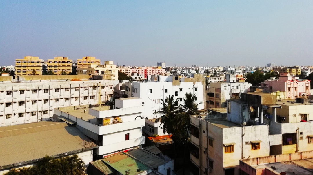


Why visit Kāvali
Townapedia lists 9 parks and trails, 4 places to eat, 3 places to stay and 2 attractions in and around town.
Highlights include public park.
Weather in Kāvali
Forecast from MET Norway (CC BY 4.0). Full forecast
About Kāvali
Kavali is a town in Nellore district of Andhra Pradesh of India. It also serves as headquarters of Kavali mandal and Kavali revenue division.It is one of the few cities from Andhra Pradesh which were selected for Atal Mission for Rejuvenation and Urban Transformation (AMRUT) Scheme. and the distance from Nellore is 54 km.
From the Wikipedia article Kavali (this version), under CC BY-SA 4.0.
Travel tips from other travellers: Kāvali on Wikivoyage (CC BY-SA 4.0).
Things to do2

Parks, trails and playgrounds9


Restaurants and cafes4



Where to stay3

Churches and places of worship11
Sharone baptist church
Church · 1.7 km
B.Guta Rail Cross To J.Pet Main Rd, Bala Krishna Reddy Colony, Kavali
Shopping2
Schools, colleges and libraries6
Healthcare23
Map of Kāvali
60 places. The map loads OpenStreetMap tiles when you open it.
Getting there and nearby towns
- Kandukūr 35 km north, about 35 min by car
- Singarāyakonda 35 km north, about 35 min by car
- Mūlaguntapādu 39 km north, about 39 min by car
- Kovūr 46 km south, about 46 min by car
- Lebur Bit ? I 47 km south, about 47 min by car
- Nellore 52 km south, about 52 min by car
- Bhuja Bhuja Nellore 58 km south, about 58 min by car
- Ongole 66 km north, about 1 h by car
- Pāmūru 66 km west, about 1 h by car
- Vadlapūdi 70 km south, about 1 h 15 min by car
Drive times are estimates from straight-line distance, not routes.
Local news
Headlines from INDB.
Reviews, tips and questions
Loading what members have shared...
Sources and licences
- GeoNames (CC BY 4.0): population, coordinates, regions and time zone
- OpenStreetMap contributors (ODbL 1.0): places, airports, map data
- Wikidata (CC0 1.0): elevation, founding date, time zone, website
- Wikimedia Commons (see each image): photos
- Wikipedia (CC BY-SA 4.0): overview and history text
Photo credits
- Kavali aerial view, Shaik Sulthan Shareef Basha, CC BY-SA 4.0
- Sree akshaya construction, Naveen125, CC BY-SA 4.0
- ISS030-E-82518 - View of Earth, Earth Science and Remote Sensing Unit , Lyndon B. Johnson Space Center, Public domain
- ISS018-E-33656 - View of India, Earth Science and Remote Sensing Unit , Lyndon B. Johnson Space Center, Public domain
- ISS018-E-33657 - View of India, Earth Science and Remote Sensing Unit , Lyndon B. Johnson Space Center, Public domain
- ISS030-E-82517 - View of Earth, Earth Science and Remote Sensing Unit , Lyndon B. Johnson Space Center, Public domain
- RESERACH ON ARTIFICAL INTELLIGENCE IN MEDICAL DRONE, Mohammad Altaf.Shaik, CC0

Page built November 3, 2026. Spotted a mistake? Tell us or suggest a place.