


Why visit Khadki
Townapedia lists 10 museums and landmarks, 32 parks and trails, 56 places to eat, 21 places to stay and 15 attractions in and around town.
Highlights include E-Square Multiplex, Bal Gandharva Ranga Mandir, Bharat Itihas Sanshodhak Mandal and Mahatma Phule Museum.
Weather in Khadki
Forecast from MET Norway (CC BY 4.0). Full forecast
About Khadki
Khadki is a cantonment in the city of Pune, Maharashtra, India. It has now flourished as a quasi-metropolis & centered in the northern region of the city.
From the Wikipedia article Khadki (this version), under CC BY-SA 4.0.
Things to do15

E-Square Multiplex
Cinema and theater · 3.3 km
One of the very first multi-plex cinemas to open in Pune.
Ganeshkhind Road, Pune
Mo-Su 08:00-22:00

Bal Gandharva Ranga Mandir
Cinema and theater · 4.6 km
Theater and exhibition hall in Pune, Maharashtra

Deccan College Post-Graduate and Research Institute
School · 2.7 km
One of the oldest Educational Institute in India. Known for its contribution to Archeology, Indology and Linguistics


Gokhale Institute of Politics and Economics
School · 5.1 km
Research and training institute in Politics and Economics based at Pune in India.

Indian Institute of Science Education and Research, Pune
School · 5.0 km
Public Research University located in Pune, Maharashtra

MES Garware College of Commerce
School · 6.0 km
College in Maharashtra, India

Sudarshan Rangmanch
Cinema and theater · 5.0 km
Theater in Pune, Maharashtra
Tata Management Training Centre
School · 4.5 km
Training centre in Pune, Maharashtra

Tilak Smarak Mandir
Cinema and theater · 6.2 km
Theatre and exhibition hall located in Pune, Maharashtra
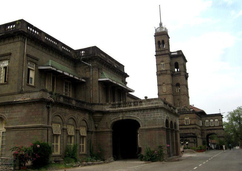
3 more on the map.
Museums and landmarks10


National War Memorial Southern Command
Monument and historic site · 6.2 km
Monument in Pune, India

Pune Tribal Museum
Museum · 5.2 km
Tribal Museum in Pune, Maharashtra




Parks, trails and playgrounds32



Tarkeshwar Mandir Hill
Park · 3.7 km
It have walking plaza,Gym equipments, and a park at top.
20 more on the map.
Restaurants and cafes56

choclate caffe
Cafe · Pizza, Coffee Shop, Burger, Sandwich, Mexican, Sushi, Ice Cream, Bubble Tea, Donut · 3.6 km
haveli, Pune
Mo-Su 10:00-22:00

the chefs way cafe
Cafe · Chicken, Burger, Pizza, Italian · 2.1 km
203 ganga legend, pune
Mo-Fr 09:00-18:00


baarish restraunt and bar
Restaurant · 3.4 km
203 dhore nagar, Pune
Mo-Su 09:00-21:00

Sicilia Italian Restaurant & Lounge
Restaurant · Italian · 3.6 km
Boat Club Road, Pune
44 more on the map.
History
Khadki was the site of the Battle of Khadki, fought between the British East India Company and the Marathas in 1817 in which Baji Rao II, the Peshwa ruler was defeated. Soon after the war, the British set up a cantonment here. It then became the base of the Royal Regiment of Artillery's 79 (Khadki) Commando Battery. World War I Field Marshal William Birdwood, 1st Baron Birdwood was born in Khadki.
The well known Indian hockey player and former India captain, Dhanraj Pillay grew up here. An equally accomplished player of yester years, full back Joe Philips too was born and brought up in Khadki. Joe Philips represented India at a number of international meets including the Summer Olympics of 1936 in Berlin, Germany at which the Indian Men's Hockey team won the gold medal. The well known Hindi film actor K K Menon is also known to have attended school here. Raj Kapoor owned 11 FM Cariappa Marg. The Cantonment Office and Small Cause Court are on 17, FM Cariappa Marg. St. Ignatius Church and St. Joseph Boys School are behind the Courthouse.
From the History section of Khadki on Wikipedia, under CC BY-SA 4.0.
Where to stay21
Churches and places of worship27
Shri Kaila Chamunda Mata Mandir
Place of worship · Hindu · 3.6 km
Deccan College Road, PUNE
St. Mary's Malankara Catholic Cathedral
Church · Catholic · 2.1 km
51 Bhau Patil Path, Pune
Mata Shitaladevi Temple
Place of worship · 3.1 km
Dapodi Pimple Gurav Road, Dapodi, Pune
Shopping18
Cyclogist Bike Hub
Shop · 3.5 km
33A Vimalabai Jadhav Road, Narveer Tanaji Wadi, Shivajinagar, Pune
Gas and EV charging14
Shri Seva Petrol Pump
Gas station · 3.4 km
Opp. E Square, Ganeshkhind Road, Shivaji Nagar, Model Colony Shivajinagar, Pune
Autolines Petrol Pump
Gas station · 3.7 km
Ganeshkhind RD, Rage Path, Model Colony, Shivajinagar, लकाकी रस्ता, Pune
Schools, colleges and libraries64
Healthcare36
Dr Jain's Dental Care
Clinic and pharmacy · 2.7 km
403 Ashok sankul 2, ABove ICICI Bank, range hills road, Ashok Nagar, Pune
Orthopaedic Fracture Clinic
Clinic and pharmacy · 3.0 km
F-23 First Floor, F-Residences Next to Brahma Sun City, New Kalyani Nagar, Wadgaonsheri, Pune
Map of Khadki
250 places. The map loads OpenStreetMap tiles when you open it.
Getting there and nearby towns
Pune International Airport (PNQ) is the nearest airport with scheduled flights listed in OpenStreetMap, 7 km away.
- Pune 5 km south, about 5 min by car
- Pimpri-Chinchwad 8 km northwest, about 8 min by car
- Pimpri 8 km northwest, about 8 min by car
- Lohogaon 9 km northeast, about 9 min by car
- Alandi 14 km north, about 14 min by car
- Hinjawadi 13 km west, about 13 min by car
- Vagholi 14 km east, about 14 min by car
- Māngvādi 15 km south, about 15 min by car
- Kharakvasla 16 km southwest, about 16 min by car
- Lonavla 52 km northwest, about 52 min by car
Drive times are estimates from straight-line distance, not routes.
Local news
Headlines from INDB.
Reviews, tips and questions
Loading what members have shared...
Sources and licences
- GeoNames (CC BY 4.0): population, coordinates, regions and time zone
- OpenStreetMap contributors (ODbL 1.0): places, airports, map data
- Wikidata (CC0 1.0): elevation, founding date, time zone, website, landmarks and historic places
- Wikimedia Commons (see each image): photos
- Wikipedia (CC BY-SA 4.0): overview and history text
Photo credits
- Kirkee War Cemetery, Pune, Joe Zachs from Pune, India, CC BY 2.0
- Konya Express at Platform 1 of Khadki Railway Station, Pune, Djknusper, CC BY 4.0
- Methodist Church, Khadki, Sureshkhole, CC BY-SA 4.0
- Khadki, Pune, Maharashtra, India - panoramio (4), Udaykumar PR, CC BY 3.0
- Khadki, Pune, Maharashtra, India - panoramio (5), Udaykumar PR, CC BY 3.0
- Khadki, Pune, Maharashtra, India - panoramio (2), Udaykumar PR, CC BY 3.0
- Khadki, Pune, Maharashtra, India - panoramio (1), Udaykumar PR, CC BY 3.0
- Khadki, Pune, Maharashtra, India - panoramio (3), Udaykumar PR, CC BY 3.0
- Khadki, Pune, Maharashtra, India - panoramio, Udaykumar PR, CC BY 3.0
- Balgandharv, Pakshya, CC BY-SA 3.0
- Fitzgerald Bridge (front) and Yerwada bridge (back) in Pune, Ketan.wa, CC BY-SA 3.0
- Gokhale Institute of Politics and Economics in Pune , Front View - panoramio, Deepak Patil, CC BY-SA 3.0
- Front view of main building, IISER Pune, DesiBoy101, CC BY 4.0
- Tilak Smarak Mandir (1), Pankajkatware, CC BY-SA 3.0
- Bharat Itihas sanshodhak Mandal pune outer wive, Ganesh suresh salunke, CC BY-SA 4.0
- Building of Mahatma Phule Museum, Pune, DesiBoy101, CC BY 4.0
- Air Carft at Nation War Memorial, Pogaface, CC BY-SA 3.0
- Tribal museum (Sadhu waswani path) (43), Sbzp, CC BY-SA 3.0
- Building of Raja Dinkar Kelkar Museum, Pune, DesiBoy101, CC BY 4.0
- Punwadi to punyanagri on tulsi bagh,Pune,India, Shankyrosh, CC BY-SA 3.0
- Entrance of IUCAA, DesiBoy101, CC BY 4.0
- MAJESTIC DECCAN COLLEGE, Dheepika Karunakar, CC BY-SA 4.0
- Yerwada jail, Sweet madhura, CC BY-SA 3.0
- University of Pune, Pune, Shreesh Kawthekar from Pune, India, CC BY 2.0
- COEP Main building, Suchakra, CC BY-SA 3.0
- Old building of Govt. Polytechnic, Pune, DesiBoy101, CC BY-SA 4.0
- College of Agriculture Pune (Main building), SBDhanawat, CC BY-SA 4.0
- Esquare3, Amey Kanade, CC BY-SA 3.0
- Pune university small, Mukul2u at English Wikipedia, Public domain
- Jail Road Yerwada Pune, Hawarnekar, CC BY-SA 3.0
- HAL HF-24 Marut (IAF) in Kamla Nehru park - panoramio, Deepak Patil, CC BY-SA 3.0
- College of agriculture5, Amey Kanade, CC BY-SA 3.0
- Interior of Pune Kali Bari pandal during Durga Puja 2023, DesiBoy101, CC BY 4.0
- Chikhalwadi, Bopodi, Pune, Maharashtra, India - panoramio, Udaykumar PR, CC BY 3.0
- Kirkee War Cemetery (92167), DesiBoy101, CC BY 4.0
- Kirkee War Cemetery (13645), DesiBoy101, CC BY 4.0
- Kirkee War Cemetery (87360), DesiBoy101, CC BY 4.0
- Kirkee War Cemetery (41081), DesiBoy101, CC BY 4.0
- Kirkee War Cemetery (50270), DesiBoy101, CC BY 4.0
- Kirkee War Cemetery (81911), DesiBoy101, CC BY 4.0


Page built November 3, 2026. Spotted a mistake? Tell us or suggest a place.