


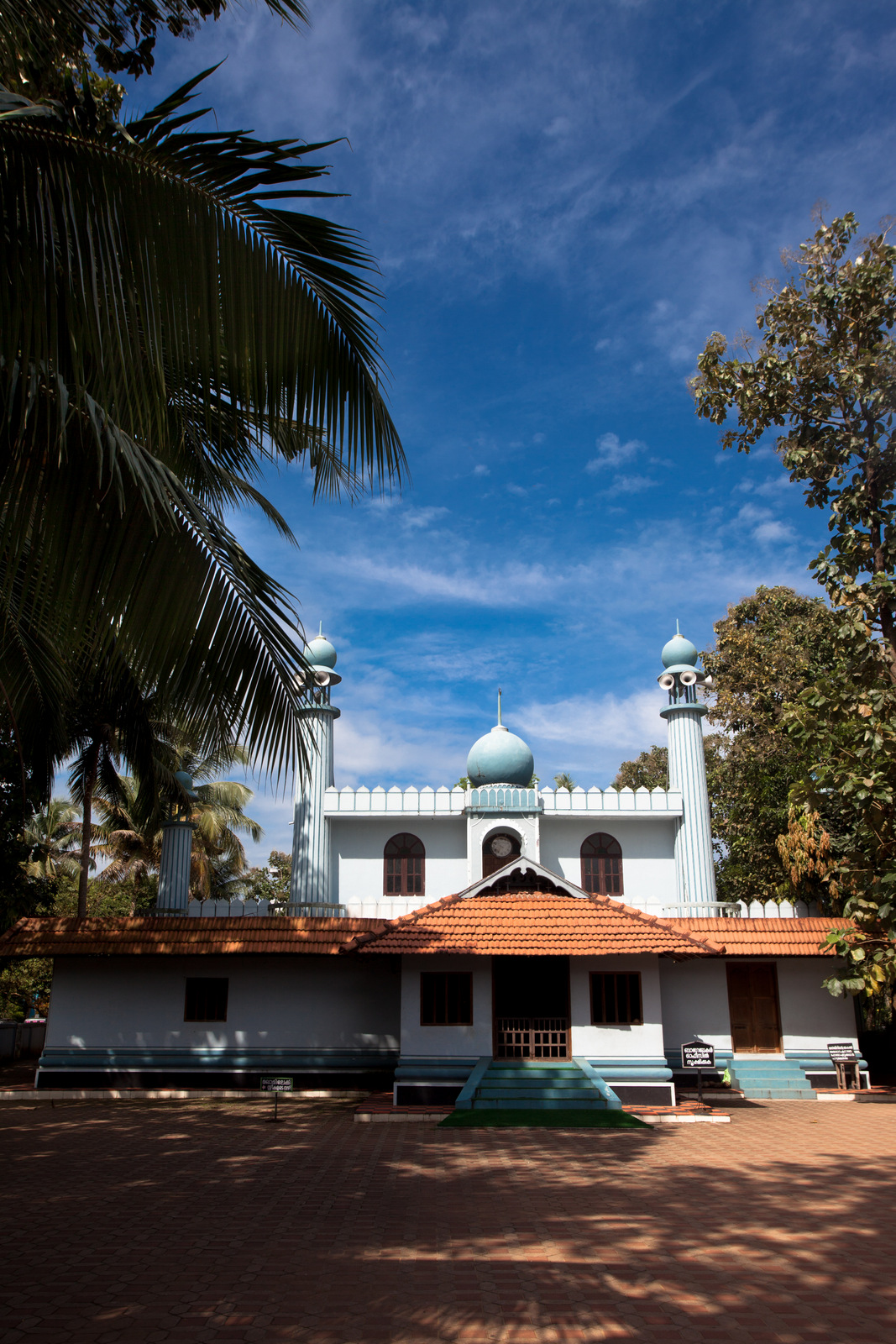

Why visit Kodungallūr
Townapedia lists 9 museums and landmarks, 23 parks and trails, 49 places to eat, 28 places to stay and 12 attractions in and around town.
Highlights include Azhikode lighthouse, Munakkal Beach and Cheraman Parambu.
Weather in Kodungallūr
Forecast from MET Norway (CC BY 4.0). Full forecast
About Kodungallūr
Kodungallur (Malayalam: [koɖuŋːɐlːuːr]; formerly also known as Cranganore (anglicised name), Cranganor (Portuguese), Mahodayapuram, Shingly, Vanchi and Muziris/Muchiri/Muyirikkode) is a historically significant town located on the banks of the river Periyar on the Malabar Coast in Thrissur district of Kerala, India. It is 36 kilometres (22 mi) north of Kochi (Cochin) by National Highway 66 and 38 km (24 mi) from Thrissur. Kodungallur, being a port city at the northern end of the Kerala lagoons, was a strategic entry point for the naval fleets to the extensive Kerala backwaters. Kodungallur is recognised as one of the world’s notable early interfaith centres, linked to the arrival of Christian, Muslim and Jewish communities in India and to early Buddhist presence in South India, in addition to its longstanding Shaiva, Vaishnava and Shakta traditions.
From the Wikipedia article Kodungallur (this version), under CC BY-SA 4.0.
Travel tips from other travellers: Kodungallūr on Wikivoyage (CC BY-SA 4.0).
Things to do12


Munakkal Beach
Beach · 6.8 km
Beach in Thrissur district, Keralam, India

LAKSHMI CINEMAS 4K laser
Cinema and theater · 1.4 km
LAKSHMI CINEMAS Kodungallur-Paravur-Ernakulam Highway, Kodungallur
Menaka Theatre
Cinema and theater · 3.6 km
Kottapuram Thuruthipuram Road, Kottapuram

Museums and landmarks9

Cheraman Parambu
Monument and historic site · 3.6 km
Archaeological site in Thrissur district, Keralam, India




Parks, trails and playgrounds23


11 more on the map.
Restaurants and cafes49




37 more on the map.
Where to stay28
Modern hospital school of nursing hostel, ward 2
Motel and hotel · 0.7 km
Chandappura-Eriyad Road, Kodungallur
Churches and places of worship68
Thiruvanchikulam Temple
Place of worship · 2.8 km
Thiruvanchikulam, Kodungallur
Kovilakathukunnu Masjid
Place of worship · Sunni · 4.7 km
Kadalayi - Karumathra Road, kovilakathukunnu
New India Church of God
Church · Pentecostal · 3.0 km
Kodungallur-Paravur-Ernakulam Highway, TKS Puram
Arakkal Sredhurgha temple
Place of worship · 4.5 km
kovilakathukunnu, puthenchira
Shopping31
Green Valley Supermarket
Grocery · 2.5 km
അഴീക്കോട്- മേത്തല - കൊടുങ്ങല്ലൂര് റോഡ്, Kodungallur
Gas and EV charging7
Schools, colleges and libraries62
Government Higher Secondary School, Edavilangu
School · 2.6 km
Edavilangu, Kodungallur
K K Velayudhan Memorial Librari
Library · 2.8 km
K K Velayudhan Memorial Librari Chappara, Konungallur
Balanubodhini Upper Primary School, Methala
School · 2.4 km
Azhikode, Kodungallur
Healthcare50
Government Homeo Dispensary Edavilangu
Clinic and pharmacy · 2.9 km
Kara Kothaparambu Road, Edavilangu
Pulloot
Hospital · 2.2 km
Govt. Ayurveda Hospital,Pulluttu, Pulluttu P.O Thrissur Pin-680663, Thrissur
Sree Krishna Clinic, Chalakulam.
Clinic and pharmacy · 3.4 km
653X+2X6, Keetholi, Kodungallur, Kerala 680669, Kodungallur
Family Health Centre Anapuzha
Hospital · 3.4 km
Fisherman's Colony, Road, Kodungallur, Kerala 680667, Kodungallur
Govt. Ayurveda Hospital,Azhikode
Hospital · 4.7 km
Eriyad-Azhikode road, azhikode
Govt.Ayurveda Dispensary Edavilangu
Hospital · 3.5 km
Krishi Bhavan Road, Kodungallur
Map of Kodungallūr
250 places. The map loads OpenStreetMap tiles when you open it.
Getting there and nearby towns
Cochin International Airport (COK) is the nearest airport with scheduled flights listed in OpenStreetMap, 24 km away.
- Kizhake Chālakudi 17 km northeast, about 17 min by car
- Vypīn 30 km south, about 30 min by car
- Thrissur 32 km north, about 32 min by car
- Kochi 33 km south, about 33 min by car
- Arukutti 44 km southeast, about 44 min by car
- Kunnamkulam 48 km north, about 48 min by car
- Kutiatodu 50 km south, about 50 min by car
- Kotamangalam 51 km east, about 51 min by car
- Piravam 53 km southeast, about 53 min by car
- Shōranūr 59 km north, about 59 min by car
Drive times are estimates from straight-line distance, not routes.
Local news
Headlines from INDB.
Reviews, tips and questions
Loading what members have shared...
Sources and licences
- GeoNames (CC BY 4.0): population, coordinates, regions and time zone
- OpenStreetMap contributors (ODbL 1.0): places, airports, map data
- Wikidata (CC0 1.0): elevation, founding date, time zone, website, landmarks and historic places
- Wikimedia Commons (see each image): photos
- Wikipedia (CC BY-SA 4.0): overview and history text
Photo credits
- Cranganore in Cranganore, Wouter Schouten, Public domain
- Azhikode lighthouse, Dr. Ajay Balachandran, CC BY-SA 3.0
- Cheraman parambu, നിരക്ഷരൻ, CC BY 3.0
- St Stanislaus Church, Mala, Church, CC BY-SA 4.0
- Cheraman Juma Masjid, Shahinmusthafa, CC BY-SA 3.0
- 0092122 Thiruvanchikulam Mahadeva temple, Chera dynasty, Kodungallur Kerala 061, Ms Sarah Welch, CC0
- BhagavathiTemple,KDR4, Aruna at Malayalam Wikipedia, CC BY-SA 3.0
- Cheraman Juma Palli (ചേരമാൻ ജുമാ പള്ളി), Arjunullas, CC BY 4.0
- Thiruvanchikulam3, Ssriram mt, CC BY-SA 4.0
- Photo of Azhikode Munakkal Beach, Haribhagirath, CC BY-SA 3.0
- Kodungallur Bhagavathy Temple-WUS00050, Rainer Halama, CC BY-SA 4.0
- Kodungallur bye pass - panoramio, Suresh Babunair, CC BY 3.0
- CHERAMAN MASJID POND KODUNGALLUR, Abdullanafih, CC BY-SA 4.0
- CHERAMAN MASJID POND, Abdullanafih, CC BY-SA 4.0
- Ficus benghalensis @ Kodungallur India 02, Ranjith-chemmad, CC BY-SA 4.0
- Giving tocken of Love to Mariya who joined Kodungallur Heritage Walk, conducted as pre - event of Malabar Literature Festival, NIZAMUDHEEN CHAVAKKAD, CC0
- Cnemaspis littoralis, rohitmg, CC BY-SA 4.0
- Ficus benghalensis @ Kodungallur India 01, Ranjith-chemmad, CC BY-SA 4.0
- Ficus benghalensis @ Kodungallur India 03, Ranjith-chemmad, CC BY-SA 4.0
- Ficus benghalensis @ Kodungallur India 04, Ranjith-chemmad, CC BY-SA 4.0
- Ficus benghalensis @ Kodungallur India 05, Ranjith-chemmad, CC BY-SA 4.0
- Kodungallur temple, Bijoyjohn269, CC BY-SA 4.0
- Kodungallur Bhagavathy Temple 10, Vis M, CC BY-SA 4.0
- Ficus benghalensis @ Kodungallur India 06, Ranjith-chemmad, CC BY-SA 4.0
- Oracle(komaram) of Kodungallur, Dpradeepkumar, CC BY-SA 4.0
- Kodungallur Bhagavathy Temple 07, Vis M, CC BY-SA 4.0
- 0092122 Shri Kurumbha Bhagavathi temple, Chera dynasty, Kodungallur Kerala 011, Ms Sarah Welch, CC0
- Kodungallur Bhagavathy Temple pond, Vis M, CC BY-SA 4.0
- 0092122 Shri Kurumbha Bhagavathi temple, Chera dynasty, Kodungallur Kerala 020, Ms Sarah Welch, CC0
- Sree Kurumba Bagavathi Temple at Kodungallur in Kerala 28, Tarunsamanta, CC BY-SA 4.0
- Sree Kurumba Bagavathi Temple at Kodungallur in Kerala 27, Tarunsamanta, CC BY-SA 4.0
- Kodungallur Bhagavathy Temple 05, Vis M, CC BY-SA 4.0
- Kodungallur Bhagavathy Temple 12, Vis M, CC BY-SA 4.0
- Kodungallur Bhagavathy Temple 03, Vis M, CC BY-SA 4.0
- Kodungallur Bhagavathy Temple 08, Vis M, CC BY-SA 4.0
- Kodungallur Bhagavathy Temple 04, Vis M, CC BY-SA 4.0
- Kodungallur Bhagavathy Temple 06, Vis M, CC BY-SA 4.0
- Kodungallur Bhagavathy Temple 11, Vis M, CC BY-SA 4.0
- Kodungallur Bhagavathy Temple 13, Vis M, CC BY-SA 4.0
- 0092122 Shri Kurumbha Bhagavathi temple, Chera dynasty, Kodungallur Kerala 043, Ms Sarah Welch, CC0
- Knai Thoma Tower 05, Tarunsamanta, CC BY-SA 4.0


Page built November 3, 2026. Spotted a mistake? Tell us or suggest a place.