


Why visit Kollam
Townapedia lists 25 museums and landmarks, 35 parks and trails, 101 places to eat, 44 places to stay and 19 attractions in and around town.
Highlights include Thangasseri Point Lighthouse, Kollam Beach, Eight-Point Gallery Cafe and Thangassery Fort.
Weather in Kollam
Forecast from MET Norway (CC BY 4.0). Full forecast
About Kollam
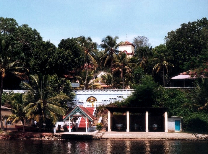
Kollam (Malayalam: [kolːɐm] ;) is an ancient seaport and the fourth largest city in the Indian state of Kerala. Located on the southern tip of the Malabar Coast of the Arabian Sea, the city is on the banks of Ashtamudi Lake and is 71 kilometres (44 mi) northwest of Thiruvananthapuram. Kollam is one of India's oldest continuously inhabited cities, with evidence of habitation stretching back to the megalithic period. The city has also been a maritime entrepôt for millennia, with the earliest attestation dating to the Phoenicians and Romans.
From the Wikipedia article Kollam (this version), under CC BY-SA 4.0.
Travel tips from other travellers: Kollam on Wikivoyage (CC BY-SA 4.0).
Things to do19


Mundakkal Beach
Beach · 3.0 km
Beach in Kollam district, Keralam, India


Sreenarayanaguru Open University
School · 4.8 km
Open university in Kerala


Dhanya Remya theatre
Cinema and theater · 2.4 km
Kadappakkada - Kappalandimukku Road
7 more on the map.
Museums and landmarks25

Eight-Point Gallery Cafe
Museum · 1.7 km
Art museum in Asramam, Kollam





Sree Moolam Palace
Monument and historic site · 0.9 km
SMP Theatre Public Library YMCA Road, Kollam
13 more on the map.
Parks, trails and playgrounds35

Cantonment Maidan
Park · 1.7 km
Historical ground in Old Quilon (Kollam) town, Kerala


Lal Bahadur Shastri Corporation Stadium
Sports field and stadium · 1.6 km



23 more on the map.
Restaurants and cafes101
8 Point Art Cafe
Cafe · Regional · 1.7 km
Guest House Road, Kollam
11:00-22:00

Magic oven bakers and coffee shop
Bakery · 2.2 km
1 Kadappakkada - Kappalandimukku Road, KOLLAM
24/7
Crown Bakery
Bakery · 0.9 km
100 years of baking the difference. Crown Bakery has a history that goes back to the times when British had influence in the area. Our...
Beach Road, Kollam


89 more on the map.
History
As the ancient city of Quilon, Kollam was a flourishing port during (c. 3rd century BC–12th century), and later became the capital of the independent Venadu or the Kingdom of Quilon on its foundation in c. 825 by Maruvān Sapir Iso. Kollam was considered one of the four early entrepots in global sea trade during the 13th century, along with Alexandria and Cairo in Egypt, the Chinese city of Quanzhou, and Malacca in the Malaysian archipelago. It seems that trade at Kollam flourished right into the Medieval period, as in 1280, there is an instance of envoys of Yuan China coming to Kollam to establish relations between the local ruler and China.
During the Sangam Era Kollam was ruled by the Ay Dynasty. Ay Titian and Ay Andiran are rulers mentioned in the Sangam Literature and can be found in the Akananuru and Purananuru corpus.Kollam functioned as a maritime and logistics outpost of the Ay Kingdom.
In 825 CE the maritime outpost of Kollam was developed into a major trading port by Syrian Christian Magnate Marwan Sapir Iso, commencing the Malayalam calendar which is also known as Kollavarsham.
From the History section of Kollam on Wikipedia, under CC BY-SA 4.0.
Where to stay44
Zodiac Regency
Motel and hotel · 0.6 km
Vadayattukotta Rd, Chinnakada, Kollam, Kerala 691001, India Vadayattukotta Road, kollam
Quilon Beach hotel
Motel and hotel · 1.1 km
Kollam - Eravipuram Beach Road, Kollam
Churches and places of worship120
St. Antony's Friary
Church · Catholic · 1.7 km
St. Antony’s Friary Tillery, Kollam, Kerala
Bharatha Rajni Church
Church · Catholic · 2.3 km
Railway Station - Chemmamukku Road, Kollam
CSI Christ Church Cathedral
Church · Anglican · 1.2 km
Bharanikavu - Kollam Rd, Chamkkada, Kollam, Kerala 691001 Chinnakkada - Railway Station Shortcut, Kollam
Muneeshwaraswami temple
Place of worship · 1.4 km
minor irrigation division, Taluk Kachery, Kollam, Kerala 691001, India Taluk Kachery, Kollam
Shopping43
H&C Stores
Shop · 0.6 km
Mill Road, Vadayattukotta, 0474-2744677,2744678, Kollam, Kerala Main Road, Kollam, kollam
RP Mall
Shopping center · 1.0 km
Salem-Kochi-Kanyakumari Road, kollam
Gas and EV charging14
Schools, colleges and libraries79
IT @ School Project District Office, Kollam
School · 3.0 km
Govt.SNDP UPS Pattathanam P.O., Kollam
Government Model Boys Higher Secondary School
School · 1.7 km
Kollam - Teni Highway
PKPM NSS Upper Primary School Bharanikavu
School · 3.6 km
Madannada - Eravipuram Road, Madannada
DB Lower Primary School Thirumullavaram
School · 3.5 km
Thirumullavaram Road, Kollam
Healthcare73
Map of Kollam
250 places. The map loads OpenStreetMap tiles when you open it.
Getting there and nearby towns
Thiruvananthapuram International Airport (TRV) is the nearest airport with scheduled flights listed in OpenStreetMap, 58 km away.
- Tirkadavūr 5 km north, about 5 min by car
- Karuva 8 km north, about 8 min by car
- Mayyanād 8 km southeast, about 8 min by car
- Kottangara 8 km northeast, about 8 min by car
- Trikonavattam 9 km east, about 9 min by car
- Panayāttur Vadakkumbhāgam 9 km northeast, about 9 min by car
- Talattala 10 km east, about 10 min by car
- Perunād 10 km northeast, about 10 min by car
- Chavara 11 km northwest, about 11 min by car
- Thiruvananthapuram 60 km southeast, about 1 h by car
Drive times are estimates from straight-line distance, not routes.
Local news
Headlines from INDB.
Reviews, tips and questions
Loading what members have shared...
Sources and licences
- GeoNames (CC BY 4.0): population, coordinates, regions and time zone
- OpenStreetMap contributors (ODbL 1.0): places, airports, map data
- Wikidata (CC0 1.0): elevation, founding date, time zone, website, landmarks and historic places
- Wikimedia Commons (see each image): photos
- Wikipedia (CC BY-SA 4.0): overview and history text
Photo credits
- Kollam Collage, Akhilan, CC BY-SA 3.0
- Kollam, Kerala, Surajram Kumaravel, CC BY 2.0
- Exhibition at Cantonment Maidan, Kollam, Arunvrparavur, CC BY-SA 3.0
- Entrance of Mahatma Gandhi Park, Kollam, Arunvrparavur, CC BY-SA 3.0
- Boatyard in Adventure Park, Kollam, Arunvrparavur, CC BY-SA 3.0
- Tangasseri Lighthouse, ANOOP R, CC BY-SA 4.0
- Eight-point Gallery Cafe, Kollam, Arunvrparavur, CC BY-SA 3.0
- Children's Park, Kollam, Arunvrparavur, CC BY-SA 3.0
- Infant Jesus Church Thangassery, Shishirdasika, CC BY-SA 4.0
- Thangassery Fort Kollam - DSC03167, Ranjithsiji, CC BY-SA 4.0
- Western entrance of Lal Bahadur Shastri Stadium, Kollam, Arunvrparavur, CC BY-SA 3.0
- Chinnakada Clock Tower, Arunvrparavur, CC BY-SA 4.0
- Sardar Vallabhai Patel Police Museum, Pranav Mohan, CC BY-SA 4.0
- British Residency in Asramam, Kollam, Arunvrparavur, CC BY-SA 3.0
- RP Mall, Kollam, Arunvrparavur, CC BY-SA 3.0
- Thevally Palace, Thessentials, CC BY-SA 4.0
- FMNC - Fatima Mata National College , Kollam, Creator984640, CC BY-SA 4.0
- Thangassery Fort, Shishirdasika, CC BY-SA 4.0
- Thangassseri Lighthouse, Shishirdasika, CC BY-SA 4.0
- British Residency in Kollam city, Mar 2017, Arunvrparavur, CC BY-SA 4.0
- Thevally Palace Kollam, Akhilan, CC BY-SA 3.0
- Infant jesus cathedral tangasseri, Roscheray, CC BY-SA 4.0
- Dredger ship "Hansitha" at Kollam Mundakkal coast, July 2016, Arunvrparavur, CC BY-SA 4.0
- KITE Office Gate Trivandrum, Vijayanrajapuram, CC BY-SA 4.0
- Sree narayana guru open university kollam (cropped), Kannan Shanmugam, Shanmugam Studio,Kollam, CC BY-SA 4.0
- Kollamportchurch1, Lovekindman, CC BY 4.0
- Paravur-Kollam Coastal Road at Thanni, Dec 2015, Arunvrparavur, CC BY-SA 3.0
- Neendakara bridge 2020, Fotokannan, CC BY-SA 4.0
- She Asramam adventure park, Akhilan, CC BY-SA 4.0


Page built November 2, 2026. Spotted a mistake? Tell us or suggest a place.